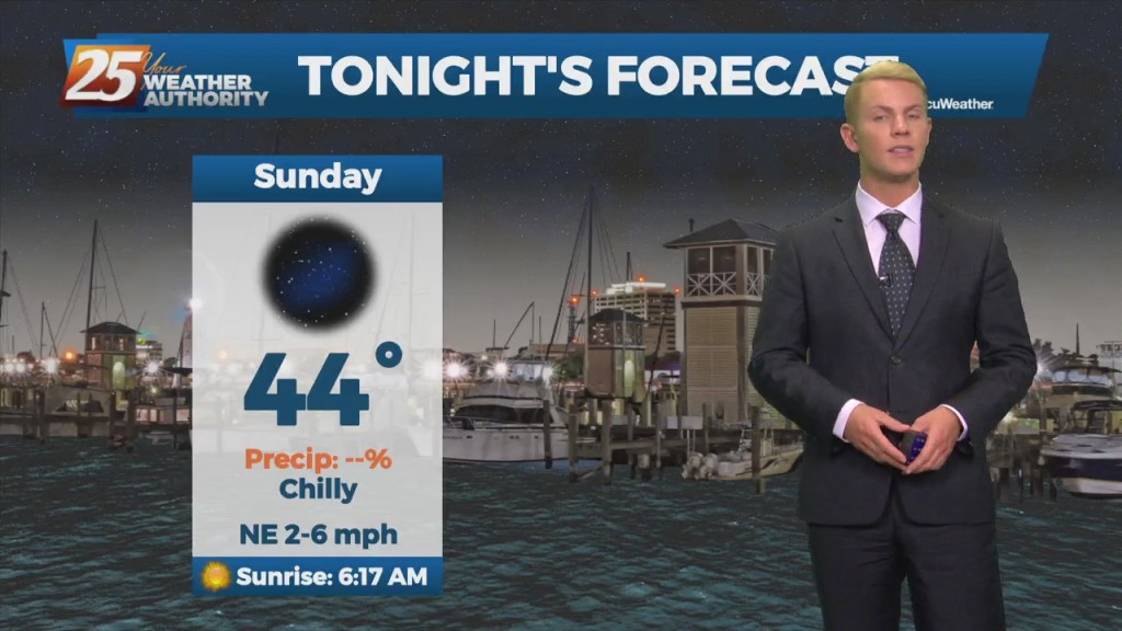
11/19 – Brantly's "Chilly Nights, Mild Days" Weekend Forecast
A cool and quiet start to the weekend is in store for the region as we remain in a post- frontal airmass under zonal flow aloft. However,…
A cool and quiet start to the weekend is in store for the region as we remain in a post- frontal airmass under zonal flow aloft. However,…
A cool and quiet start to the weekend is in store for the region as we remain in a post- frontal airmass under zonal flow aloft. However,…
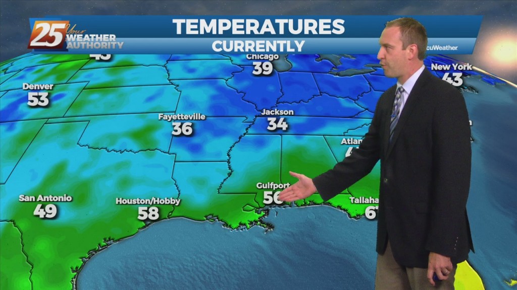
Behind the cold front moving across the area right now, northerly winds will increase and allow for a cooler airmass to filter in. Recent forecast soundings and satellite…
Behind the cold front moving across the area right now, northerly winds will increase and allow for a cooler airmass to filter in. Recent forecast soundings and satellite…
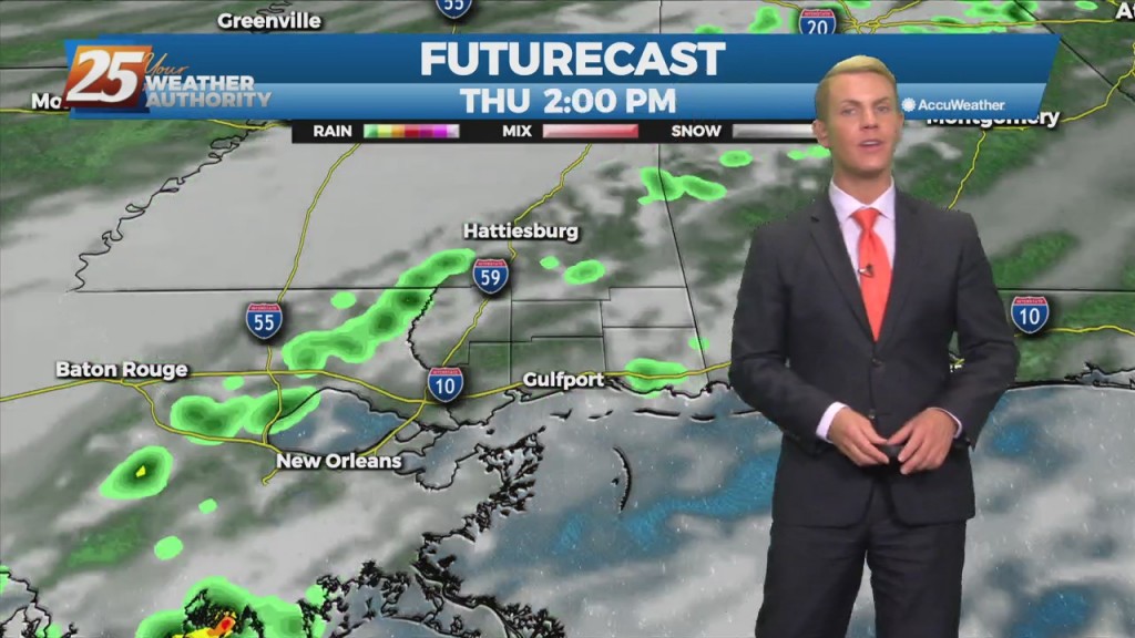
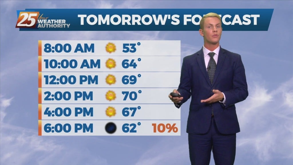
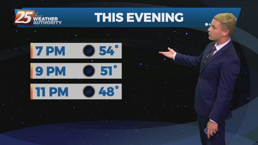
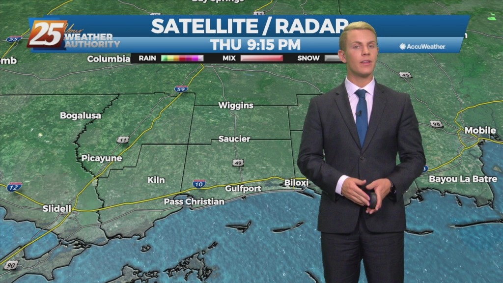
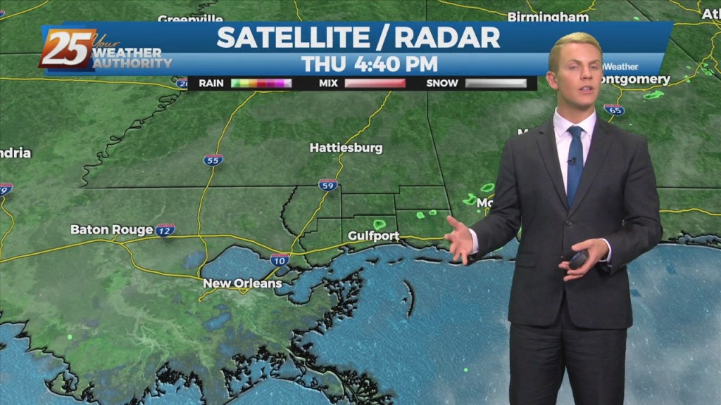
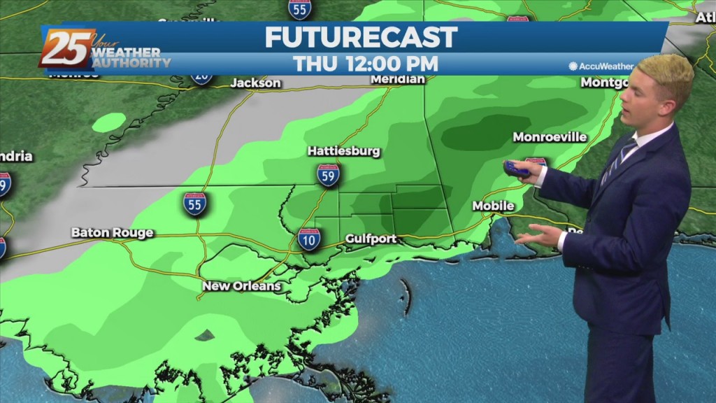
A cold front will move toward our area from the northwest today and tonight before moving east across our area late Thursday into Thursday evening. Before the…
A cold front will move toward our area from the northwest today and tonight before moving east across our area late Thursday into Thursday evening. Before the front…
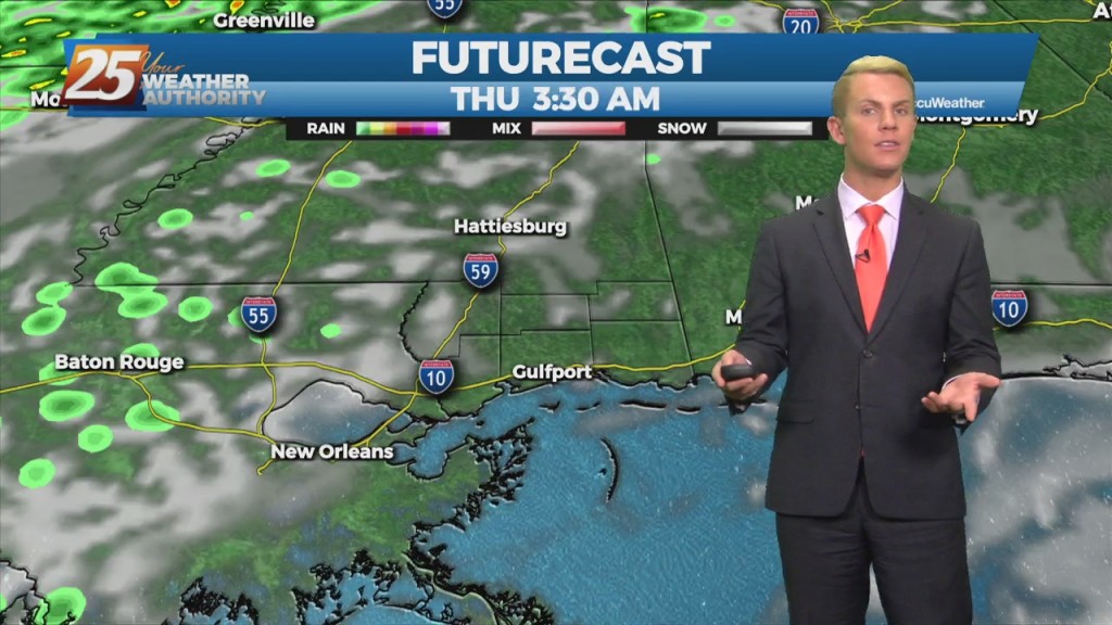
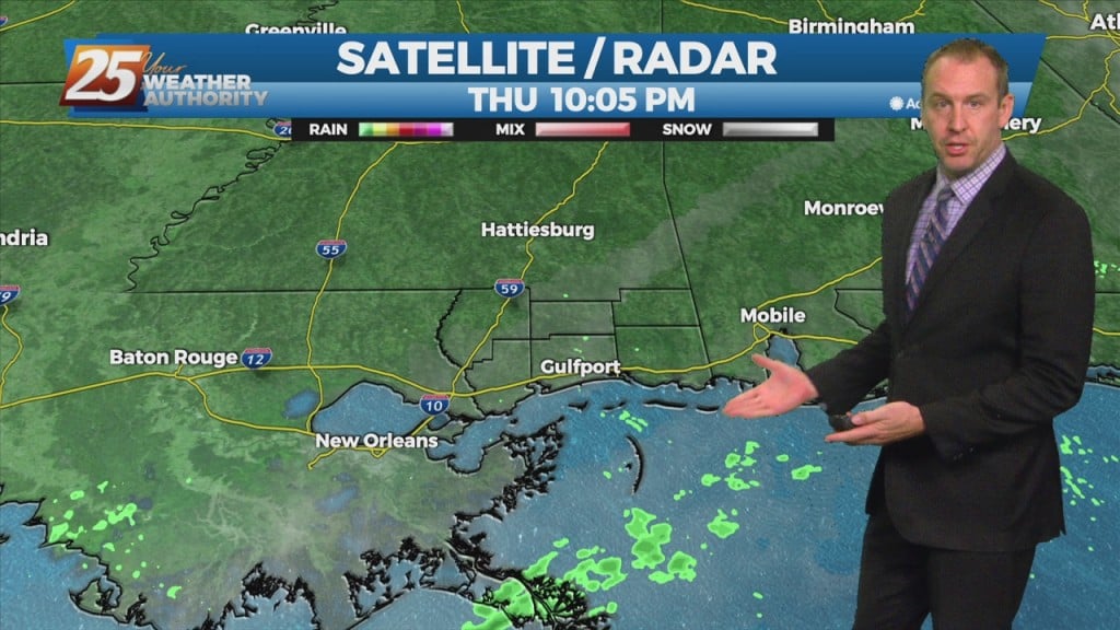
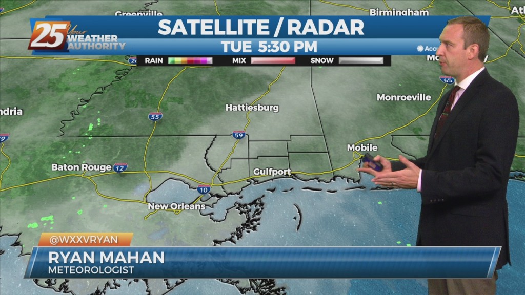
Tonight through early Wednesday, we see a continuing increase in moisture along part of the coast, which may lead to the development of dense fog. Wednesday morning, low temperatures…
Tonight through early Wednesday, we see a continuing increase in moisture along part of the coast, which may lead to the development of dense fog. Wednesday morning, low…
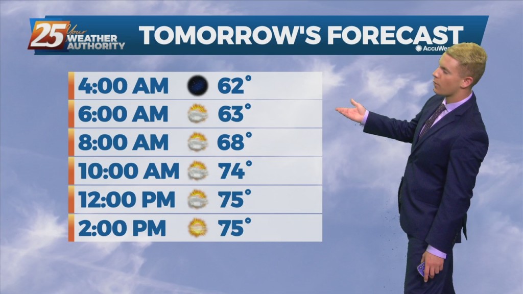
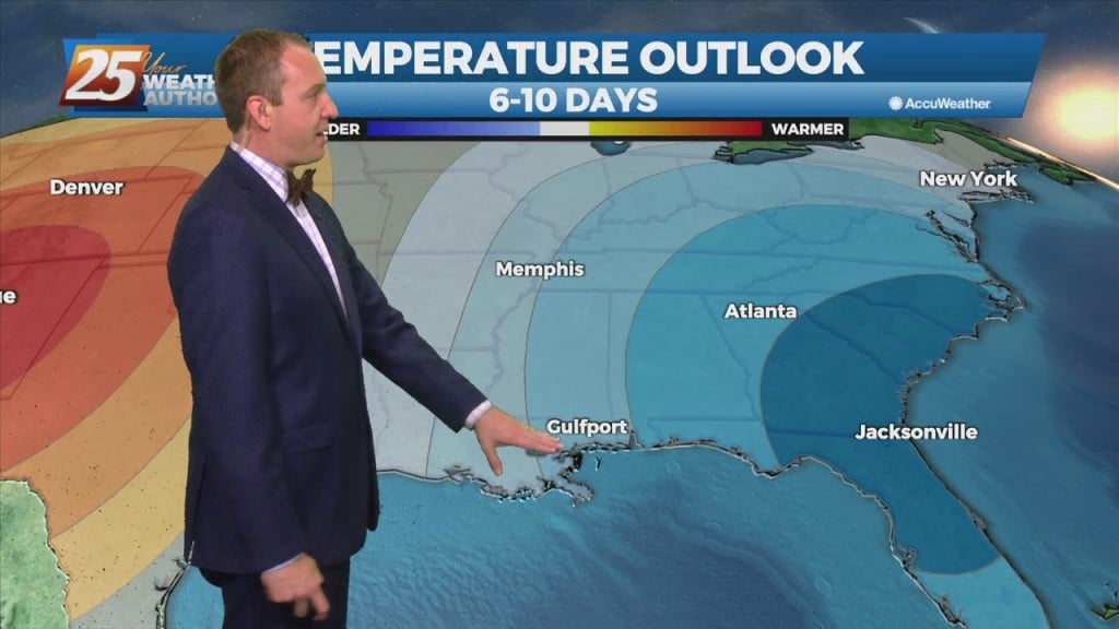
High temperatures for Tuesday continue to be on the warm side, sticking to the mid to upper 70s in most areas. Tuesday night, northern areas will see…
Surface high pressure will continue to slide to the east, turning our wind flow to the south/southeast for the next couple days. This will gradually increase moisture during this…

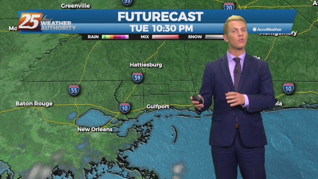
A weak cold front will pass over the forecast area tonight and will be followed by building surface high pressure over our region into Monday. Clear skies and dry…
Sadly, today was my last day at WXXV News 25. I've had a heck of a time here over the last seven years, and I am truly sorry to…
A cold front moved through today bringing changes for the weekend, and but we still have fog to deal with first. Not too much going on to discuss…
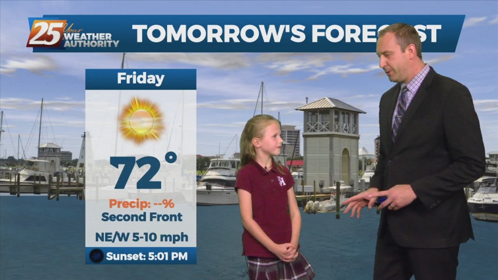
A cold front moved through today bringing changes for the weekend, and a special guest came in to discuss it. She's my niece Claire, and she's been wanting…
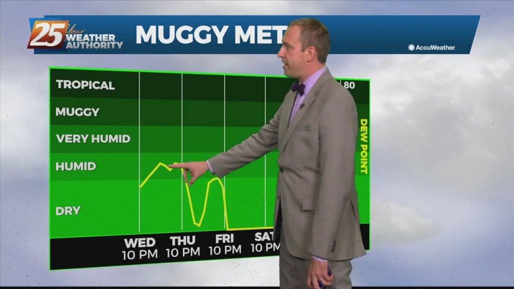
No rain tonight, but more fog on the way as the humidity deepens ahead of tomorrow's front. Still only expected to be patchy, but last night we saw…
Surface high pressure that has been dominating the area will begin to shift off to the east today as an upper level disturbance extends down into our area…
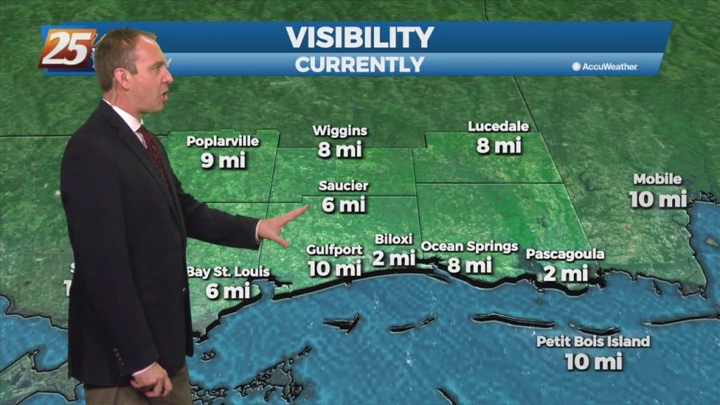
Expect some fog, just patchy tonight, but we'll see more tomorrow night as a front closes in. Cloud cover will break up a bit through the evening, but…
It was already on the cloudy side, but you can expect even more tomorrow and into Thursday. They will break up slightly through the evening hours, but will…
High pressure remains in control today before quickly scooting east Wednesday. This helps to shift surface winds from northerly to southeasterly, and likewise begin a modest warm air advection…
The weather has been consistently clear and crisp for the last few days, but that will change shortly. Not tonight though as the the only change we'll see…
The weather has been consistently clear and crisp for the last few days, but that will change shortly. Not tonight though as the the only change we'll see…
An area of high pressure will continue to move slowly east across the central U.S. states and Gulf Coast region into Monday. Expect generally clear and sunny skies to…
An area of high pressure ridge will continue to move slowly east across the central U.S. states and Gulf Coast region into Monday. Expect generally clear and sunny skies…
Cloudy and cooler weather dominates today thanks to a stalled front to the South, but a long period of sunny days lies ahead. Not going to be…