2/15 - Rob Knight's "WARMER" Friday Morning Forecast
Extensive cloud coverage continues through the region with MUCH WARMER temperatures than yesterday morning...
Extensive cloud coverage continues through the region with MUCH WARMER temperatures than yesterday morning...

A COLD start to the day with a lot of upper-level clouds streaming across the area...
Major changes this morning with a colder/drier air mass moving into the region in the wake of yesterday's cold front...

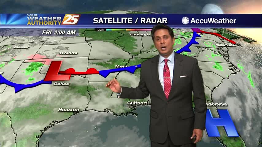
A foggy and wet start to the day as a cold front is moving into the area from the west...
A warmer start to the day with areas of light fog and light rain moving in from the south...
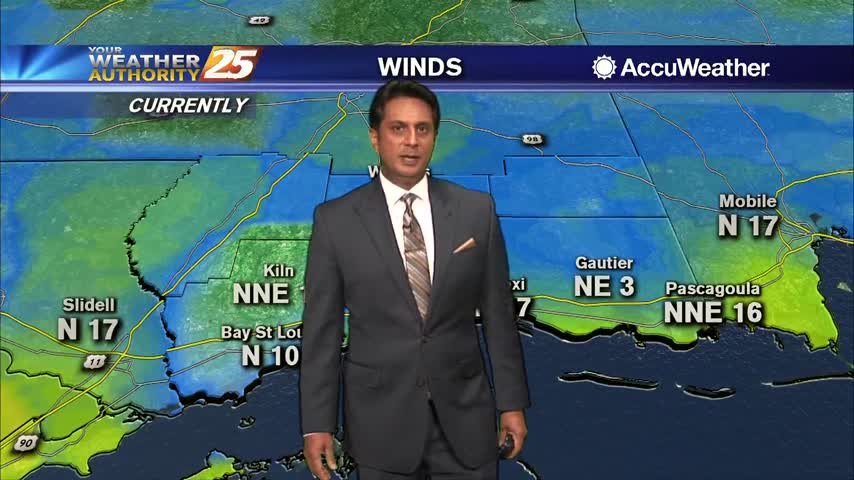
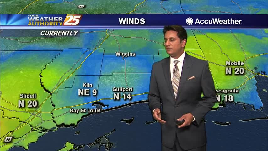
Cloud coverage is still in the area as winds continue to gust into the upper teens to low 20 mph range...
A colder and windy start to the day in the wake of last night's cold front...

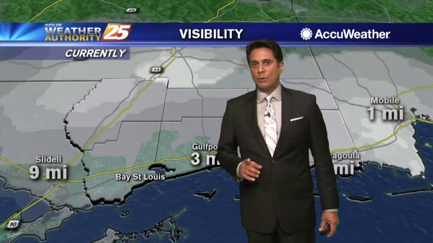
Fog is still in the area and we could see RECORD HIGH temperatures this afternoon...
Another warm and humid start to the day with DENSE FOG confined to the coastal counties...

Dense fog has dissipated but with the warm and humid air mass, areas of patchy fog will continue...
Another WARM/HUMID start to the day with DENSE FOG along the viewing area...
With a warm/humid air mass through the region, you're heading the door into DENSE FOG...
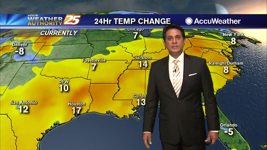
After a very cold start to the day, the return flow has begun with MUCH WARMER temps ahead...
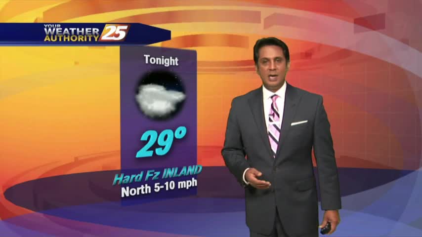
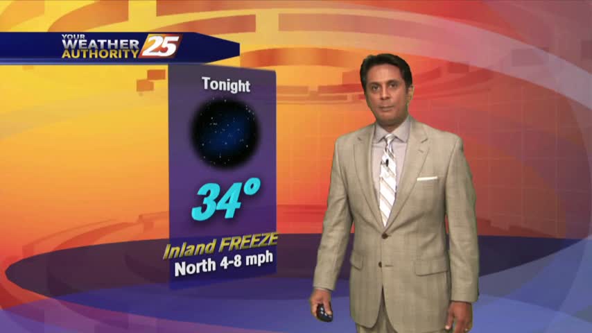
With a VERY COLD air mass north of our state, cold air is filtering in with frigid temps heading out the door...
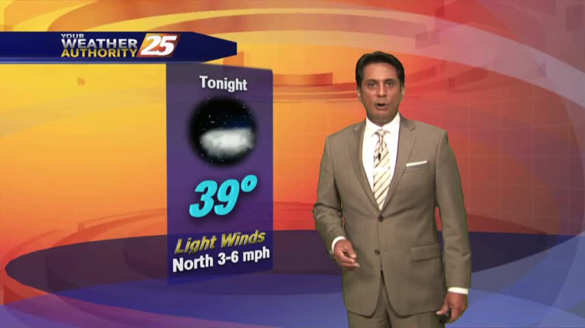
Rainfall has moved to the east with the associated cold front, with SUNSHINE ahead...
Rain is currently moving across the area as a vigorous cold front overhead is moving east...
Cloud coverage lingered into this morning but have cleared since with BEAUTIFUL blues skies now in the area...
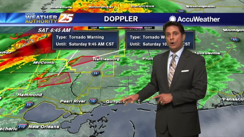
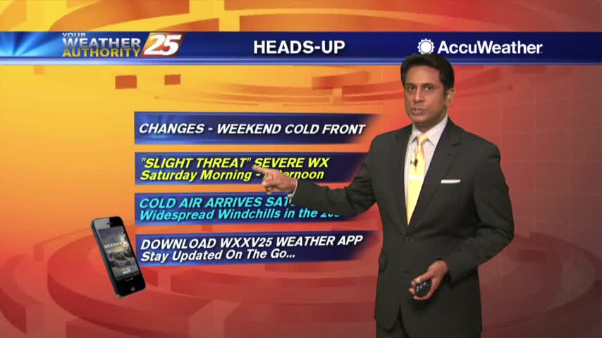
A line of t-storms associated with a cold front will move in from the west later this morning...
Very light fog remains in the area with elevated humidity as temperatures continue to warm into the upper 60s!
The pesky cloud coverage seems to want to linger through the region, but changes will come later today...

The cold air is back in the region as an area of high-pressure to the NW brings extensive cloud coverage...

The warm-up has been slow under clear skies, but major changes will occur overnight...
The heavier rainfall has moved east but spotty showers and t-storms will continue this afternoon into tonight...
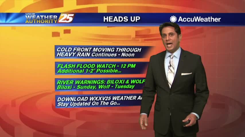
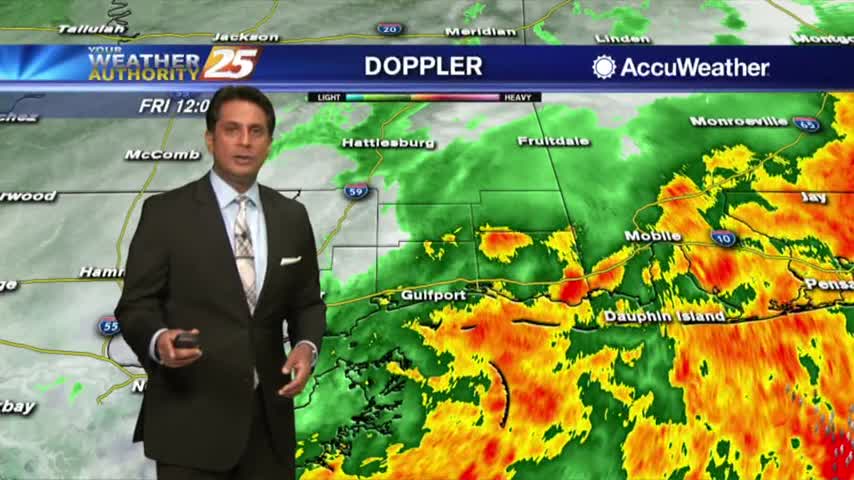
A VERY WET start to the day as HEAVY RAINFALL continues to move across the viewing area...