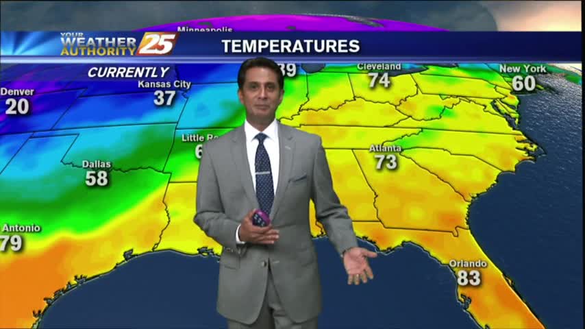
3/23 - Rob's 1st Weekend of Spring Forecast
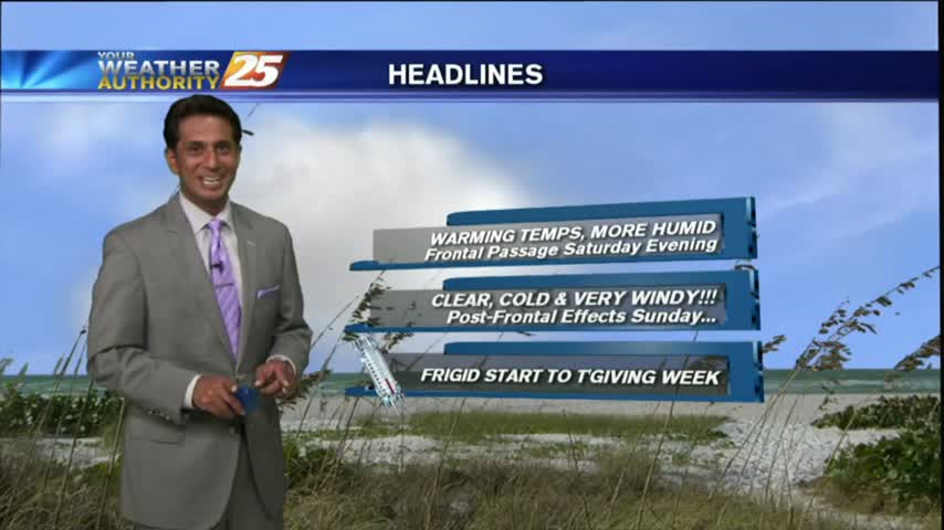
After a warmer start to the day, warmer temps will begin moving into the region as the humidity elevates...
After a warmer start to the day, warmer temps will begin moving into the region as the humidity elevates...
After another FRIGID start to the day, temps are a bit warmer this afternoon under sunny skies...
Warming temperatures under beautiful blue skies as the humidity is beginning to return to the area...
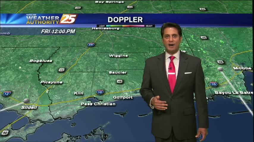
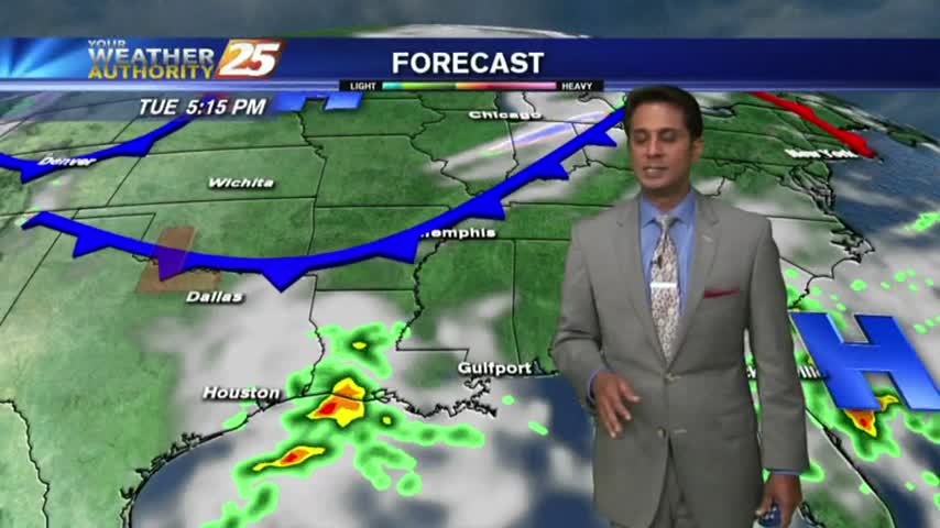
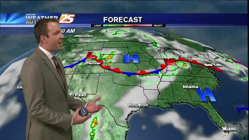
The humidity has been increasing seadily throughout the day as a cold front moves in from the Northwest, and showers and thunderstorms are expected overnight. Watch the full forecast for the details.
We're seeing clouds move in today after our amazingly dry weekend, with rain and thunderstorms moving in quickly. Watch the full forecast for details.
It's a slight warmer start to the day with cloud coverage and light rain as a warm front is moving through the NW Mississippi...
Warming temps continue to move into the region. A cold front is now to the south of the viewing area...with rainfall moving NE into south Mississippi..
A MUCH WARMER start this morning compared to the VERY FRIGID conditions just 24 hours ago...
After a mild start with areas of patchy fog, it has turned out to be a beautiful 1st day of December with DENSE FOG lingering in southern Harrison Co...
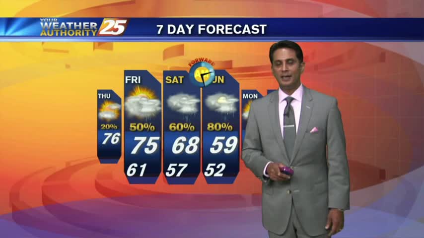
A cold start, but temperatures and rain chances are on the rise this week.
After a FRIGID start yesterday morning...cloud coverage overnight has WARMER temps in the low 40s to kick-off your Tuesday...
Patchy morning fog is out of the area as temps continue to warm into the upper 70s under a few clouds along the immediate coast...
Clear skies last night led to cooling, coupled radiational with a more humid air mass, areas of PATCHY DENSE FOG has developed...

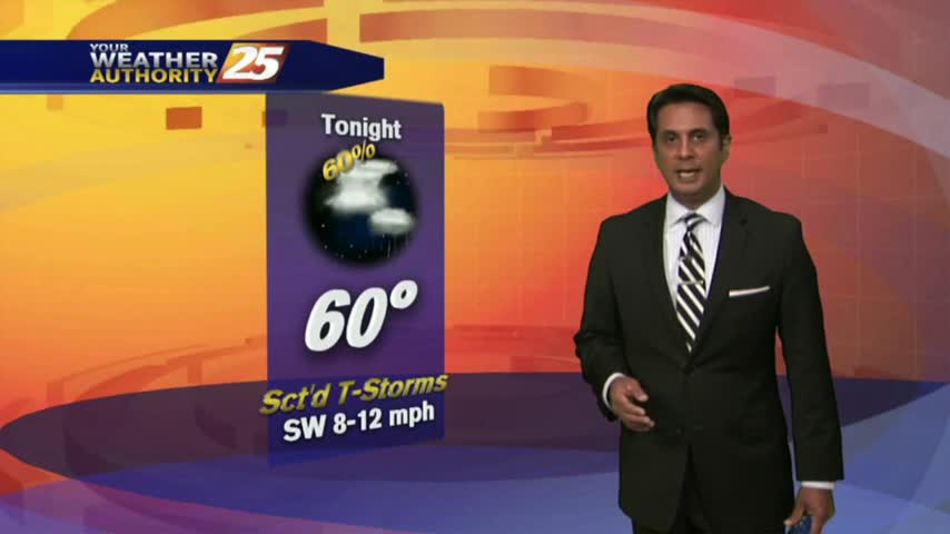
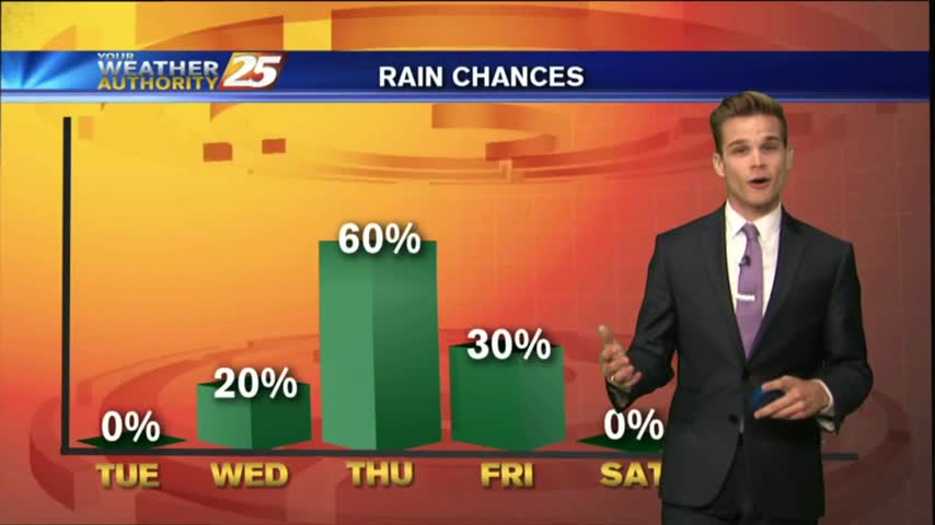
The humidity and temperature will continue to rise into tomorrow ahead of our next cold front, which could bring some damaging weather overnight Friday. Watch the full forecast for details.
After another CHILLY morning...changes in the patter is bringing a more humid and unstable air mass in advance of an approaching cold front...
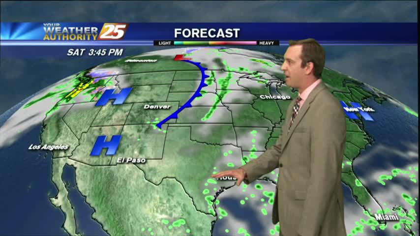
Moisture was on the rise this afternoon and will wane a bit tonight, but expect it to return in earnest for the weekend just before a front brings thunderstorms. Watch the full forecast for more.
A few wispy cloud have moved in, but still expected to be mostly clear until right around sunrise when the clouds will thicken. Be sure to watch the full forecast for further details.
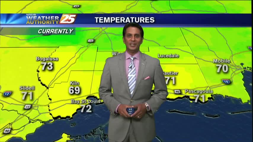
Another humid start with areas of patchy fog as an area of high-pressure continues to block the Gulf Coast...
A southerly component with the winds overnight has continues as a more humid air mass is now the the area, with warmer temps this morning.
After a CHILLY morning, temperatures have warmed nicely into the 80s, under SUNNY skies...

After a warm/cloudy and BREEZY morning...winds continue to escalate higher just below WIND ADVISORY criteria...

As the return-flow has begun, a south wind has MUCH WARMER temps along the Gulf Coast on this St. Patrick's Day morning...
A few clouds continued overnight through this morning with cool temps and areas of very light fog...
Dense fog burned off earlier this morning, with now partly cloudy skies and breezy conditions setting up...