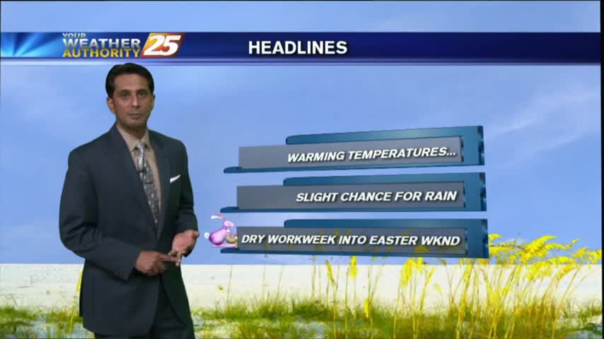
04/27 Ryan's "Warm/Cold Front" Thursday Forecast
A cold front may have passed through overnight, but temperatures warmed today. Expect a few days of calm weather before another potential severe threat. Watch the full forecast for details.
A cold front may have passed through overnight, but temperatures warmed today. Expect a few days of calm weather before another potential severe threat. Watch the full forecast for details.
Storms are beginning to creep in from the NW, and despite our "marginal" threat for severe weather, conditions are trending for weaker storms in South MS. Watch the full forecast for more details.
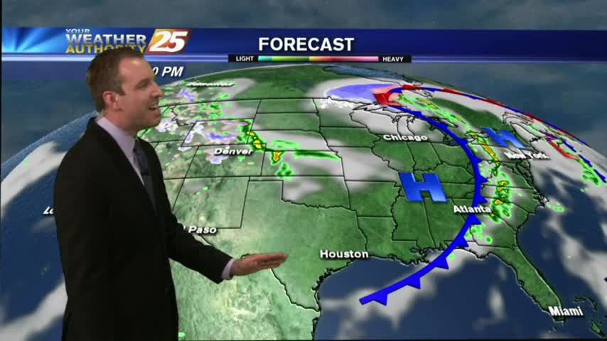
I hope you enjoyed our two mild days and cooler evenings, because a warming trend begins tonight and doesn't stop until the beginning of next week. Watch the full forecast for details.
We're finally going to see our "boring" weather streak coming to an end, but not until after one more sunny and humid afternoon. Showers and thunderstorms begin moving in by sundown, so be sure to check out the forecast for details.
Last night's clouds have moved on, so things should cool by a degree or so, but will remain warm and humid with overnight fog. Click the forecast link for more details on this weekend's weather.
After another beautiful Spring day, you've got to be expecting the "other shoe to drop" soon right? Well, it does, but not until after a few more great days. Click the forecast link and find out when the rain arrives.
The rest of the week will be dry, sunny, and beautiful, but "active" weather moves in for the weekend. Watch the forecast for details.
So far the forecast from last weekend has held up well. We continue to see gradually warmer and more humid conditions, but now the clouds will begin clearing, leading to a few sunny and dry days. Forecast details inside.
The clouds are beginning to clear from the area, but we'll retain the small chance of an isolated t-storms in the afternoon. Watch the full forecast for details.
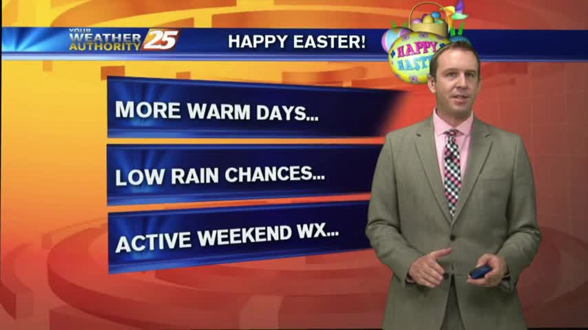
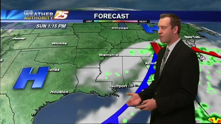
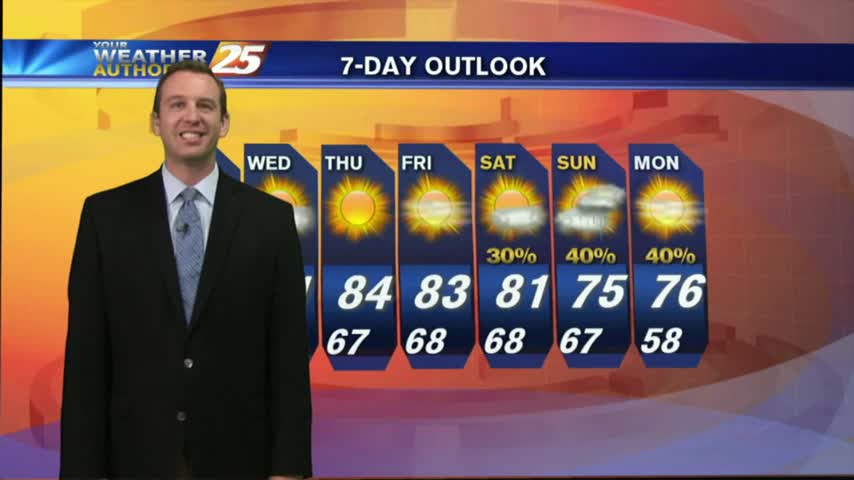
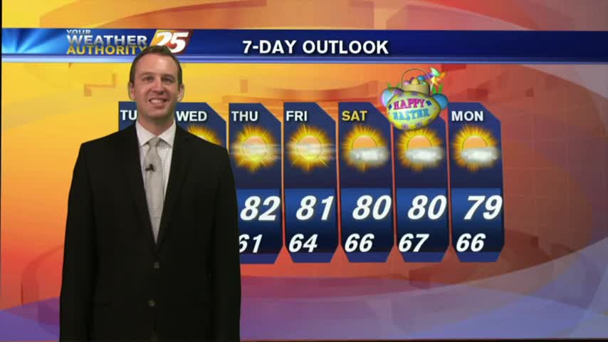
I hope everyone enjoyed their cloudy, but otherwise pleasant, Easter weather! We've more beautiful days ahead, though it looks like stormy weather will move in late Saturday. Watch the forecast for details.

As moisture flow returns to the region, "Good Friday" morning has brought areas of patchy FOG the the viewing area...

A MUCH BETTER start to the day with only VERY LIGHT FOG in Jackson Co...
Thicker cloud cover moved in a bit earlier and will linger through the night, causing some warmer temperatures. Tomorrow will begin cloudy, but clear through the afternoon. Watch tonight's forecast for more details.
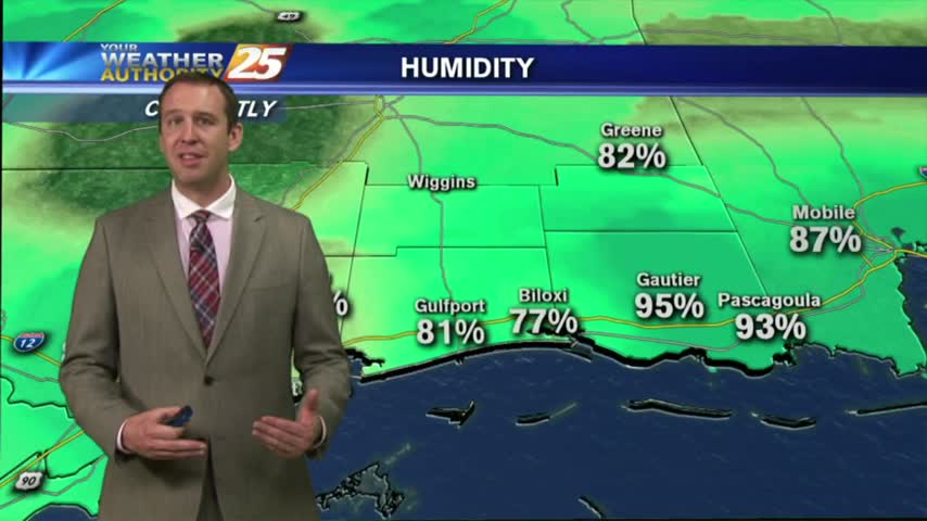
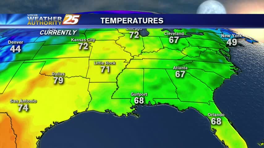
After a dry & mild weekend, we're starting to see the temperatures and humidity rising back to "normal" levels. Be sure to watch the full forecast for details.
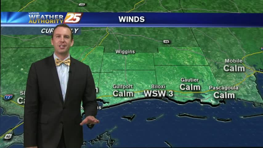
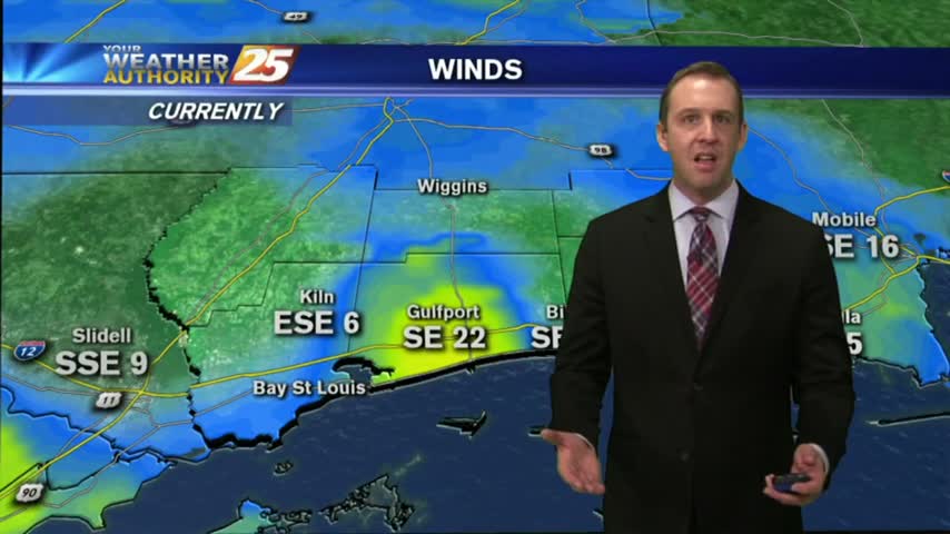
With a SOUTHERLY wind flow, warming temps continue with elevating humidity moving in from the GOM...
Things are starting to warm up after a picture perfect weekend, so be sure to watch the full forecast for details.
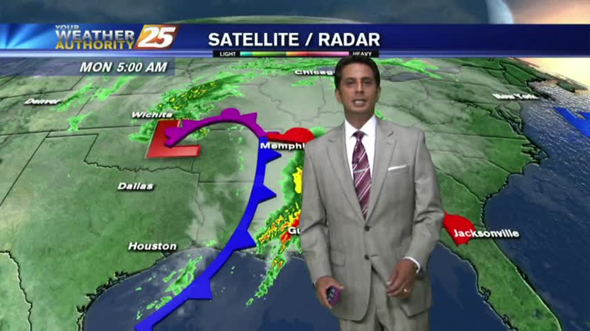
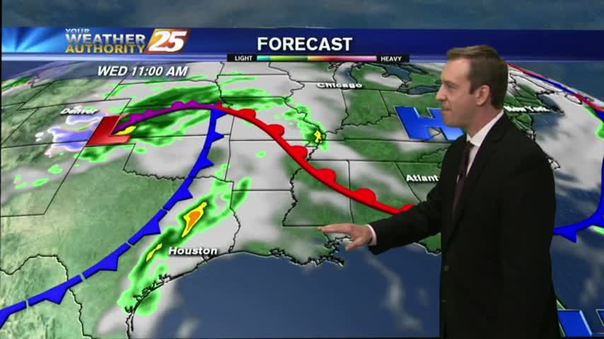
A BUMPY start on this Monday morning as weather with associated with a vigorous cold front approaches from the west...
Today was as beautiful as advertised, and tomorrow is on pace to be even better. Great weather doesn't last forever though, so watch the full forecast for all the details.
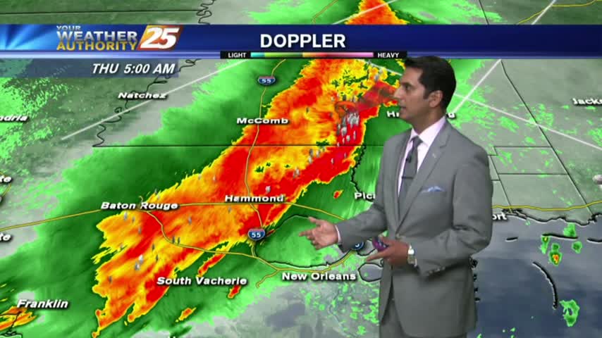
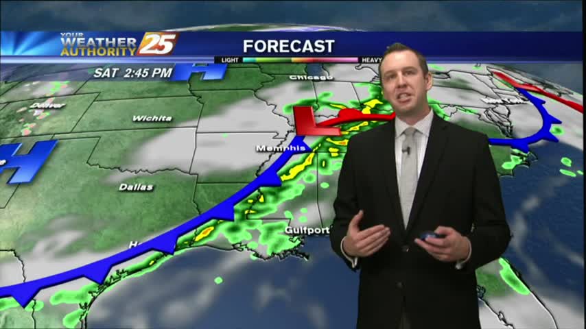
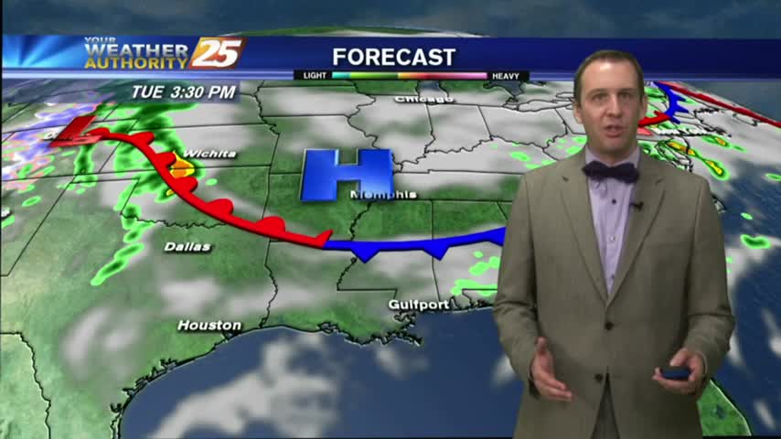
Showers/T-Storms moving in from the west with an associated cold front...SLIGHT THREAT for SEVERE STORMS...
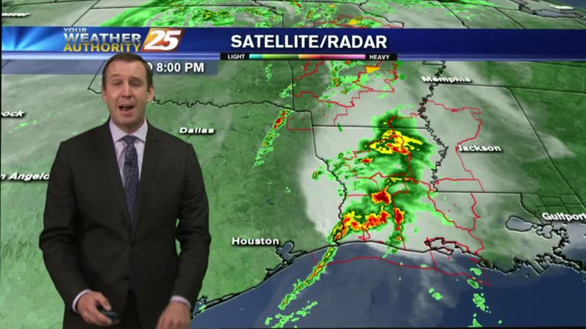
Clouds are increasing ahead of Thursday's storm system, and while it seems to be weakening, South Mississippi remains under a "slight" threat of severe weather. Watch the forecast for more.
Another dry day in the books with another on tap for tomorrow. Rain is moving in soon though, with storms that could be severe. Watch the full forecast for details.
Mostly cloudy skies and a few showers came and went today, but the next few days will be drier and a little clearer. Watch the full forecast for details.
The cloud cover seemed to come and go throughout the day, but now that the night is moving in the skies will darken ahead of our next frontal system tomorrow. Click the forecast link for all the details.
The winds have continued to increase and we'll see the first drops of rain within the next few hours. Watch the full forecast for complete details of tomorrow's "active" weather event.