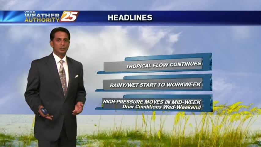
8/28 - Rob's Final Monday of August Forecast
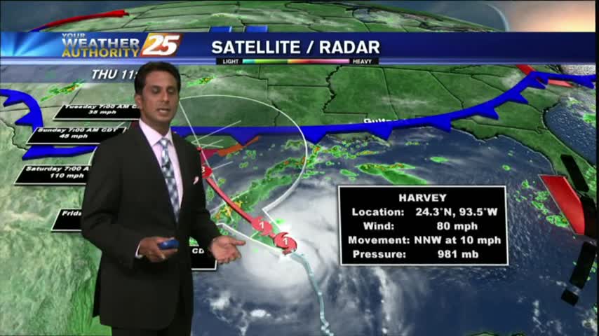
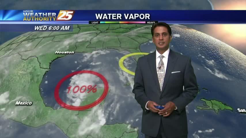
Harvey continues to pummel E/SE'tern Texas as the rain shield is beginning to move into the area: light rain moving in from the sound...
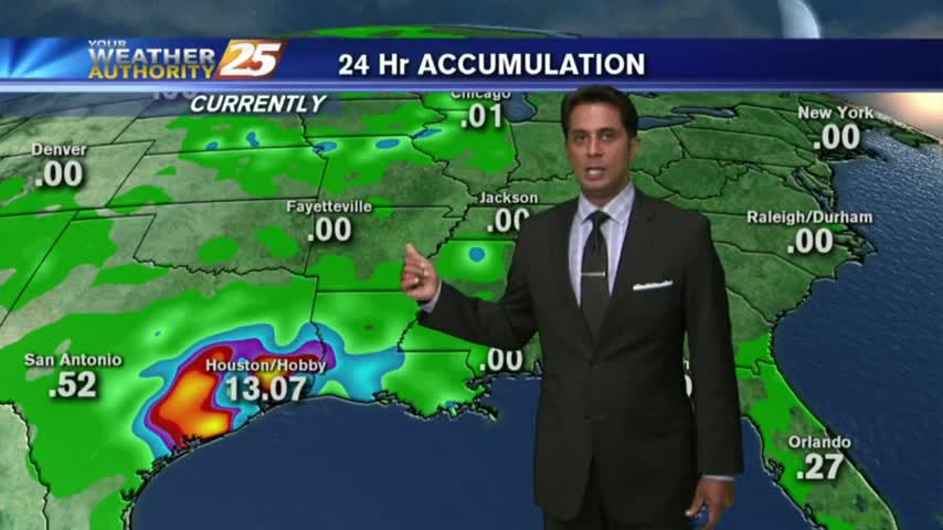
Harvey continues to pummel E/SE'tern Texas as the rain shield is beginning to move into the area: light rain moving in from the sound...
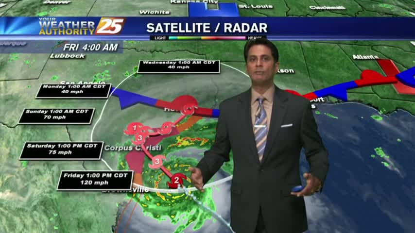
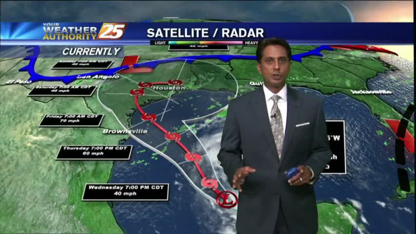
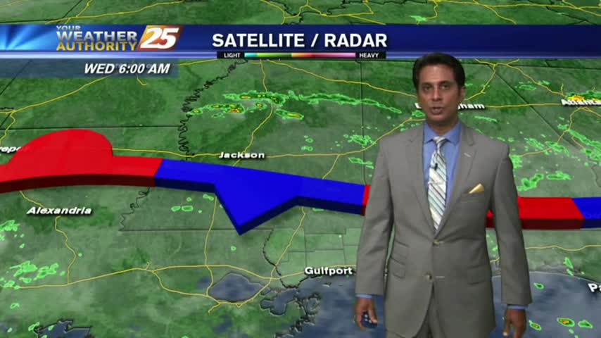
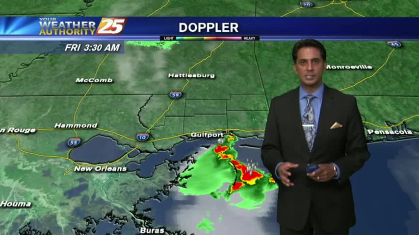
The local radar is fairly quiet this morning as most eyes are on Hurricane Harvey...
Cloudy skies continue as a weak cold front overhead will go stationary...providing for isolated showers/t-storms this afternoon...
Warming temperatures but still no showers/t-storms in the area...
It's a warm and humid start to your "Hump Day", with isolated showers and t-storms moving into the area from the south...

A warm start to the day/week with isolated showers moving into the area from the south...
As the TROPICS continue to heat up, it's a warm/humid start to the day along the Gulf Coast with rain-free conditions...
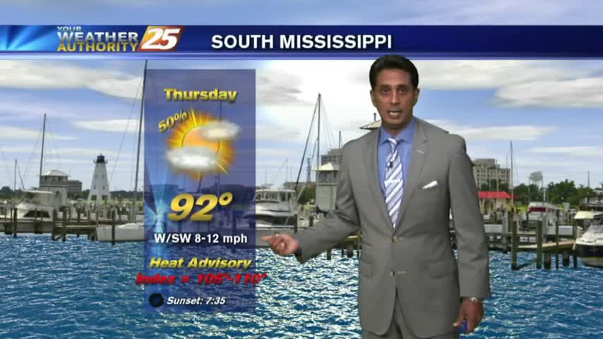
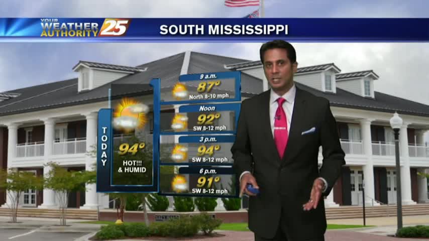
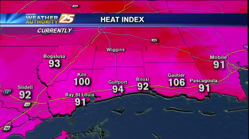
A warm/humid start to the day with minimal activity compared to the past month. DANGEROUS HEAT is on-tap though today...

A WARM morning along the Gulf Coast as showers/t-storms are beginning to move in from the south...

As the very tropical air mass continues to dominate the region, isolated showers/t-storms are moving in from the south...
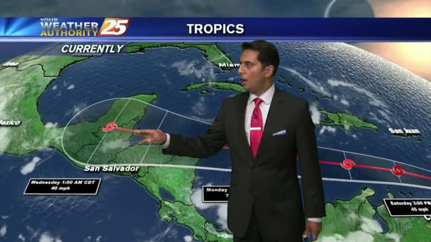
As TS Franklin moves west across the bay of Campeche, it's a warm/humid start to the day with light rain moving in from the GOM.

As we continue to keep an eye on TS FRANKLIN moving across the Yucatan peninsula, a VERY TROPICAL air mass continues to dominate the region...

After clear skies overnight, the clouds along with isolated showers are moving in from the south...

As the majority of energy stayed south yesterday, the activity has moved into south Mississippi this morning...
Another warm start to the day with HOT & HUMID conditions. Changes are expected through the final weekend of July with an approaching cold front...

After very WET conditions the past few days, a drier patter is beginning to move into the region which will dominate through the rest of the workweek...

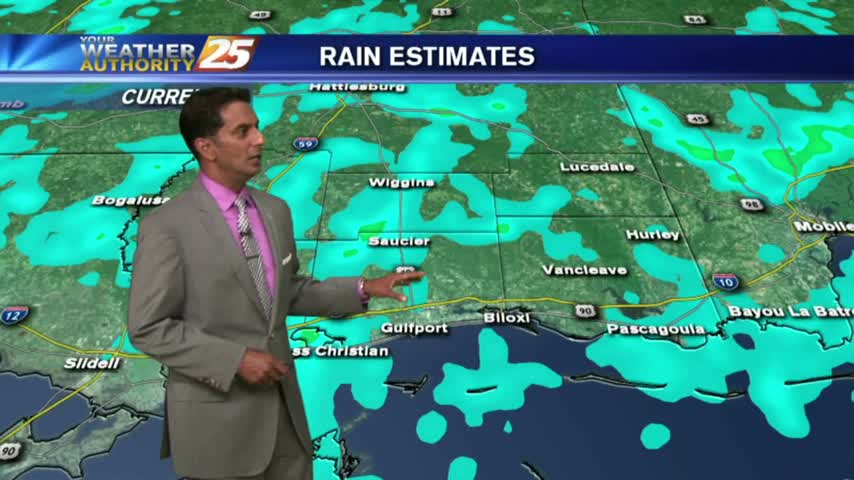
Overnight showers/t-storms continue to affect the viewing area as we kick off the workweek...
A warm and humid start to the day/weekend with isolated activity to the south over the sound/northern Gulf...
After a rain-free and clear start to the day, heating and moisture flow has triggered a few clouds along the coastal counties.
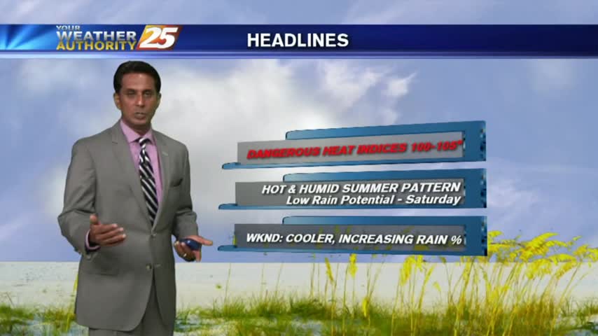
A warm and humid start to the day...but rain-free. MAIN CONCERNS today through the weekend will be DANGEROUS HEAT INDICES...

As with the past couple of weeks, overnight activity over the water is moving north into the coastal counties...

As the tropical air mass continues to dominate the region, showers/t-storms from last night continues to move in from the south...
Another morning with showers/t-storms over the sound/northern Gulf of Mexico moving into the Southern 6...
Isolated showers/t-storms have been moving in since midnight and will continue through much of today...