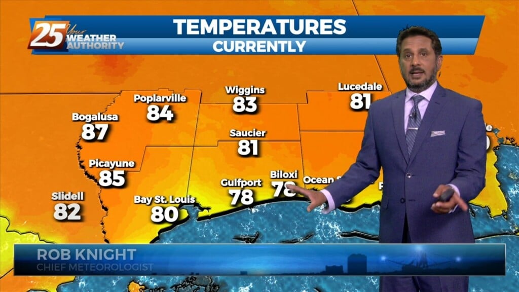
5/7 - The Chief's "Warm & Often Breezy" Tuesday Afternoon Forecast
A somewhat weak high pressure across the Bay of Campeche and southern Gulf will help warm most of our region well into the 80s again…
A somewhat weak high pressure across the Bay of Campeche and southern Gulf will help warm most of our region well into the 80s again…

T-storm complexes will stay on the lee side of the Rockies this morning and have been for a while. Another weakening one is moving up from…
Another wonderful day ahead with sun and clouds mixed, with increasing cloud coverage tonight. A tightening gradient will continue to bring breezy conditions to the area…
As temperatures warm into the 80s, low level instability will increase and some cumulus development is expected to take hold by late morning. However, a…
High pressure continues across the Gulf of Mexico, with an upper level disturbance noted over southern Minnesota and over Saskatchewan into the Idaho Panhandle. Surface…
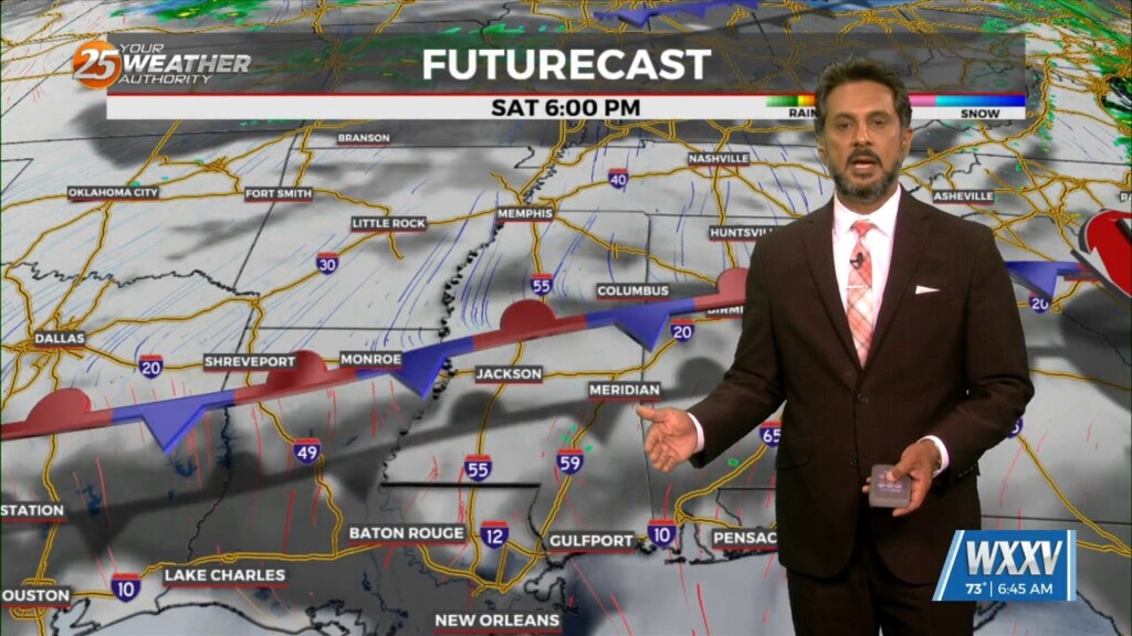
An are of upper-level low pressure will continue to move northeast over the next 36 hours as it gradually gets absorbed by a stronger system over…
High pressure extended from the Gulf of Mexico to Wisconsin, with an upper-level low pressure near the Colorado-Kansas border. Low pressure was noted over Nebraska with a…
Again today, we should see showers and a few t-storms around. But as we move forward in time, a few of these storms could become…
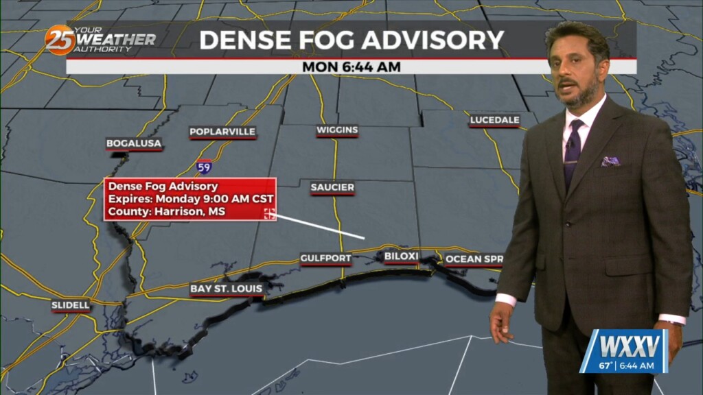
Dense morning fog will be a factor though late morning with a dense fog advisory in effect. Tonight, sounding profiles are showing a…
Fog will be in and out at most locations this morning. This fog should get lifted rather quickly by mid-morning as the entire boundary layer should…
With low level moisture continuing to advect into the region from the south a solid low stratus deck of low level clouds has developed across most…
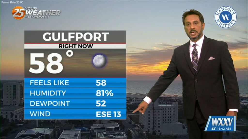
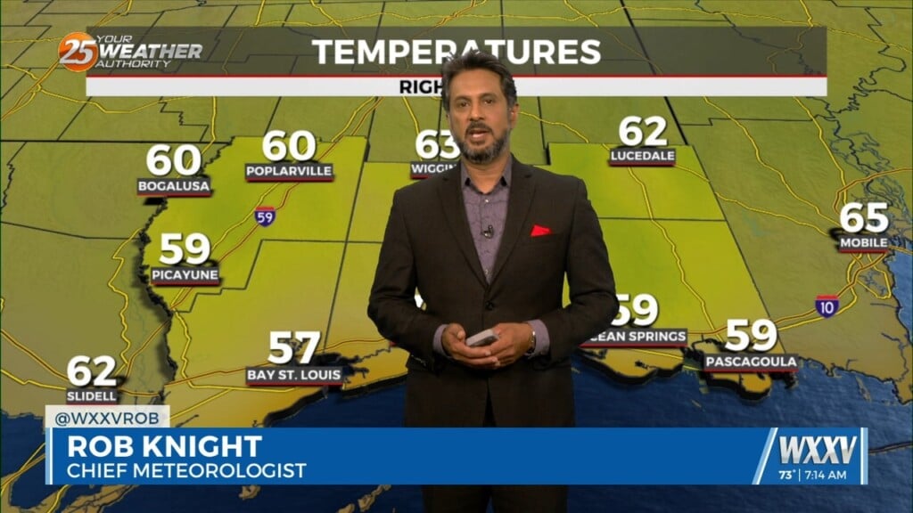
Low level moisture continues to increase with dew-points rising into the upper 40s or tower 50s. This warming/moistening trend will continue today. The…
A few clouds to partly cloudy skies can be expected this afternoon with warm temperatures yet again. Winds remain out of the south which will keep humidity around.…
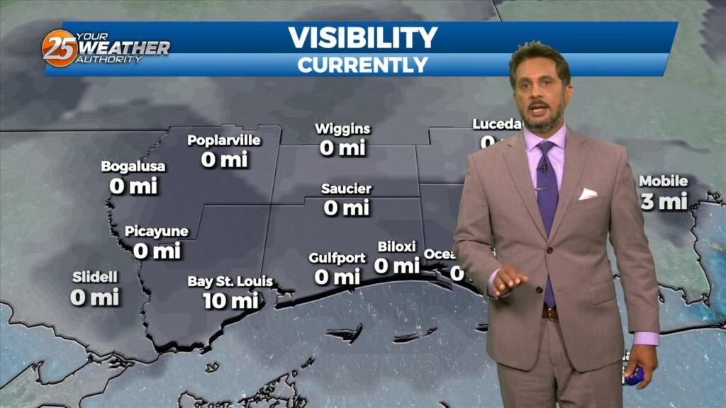
Patchy dense fog has formed across portions of southeast LA and southern MS this morning and could become more widespread toward sunrise. Dense fog development will remain…
Fog development has been hampered this morning due to the increase in surface winds due to the developing surface low over the central US, this…
At the surface, high pressure currently extends along the Atlantic Coast into the northeast Gulf of Mexico. Low pressure over Wisconsin had a cold front…

A deepening upper level disturbance is situated over the Southeast U.S. An approaching weak backdoor cold frontal boundary is expected in the region later this…
Light westerly flow ahead of the weak surface front will favor initiation of thunderstorm activity on the eastern side of Lake Pontchartrain and coastal MS earlier…
Surface warming will once again commence bringing us to convective temperatures in the upper 80s by noon, however, more abundant high clouds may just keep us…
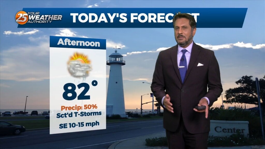
A HOT & HUMID afternoon ahead with breezy conditions out of the SE. High temperatures will max out in the mid to upper 80s, some areas…
Overall, a complicated forecast through the short term, mainly due to the upper level pattern over the region. An upper level weakness continues to reside…
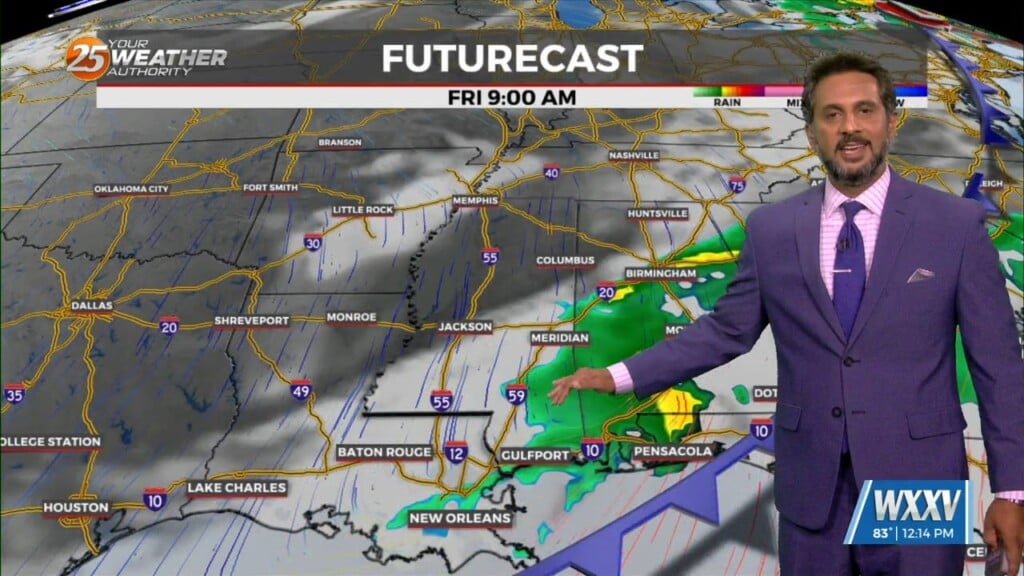
A line of showers & t-storms moving across SW Mississippi should continue to slowly spread/work east-southeast through the pre-sunrise hours and slide east through 9 a.m. before…
Starting off with early this morning, recent radar trends illustrate some isolated showers developing generally along the I-10 in coastal MS. The main story for today…
Warm & windy conditions will continue as a cold front to the west has slowed dramatically. This means that just about all of the associated dynamic…