9/22 - Sam Parker's "Soon to be Helene and Hot Start" Sunday Night Forecast
For the first few days, ridging and high pressure will continue to build over the area. As a result, expect dry conditions…
For the first few days, ridging and high pressure will continue to build over the area. As a result, expect dry conditions…
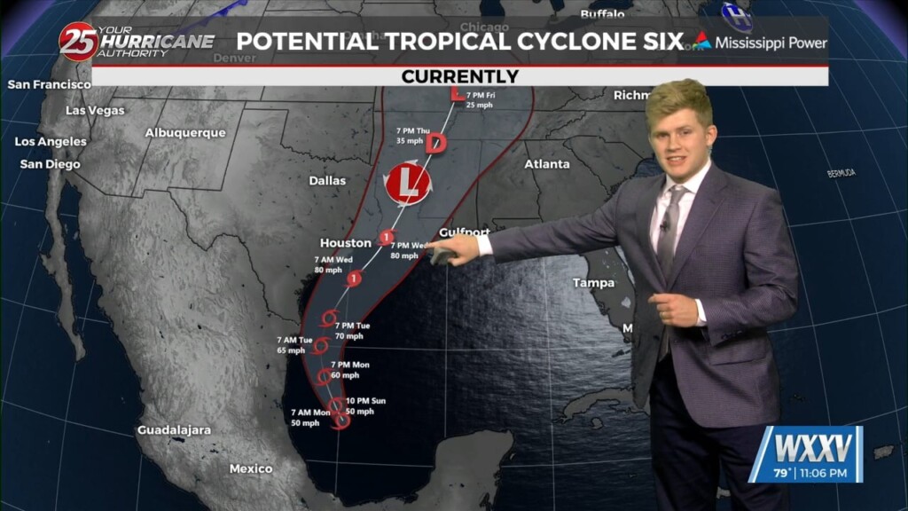
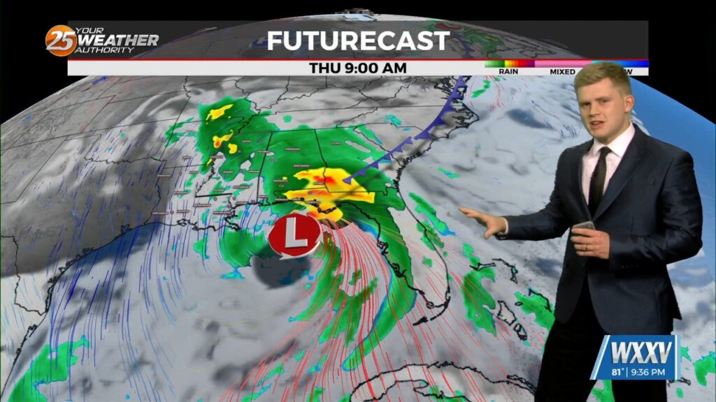
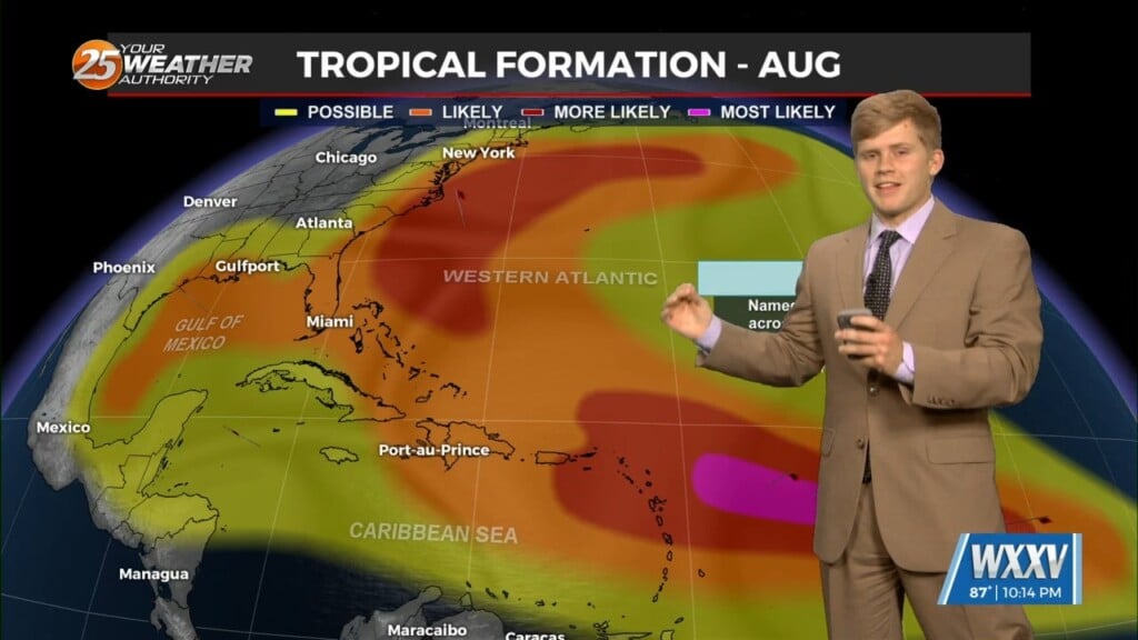
All eyes now shifting towards the tropics as potential tropical cyclone in in the Gulf of Mexico and if forecasted to strengthen into a category 1…
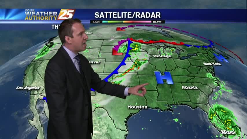
As the surface trough over the northwestern Gulf slides a bit farther from the local area and upper level ridging tries to build into the area,…
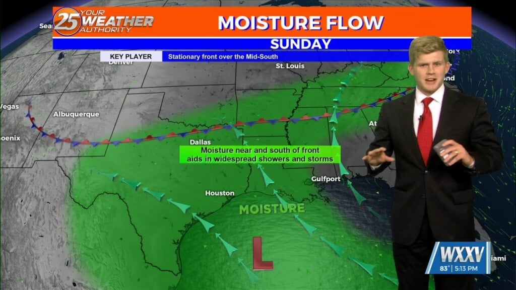
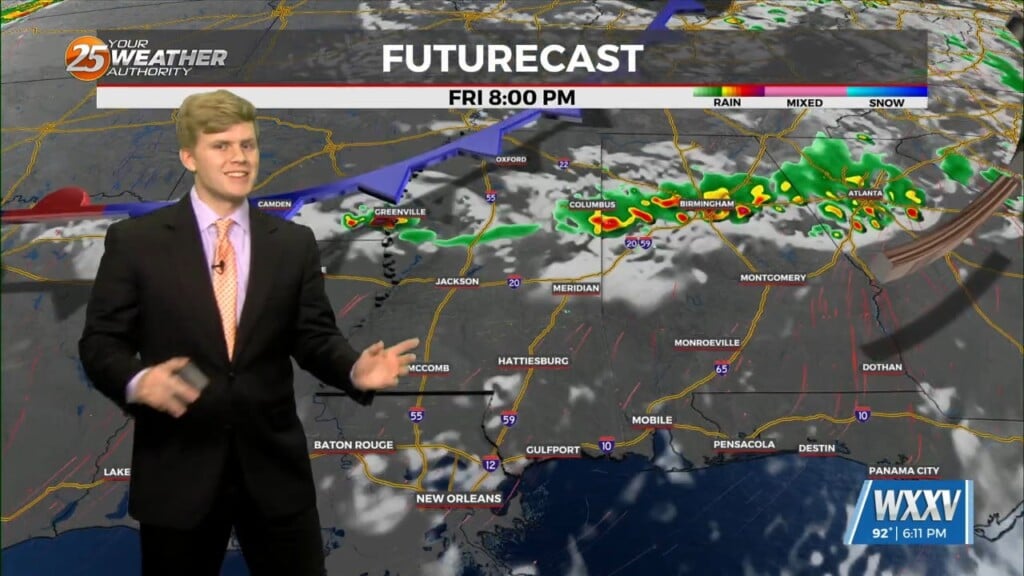
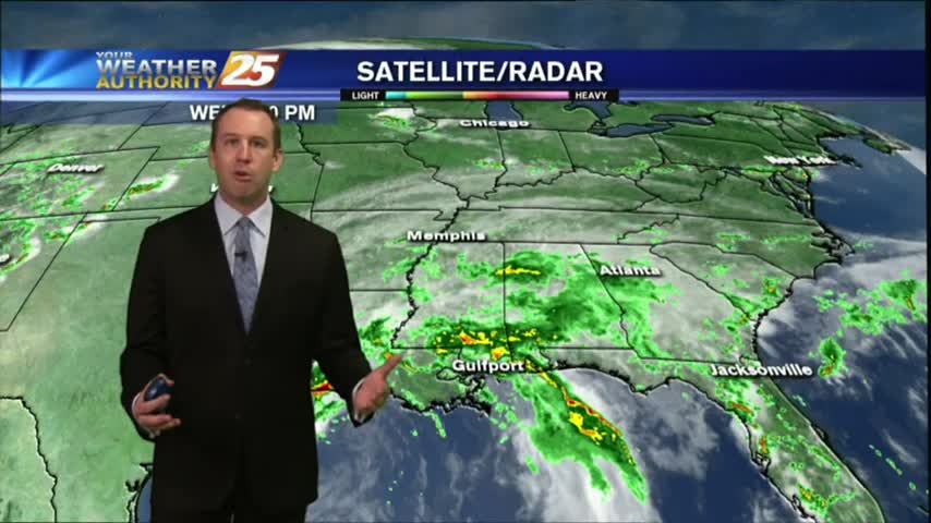
Low level flow will continue to pump tropical moisture into the local area, resulting in widespread showers and storms. Have extended the flood watch through…
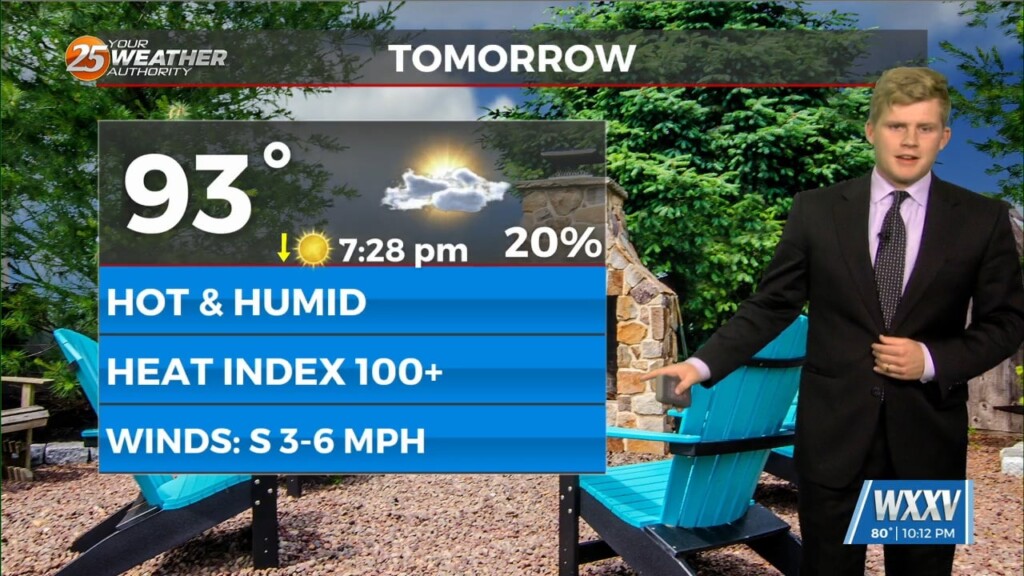
Several locations reached heat indices of 110 F or higher today, few clouds were above our heads this afternoon too. Expect one change for the…
Looking into this upcoming week we see temperatures above average in fact, Stone and George counties will have heat advisory until tomorrow evening. However, the…
Tropical Storm Beryl is strengthening in the central Atlantic Ocean and is a hurricane threat to the Windward Islands, but then faces an uncertain future in the Caribbean Sea. The tropical storm could be a hurricane by Sunday morning…
What a quick change since yesterday morning with Tropical Depression Two forming yesterday afternoon. This happened because it is easier for a small system to tighten…
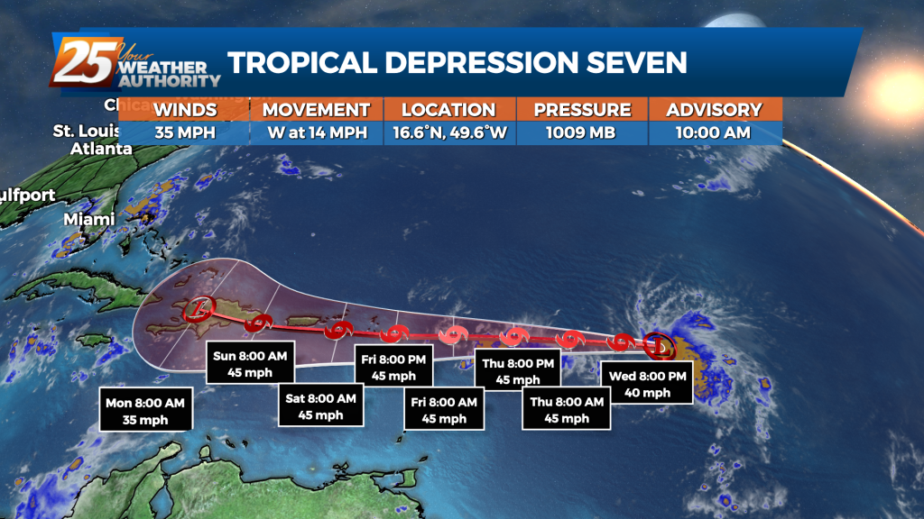
Tropical Depression 7 has formed in the Atlantic Ocean near the Leeward Islands. At 10 a.m., the depression was located about 800 miles east of the Leeward Islands with maximum winds of 35 mph moving 14 mph in a westerly…
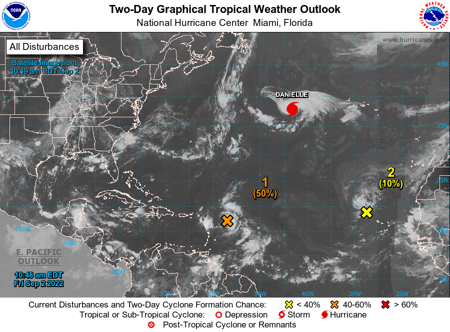
MIAMI (AP) — Tropical Storm Danielle strengthened into a hurricane Friday morning — the first of an unusually quiet storm season. The storm is not currently a threat to any land. The storm’s maximum sustained winds were clocked at 75 mph…
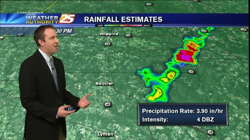
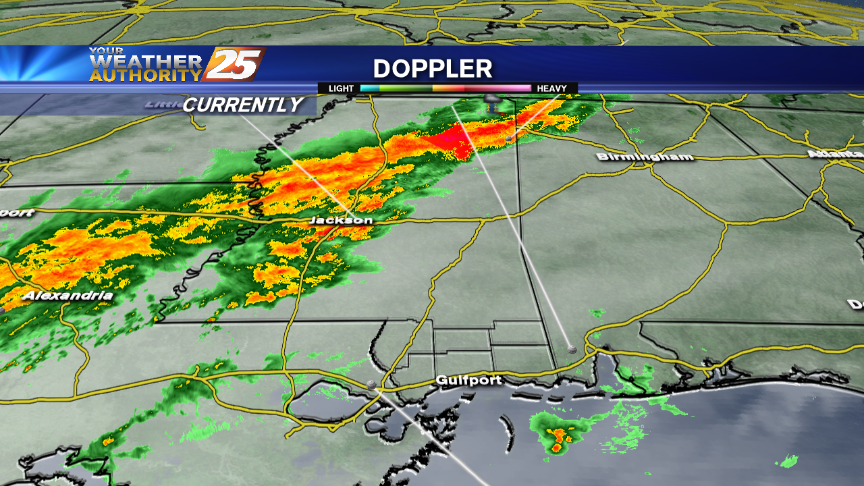
It did indeed hit the fan a bit late this afternoon, with a severe t-storm in George County and a flood advisory in Stone County. This…
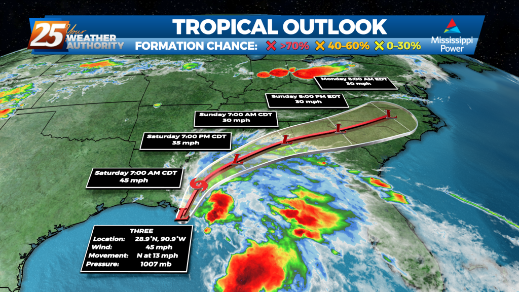
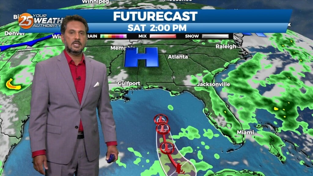
What should have been Tropical Storm Claudette by now still remains "Potential Tropical Cyclone 3." The reason for this is the system has not yet developed a closed center of circulation. It's close, the winds are at the threshold, and…
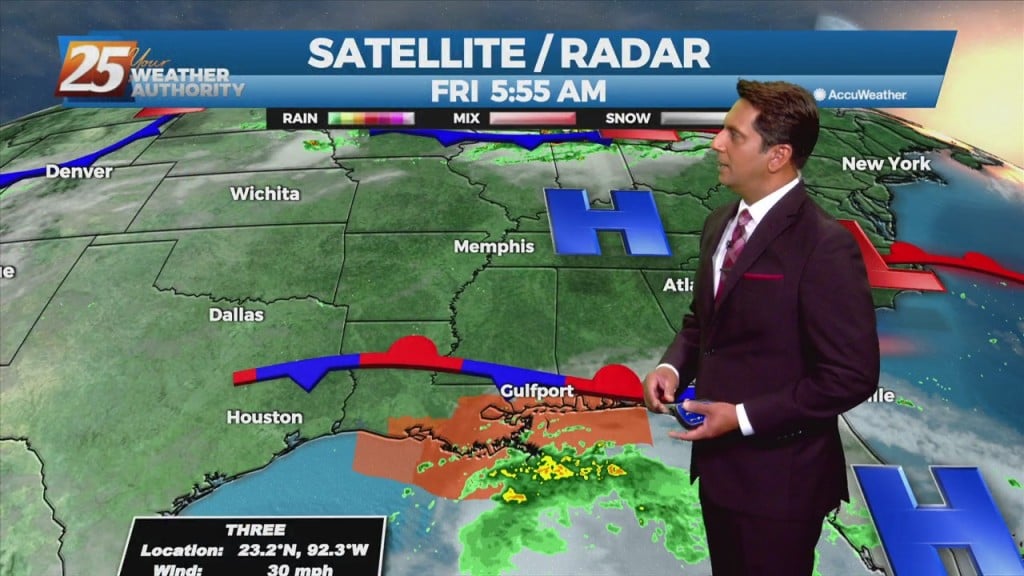
South Mississippians woke up to a rainy morning as a tropical system moves through the Gulf of Mexico and bears down on Gulf Coast. WXXV Chief Meteorologist Ron Knight said Tropical Cyclone 3…
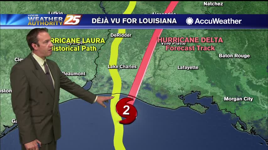
Delta is land falling in Southwest Louisiana, missing us but bringing at least a few issues to the South MS area.

Didn't see much rain today, but more is on the way as Beta begins to drift our direction.
Quiet end to this week, but next week will be quite a doozy with two potential hurricanes in the Northern Gulf.
We expect more showers and thunderstorms through the night, but the end of Harvey is in sight. Click the forecast link for more details.
Harvey continues its rapid intensification, and will strike Southeastern TX overnight tomorrow. We'll see some enhanced rain locally, but you'll have to click the link for details.
Skies quieted for a while after an "active" morning, but even then a few tornado warning were issued. The stormy weather will continue, so click the link for the forecast details.
It may feel like a tropical rain-forest now, but it'll keep getting worse until a strong cold front moves through Sunday night. Watch the full forecast for details.
More cloudy and warmer today than we've seen recently, but clearing & cooling conditions are right around the corner. Local and tropical details inside.
We talk about Major Hurricane Matthew and it's landfall ... forecast for tomorrow midday along Florida's east coast.
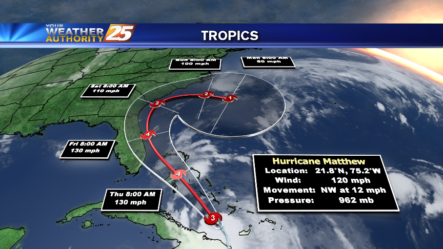
Major Hurricane Matthew will dominate weather headlines over the next few days. We have the latest!

Rain and storms have lurked around the Coast today, dropping heavy rain at times as they moved in from the Gulf of Mexico. More of the same can be expected overnight, as abundant moisture will remain in place. For the…