5/14 - The Chief's "Simply GORGEOUS" Tuesday Afternoon Forecast
An area of weak low-pressure overhead will slide to the east and dissipate. We will transition into somewhat lower dew-points and maintain those conditions for the next…
An area of weak low-pressure overhead will slide to the east and dissipate. We will transition into somewhat lower dew-points and maintain those conditions for the next…
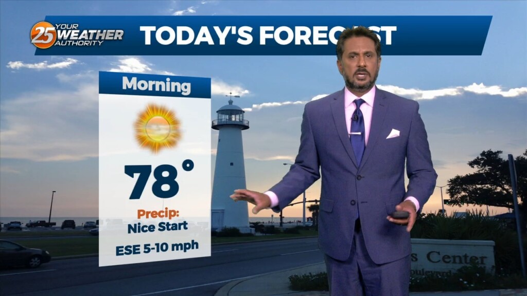
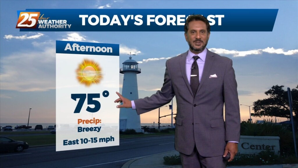
Dense fog should quickly burn off in the following hours after sunrise and temperatures will rapidly warm into the upper 80s to low 90s area…
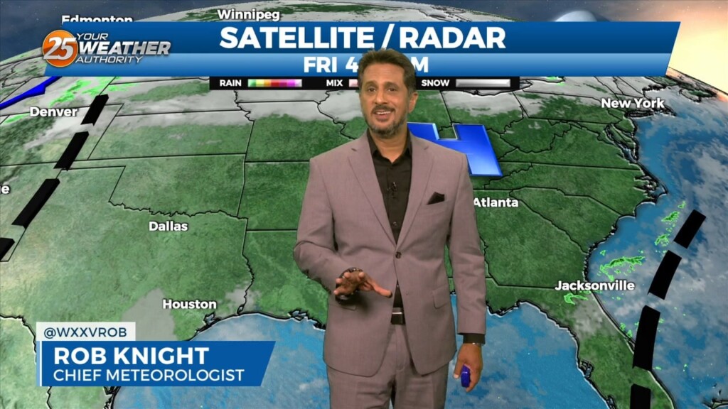
At the surface, high pressure extended from near Bermuda westward across much of the northern Gulf of Mexico. A stationary frontal boundary was well to the…
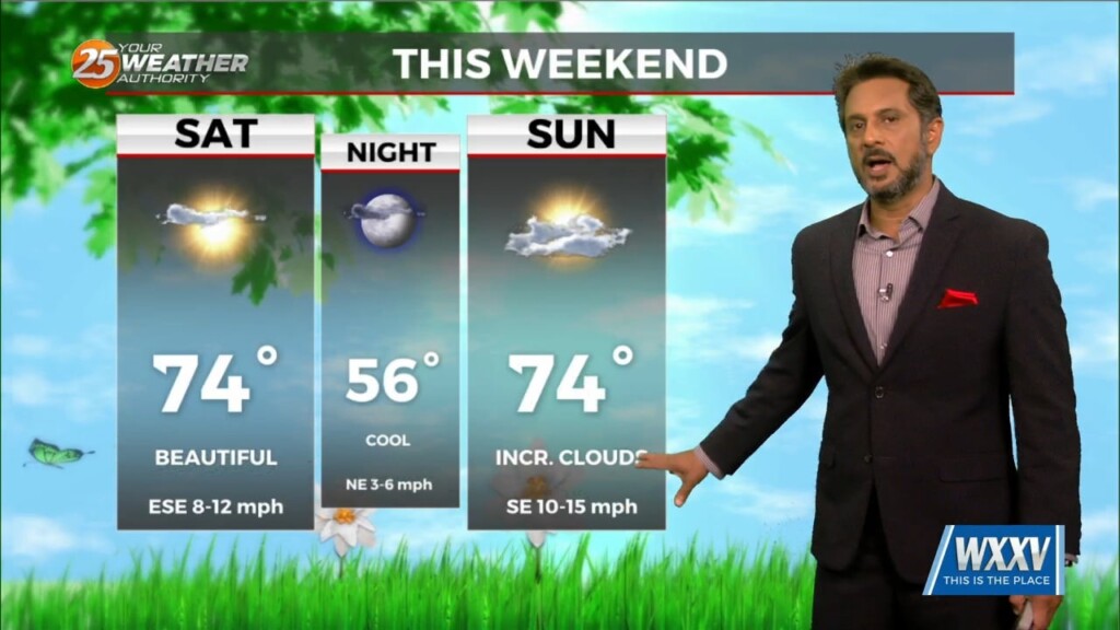
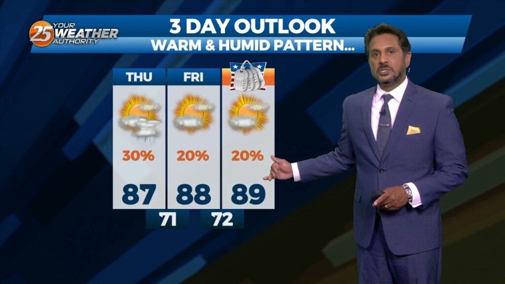
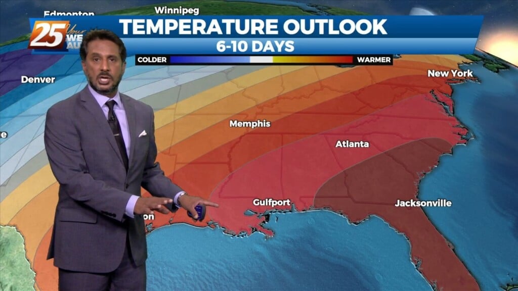
MAKE PLANS FOR OUTDOOR ACTIVITIES THIS WEEKEND... High pressure moving into the region from the NW will provide for dry conditions, which will go a long…
Overall, entire weather pattern is benign with the high pressure bringing moderate temperatures and no precipitation. Northwest flow aloft will give us one more night of cool…
The strong solar insolation expected this afternoon will allow highs to climb to near average this afternoon, but low tonight will quickly plunge into the 40s north…
Pretty quiet conditions expected through the short term as high pressure gradually shifts eastward allowing southeasterly winds to take hold of the area. The southeasterly winds…
A beautiful day is ahead with mostly clear skies becoming partly cloudy this afternoon. The next frontal system will be getting together by tonight as the…
Dense morning fog will be a factor though late morning with a dense fog advisory in effect. Tonight, sounding profiles are showing a…
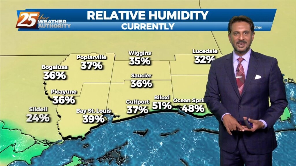
High pressure to our east today will help low level dew points to begin to climb and a slight warming trend (overnight) is anticipated to…
High pressure will continue to move downstream over the Mid-Atlantic States through today. As the high moves east, onshore flow will be initiated at the surface.…
Today can be best characterized as the transition day across the area/region. High pressure will continue to move downstream over the Mid-Atlantic States through today. As…
High pressure will continue to build into the region from the west as the low pressure that gave us rain/hail on Sunday continues to move…
It’s another cool or coldish morning across the forecast area as the air mass has been slowly modifying. In the upper levels, an area of high…
High pressure yesterday just west of Shreveport/Bossier City La has shifted to our NE. This will innate the return flow from the Gulf of Mexico. Warmer…

High pressure remains dominate over the area and this will remain the case into mid-week. A few showers could tickle the coast from time…

The main story remains to be a weak inverted trough situated over the northern Gulf just south of a weakening stationary front. This continues to…
Despite the frontal passage overnight, temperatures will actually be slightly warmer today given the drier mid-levels holding down afternoon convective development. Rain chances will be lower…
A broad longwave disturbance is currently encompassing the eastern 1/3 of the country and will continue east today and tomorrow. Upper level high pressure…
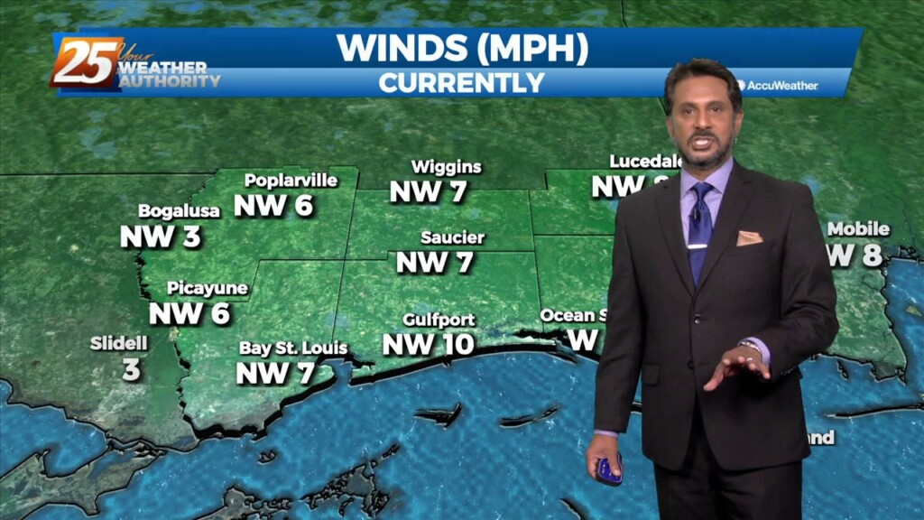
High pressure will continue to move east today with the axis crossing the local area late this afternoon and tonight. This will allow winds to turn…
High pressure was currently located over the Great Plains, with the next in the series of strong storm systems moving across California. At the surface, high…
With no significant cold advection behind this morning's cold front, we should mix out deep enough to get temperatures back in the 70s today with much…
Surface high pressure will continue to spread into the region, which should limit surface winds keeping things light and variable through the short term period.…
It will be a bit cooler today, but overall a very beautiful day ahead across the lower Mississippi River Valley/North Central Gulf Coast. Aloft,…