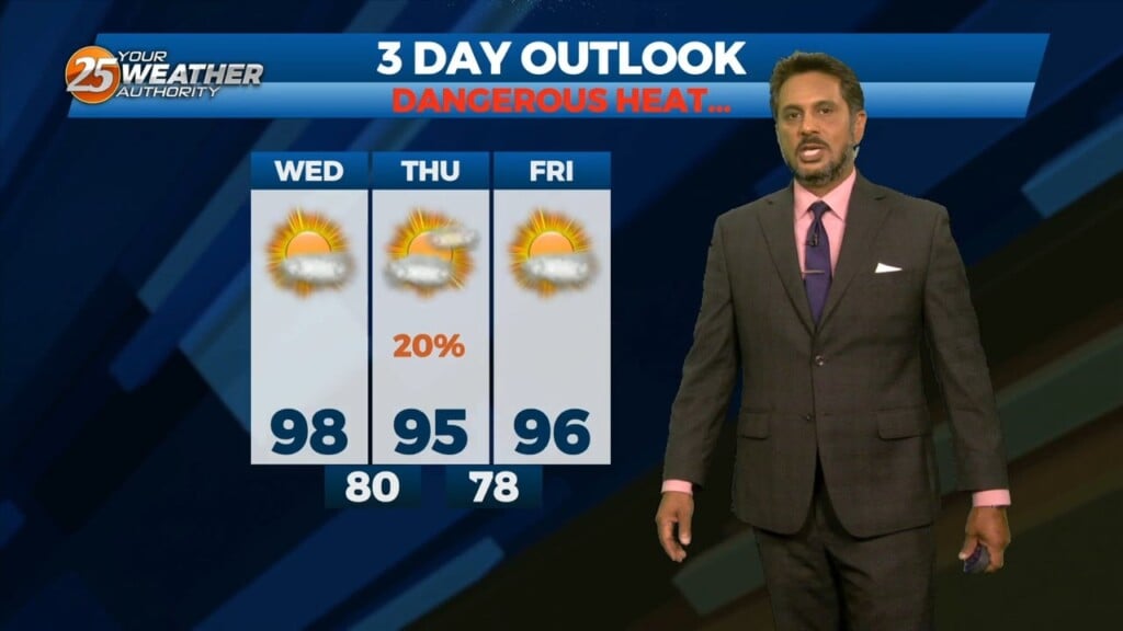
8/23 - The Chief's "DANGEROUS HEAT Continues" Wednesday Afternoon Forecast
An easterly wave is currently located from Appalachia Bay FL down to the NE’tern Gulf of Mexico. This wave will also get flattened down on its…
An easterly wave is currently located from Appalachia Bay FL down to the NE’tern Gulf of Mexico. This wave will also get flattened down on its…
Not much in the way of anything to help showers/t-storms get started today and relatively low chances will continue over the next several days. But some…
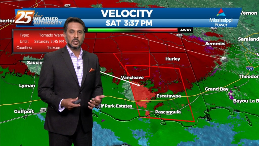
Multiple tornado warnings are being indicated by Doppler in SE Jackson County. Stay safe and stay weather aware...
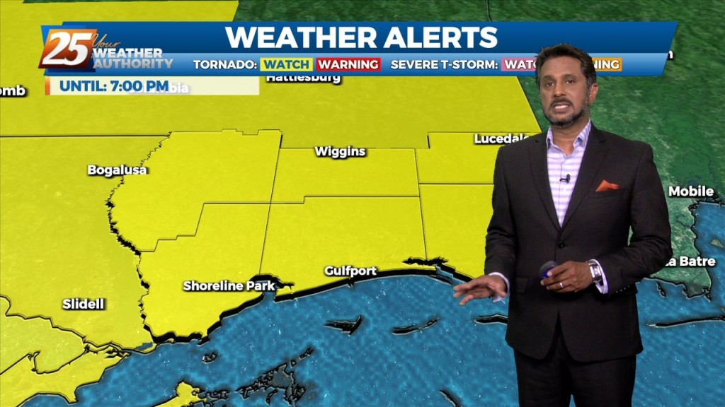
Issued By New Orleans/Baton Rouge - LA, US, National Weather Service Affected Area: Mississippi Sound Description: THE NATIONAL WEATHER SERVICE HAS ISSUED TORNADO WATCH 558 IN EFFECT UNTIL 7…

High pressure continues to dominate the upper level pattern. Heat will be the biggest concern tonight through Saturday. The high pressure is still building/staying over our…
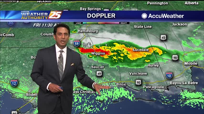
More of the same hot, muggy weather is expected to continue for the next couple of days. Afternoon and early evening showers will be possible over the next few days, with a slight elevation in precip chances into the weekend.…
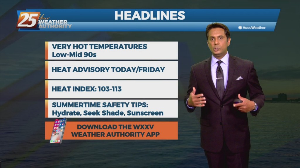
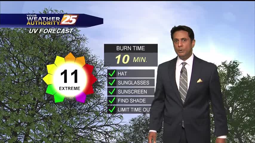
Temperatures continue to climb into the low/mid 90s with the HEAT INDICES topping the 100 degree mark...
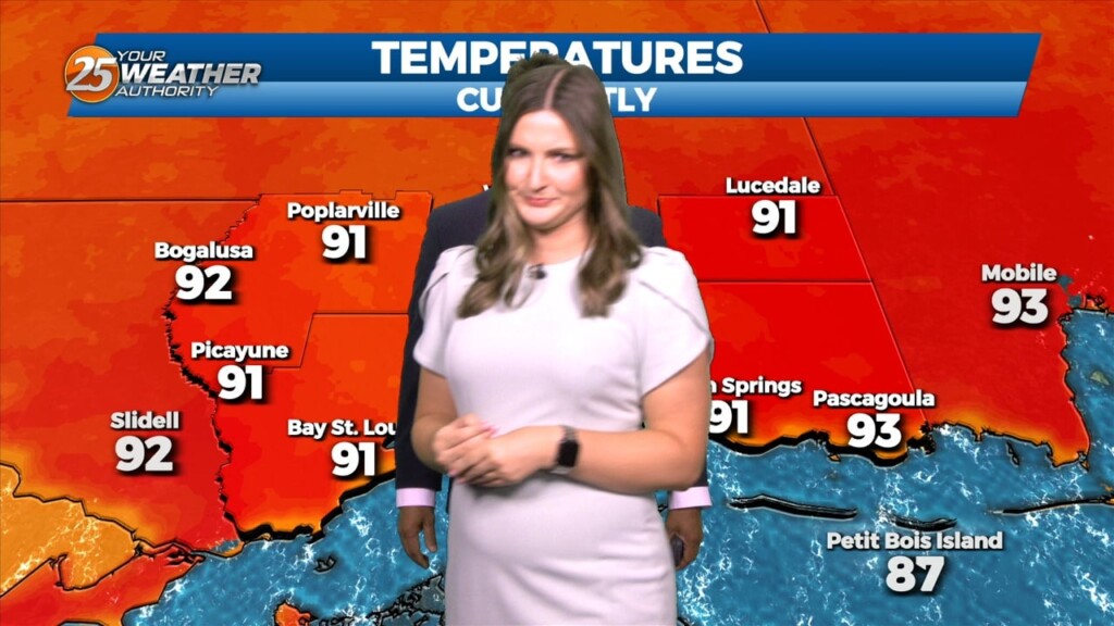
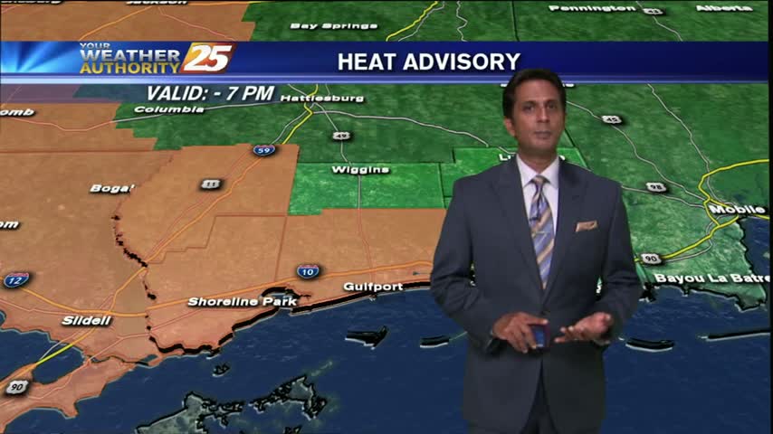
A very warm start to the day with a HEAT ADVISORY in effect through this evening...
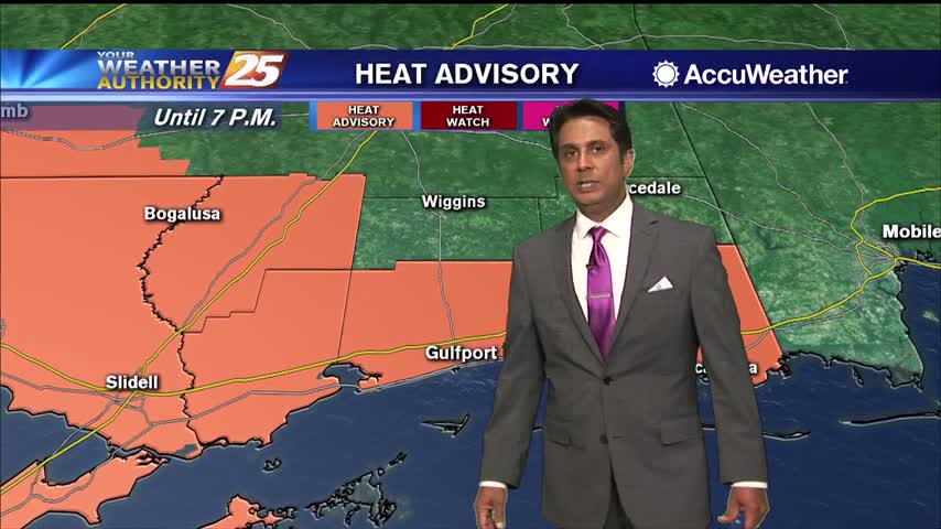
Avery warm start to the day with ares west of south Mississippi already under a HEAT ADVISORY...

A windy and humid start to the day with isolated rain moving in from the south...
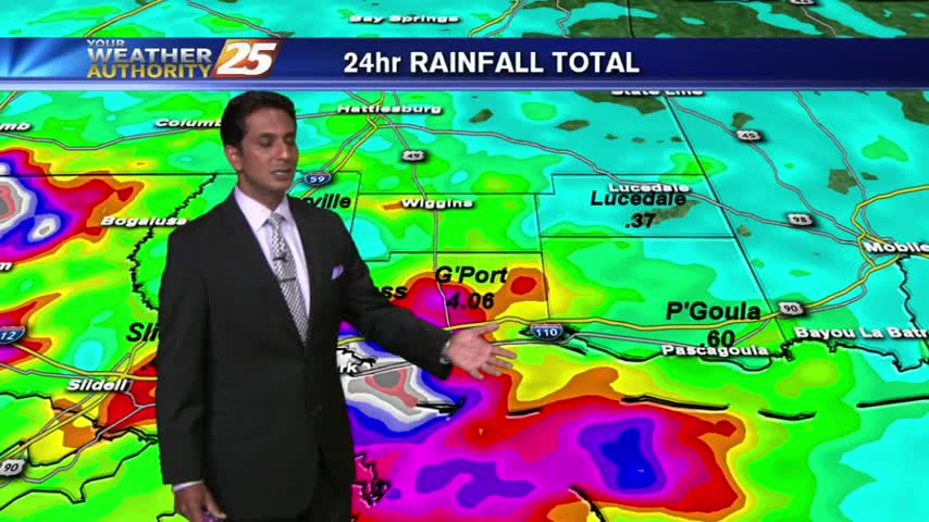
Round 2 has begun with HEAVY RAIN already in the area. Coupled with areas of patchy FOG...visibility is greatly reduced.
Temps continue to rise as showers and t-storms pop in the local area and over the sound...