1/12 - The Chief's "Morning Severe Threat Potential" Friday Morning Forecast
With an approaching system to the west, showers and t-storms are expected through midday. It seems that the best instability and forcing will remain north.…
With an approaching system to the west, showers and t-storms are expected through midday. It seems that the best instability and forcing will remain north.…
We continue to see scattered t-storms develop along a boundary well to the southwest, with strong to severe storms noted over the Gulf of Mexico to…
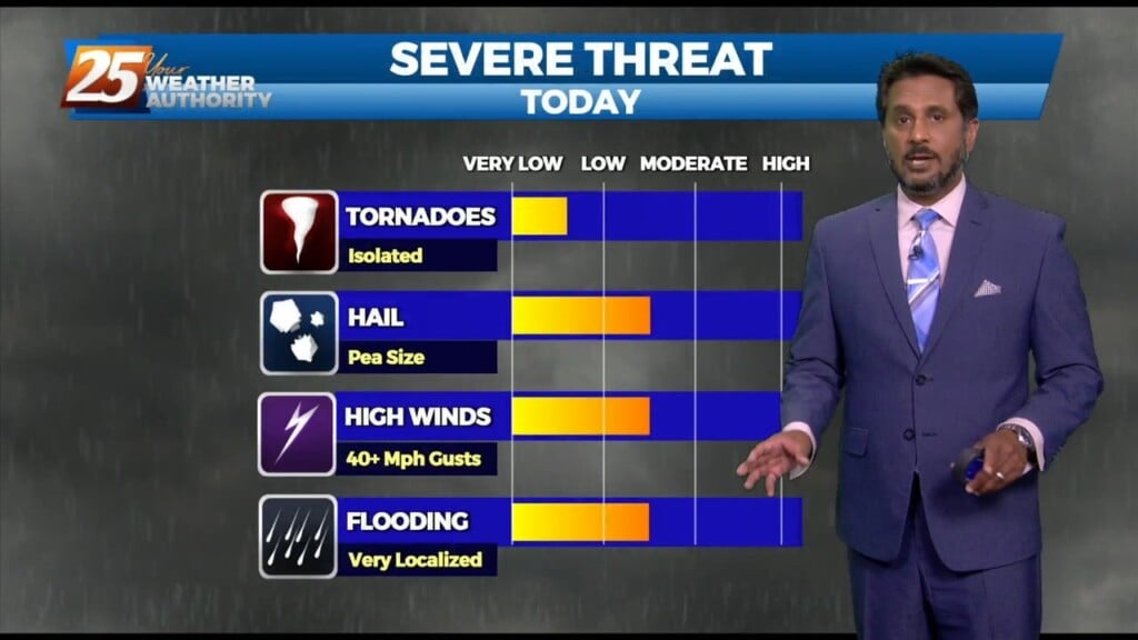
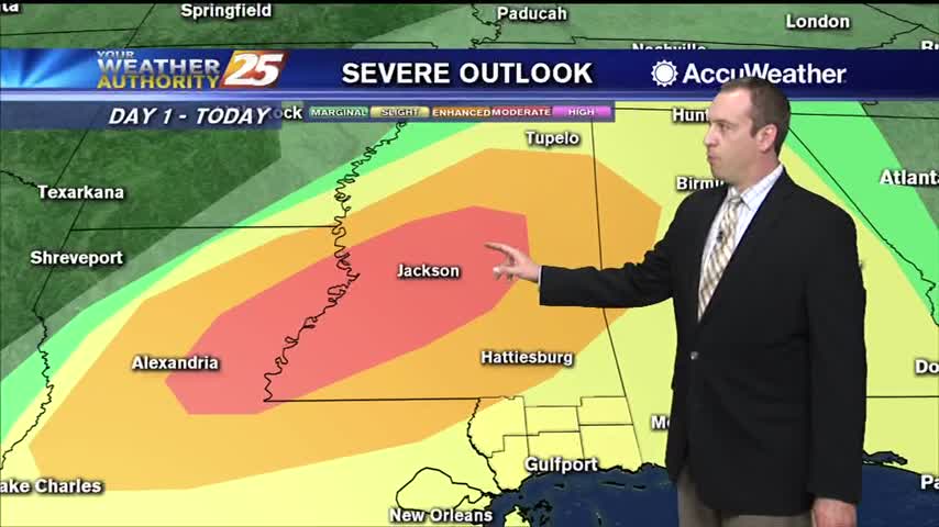
A vigorous system is in the area moving to the east. The area is under a TORNADO WATCH until 10 AM. All form of SEVERITY will…
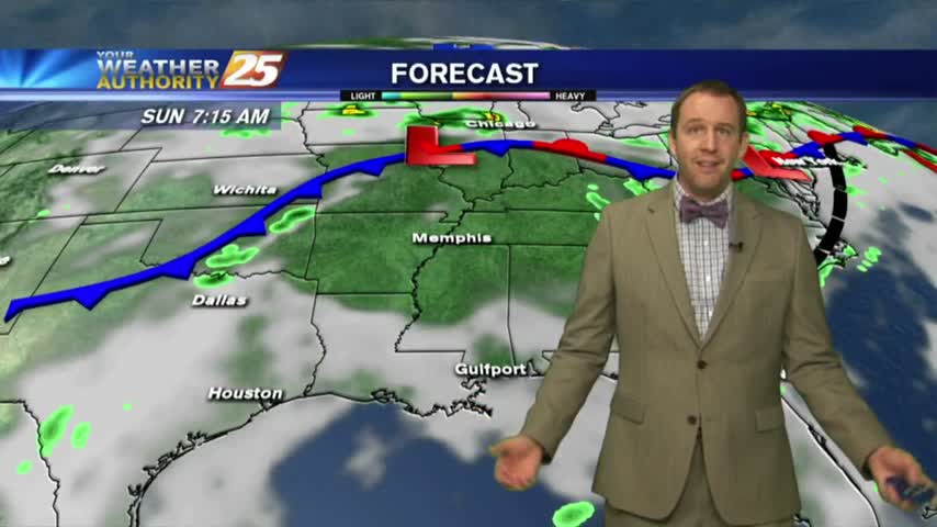
A brief dry period today will change overnight as the stationary front drifts north, along with a vigorous cold front approaching from the NW. Rain will move back…
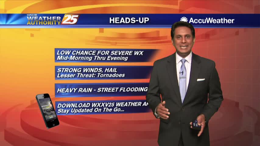
Wet conditions will continue this afternoon with the THREAT for heavy rainfall...
A cold front is moving in and strong thunderstorms are likely overnight before nicer weather moves in.
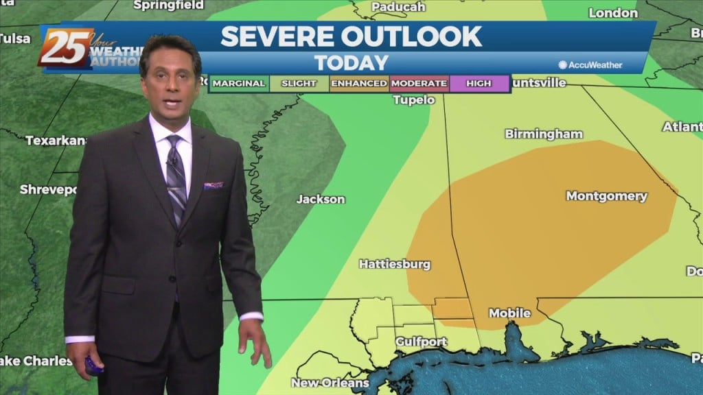
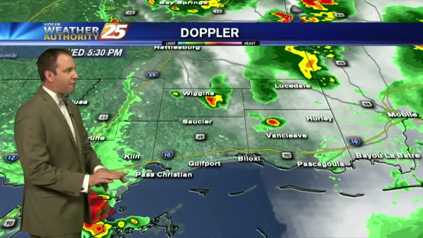
Showers and t-storms continue to move into south Mississippi with a TORNADO WATCH in effect through 3 PM...
It's a cloudy start this morning as a cold front will move through south Mississippi later today...
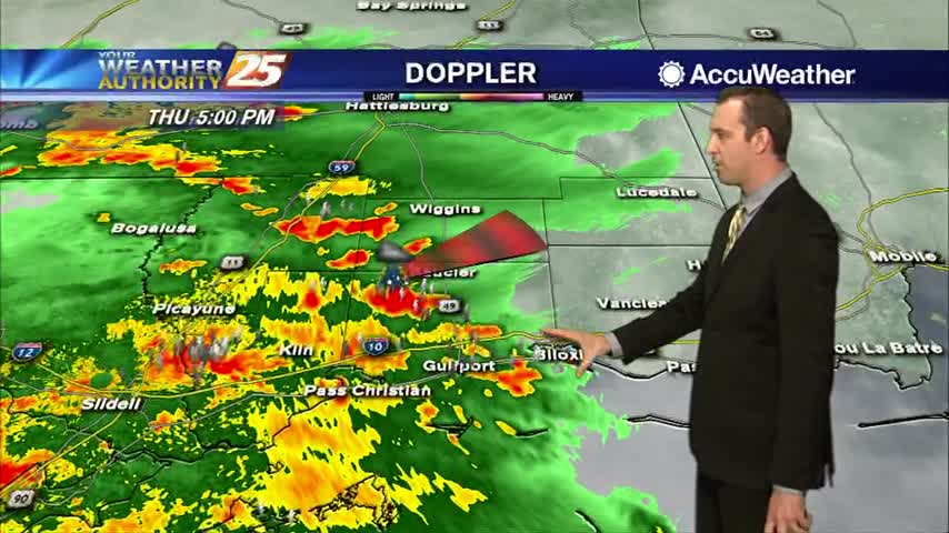
A few thunderstorms moved through the area earlier in the evening, but even more are expected over the weekend....
Afternoon storms brought some severe weather an lingered into the evening, but I'm expecting less of those each day through the weekend....
Another hot and humid day, another afternoon of showers and thunderstorms with severe weather traits. Expect similar days ahead....
Today's record breaking temperature brought another afternoon of showers and thunderstorms, and I'm expecting very little change for the rest of the week....

It hasn't been officially confirmed yet, but we received a report of hail in one of the afternoon storms near Perkinston, MS. Expect more showers, t-storms, and hot afternoons ahead....
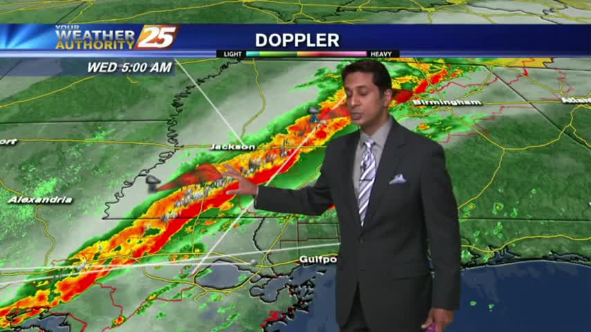
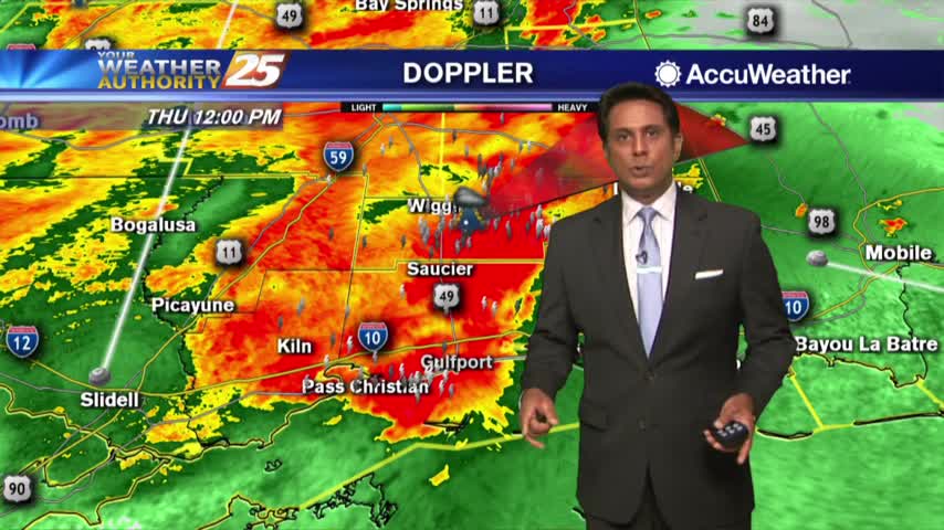
A line of INTENSE t-storms associated with a slow moving cold front will affect the viewing area this morning...