04/21 Ryan's "Slightly Warmer, More Cloudy" Tuesday Morning Forecast
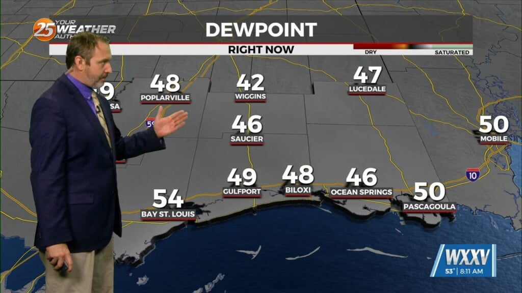
It was still a little chilly and largely clear this morning, but it'll get more cloudy and continue our subtle warming trend as we head into…
It was still a little chilly and largely clear this morning, but it'll get more cloudy and continue our subtle warming trend as we head into…
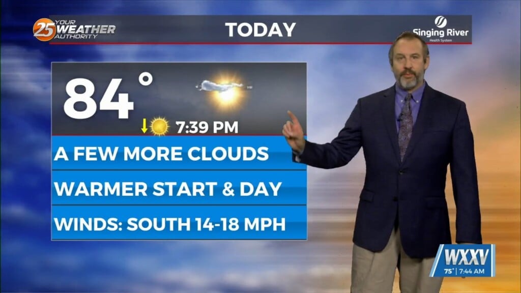
Today will still be a fairly typical spring afternoon, but conditions will be a bit closer to summer as we head through the rest of the week and…
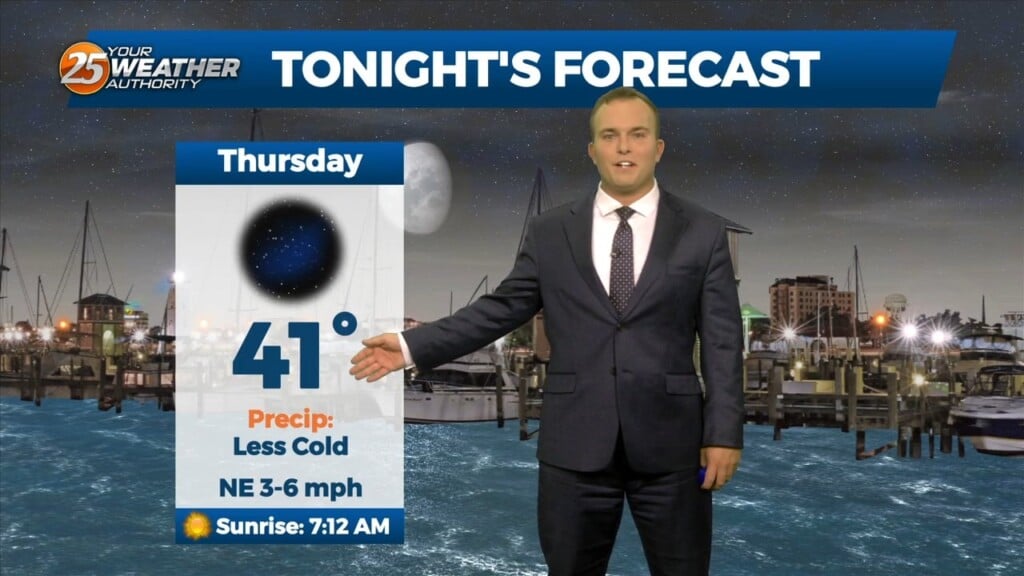
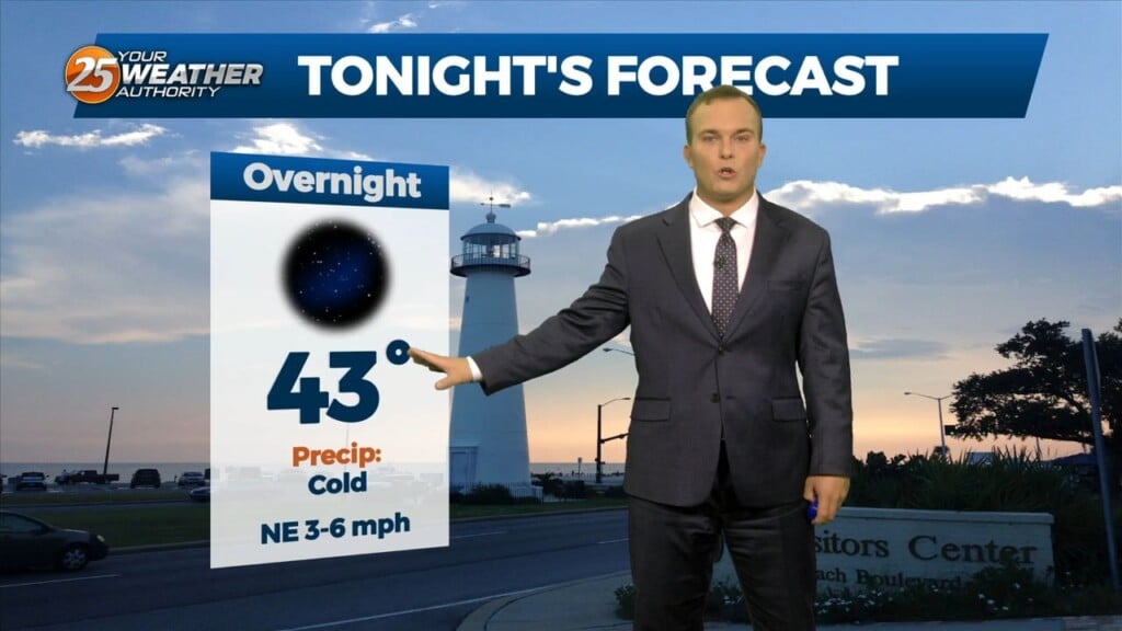
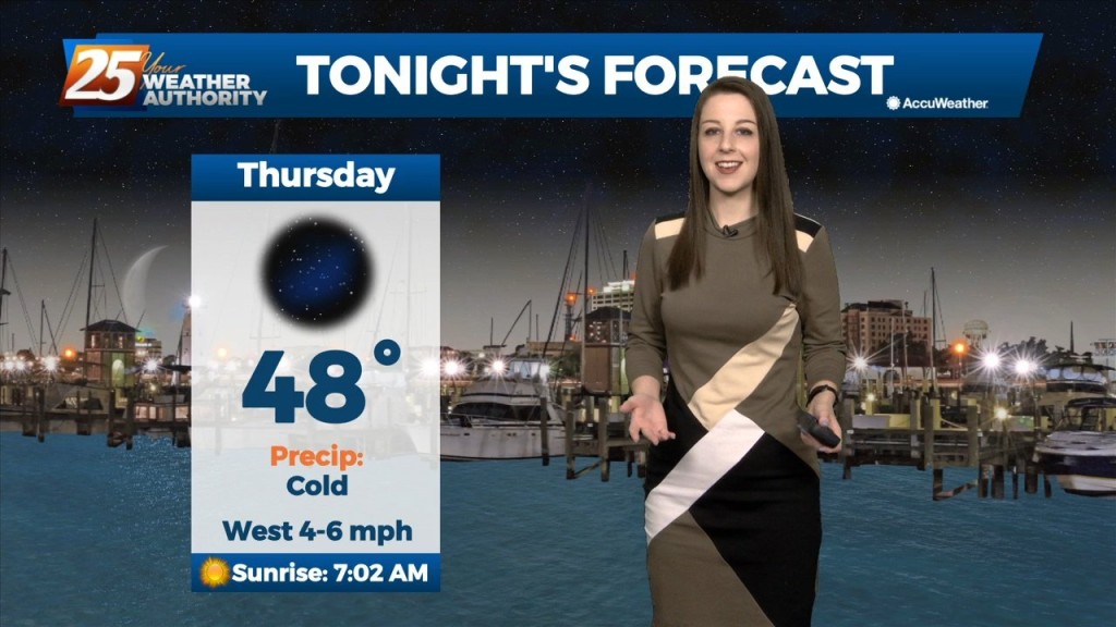
Tonight will feature cold temperatures again but freeze concerns are off the table. Expect morning low temperatures to be around 5 – 10 degrees warmer than last…
Temperatures are warmer than this time yesterday as the cold airmass loosens its grip on the area. Expect one more cold night with only very…
As the deep longwave trough situated over the eastern CONUS this week finally lifts out it will be replaced by a shortwave mid-upper ridge on Friday before flow…
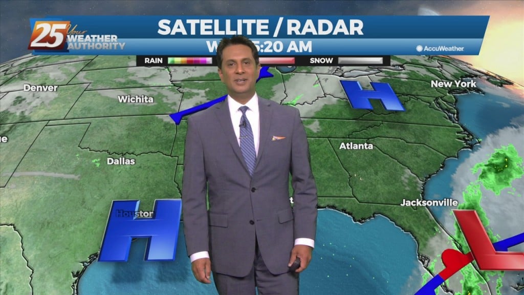
High pressure will dominate throughout the region over the next few days. Today will bring sunshine and slightly warmer temperatures, with dry and cool tonight under clear…
A weak cold front will slip though the area early tomorrow morning. There isn't sufficient moisture so I'm not expecting any weather with passage with the exception…
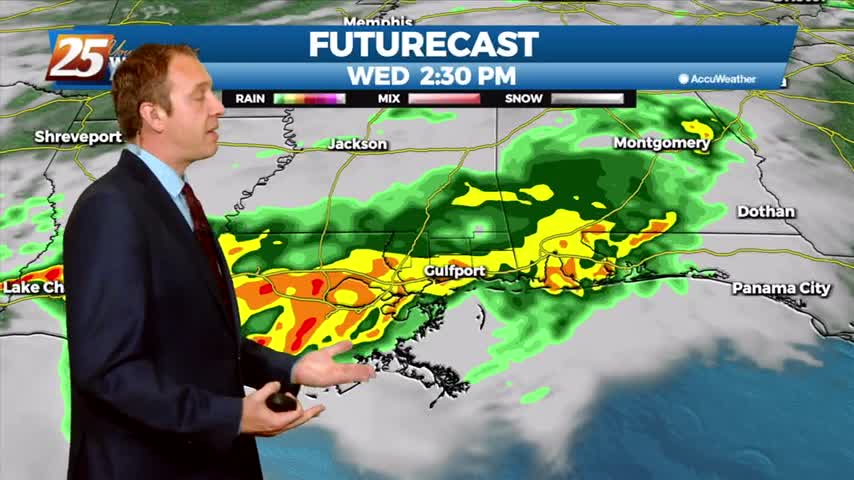
Expect to have seen the last clear skies for most of the week as clouds and rain move in, but they'll be on their way out by the weekend.
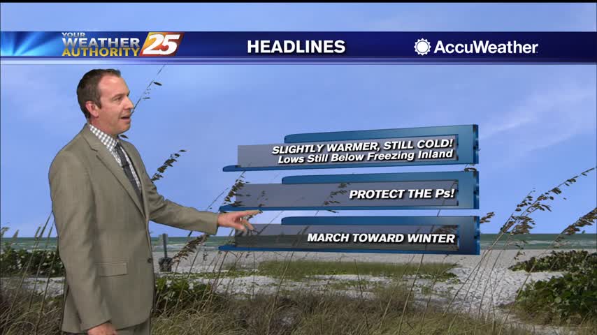
Still going to be very cold tonight, still below freezing in many areas, but will be a little warmer than last night was...a trend that'll continue through the middle of the week.
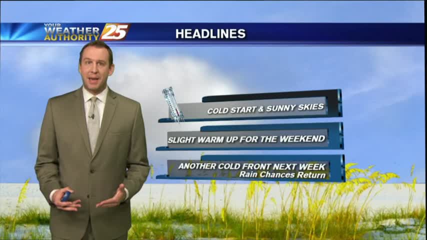
Get ready for another cold one, but I expect it to be slightly (a degree or so) warmer than last night. Warming increases into next week, into the low 70s by Tuesday.
Last night was as cold as we've been since early this year, but we'll warm over the next day or so before another slight cool down. Watch the full forecast for more.