3/7 - Rob Afternoon "Impending Weather" Forecast
After light showers earlier this morning, isolated t-storms are beginning to develop to the west...
After light showers earlier this morning, isolated t-storms are beginning to develop to the west...
After a BEAUTIFUL sunny weekend of parades, showers/t-storms are starting to move into the area...

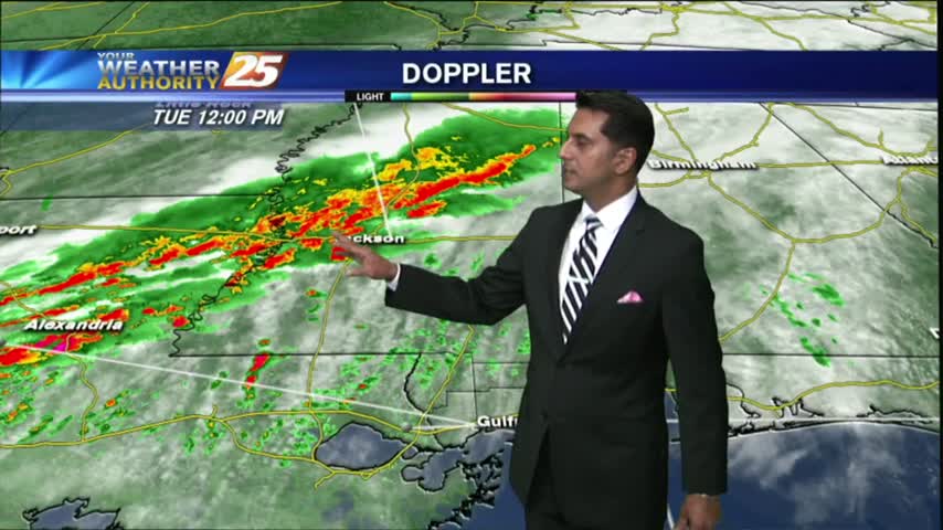
The gray/gloomy continues with rain and t-storms already in the area...and a SEVERE THREAT for this afternoon.

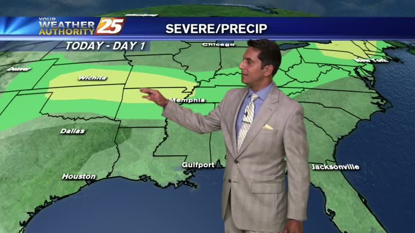
Showers and t-storms continues to move in from the northern Gulf, HEAVY RAIN will be possible this afternoon...
Isolated morning rain is moving in from the Gulf/Sound, with the activity expected to increase...

With an elevated cold front overhead slowly moving SW, the wet stuff is in the forecast for another day...
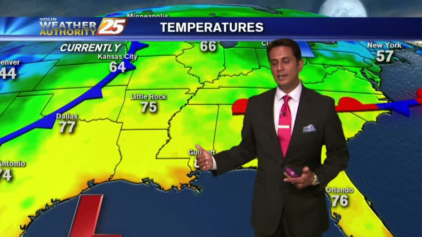
A mild and humid start this morning as high-pressure to the south moves to our SW...
After a batch of t-storms with heavy rain overnight, isolated activity continues this morning...
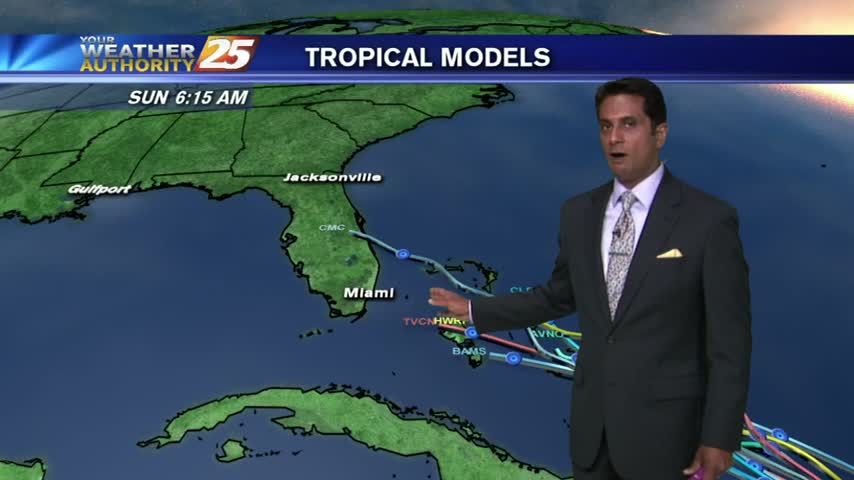
As an upper-level area of low-pressure moves west...wet conditions will be in the area once again.
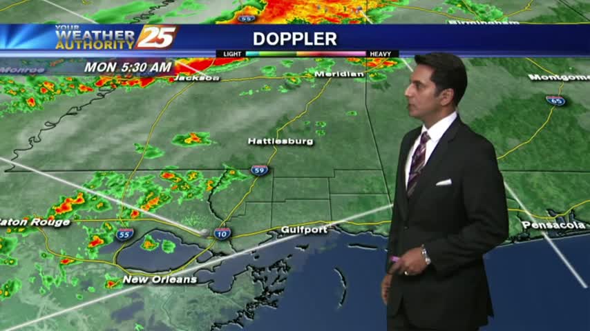
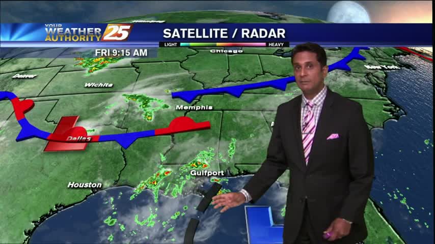
Showers and t-storms moving in from the northern Gulf to kick-off your morning commute...
After a warm and humid start, showers developed earlier...now becoming t-storms with daytime heating...
Showers and thunderstorms have developed north of the coast and are pushing south...
Isolated t-storms continued overnight...the activity will begin early today and continue through this evening.
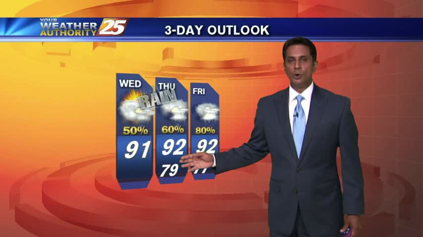
A warm start with another day of showers/t-storms, along with elevating rain potential through the weekend...
The strong tropical air mass continues, with showers and thunderstorms developing and moving into the area...