Weather causing road flooding, power outages along Coast
City officials and first responders are reporting some issues this morning caused by the weather. In Biloxi, Cedar Road is closed from the Methodist church to Christian Assembly…
City officials and first responders are reporting some issues this morning caused by the weather. In Biloxi, Cedar Road is closed from the Methodist church to Christian Assembly…

T Today will be the day of transition in our weather pattern. A chilly start will turn into a mild day with an easterly breeze picking up…
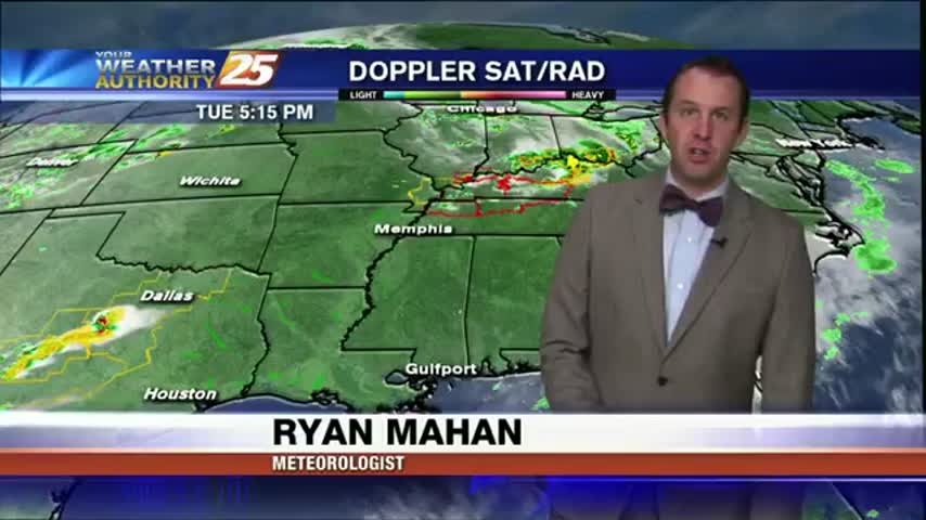
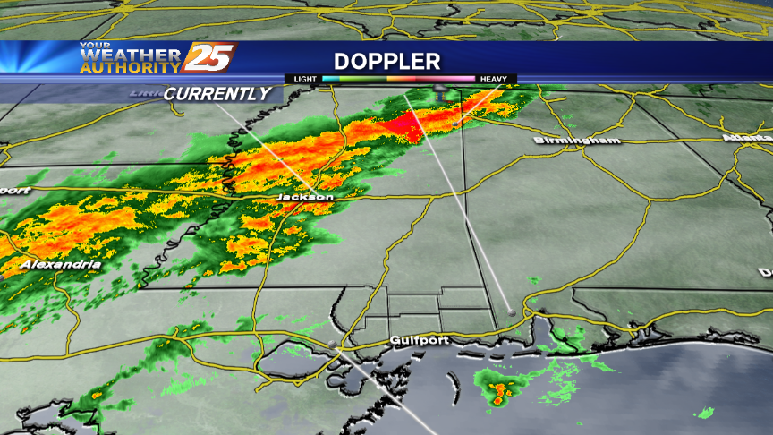
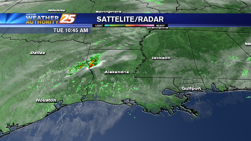
Didn't see too much severe weather in South MS during the event, but showers still linger....
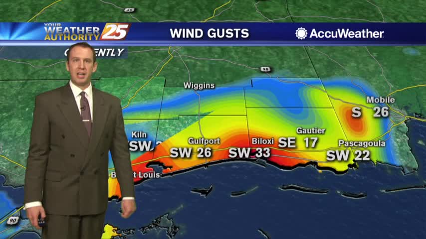
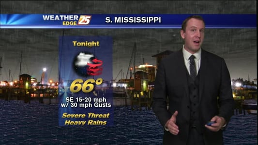
While South Mississippi may have missed the brunt of the severe weather, officials are stressing how important it is to always be prepared. This morning in Harrison County winds picked up in the 30 mile per hour range. We also…

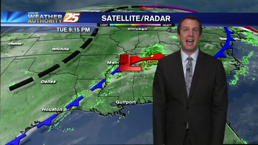
Cold front has pushed through half of the State so far, and is just now arriving in South MS. I'll be monitoring for severe weather during the next few hours, so be sure to check back for updates but enjoy this forecast now.
After a pleasant day, we'll see a strong round of storms tonight. Details within, updates to come.

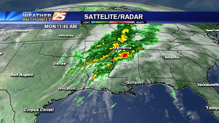
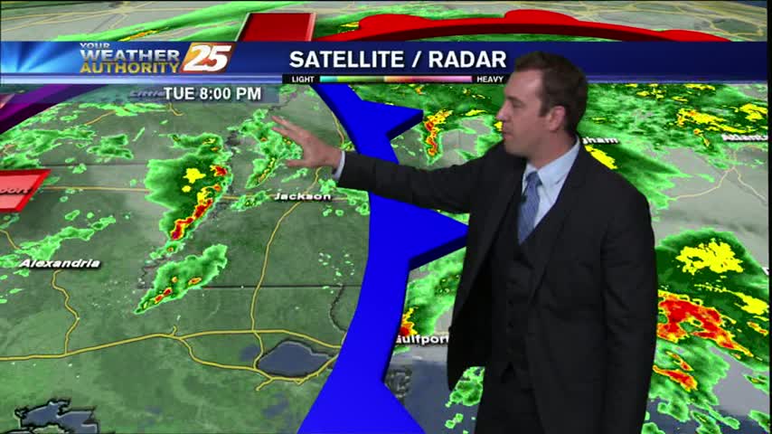
After a stormy afternoon with some severe damage, things have quieted down for the evening. How long will it last? Watch the forecast for more.
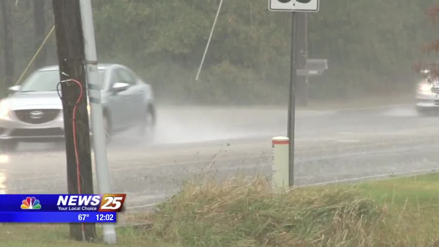
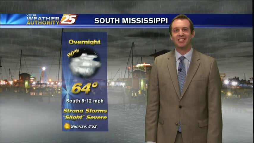
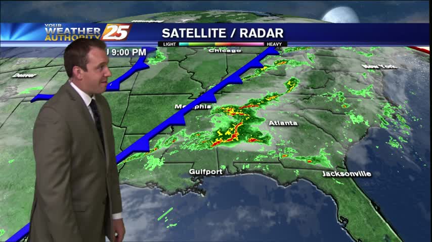
Rain and thunderstorms will persist into the afternoon, bringing heavy rainfall at times and the chance for a few severe storms late in the afternoon and into the evening hours, ending after midnight.
Rain has ended across southern Mississippi and milder weather will complete our workweek. However, a few consecutive days of rain are to affect us starting this weekend.
Strong storms expected overnight, but the sun returns before the weekend. Details inside.
Strong to severe storms are possible on the Coast tonight and into early Wednesday. Damaging winds and isolated tornadoes will be possible from late this afternoon through mid-morning Wednesday.

Cold front moving nearby tonight, but rain will last into Wednesday. Full forecast inside.
Strong to severe storms will be possible tonight on the Coast and again Tuesday night and Wednesday morning.
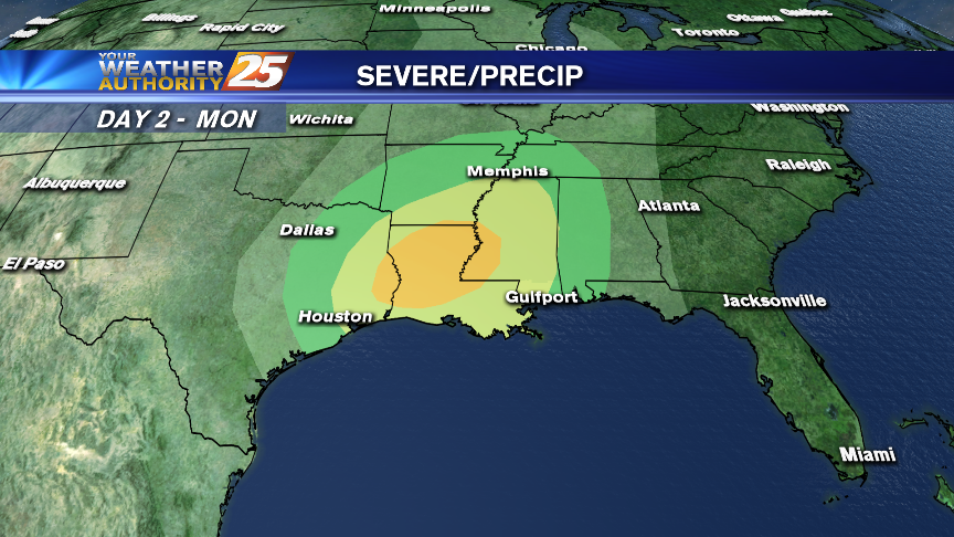
Rain and thunderstorms will affect the area starting on Monday afternoon through Wednesday with rounds of severe storms possible Monday evening and again Tuesday night.

Hurricane season may soon be coming to a close, but that doesn’t mean you can let your guard down. Today, Governor Phil Bryant declared October 24th through the 28th Fall Severe Weather Preparedness Week. According to the National Weather Service,…
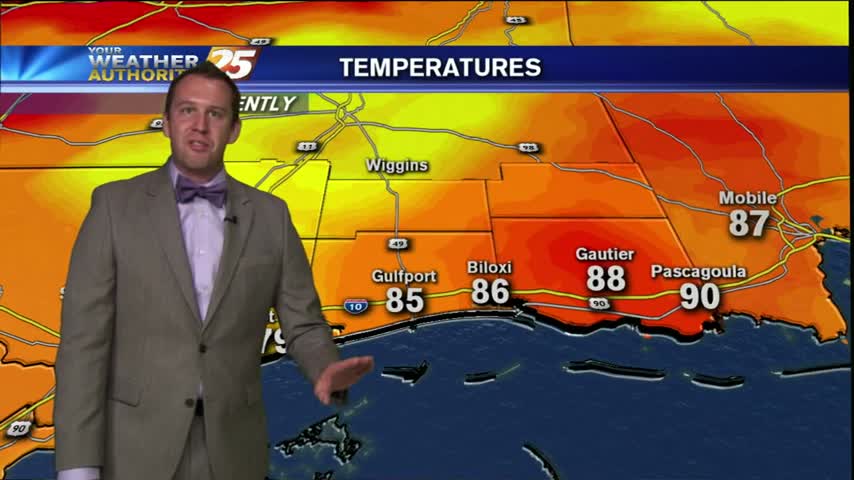
The last few days have gone exactly as we expected them to, and the "Hump Day Forecast" calls for even more consistency. We're seeing a lot of hot & humid days with showers that move in during the late afternoon,…
I really expected to see more thunderstorms in the area on this Thursday afternoon, but this cold front is moving very slowly and convection has yet to fire anywhere in the six coastal county area. These storms have had a…

We are continuing to see strong southerly winds bringing an excess of Gulf moisture here on Tuesday night, which causing the formation of convection fog near coastal areas. Many fronts are primed to move through South MS, but it seems…
We've been seeing them approach slowly over the last few days, but the rainy conditions have finally arrived in South Mississippi. The coastline has still been largely spared but some moderate to heavy rain showers have already moved over the…
We certainly had quite an active afternoon here in South Mississippi. Severe storms ripped through much of the Southeast with most of the damage centered in Southern Louisiana and near Hattiesburg. Strong sustained winds battered much of the coastline, gusting…
Weather forecast for the week after 11/17/15.