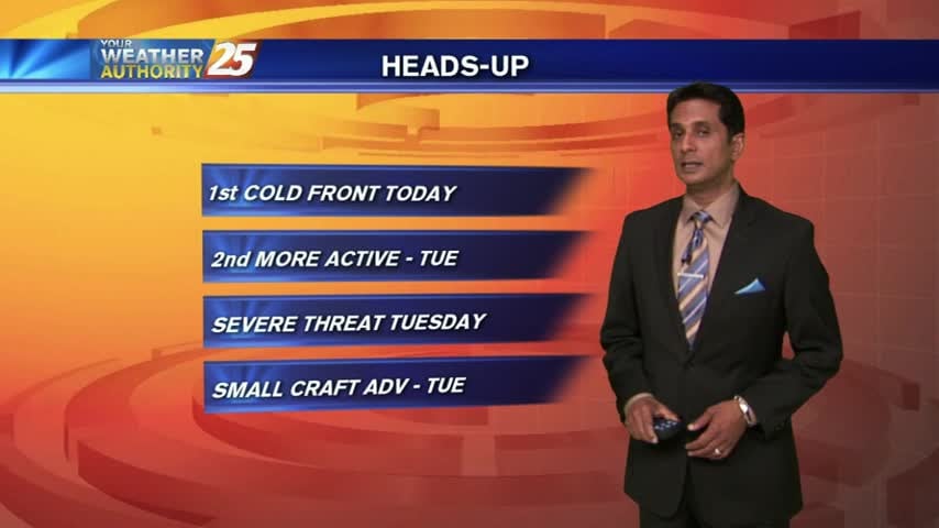
11/30 - Rob's "SEVERE UPDATE"...
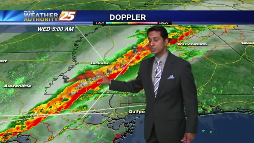
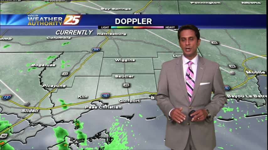
The more intense activity associated with the cold front is now moving across the area...
The more intense activity associated with the cold front is now moving across the area...
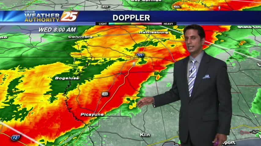
A line of INTENSE t-storms associated with a slow moving cold front will affect the viewing area this morning...
A south wind from yesterday continues; increasing humidity and feeding an approaching cold front to our west...
A WARM & HUMID start...
Showers and thunderstorms are developing in the local area in advance of a more vigorous line to our west...
A warm/humid start as a cold front begins to affect our western region...
Cloudy skies continue with WARM & HUMID conditions in advance of a cold front developing to the west...
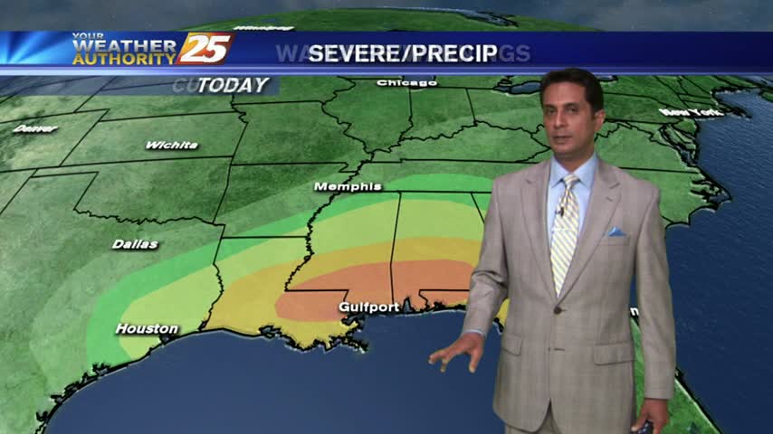
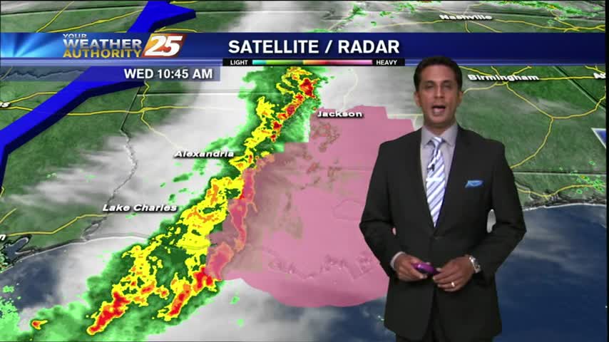
It's a mild start with humid conditions and areas of patch fog. The gulf south is in a "MODERATE" THREAT for severe storms this afternoon/tonight...
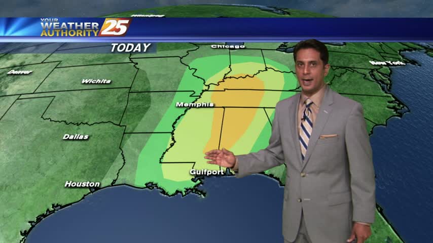
With a cold front in central Mississippi...expect periods of rain through today along with a few thunderstorms.
A WARM and HUMID start with patchy dense fog along the coastal counties...