06/15 Ryan's "Almost Summer" Monday Evening Forecast
We've begun the final week of Spring, so I guess it's appropriate it won't be very "spring-like."
We've begun the final week of Spring, so I guess it's appropriate it won't be very "spring-like."
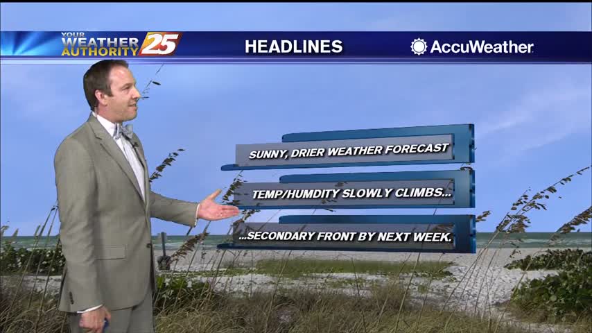
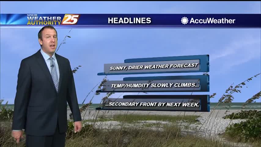
More sunny and drier weather is on the way, with very little cloud cover in the days ahead.

Beautiful, cloud-free skies have moved in, and will largely remain consistent for the weekend and most of next week.
Much more pleasant weather is moving in and won't be in any hurry to leave through the weekend.
Finally a dry day out there, no chance of rain and plenty of sunshine for the rest of the week!
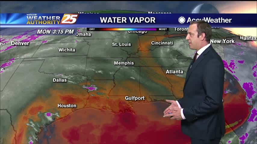
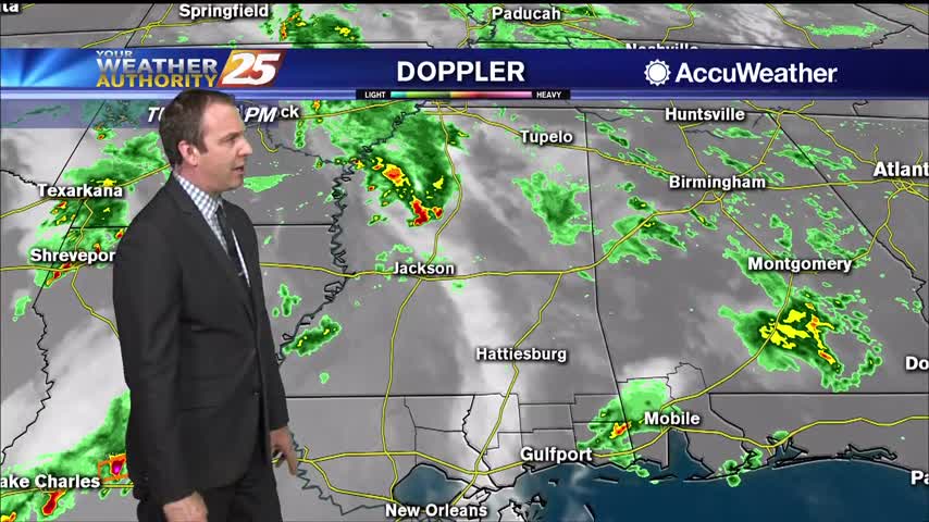
Started off the day with rain, but drier air is moving in rapidly over the next few days.
One last blast of rain this morning, but clearing skies and cooling air is on the way.
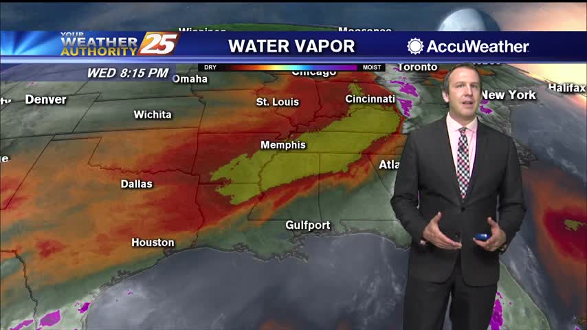
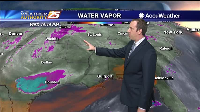
Drier air is finally on the way, but until it really takes hold it'll still be raining a little longer.
Scattered showers continue in South MS, but these wet, hot, and muggy days are almost over.
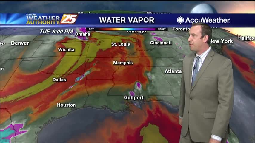
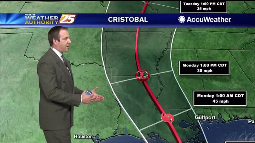
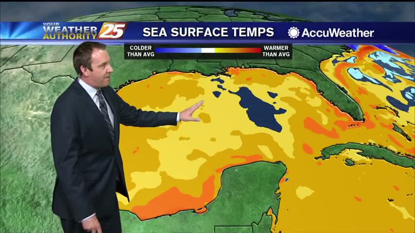
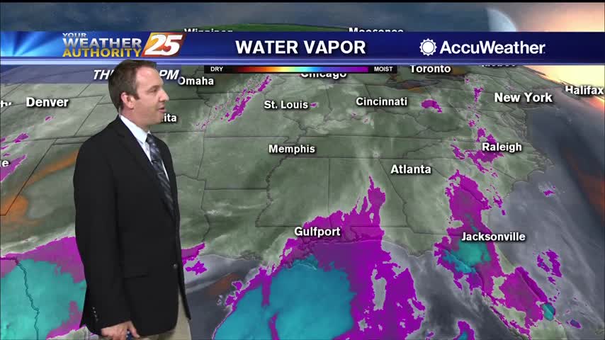
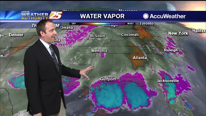
Cristobal brought over a foot of rain since yesterday, but is now moving on. The rain lingers a bit longer though....
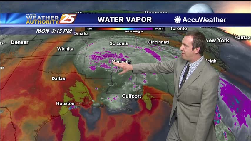
Cristobal has moved inland, but rain will continue for the next few days....
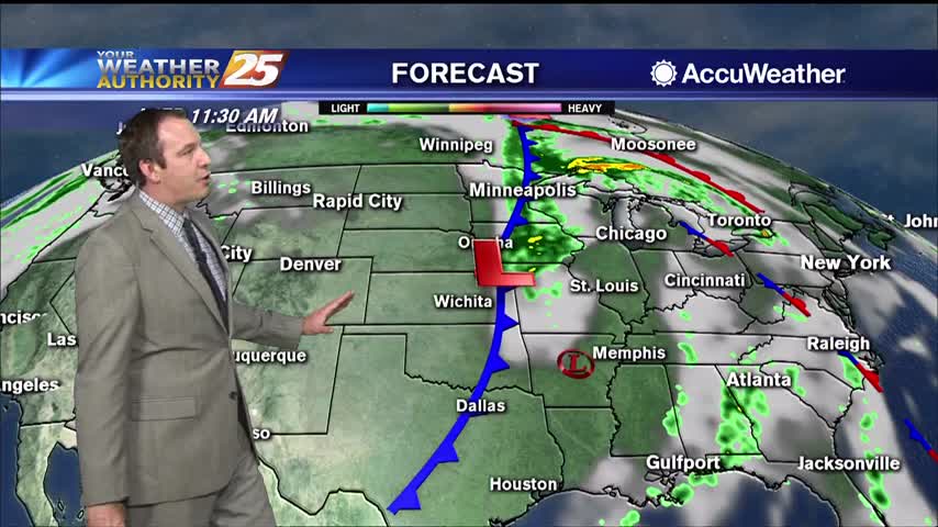
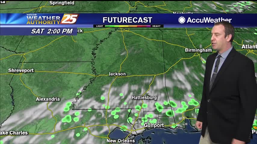
Didn't see much rain today, but we'll see nearly a foot by Monday as tropical storm Cristobal moves in and slowly pushes inland.

Today was nice and sunny with a couple of isolated showers, but tropical influences will bring heavy rain and strong storms to the Gulf Coast for the weekend.
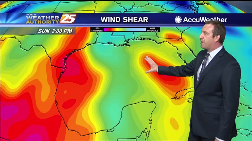
More afternoon rain today and tomorrow, but a tropical system will drive our active weather over the weekend.
Didn't see many afternoon showers today, but we'll rarely be completely rid of them as summer rolls around....

Earlier rain has given way to partly cloudy skies and humid conditions, but the afternoon rain moves back in quickly tomorrow.

Wet conditions earlier today as showers and thunderstorms moved through, but the evening has cleared some.
Our afternoon clouds and showers have cleared, and we're in for a long string of sunny days ahead.

It's been pretty cloudy all week, but we're finally starting to see some positive changes moving in.
Only a small spot of rain today in South MS, but we saw plenty of clouds and high humidity again.
Much less rain today, but still cloudy in South MS. Expect the rain to return tomorrow ahead of some weekend clearing.
Thunder rolled this morning as strong thunderstorms lingered, but things have cleared up since...won't last long though.
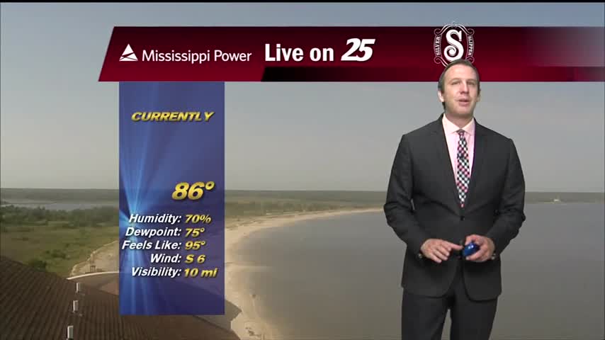
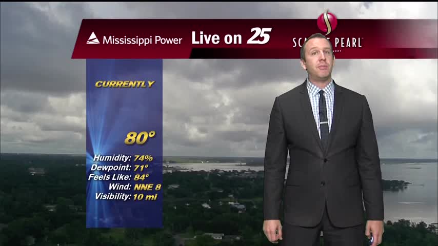
Another hot and humid day with a warm and humid night in between, but we're seeing more afternoon shower activity.
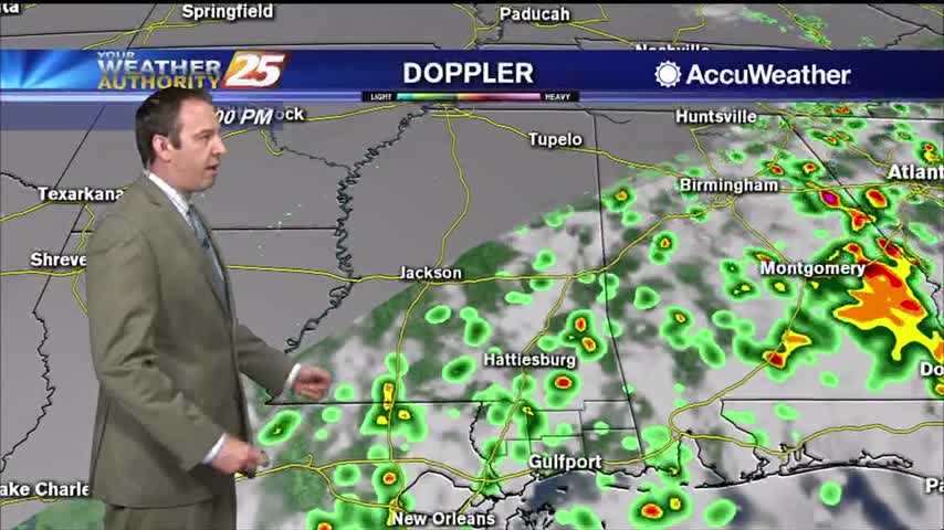
More rain today during a stormy afternoon, but it will die off a bit into the night...only to come right back tomorrow.