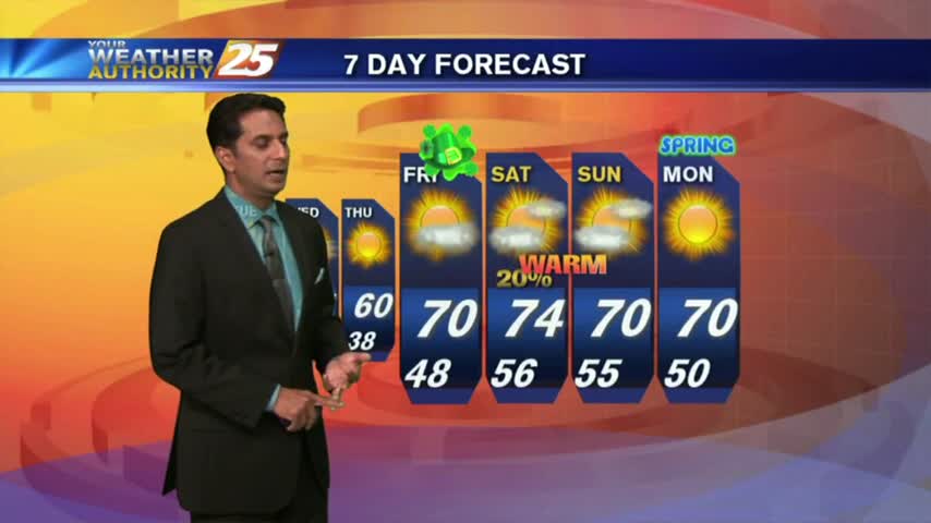
4/7 - Rob Knight's Friday Morning Forecast
Its a BEAUTIFUL start to the day with chilly temperatures, low humidity and clear skies...
Its a BEAUTIFUL start to the day with chilly temperatures, low humidity and clear skies...

After a chilly morning, temperatures continue to warm under BEAUTIFUL clear skies...
In the wake of yesterday’s cold front, BREEZY conditions will continue with a tightening gradient and high-pressure moving in from the NW...
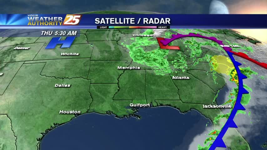
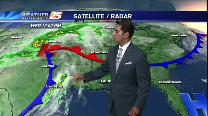
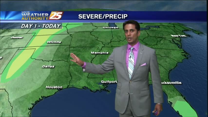
Showers & t-storms moving into and developing along the Southern 6 with a TORNADO WATCH in effect...
PATCHY DENSE FOG around sunrise has burned off leaving beautiful blue skies through this afternoon...

Residual moisture from yesterday has areas of PATCHY DENSE FOG, then sunny and warm conditions through today...

After a BUMPY start with NUMEROUS showers/t-storms earlier this morning, conditions are improving...

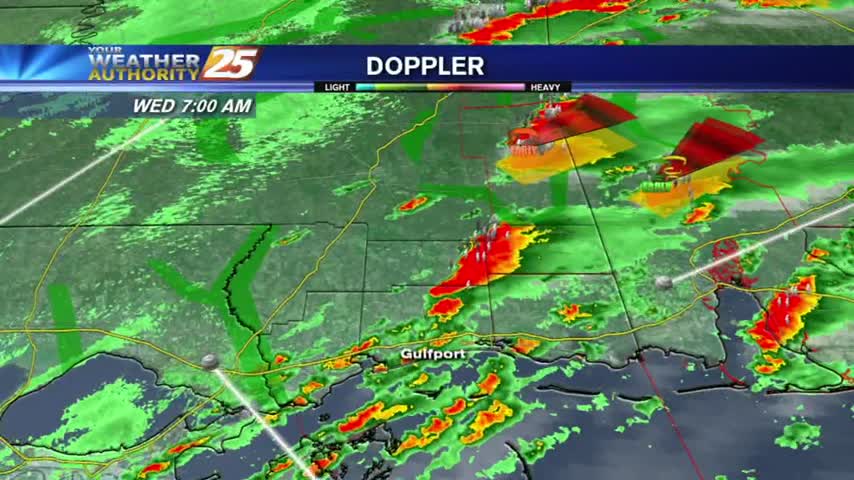
SEVERE WEATHER continues to move across the Southern 6...

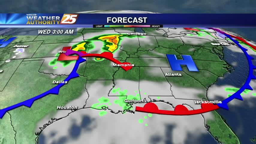
Showers/T-Storms moving in from the west with an associated cold front...SLIGHT THREAT for SEVERE STORMS...
With a batch of low-level moisture from earlier this morning now to the east, skies have thinned to partly cloudy...
After a few very light showers earlier this morning, drier conditions are moving into the area...
A warm and humid start with a cold front in central Mississippi and a few light showers along the Southern 6...

After a warm/cloudy and BREEZY morning...winds continue to escalate higher just below WIND ADVISORY criteria...
A tightening gradient brought WINDY conditions to the region yesterday, which continued overnight and into this morning...
After a BEAUTIFUL start to the day with clear skies and low humidity...clouds are beginning to form as the humidity increases..
After a cloudy start to the day, skies have cleared with an abundance of sunshine along with breezy conditions developing...
After a BEAUTIFUL Sunday without a cloud in the sky, low-level moisture has clouds developing along the coast...
Clear skies last night had COLD temps earlier this morning with mid-levels moving across the southern 6, which have cleared the area...
In the wake of last night's cold front, it's a CHILLY start with partly cloudy skies through the area...
The cold front has moved into the norther GOM with light drizzle lingering along the southern 6...

A warm/humid and breezy start to the day along with light showers, as a cold front to the NW approaches the area...
Warm/humid conditions continue to move into the area with a STRONG southerly wind in advance of an approaching cold front...

After a CHILLY start to the day, an abundance of sunshine already has temperatures in the mid/upper 60s...

The morning brings chilly temperatures under clear skies through the region, as we head into the first weekend of March...