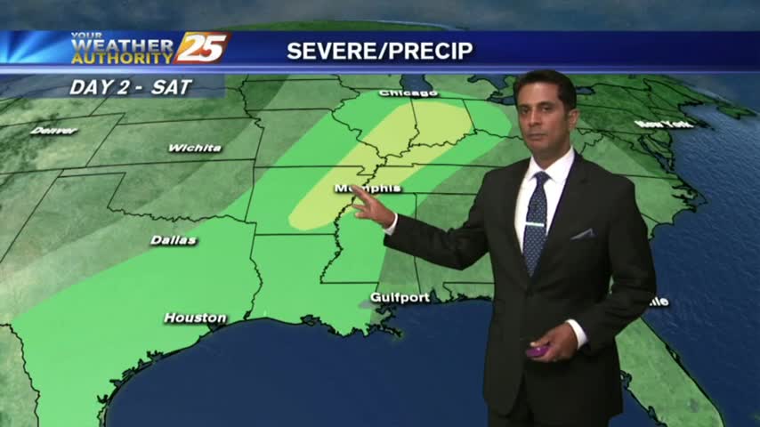
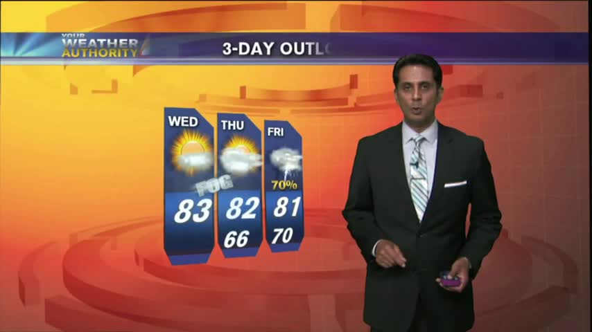
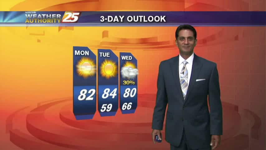
5/19 - Rob's Friday/Weekend Forecast
Under mostly cloudy skies...it's a warm & Humid start with very light sprinklers along the coast.
Under mostly cloudy skies...it's a warm & Humid start with very light sprinklers along the coast.
After a HUMID start to the day, isolated showers have been moving into the area along with a few T-Storms for this afternoon...
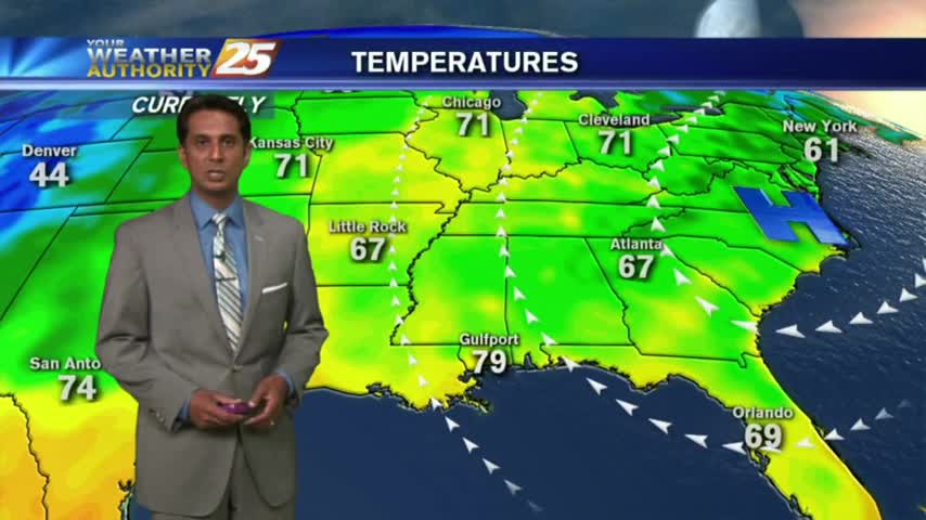
After a warm/humid start...a tightening gradient east of the Rockies continue to elevate winds, now gusting into the upper teens/low 20 mph range.
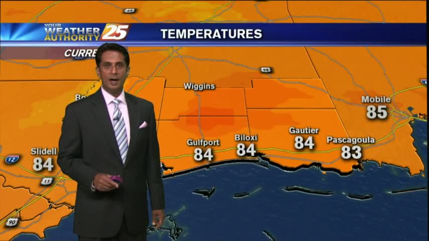
Another Warm/Humid start to the day with areas of PATCHY DENSE fog along the coastal counties...
After a few morning clouds and patchy fog, a low-deck of clouds have now formed along the coastal counties...
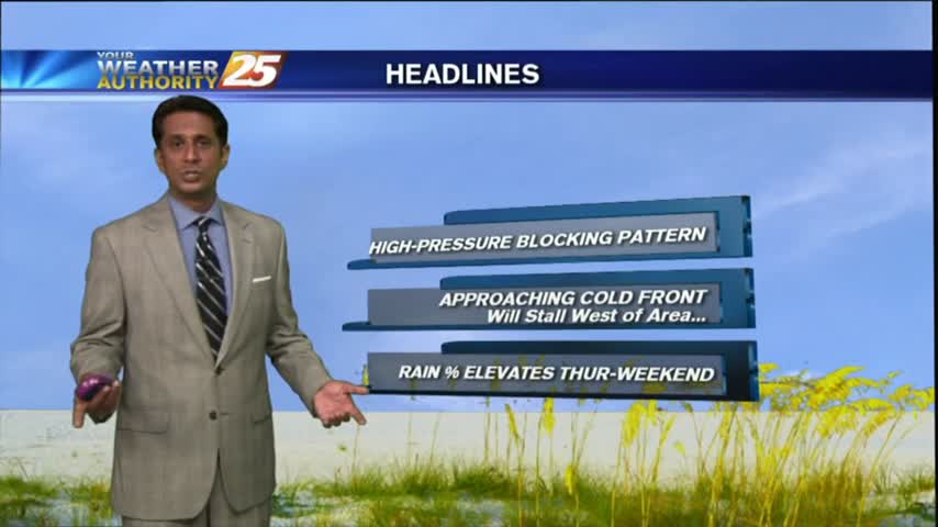
Another humid start with areas of patchy fog as an area of high-pressure continues to block the Gulf Coast...
After a clear start with patchy fog, temperatures continue to warm with a few clouds developing...
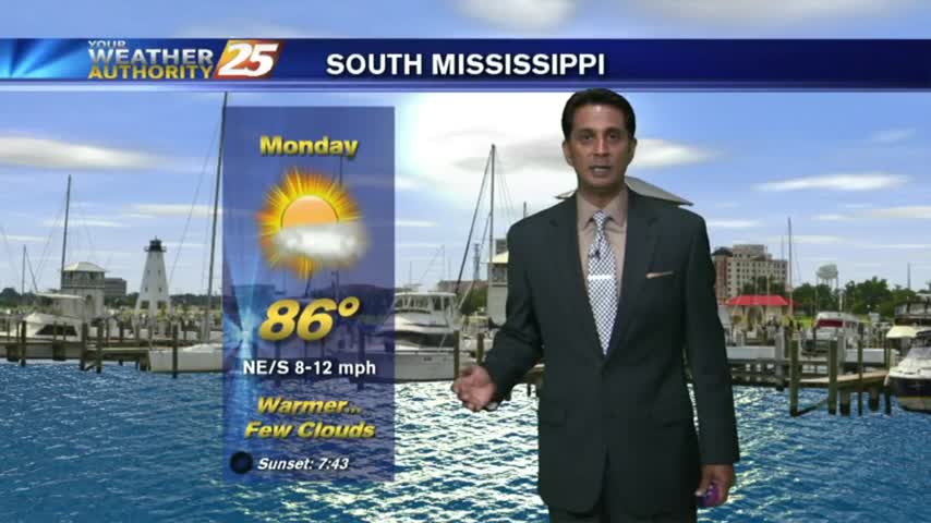
A warm/humid start to the workweek along with areas of PATCHY FOG along the Southern 6...
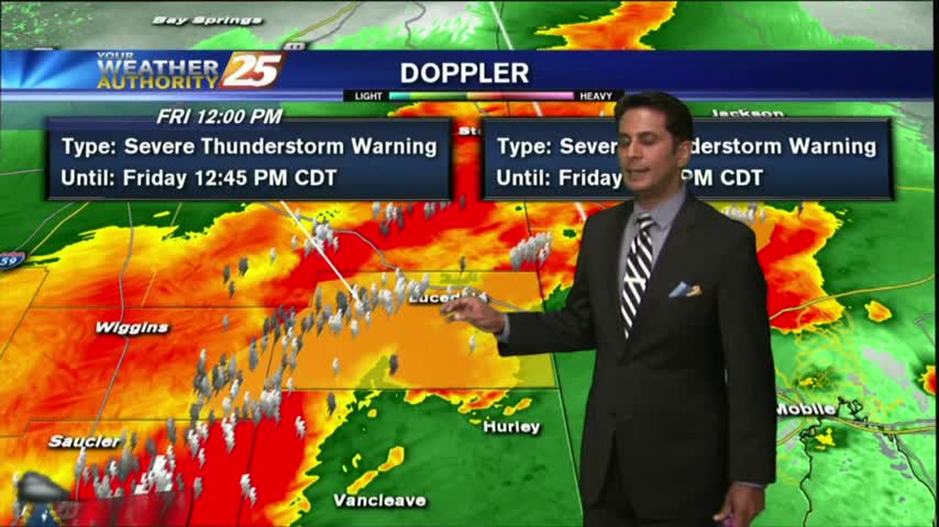
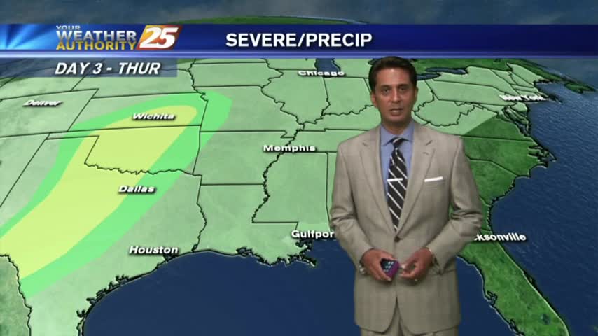
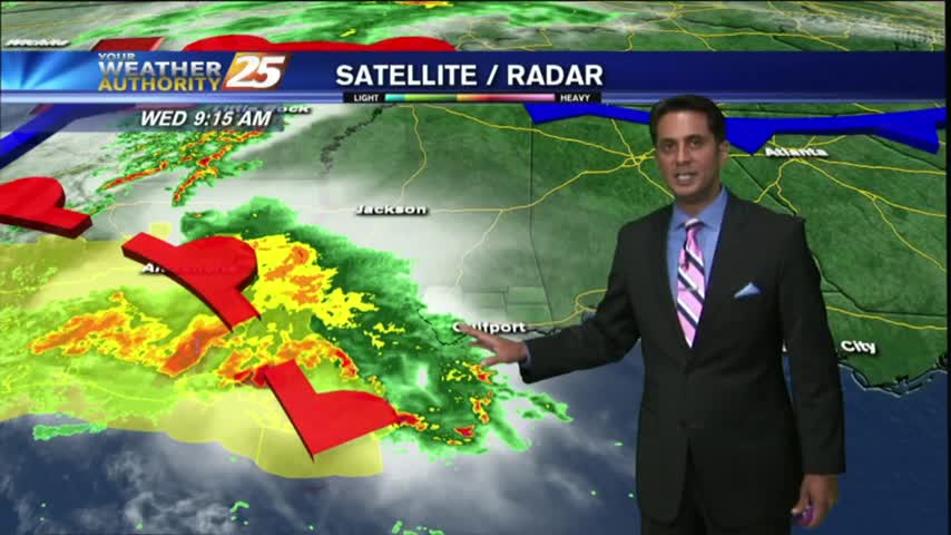
A line of T-Storms moving into the area in advance of an approaching cold front...

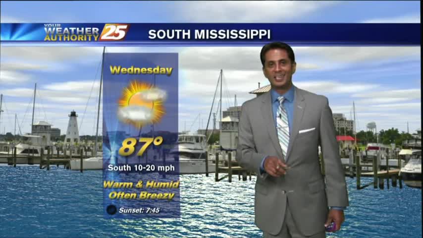
A warm/humid and BREEZY start to the day, along with areas of patchy fog along the coastal counties...
As a more humid air mass moves into the region, areas of PATCHY DENSE FOG has developed once again...
With elevated humidity, patchy fog this morning has burned off leaving a few/partly cloudy skies...

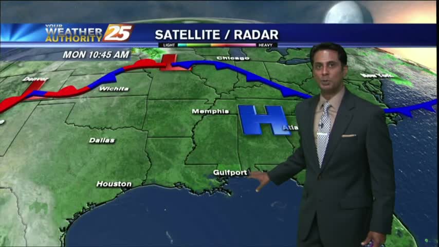
The area of high-pressure overhead has shifted to our east and is now providing for a return-flow from the GOM, with areas of patchy fog this morning...
Another cool start to the day as high-pressure continue to bring clear skies and cool overnight temps...

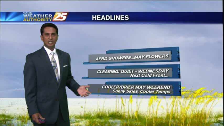
After an ABSOLUTELY BEAUTIFUL weekend, the same conditions will continue through much of the workweek...
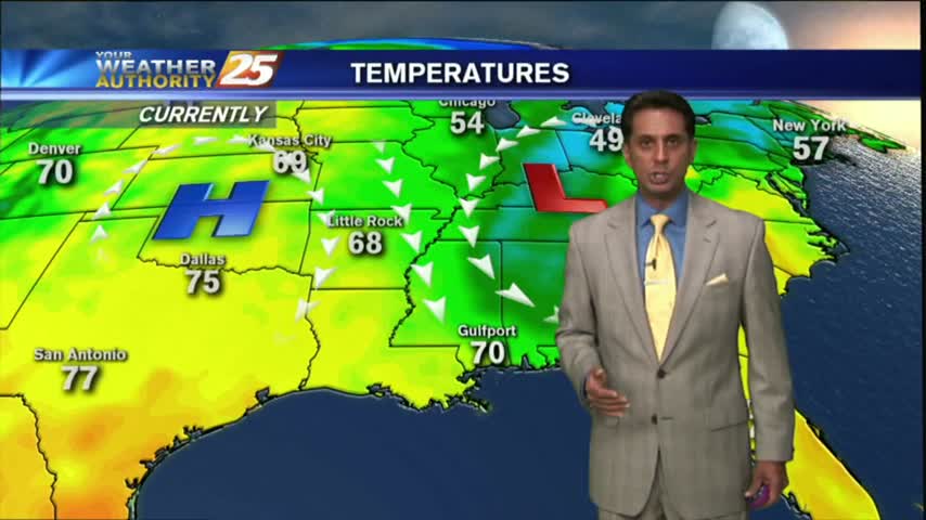
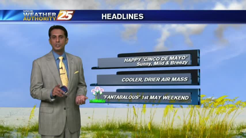
After a CHILLY START earlier this morning...temps have warmed nicely on this "Cinco De Mayo" afternoon...
Another CHILLY morning as a COOLER/DRIER air mass begins to move into the region...
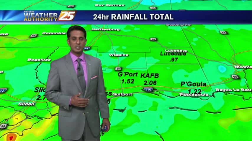
HEAVY RAINFALL from yesterday/last night is beginning to tapper-off as the cold front moves to our east...
After a clear start...clouds have moved in along with isolated t-storms associated with a warm front moving through the area...
A southerly component with the winds overnight has continues as a more humid air mass is now the the area, with warmer temps this morning.
After a CHILLY morning, temperatures have warmed nicely into the 80s, under SUNNY skies...
With high-pressure, clear skies and a drier air mass...it's a CHILLY start with temps in the upper 40s to low 50s...
As the cold front from yesterday continues to move further away from the area...we are now under an abundance of sunshine...
After HEAVY RAIN and some BUMPY weather yesterday, the cold front and associated weather continues to move east of the area...