12/30 - Rob Knight's "Sunshine Returns" Morning Forecast
A cold front has moved east of the area with clearing skies and colder air moving in from the NW...
A cold front has moved east of the area with clearing skies and colder air moving in from the NW...
A gray afternoon along south Mississippi with very light rain moving north...
A warm and muggy start to the day with isolated rain moving in from the south...

Sunshine is peeking through the clouds as temperatures warm into the 70s...

A mild and humid start to the day with areas of patchy fog...

After a cool start, temperatures are warming into the mid/upper 60s with sunshine inland...

A cool start with a few upper clouds moving across the area...
Clouds continue to roll in from the west as rain will follow for the weekend...
After a FRIGID start, the air mass will slow modify as we close out the workweek...
Another FRIGID start to the day but the air mass will begin to modify later today...
After a COLD start, sunny skies and cool temperatures dominate the area...

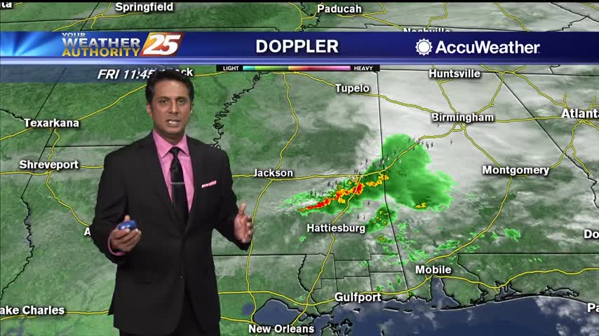
After a rather active night of severe weather across parts of the region, colder air is moving in after a recent cold front passage. Any lingering rain this morning will be quick to exit the area, and be mostly confined…

A mild and very humid start to the workweek with areas of patchy fog...

Areas of patchy fog and light rain continues to affect south Mississippi...

A damp start to the day with light rain and areas of patchy DENSE fog...

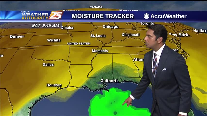
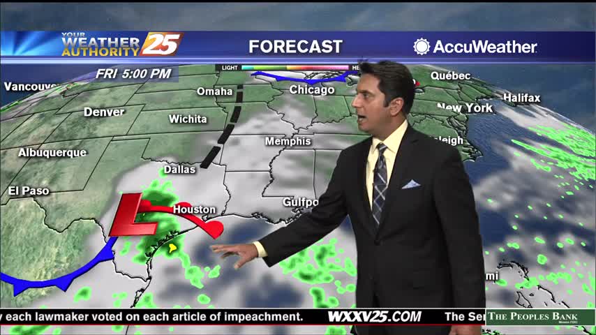
Models are in pretty good agreement in depicting low-pressure development along the stationary front situated across the central Gulf. This feature remains relatively weak but does cause pressure winds in the outer-coastal to increase later today along with rainfall into…

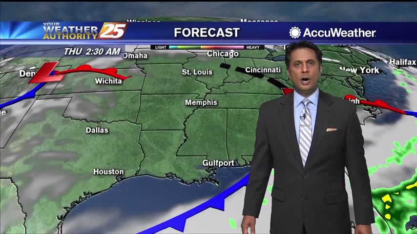
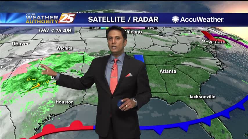
The cold front is well south and east of our coastal waters this morning as high-pressure extends from western Kentucky to northeast Texas. An upper level low pressure system is driving the large patch of rain away from our area…

Another morning with areas of DENSE FOG and spotty rain moving in from the west...
A very warm and humid start this morning has develop DENSE FOG though south Mississippi...
Sunshine is beginning to peek through the clouds as spotty rain continues...

Quiet weather continues across the region as surface high pressure dominates the southeastern United States. The airmass in place over the area will moderate slightly today, with highs a degree or 2 warmer than yesterday. Expect a very pleasant day…

No real changes to the ongoing forecast this morning as things still look to be on track. Some showers will move through the majority of the area south of the area of thunderstorms. Then another area of showers and a…
Freezing cold temperatures will last through the middle of Tuesday morning and some patchy frost is being reported across South Mississippi. Temperatures will warm up gradually under mostly sunny skies. Eventually, highs will top out in the mid to upper…
Cooler temperatures and clear skies makes for a beautiful start to Thanksgiving...