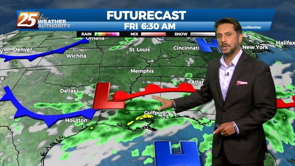
9/9 - The Chief's "Changing Pattern" Friday Morning Forecast
The same closed mid to upper-level low pressure remains parked over our area, centered generally over SE LA. The same corridor of deeper moisture continues along progressive…
The same closed mid to upper-level low pressure remains parked over our area, centered generally over SE LA. The same corridor of deeper moisture continues along progressive…
Through the end of the week, an upper level low is expected to influence the area, enhancing rain chances for the region. There are still some…
A trough of low pressure along the NW'tern Gulf of Mexico will slowly push SE as an upper low pressure system and training cold front moves through…
The area is still under the influence of upper level weakness which is slowly moving east while further west has a large area of high pressure with…
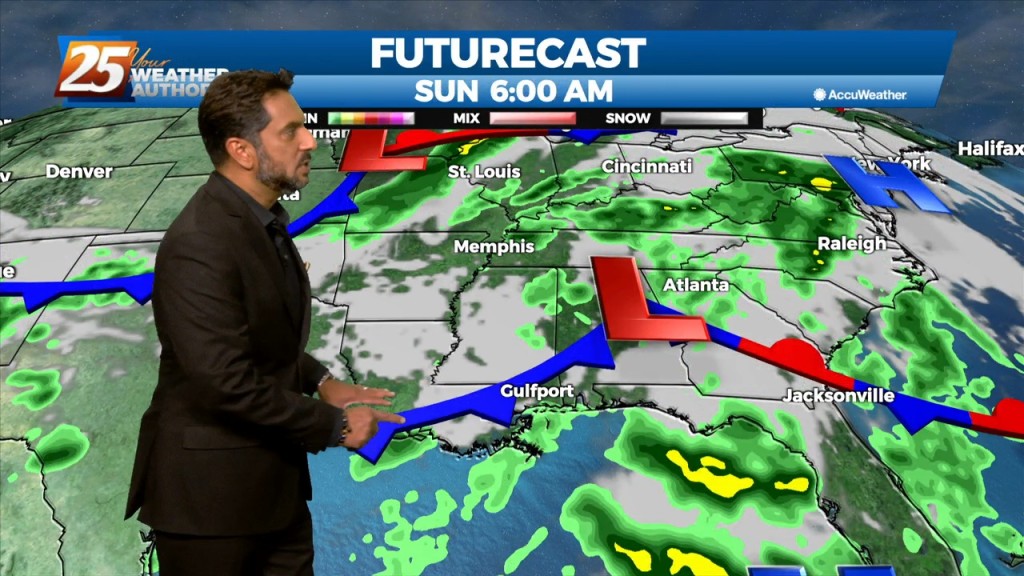
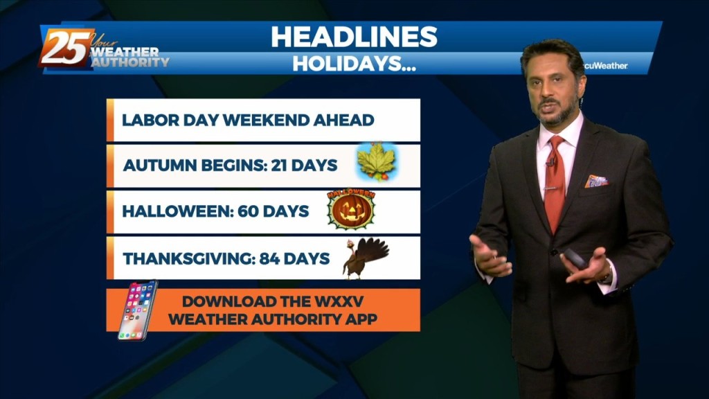
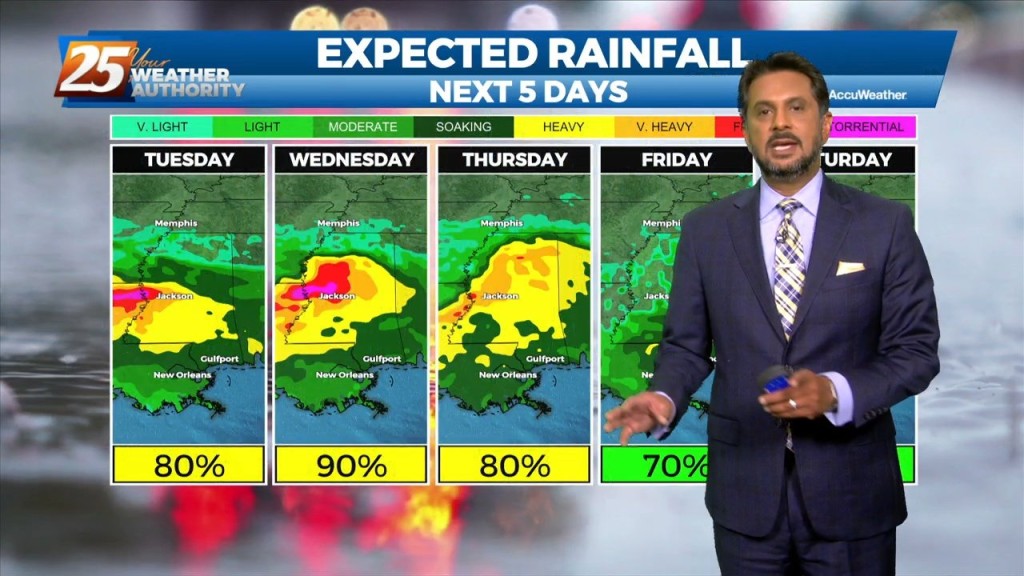
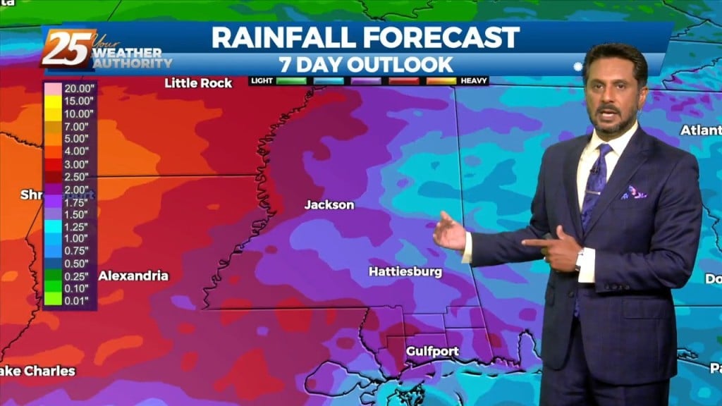
Going into Labor Day weekend, the general thought is that the dry pattern we’ve enjoyed (although hotter) will likely come to an end this weekend. Aloft,…
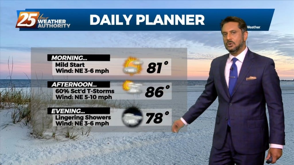
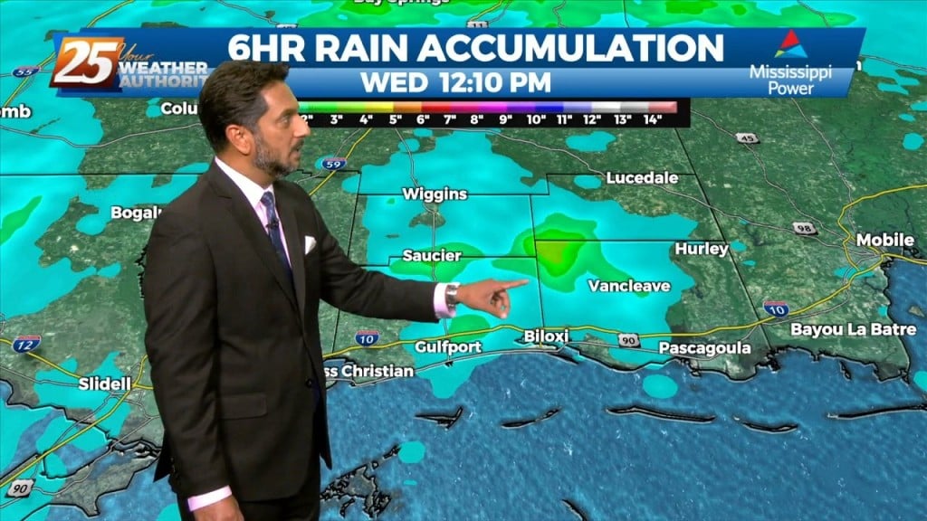
The best potential for rainfall, similar to Wednesday looks to be again along and west of the I-55 corridor later this afternoon. With the…
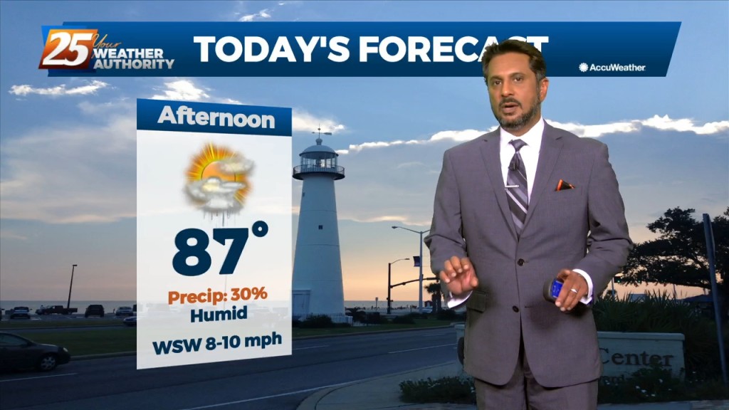
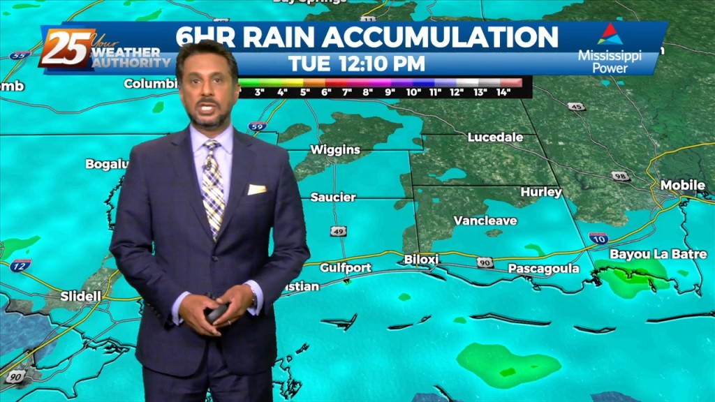
Overall, a fairly quiet day is expected across the area. It should be another lackluster convective day with plenty of dry air aloft. The best potential…
We will tip toe into September Thursday, and some of the area could feel some surface "drier" air filter in. With depth of dry…
Mid level dry air will remain in place today. This will help cap the environment, making it harder for thunderstorms to get started. There will be some…
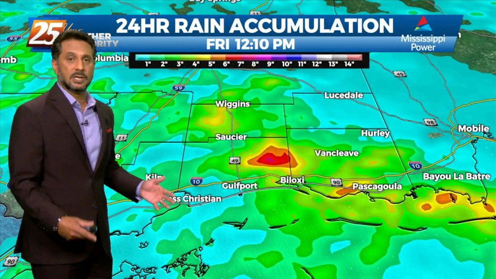
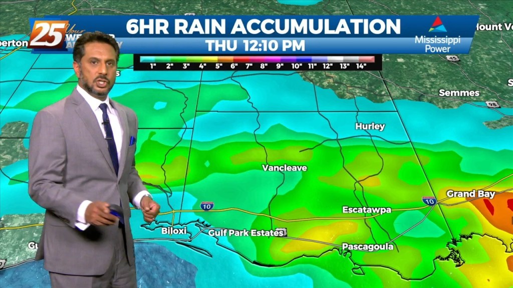
Heavy rainfall wording will remain with us as rates up to 4"/hr will be possible but most of this activity will be moving, so without lingering over an area or training, flooding will be less of an issue. But what could…
A strong surge of tropical moisture and upper diffluence is approaching the north central and NW gulf this morning. The deepest moisture surge will be…
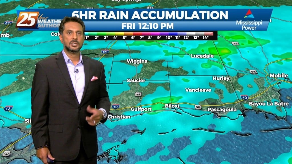
FLOODING ALONG RIVERS; WOLF, BILOXI AND TCHOUTACABOUFFA... A weaker surface low pressure and attendant boundary near or just offshore this afternoon will be the focus for…
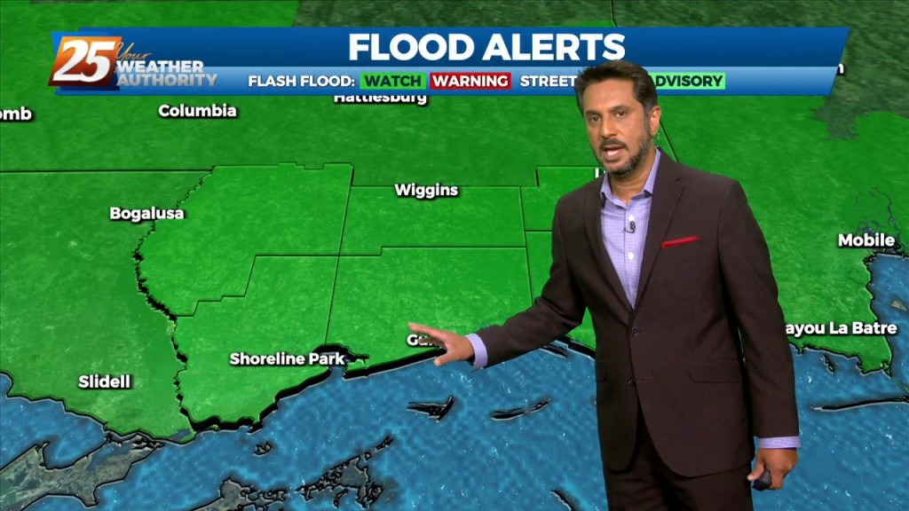
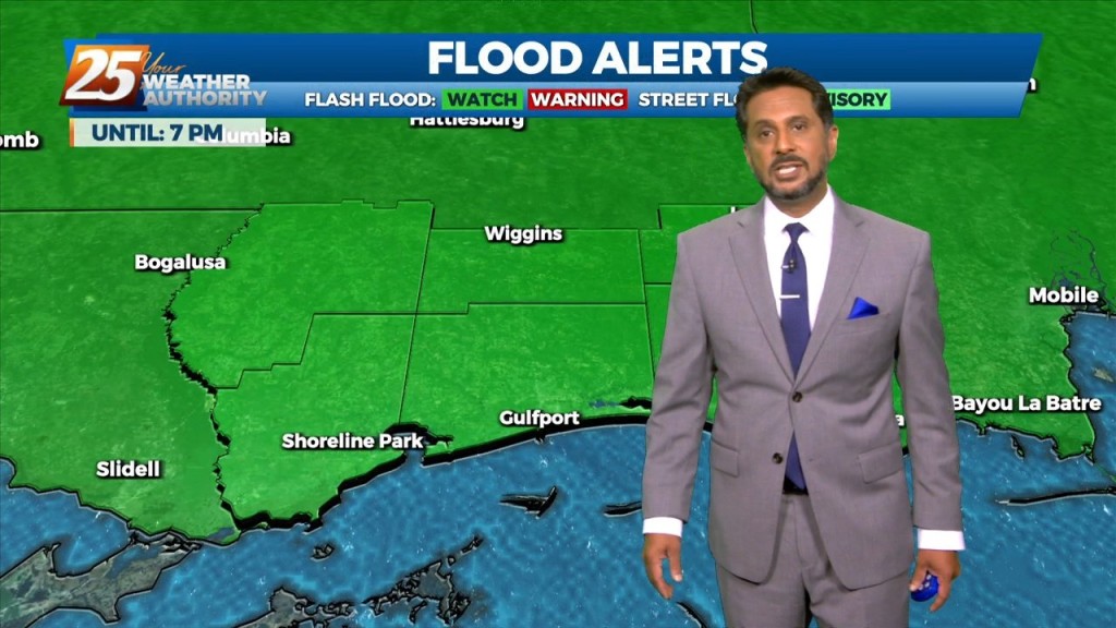
FLASH FLOOD WATCH IN EFFECT - 7 PM... A stalled stationary front overhead will continue to bring the abundant moisture flow to the area. But with…
FLASH FLOOD WATCH IN EFFECT - 7 PM... The threat for pockets of HEAVY RAIN will continue this afternoon. This will not be…
FLASH FLOOD WATCH IN EFFECT - 7 PM... Today through Saturday will continue with the wet pattern. A flash flood watch has…
Today through Friday, high precip chances along with high rainfall rates will remain the topic along with an environment conducive for waterspouts. The surface…
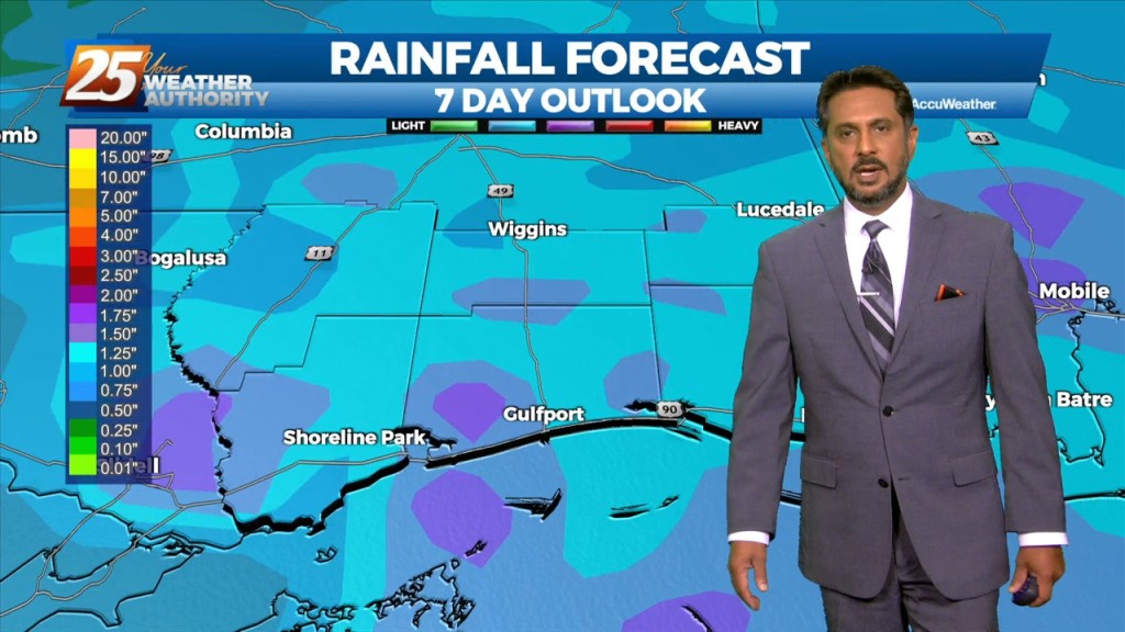
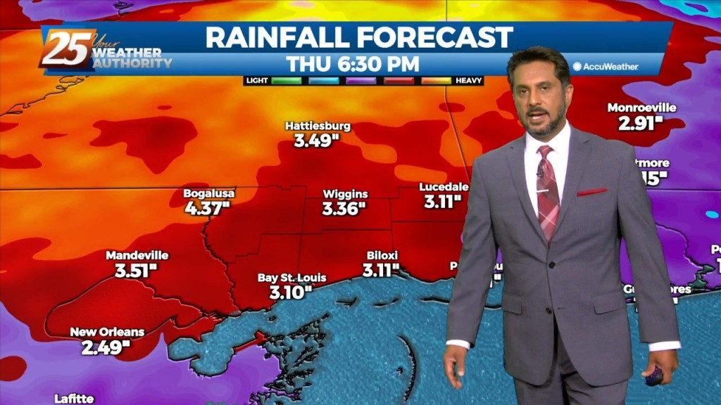
Rainfall tallies could be robust the farther north one moves though. This will be due to a surface low over east Texas and trough extending…
High precip chances will remain the topic along with an environment conducive for waterspouts. Rainfall tallies could be robust the farther north one moves though. This…
As minor disturbances move through multiple frontal systems through the Gulf South, they will trigger rounds of showers and thunderstorms each day. Moisture flow values remain…
A broad upper disturbance across the eastern half of the country doesn’t really go anywhere over the next several days. As minor disturbances move through the…
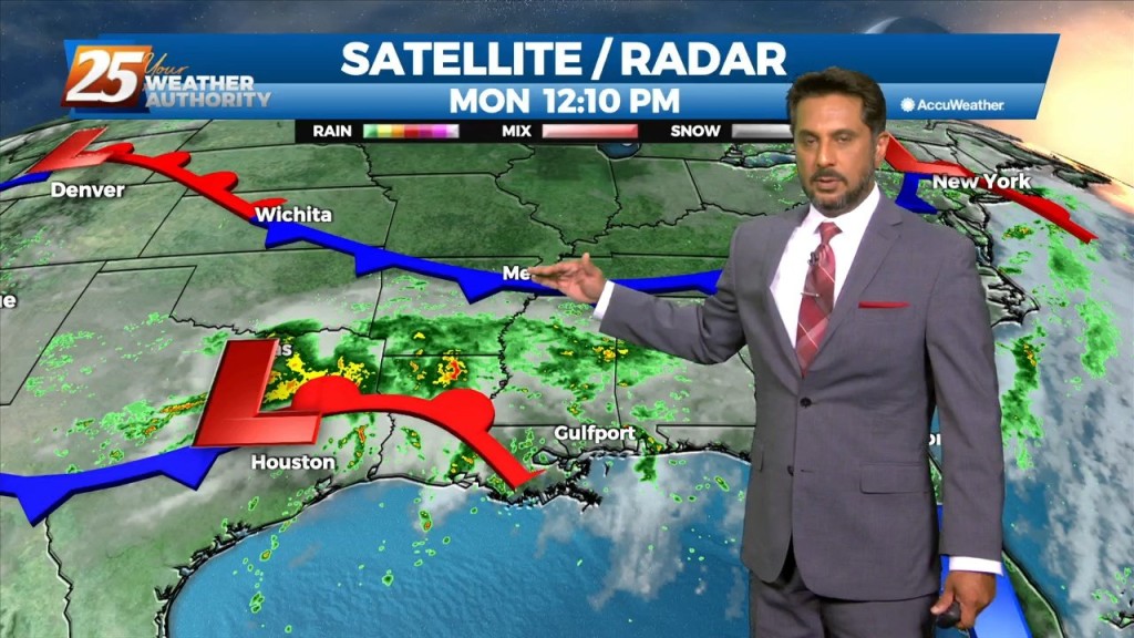
Water vapor imagery continues to show a plume of moisture extending from south Texas to the Carolinas, covering much of our area. The current disturbance that is…
Multiple disturbances expected to move through the eastern US today. One is moving through Arkansas and east Texas into Louisiana, while a stronger one is dropping…
This afternoon will continue to bring showers/t-storms to the area. The main concerns over the next few days will be the threat of thunderstorms. Heavy rain…
The focus this afternoon and evening will be on convective development to our north and east, moving into south Mississippi. A zone of low-level convergence oriented NW…