5/9 - The Chief's "Low-End SEVERE THREAT Tonight" Thursday Morning Forecast
First things first this morning it appears there could be a few isolated low topped showers develop with the initial impulse moving into NW Louisiana.…
First things first this morning it appears there could be a few isolated low topped showers develop with the initial impulse moving into NW Louisiana.…
A stable layer in the low-levels of the atmosphere is eroding, Which thus far has protected us so far, but this is currently leaving and…
Again today, we should see showers and a few t-storms around. But as we move forward in time, a few of these storms could become…

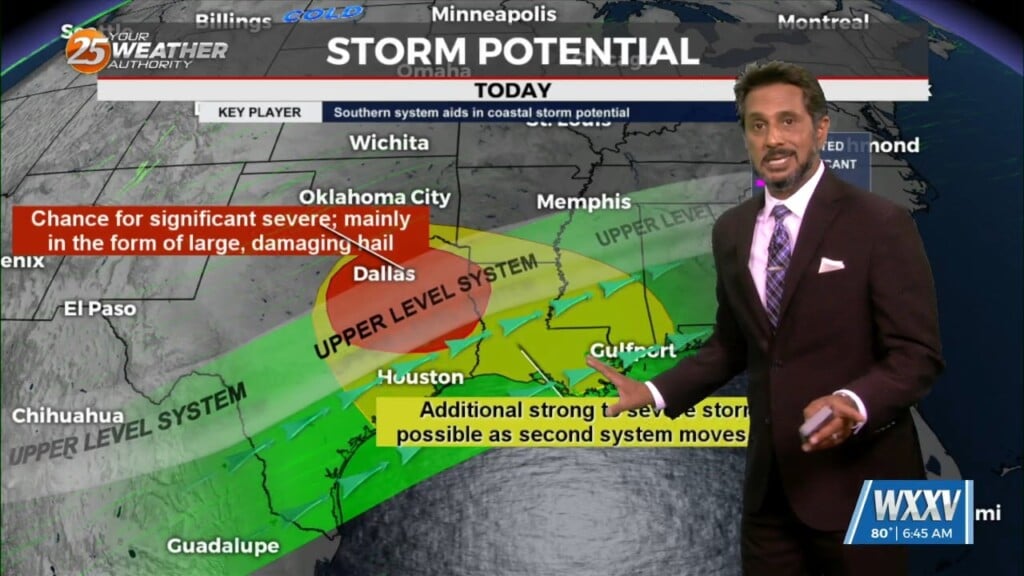
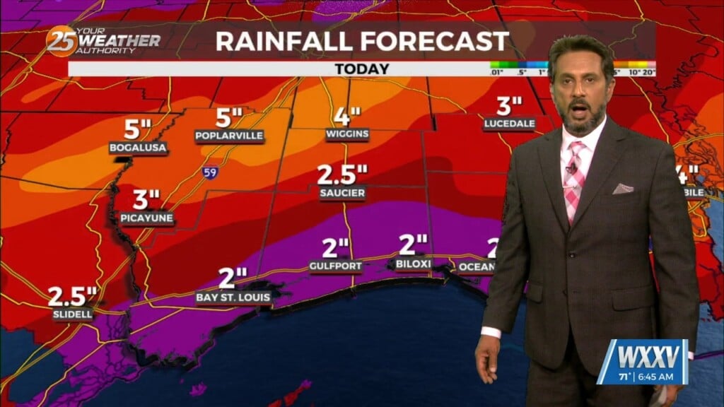
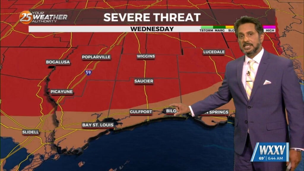
Early Wednesday we will see a cold front moving toward the area with very moisture content for this time of year. If this were stalled over the…
All precipitation has cleared the coast at this point as cloud coverage will continue through mid/late morning. High pressure to the NW will move in…
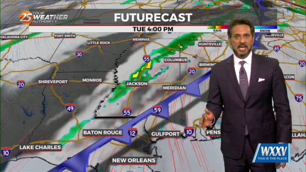
This afternoon will continue to bring breezy conditions from the south...increasing the moisture. Tuesday is still the main forecast issue but honestly it…
The cooler, drier air has been slow to arrive, with dew points only now starting to drop over southwest Mississippi. The local area will be under a…
An area of low-pressure remains over Arizona, with a cold front to the SE of the area. A few sprinkles early this morning, but that’s about…
A dry airmass continues to reside across the region this morning with a fairly active WSW flow aloft with moisture continuing to stream into the…
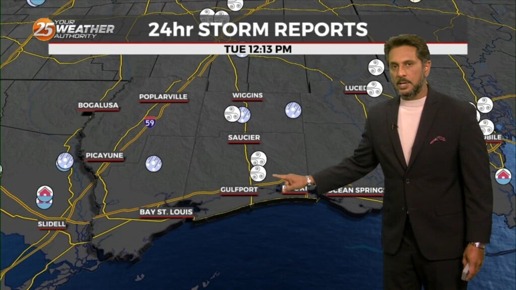
The system to the SE that brought thunder/hail to parts of the area yesterday evening will continue to meander south and east today. On the backside…
This afternoon will be rather quiet with cloud coverage and isolated rain later today and that along with some daytime warming should get…
T-storms and rain from this morning is now east of the area with little or no precipitation expected this afternoon. Expect rapid clearing with a few…
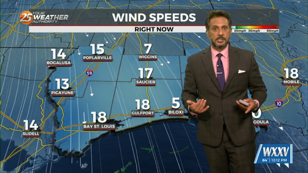
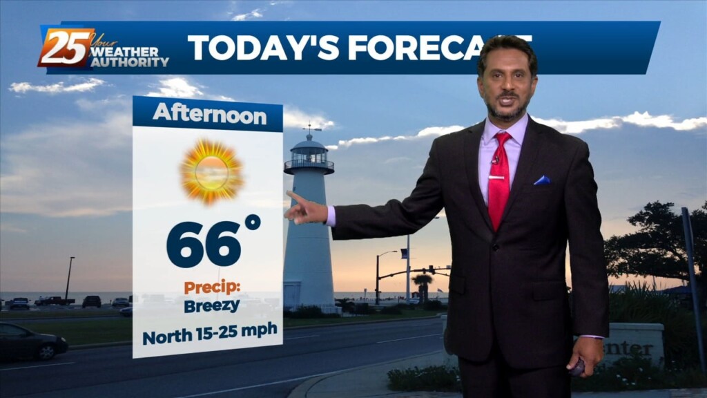
The WIND ADVISORY will continue through this evening before the flow begins to weaken. Breezy conditions will continue overnight with winds around 15 mph…which means the…

A warm front will remain along the coast today while the surface low-pressure developing over the NW gulf rides along it. This system will kick east rapidly through…
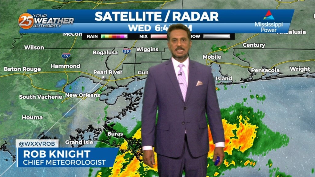
Mostly light showers have been intermittent across the region this morning as rain continues to move in from the south. An area of…
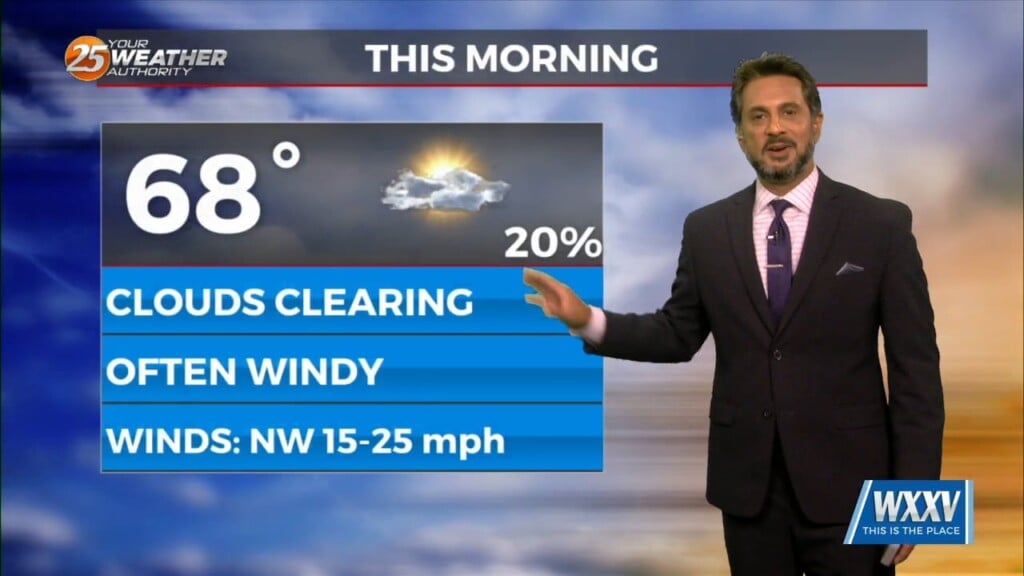
Breezy conditions will continue today and with calmer winds expected tonight, this will help tremendously toward radiational cooling. Temperatures will be…
The biggest impact of this morning is the fog development out ahead of the front across our area. The front is just starting to get into…
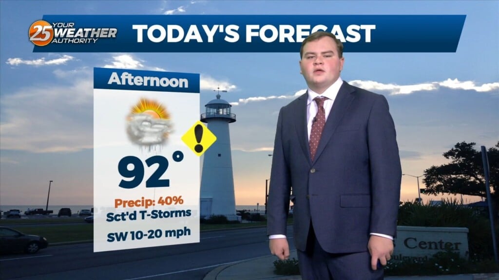
A Heat Advisory is in effect untill 7pm, showers and thunderstorms will bring relief to a lucky few. How long can our NW to westerly upper…
High pressure over the northern Rockies is setting up a quasi-zonal flow across the southern third of the country. At the surface, a reinforcement of drier…
An area of low pressure remains over the Great Lakes this morning, with a disturbance moving into the Pacific Northwest. High pressure was noted over the…
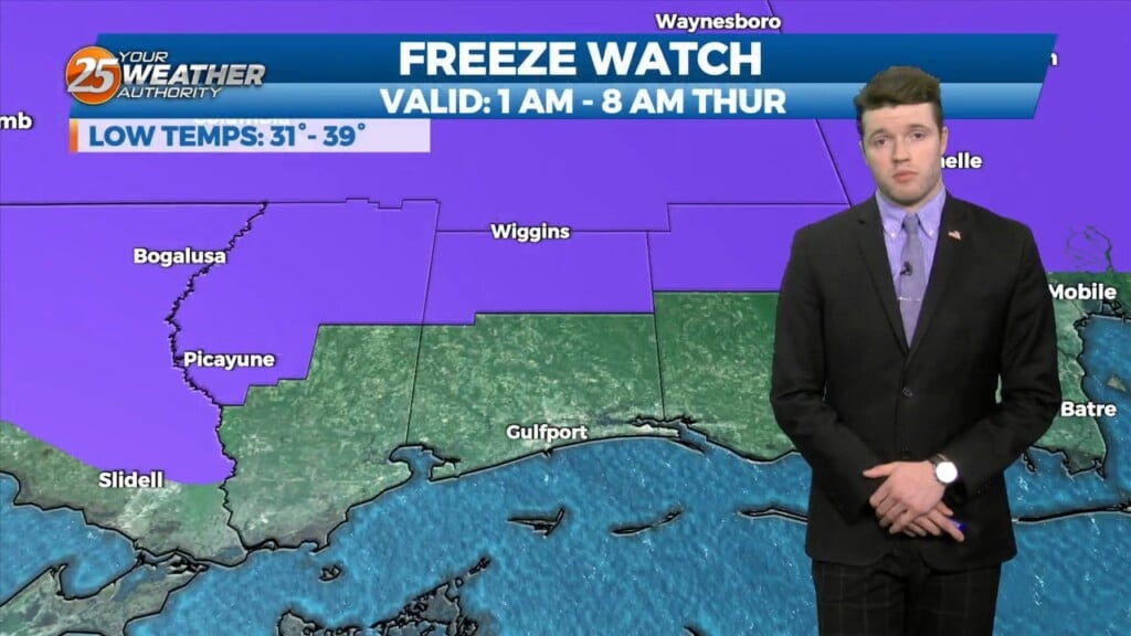
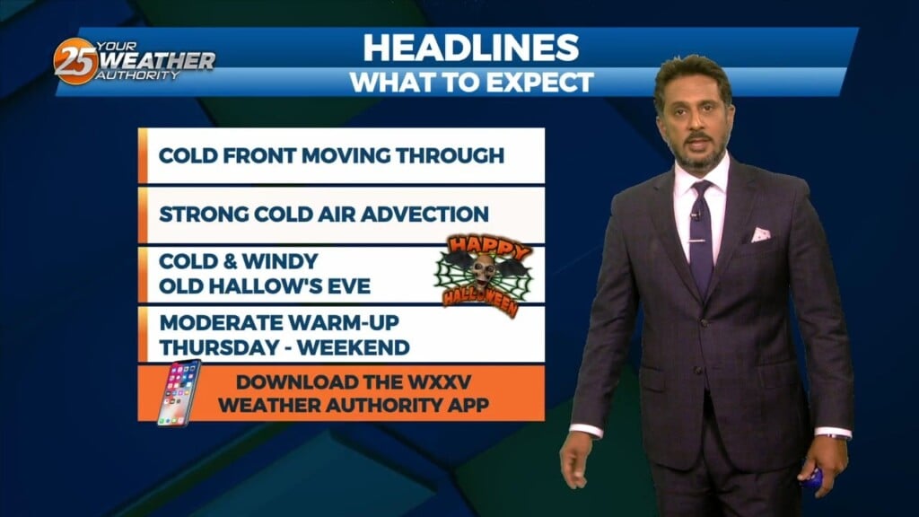
As last night’s cold front continues downstream, cold air advection will continue to be the story, along with decreasing clouds later in the afternoon from…
Ahead of a front today will be quiet the windy day and warm. Because we will be able to mix out quite high we will…
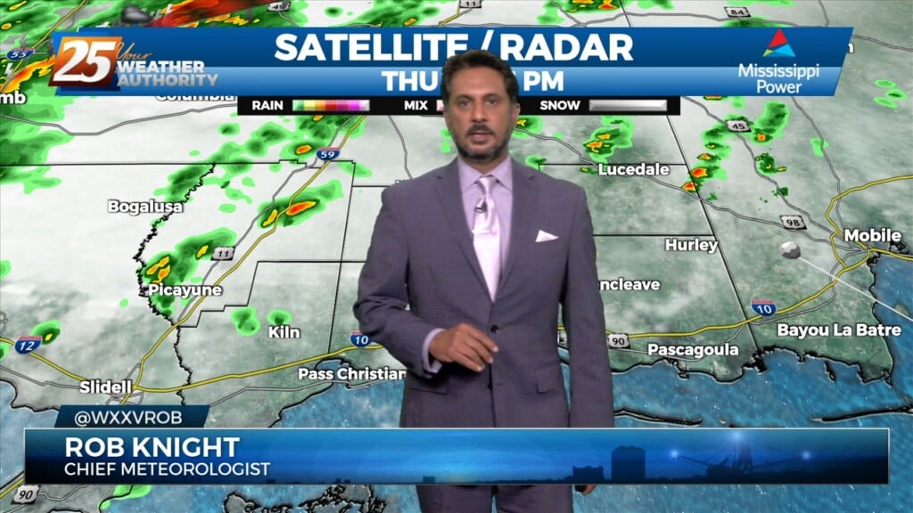
The threat for severe weather will be in the area this afternoon/evening with a cold front approaching from the west. Severe weather variables are not remarkable…

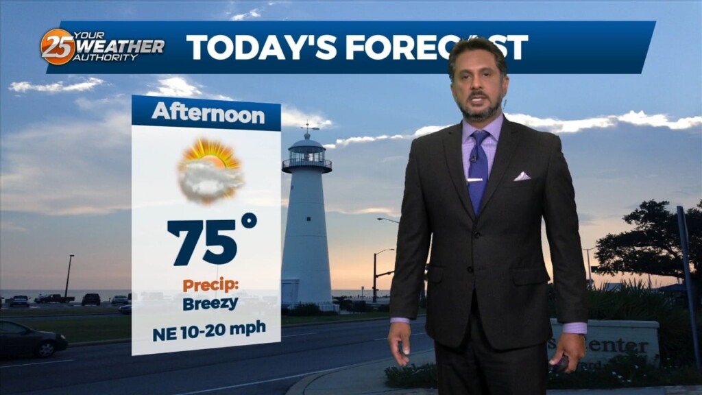
A BEAUTIFUL afternoon ahead with breezy conditions out of the SW. A cold front moves through Thursday and should enter the area around 9am and…