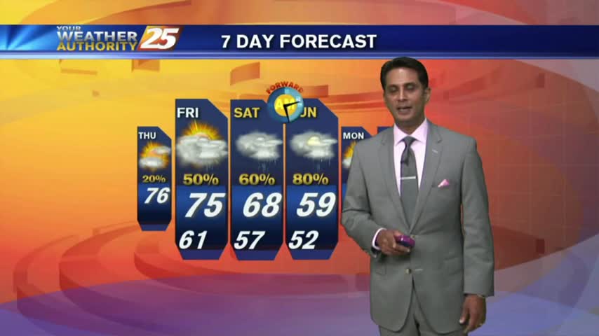
3/17 - Rob's St. Patrick's Day/Weekend Forecast
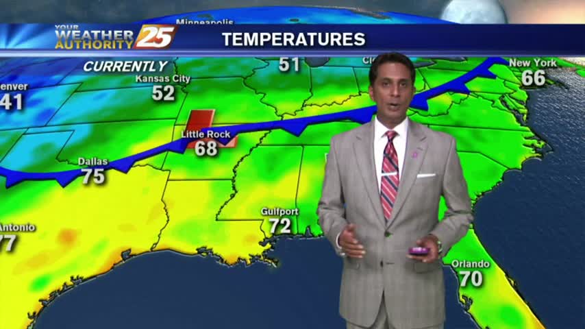
As the return-flow has begun, a south wind has MUCH WARMER temps along the Gulf Coast on this St. Patrick's Day morning...

As the return-flow has begun, a south wind has MUCH WARMER temps along the Gulf Coast on this St. Patrick's Day morning...
A few clouds continued overnight through this morning with cool temps and areas of very light fog...
Another start with warm/humid air flowing from the GOM, has PATCHY DENSE FOG affecting the local area...
After a good bit of sunshine this morning...the clouds have rolled back in as temps warm to around 70 degrees...
After PATCHY FOG this morning...SEA FOG rolling in from the sound could affect areas along the coastal counties this afternoon...

After a bit of light rain earlier this morning, the cold front has moved to the south over the sound...
After a FOGGY start, the fog has burned off with the low clouds lifting. Partly/mostly cloudy skies will continue as upper-level clouds begin to move in...
Another morning of patchy fog as a humid wind continue from the south, in advance of an approaching cold front...
After patchy fog earlier this morning, we have BEAUTIFUL mid-October conditions to close-out the workweek...
It's another cool start on this Friday morning with temps averaging 60 degrees, and areas of patchy fog...
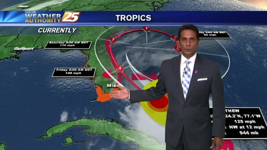
High-pressure dominance continues along the Gulf Coast as MAJOR HURRICANE MATTHEW heads towards the Florida coast...
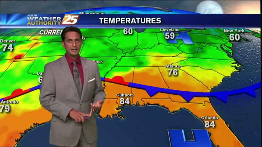
After a southerly wind much of yesterday, increasingly humid conditions have developed with warm temps...
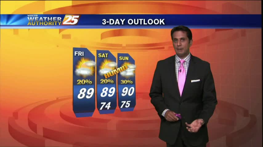
Your Friday afternoon includes warming temps, mostly clear-partly cloudy skies and VERY isolated showers/t-storms...

HOT conditions continue as moisture flow from the sound moving in, has developed a low-deck of clouds...
Warm & humid with light winds and mostly clear skies...