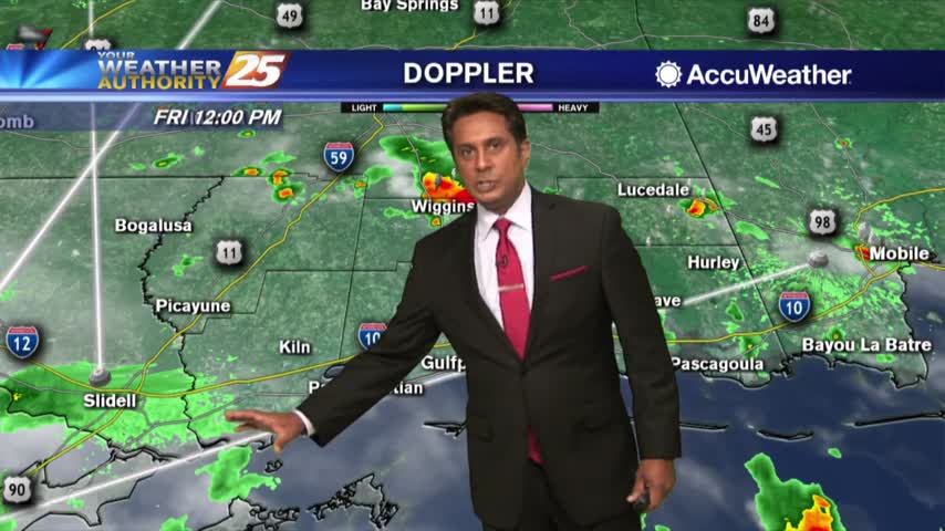
6/20 - The Chief's "Flash Flood Watch" Afternoon Forecast
With a weak cold front overhead and drier airmass, showers and thunderstorms will pop a little later this afternoon. The activity will get started farther NW and…
With a weak cold front overhead and drier airmass, showers and thunderstorms will pop a little later this afternoon. The activity will get started farther NW and…
At the surface, the Wednesday night's cold front is well out into the central Gulf of Mexico, with high pressure extending from Wyoming to near…
This afternoon will remain mostly quiet outside of a couple possible showers over the coastal waters. We see our first real warm-up day of the warming…
A COASTAL FLOOD ADVISORY is in effect through midday Thursday. High pressure over the western Atlantic will keep the area in a period of…
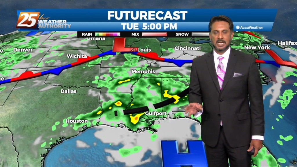
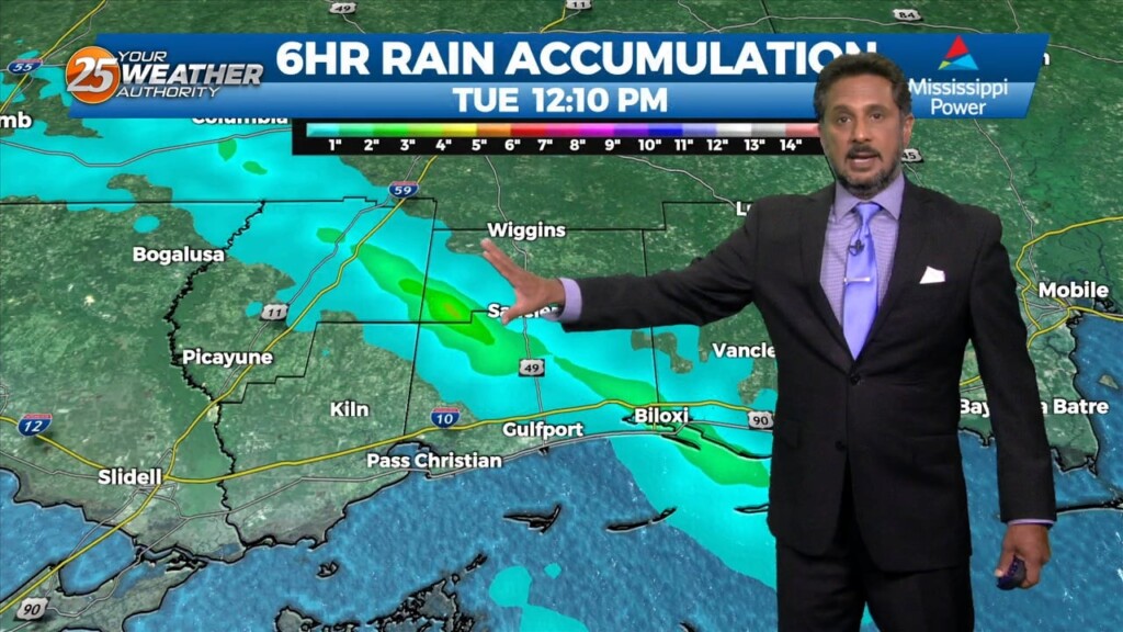
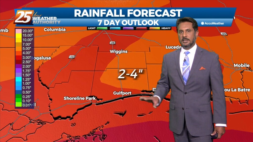
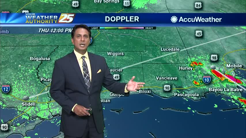
Daytime heating will continue to flare up afternoon showers and t-storms which could produce pockets of HEAVY RAINFALL... Over the short term period a wetter period will…
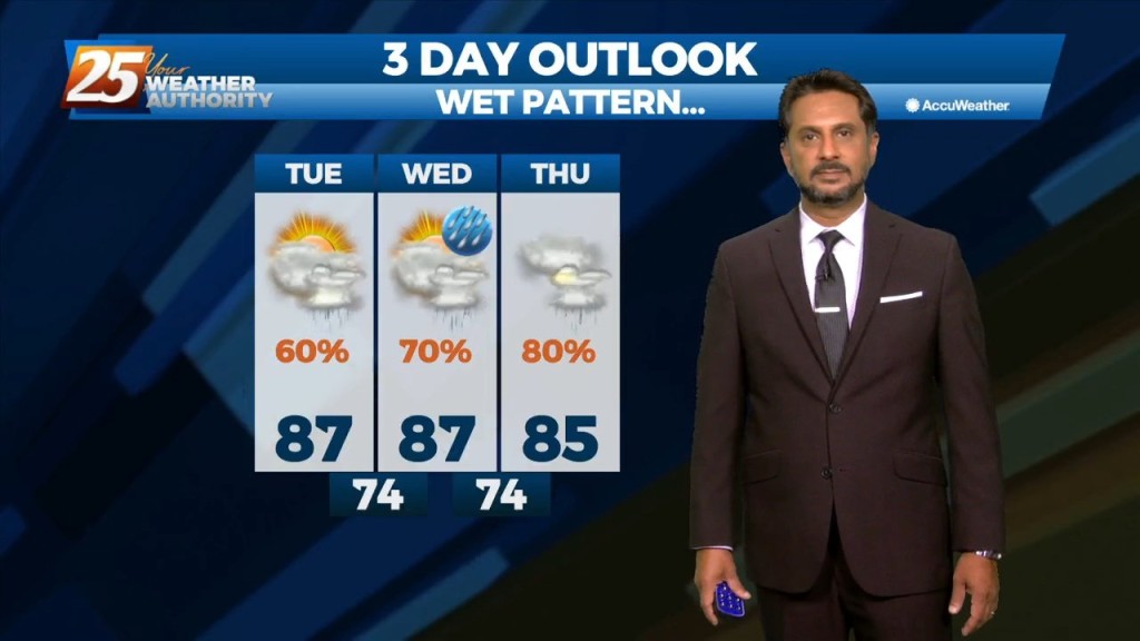
Scattered shower/t-storms this afternoon will see a gradual transition of dry air replace deep moist air this weekend. Then another transition of this dry air to…
Today we will be between two areas of high pressure that will try to merge across the entirety of the southern CONUS leaving us in a…
High-pressure will begin to shift off to the east tomorrow as an upper disturbance extends down into our area ushering in returned moisture. Though this disturbance is expected to…

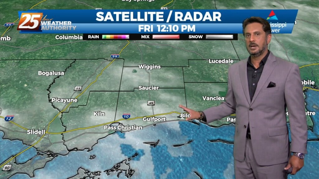
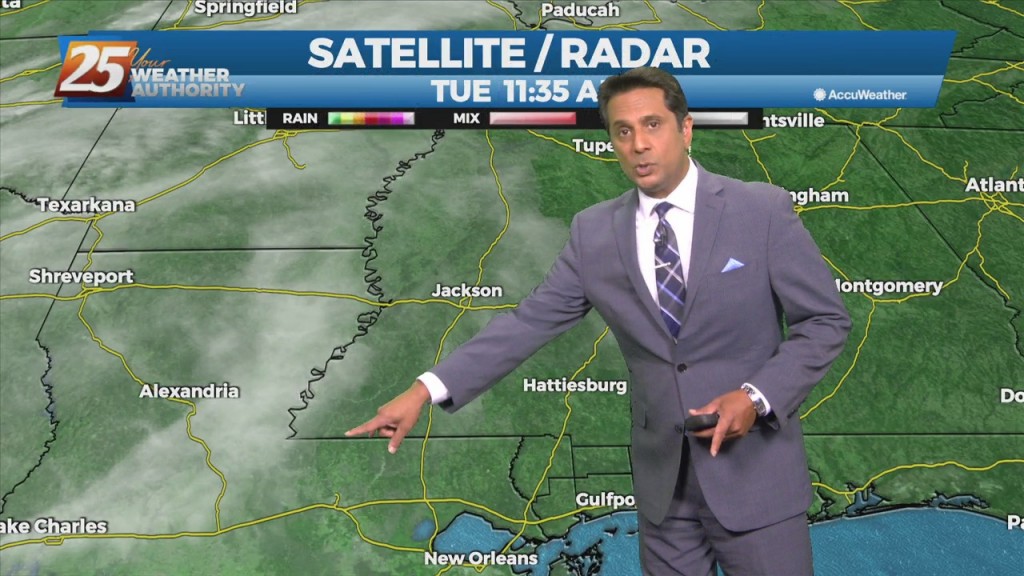
Rain with patchy dense fog continues through the area and much of the region...

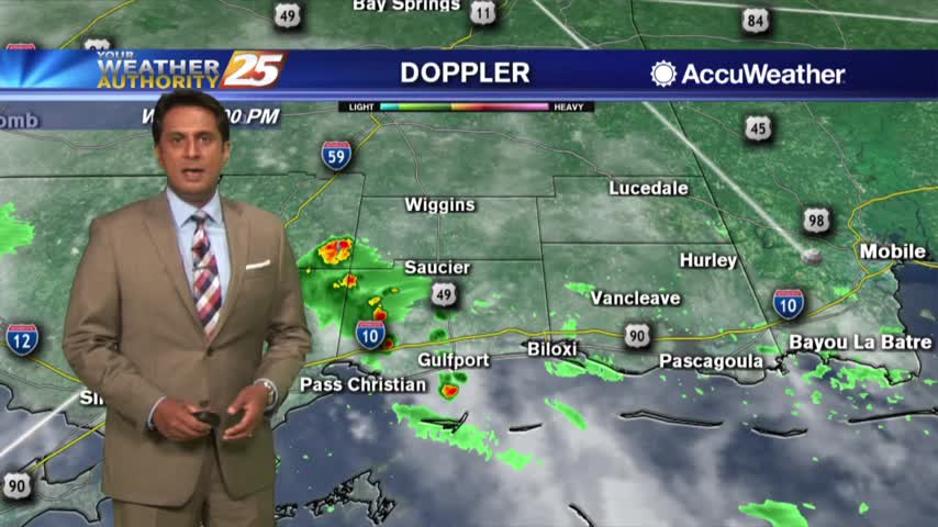
Light rain continues with a few t-storms possible this afternoon...
After a chilly start, cooler temperatures and breezy conditions are affecting the viewing area...
Sunshine is peeking through the clouds as temperatures warm into the 70s...
Temperatures are warming as thin upper-level clouds continue to stream across south Mississippi...
After a clear start to the day, upper-level moisture/clouds are moving in from the west...
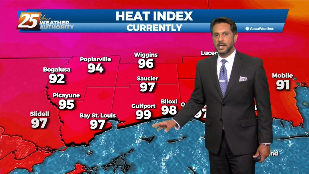
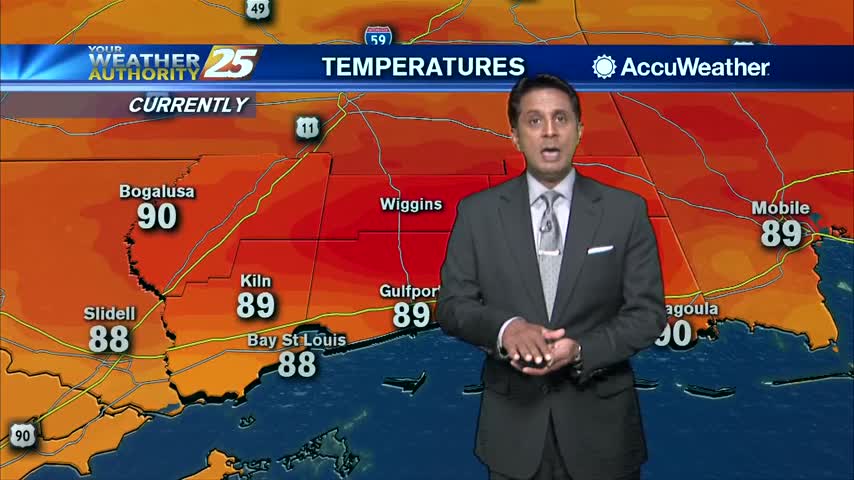
After a warm start to the day, warming temperatures and humidity has it feeling close to 100 degrees...
After a clear and mild start to the day, low level clouds continue to form along the coastal counties...
Warming temperatures as clouds continue to develop...

Another very hot afternoon along south Mississippi with the heat index climbing into the low 100s...
Although temps are getting close to 90 degrees, it's fairly comfortable with a N/NE'terly wind...
Sowers and t-storms earlier this morning will flare back up this afternoon...

After a clear start to the day, a few clouds have developed along with VERY HIGH heat index values...
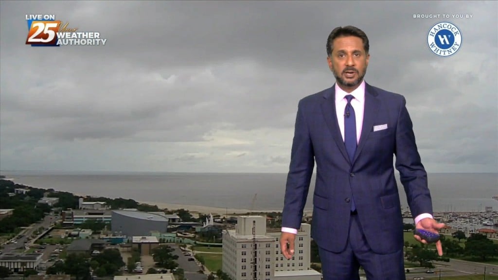
The warm and humid conditions continue as skies have become mostly cloudy...
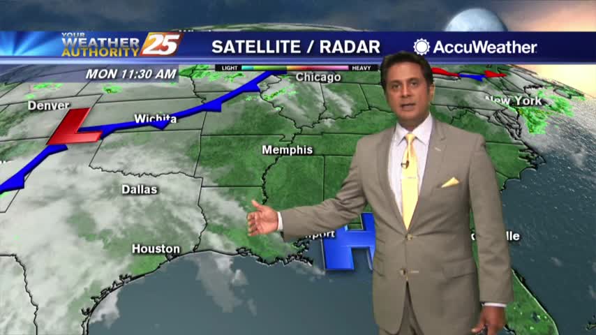
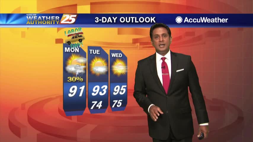
It is Monday but what a LOVELY start to the workweek...

Clouds continue to linger as wrap-around moisture is still in the area in the wake of last night's system...