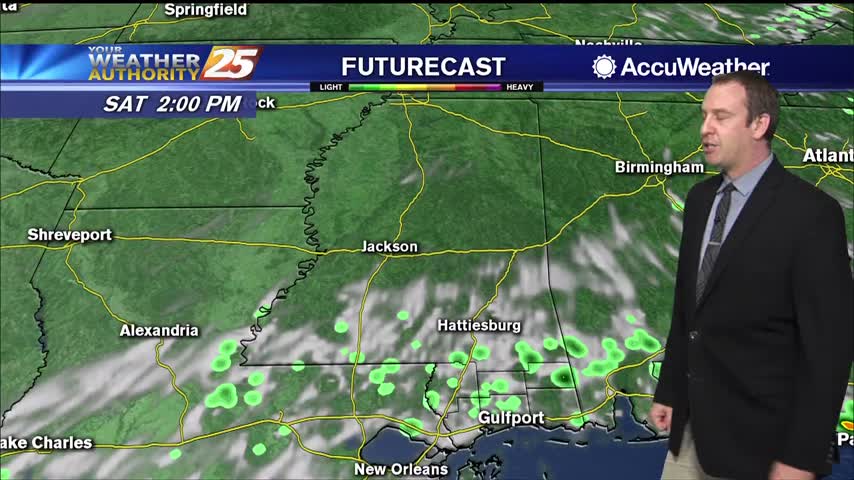
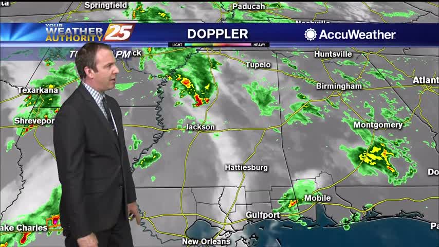
06/03 Ryan's "Wet" Wednesday Evening Forecast
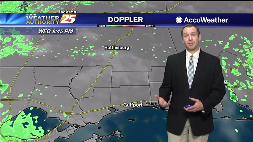
Wet conditions earlier today as showers and thunderstorms moved through, but the evening has cleared some.

Wet conditions earlier today as showers and thunderstorms moved through, but the evening has cleared some.
Our afternoon clouds and showers have cleared, and we're in for a long string of sunny days ahead.

It's been pretty cloudy all week, but we're finally starting to see some positive changes moving in.
Only a small spot of rain today in South MS, but we saw plenty of clouds and high humidity again.
Much less rain today, but still cloudy in South MS. Expect the rain to return tomorrow ahead of some weekend clearing.
Thunder rolled this morning as strong thunderstorms lingered, but things have cleared up since...won't last long though.
Another hot and humid day with a warm and humid night in between, but we're seeing more afternoon shower activity.
More rain today during a stormy afternoon, but it will die off a bit into the night...only to come right back tomorrow.

Little more rain tomorrow than we saw today, but not much changes for the rest of the week heat/humidity-wise.
The high humidity isn't going anywhere, so get ready for more of the same, but with more afternoon shower activity.

The afternoon rain has dried up and the clouds are clearing, but they'll be back before long....
Cloudy and dark end to the day today, but we'll see more sun ahead! More rain too though...
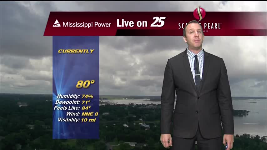
Tonight, a gradual cool down is expected with temperatures only getting into the mid 70s by midnight and into the lower 70s by Friday morning. Clouds will filter into the region overnight, creating partly cloudy skies by sunrise. A few…
Earlier today, temperatures soared into the lower 90s for many locations across South Mississippi. With humid air in place with little wind, heat index values or "feels like" temperatures were in the mid 90s. Tonight, a gradual cool down is…

Didn't see much rain in South MS today, but we'll see a little more in the days ahead.
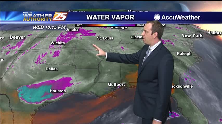
Rain has been hard to come by, but gloomy weather remains in place across the coast.

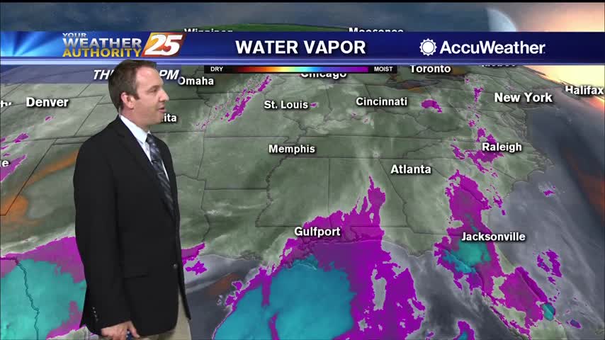
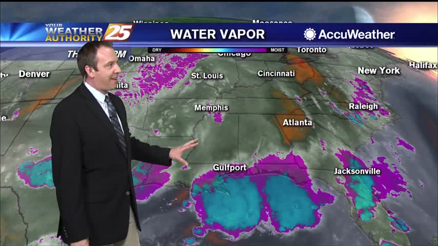
Heavy rainfall has fallen just to the west, but so far very little has moved into South MS. More is on the way though.
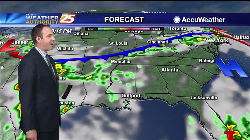
Much more cloudy today than recent days and with our first "active" weather in over a week!
Warm and humid like the last few days have been, but now much more cloudy...something that won't change for the rest of the week.
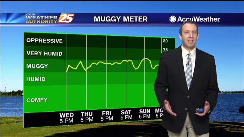
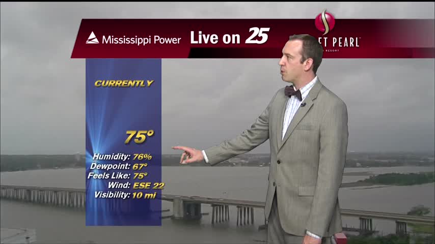
A stiff southerly breeze has increased dewpoints into "muggy" territory, and it doesn't get much better until next week.
The weather will remain nice, but heats up tomorrow before a slight cool-down and some end of week rain.
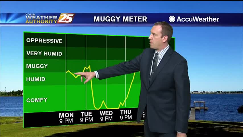
The humidity and temperature have been slowly rising through the weekend, but will rise sharply tomorrow before a slight cool-down.
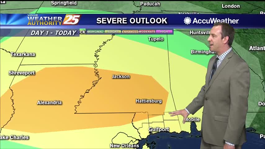
Expecting showers to get going a little after midnight, but stronger, potentially severe storms are likely before sunrise.
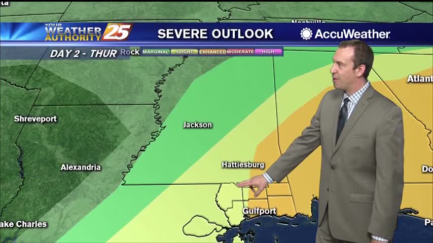
Expect the breezy conditions to linger through the night as a front closes in and brings strong storms tomorrow afternoon.