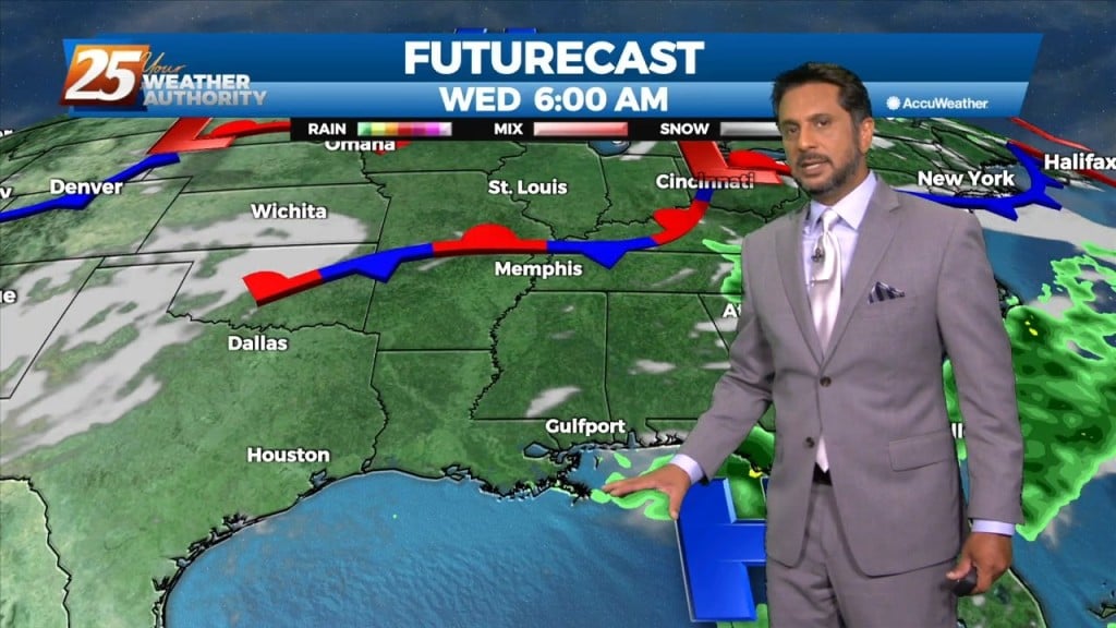
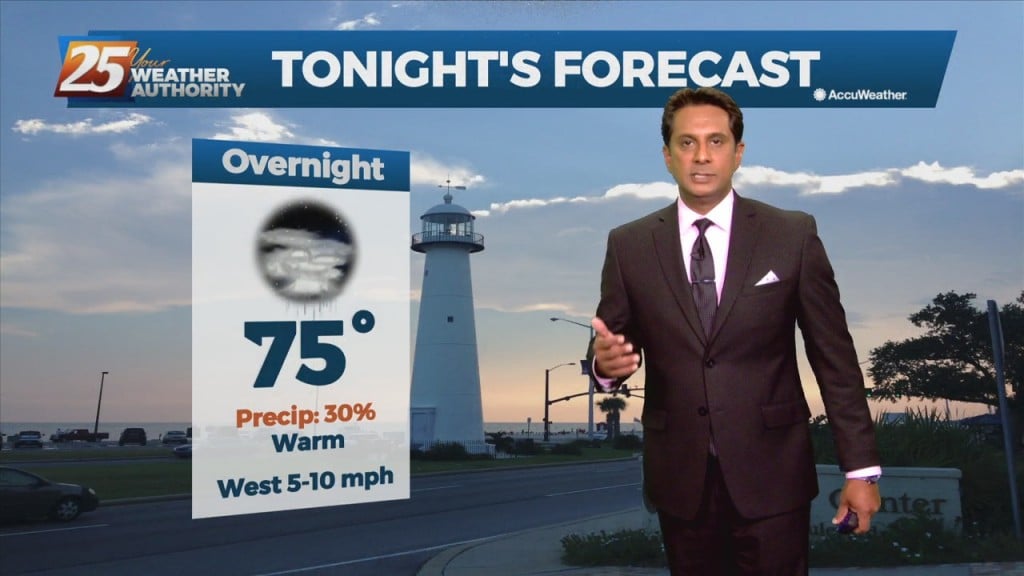
6/25 - Sam's "Higher Rain Chance" Wednesday Evening Forecast
Hot and mostly sunny conditions continue across South Mississippi and the eastern half of the US. A few isolated showers and storms are possible this evening and again overnight,…
Hot and mostly sunny conditions continue across South Mississippi and the eastern half of the US. A few isolated showers and storms are possible this evening and again overnight,…
Very little change to our weather pattern today as a very weak frontal boundary moves through the region and pushes offshore and weak it shall be because…
Surface dewpoints are running a couple degrees below expectations in a few areas, but the only impact on the forecast would be that it might…
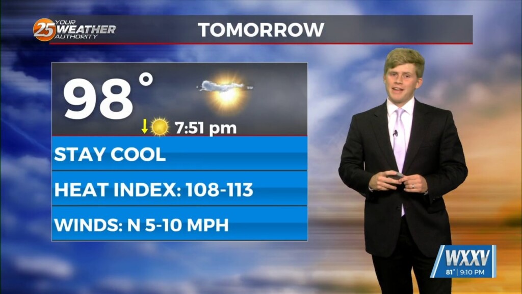
Monday through Thursday will be hot, but drier overall humidity. Looking at the models, ridging will be in place over the next few days. Temperatures will…
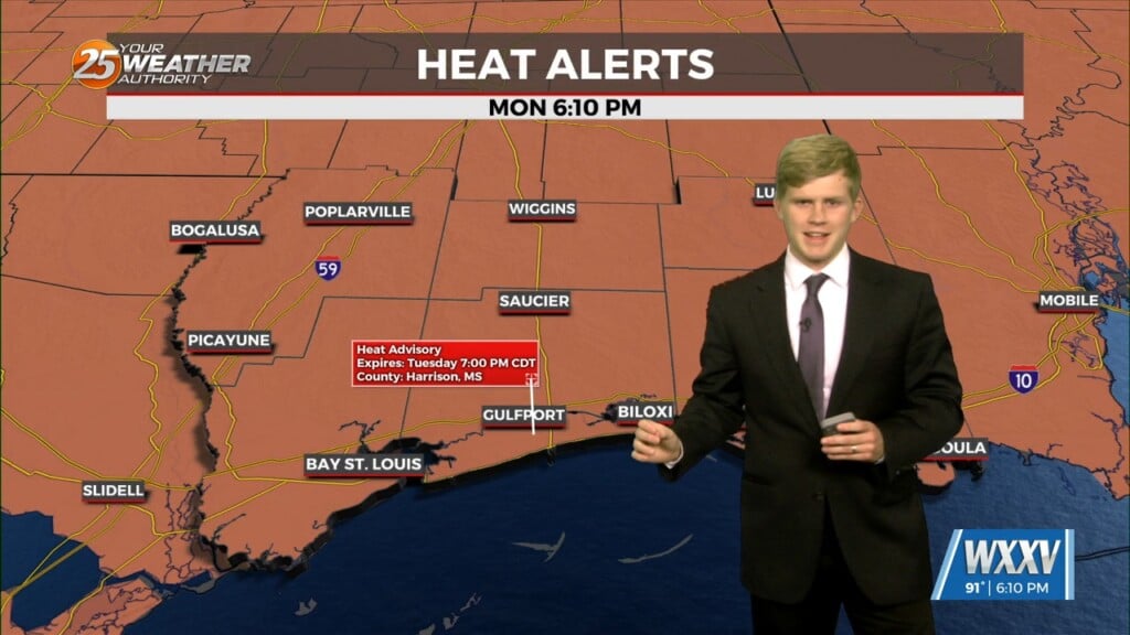
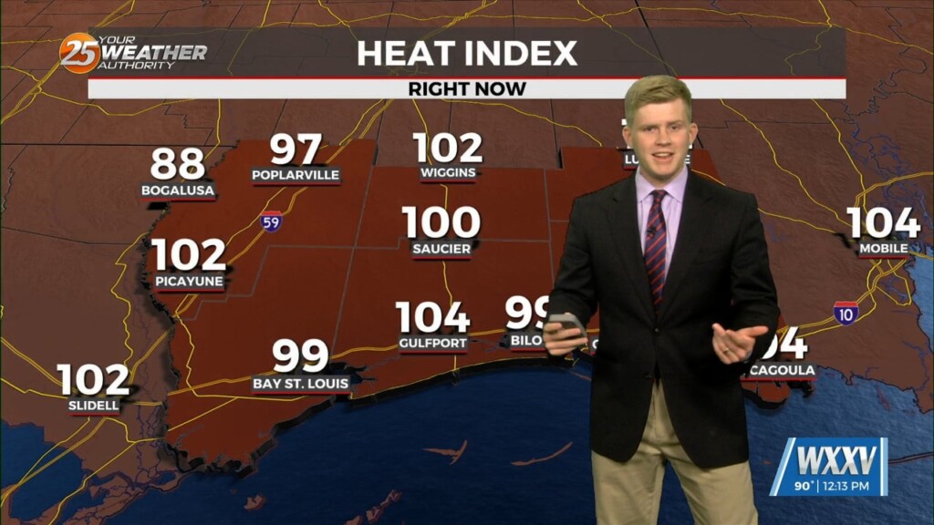
Quiet for tonight same deal on Tuesday with again another day of highs in the mid to lower 90`s. Going ahead with another heat advisory in…
Quiet tonight other than some potential isolated showers across marine areas. Same deal on Tuesday with again another day of highs in the mid 90`s. Going…
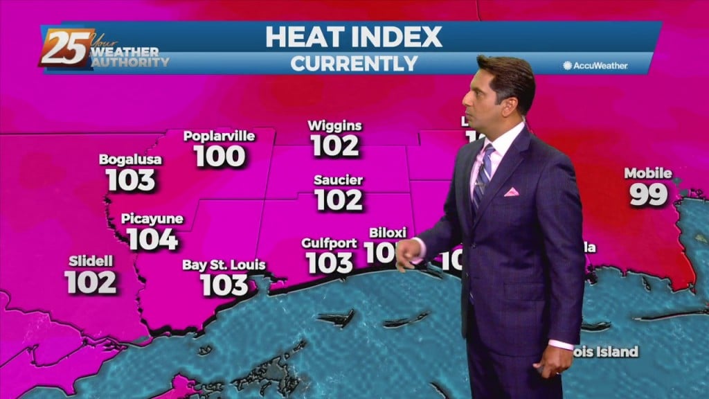
Looking into this upcoming week we see temperatures above average in fact, Stone and George counties will have heat advisory until tomorrow evening. However, the…
High pressure becomes centered over the region and the activity will remain suppressed today and tomorrow. Very dry air aloft associated with subsiding air will effectively…
A weak stationary front overhead will slowly drift south with energy moving into the area this evening. Coupled with daytime heating…isolated t-storms will pop mid-afternoon into…

A stationary front is overhead or just to the south of our area. With that being said activity may be ignited along the stationary…
This morning there are a few high clouds pushing out of our area to the southeast. This will leave us with clear skies allowing plenty of…
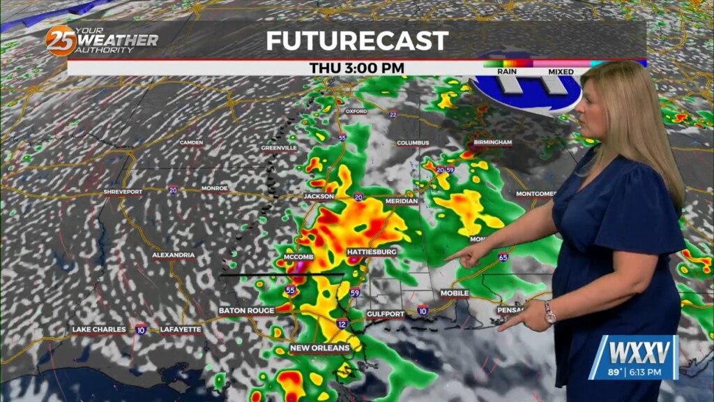
We are still in a persistent pattern of afternoon showers and thunderstorms due to a boundary in the area will last through Wednesday. This afternoon daytime heating interacts…
High pressure to the NW coupled with TD #2 to our SE will continue to provide for e NE/E wind this afternoon...dropping relative humidity into the 40% range.…
There is a surface boundary running northwest to Southeast across the area. We are seeing temperatures this afternoon 3-5 degrees warmer than yesterday at this time. Considering today and yesterday are very similar, we still…
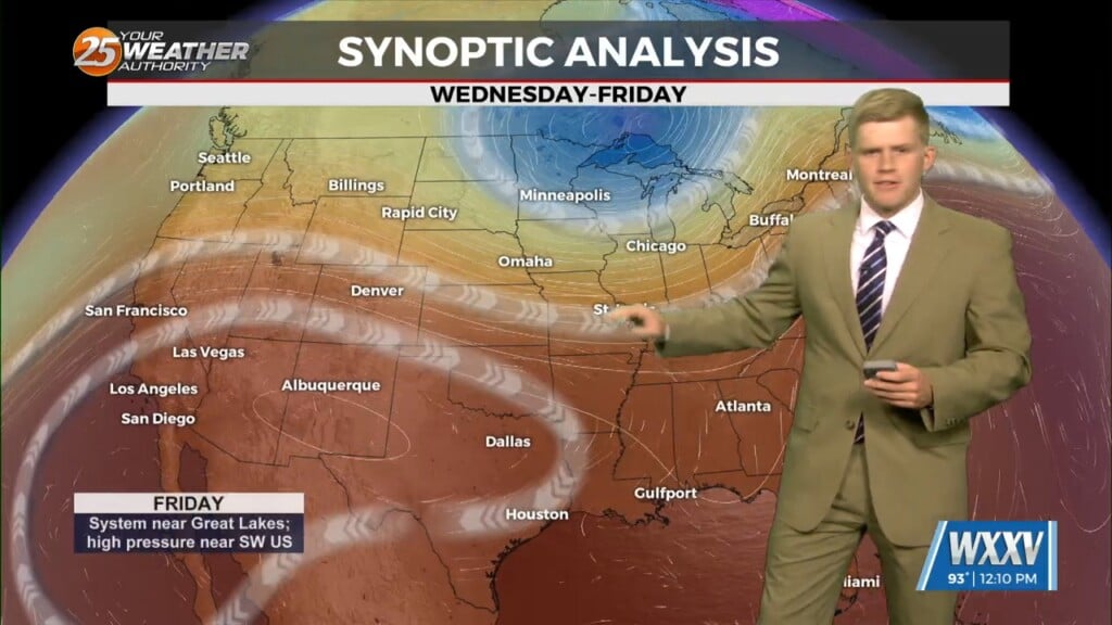
A blocking pattern remains across the eastern half of the country with an upper ridge over the Great Lakes. Yesterday’s double barreled upper low, as expected, has…
Tomorrow will likely be drier. The ridge will continue to build over both the southern Plains and Lower MS Valley likely stretching east across most of the southeastern CONUS.…
The main focus of the short term forecast will be the warmer temperatures heading into Tuesday and likely again Wednesday. It has been a while since we`ve…
The general upper level setup aloft hasn’t changed in the last week or so for all intents and purposes with the exception of small variations. A broad…
A surface low associated with Tropical Depression Ida will continue to move NE, dragging a weak cold front into south Mississippi Thursday morning. Northwesterly flow aloft will develop across the area today between the upper level High pressure over Texas…
Isolated-Scattered showers and t-storms will be possible each day over the next couple of days, primarily during the peak daytime afternoon heating hours. Locally heavy rainfall will be possible inside thunderstorm development, based on the model consensus and parameters. Heat…
Winds from the southwest will spread over the entire area throughout the day today which will help to bring back a steady increase in moisture. The typical summertime pattern will dominate with mostly clear skies in the morning with clouds…

Mid/Upper level no rain producing clouds continue to move into the area...
A warm and humid start with a few showers moving in from the S/SE...
An ABSOLUTELY beautiful start to the day with cooler temperatures and very low humidity...