HOT & Humid

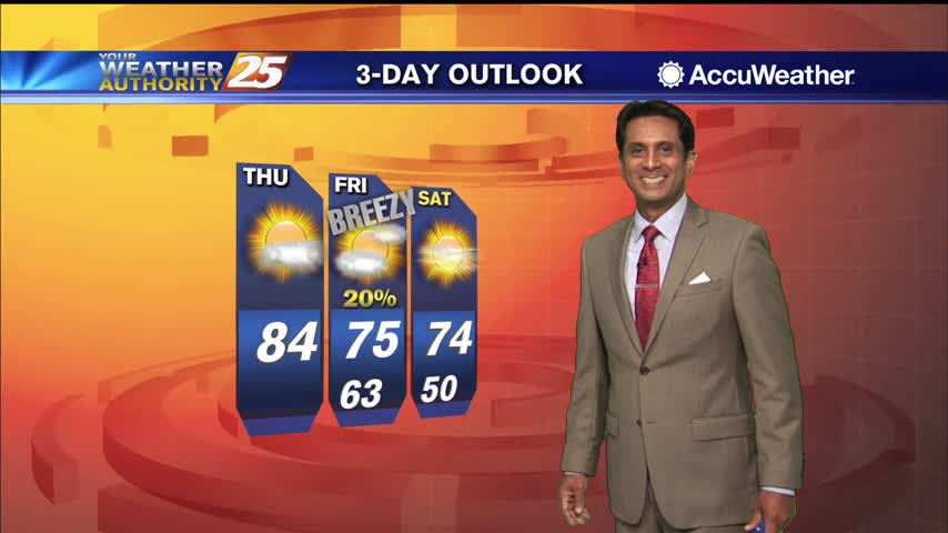
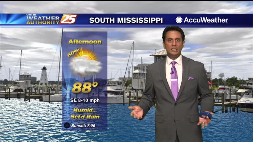
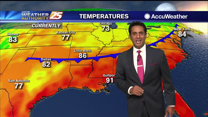
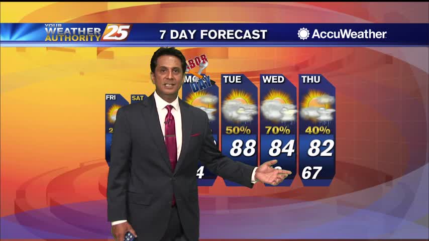
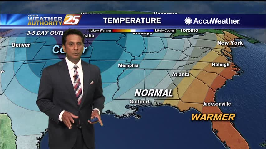
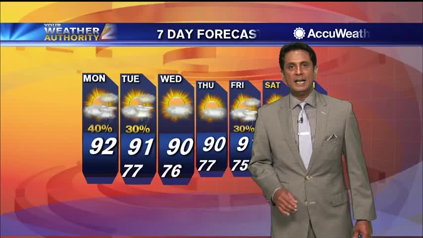
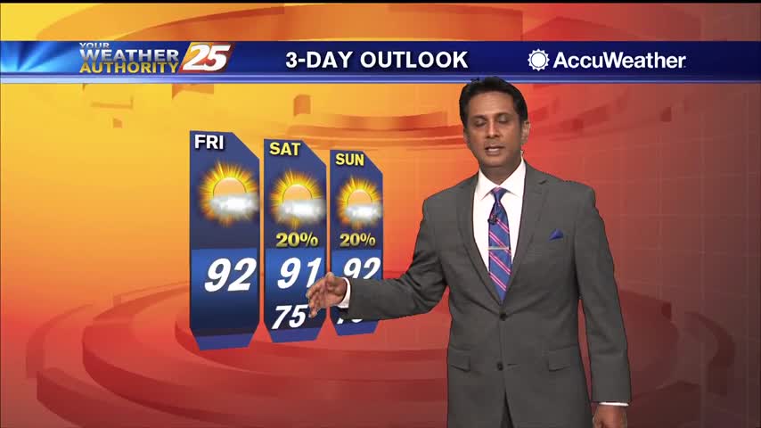
7/15 - The Chief's "Weekend Look Ahead" Afternoon Forecasts

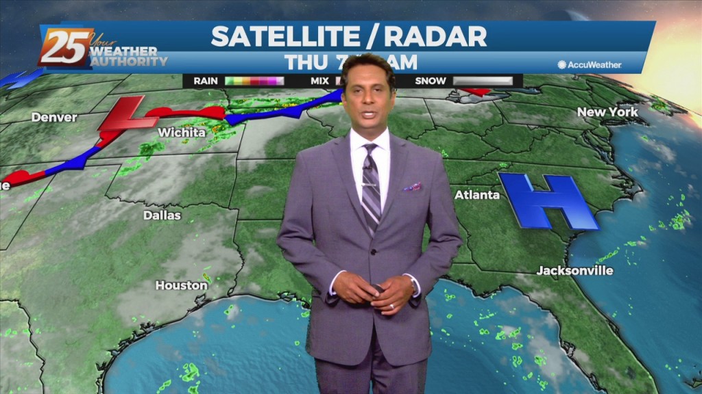
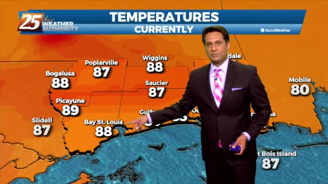
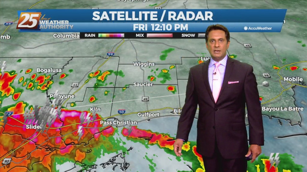
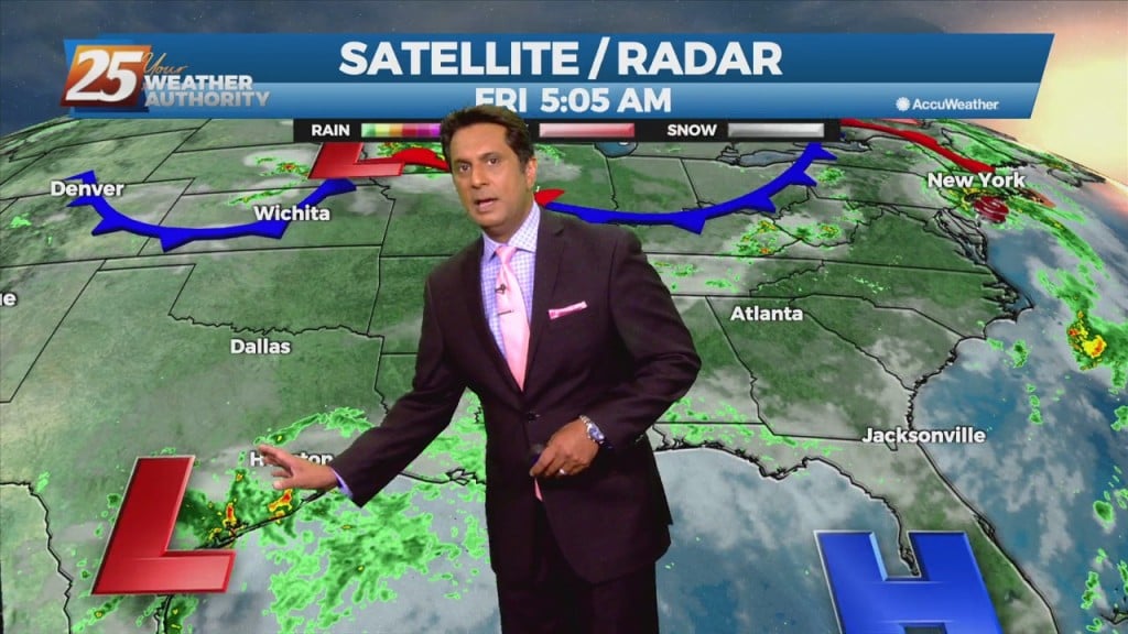
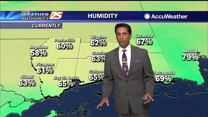
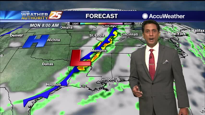
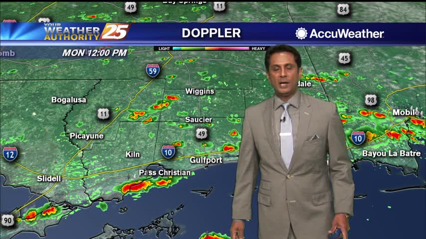
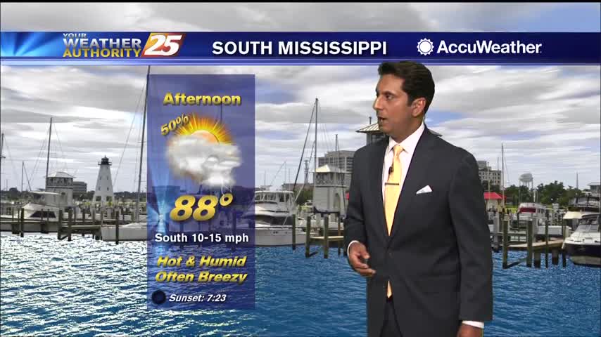
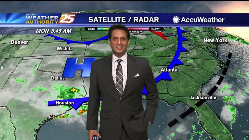
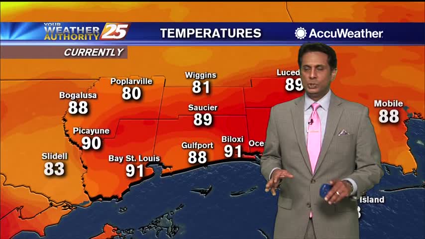
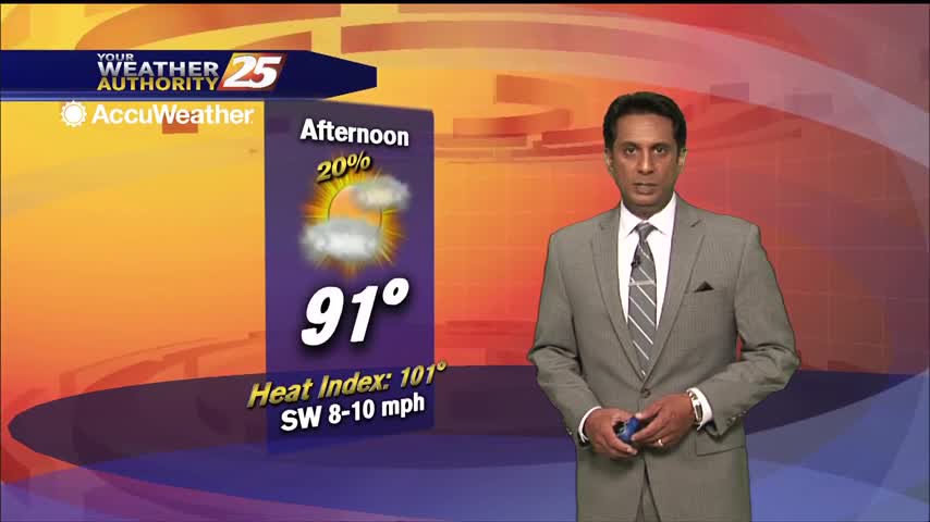
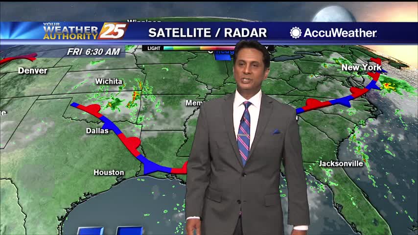
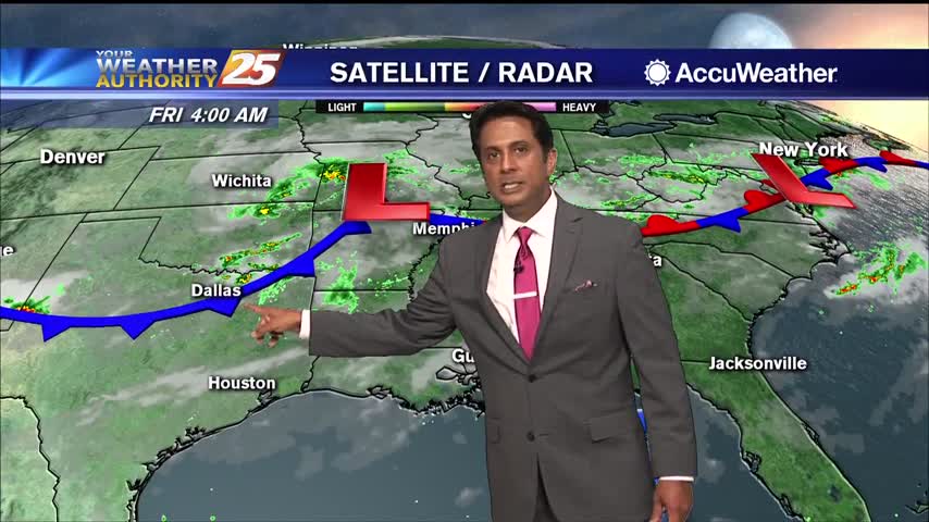
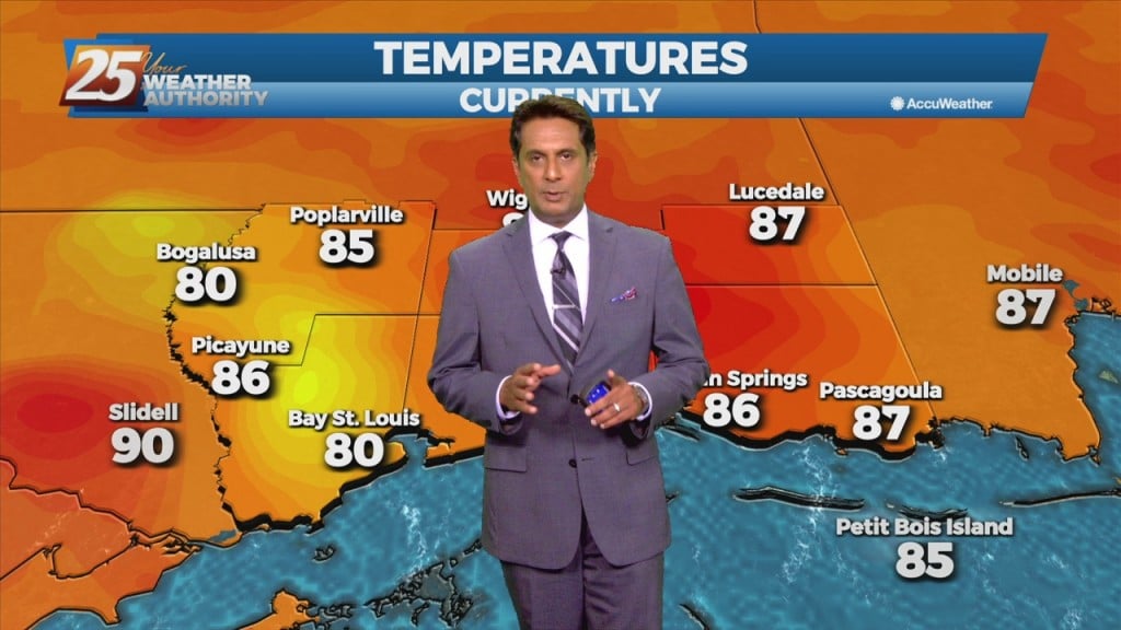
This afternoon though the weekend, south Mississippi will be in the middle of lower moisture to the east, higher moisture to the west. Convection in the onshore flow should remain isolated to scattered, with the best coverage over the western…

7/15 - Rob's "Continued HOT" Thursday Morning Forecast

The Bermuda high-pressure is at the surface and aloft, extending westward across the Gulf Coast into east Texas early this morning. The eastern portions of the area may squeeze out one more relatively dry day today, as moisture flow will…

7/13 - Rob's "Hot & Humid" Afternoon Forecast

This afternoon will bring a few showers/air mass t-storms to south Mississippi. The good news is we are not anticipating AS widespread coverage as the previous few days, but an enhancement of typical summertime coverage will persist. Also any airmass…

7/13 - Rob's "Hot & Hazy" Tuesday Morning Forecast

Today will bring much less in the way of rainfall than we have seen over the past several weeks. We will need to watch just how much coverage of convection develops across the coastal areas. The good news is we…

7/9 - Rob Knight's "Lower Rain Chances" Weekend Forecast

This afternoon will bring scattered showers and t-storms. A southerly surface winds will help to enhance the warm air and moisture advection into the area, which will enhance the lifting in the environment. Models indicate the possibility for locally heavy…

7/9 - Rob Knight's Friday Morning "Hot/Humid" Forecast

Today through Sunday, scattered showers and t-storms and enhanced rain chances will be possible, especially each afternoon. Southerly surface winds will help to enhance the warm air and moisture advection into the area, which will enhance the lifting in the…