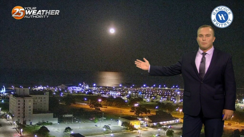
9/1 - Sam Parker's "Hot Labor Day" Sunday Night Forecast
As the surface trough over the northwestern Gulf slides a bit farther from the local area and upper level ridging tries to build into the area,…
As the surface trough over the northwestern Gulf slides a bit farther from the local area and upper level ridging tries to build into the area,…
Today and Friday will look to be fairly similar like the past few days. A few more storms around each day taking full advantage of the strong…
A stationary front overhead will be the focal point for activity into the weekend. This boundary will help a very large complex of elevated storms develop later…
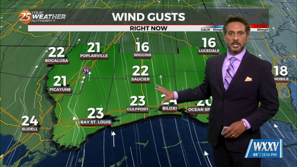
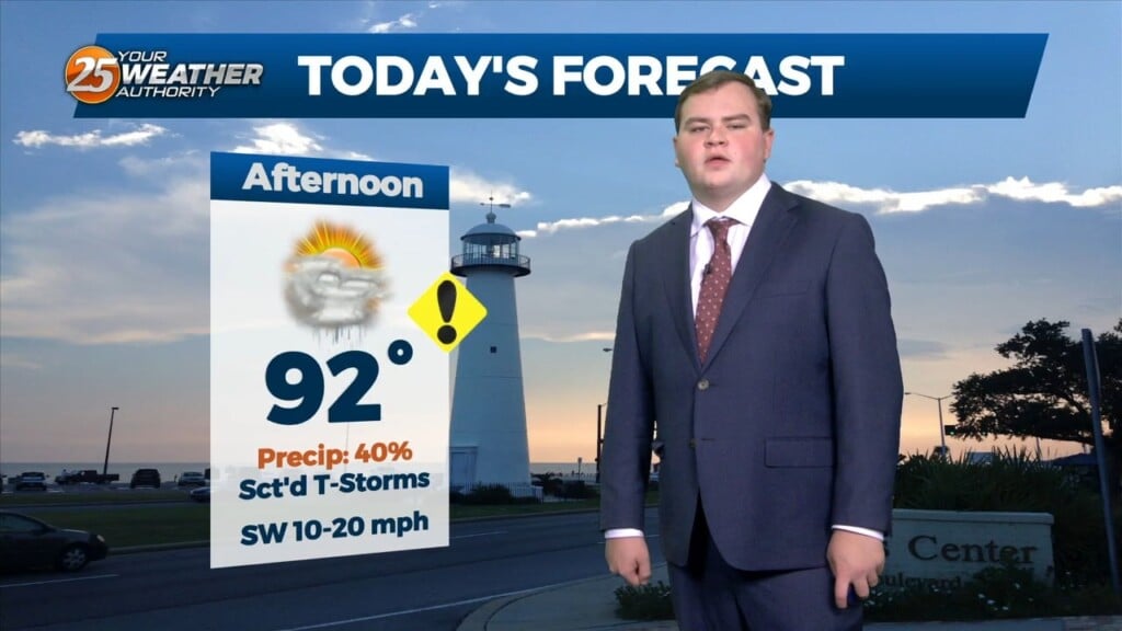
HOT...HUMID & BREEZY afternoon ahead... On Thursday a strong upper level disturbance will help send a cold front southward toward the region. During the…
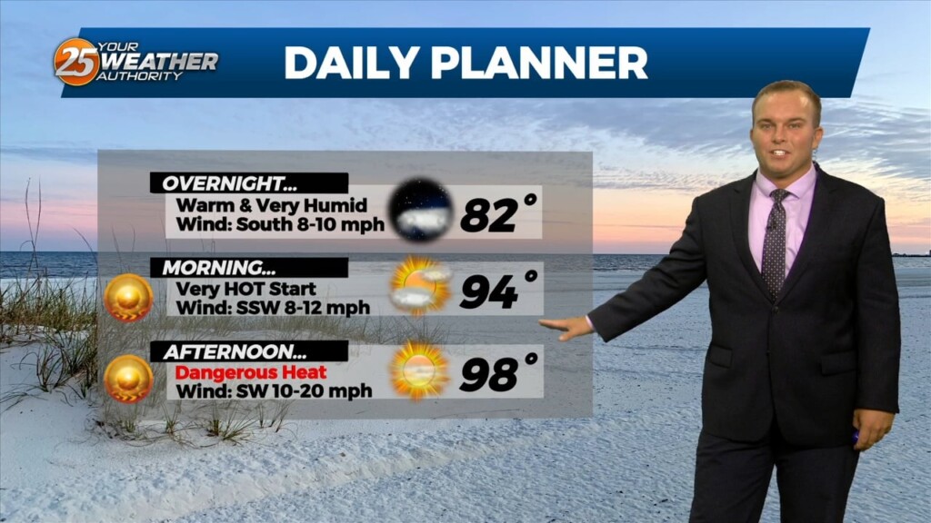
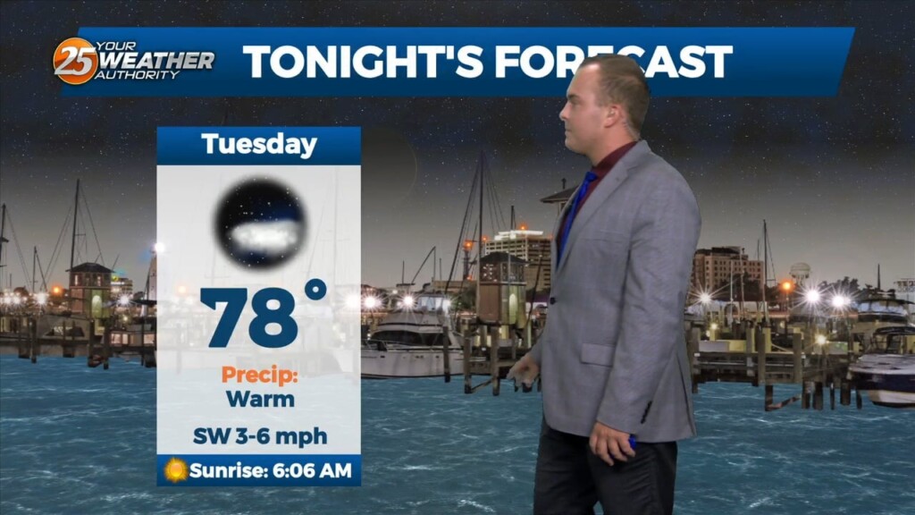
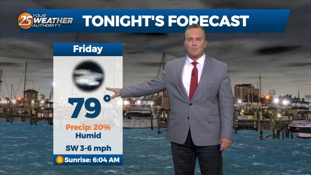
It will remain very warm overnight with southerly winds ushering in extremely high levels of humidity. Some clouds will be around at times but the…
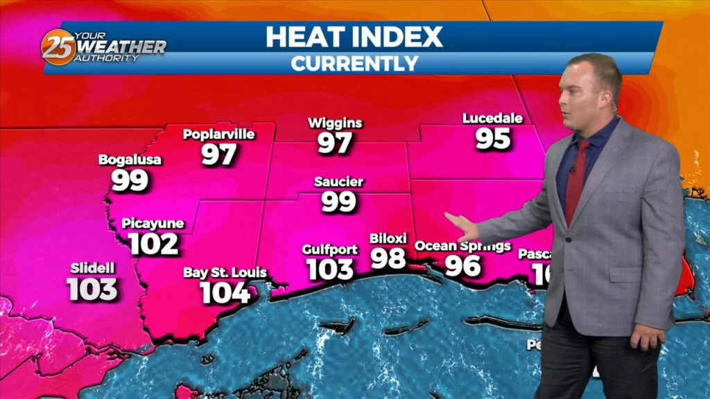
As has been the case for a while, dangerous heat continues into this evening. Heat alerts expire at 7 PM but it will still be VERY…
Winds remaining out of the south overnight will keep it very warm and extremely humid overnight. Some clouds will be present at times but expect the…
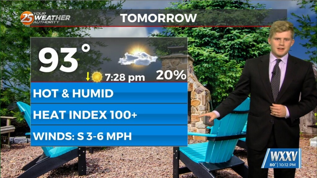
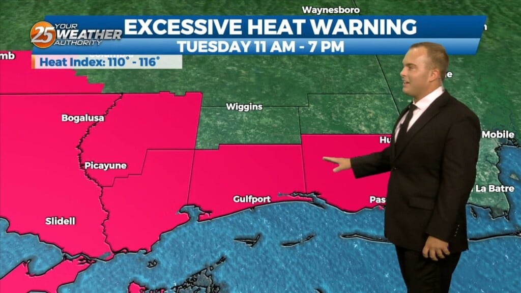
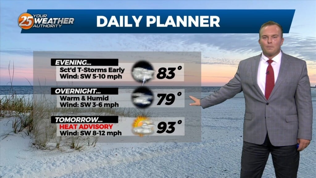
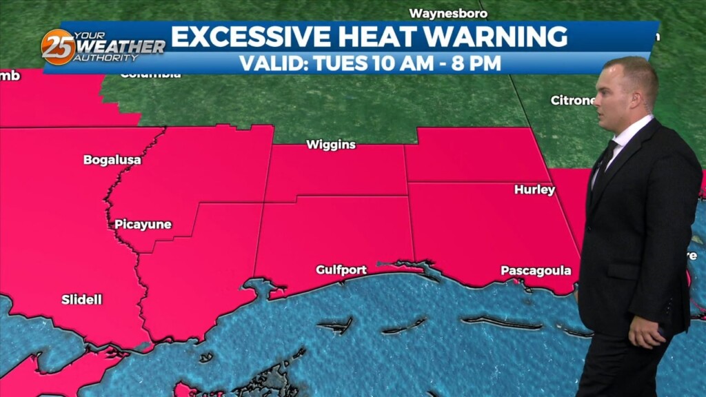
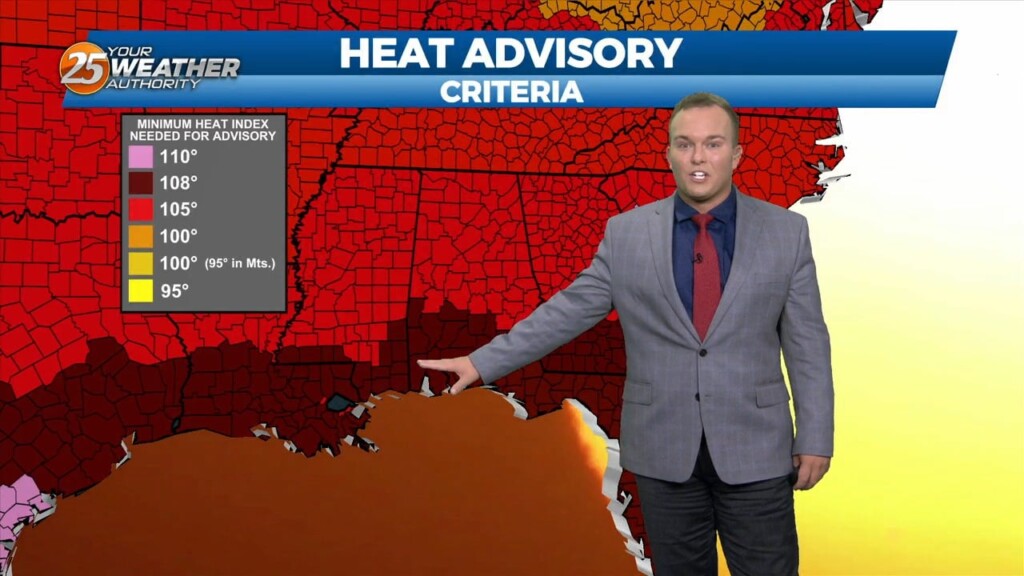
The heat wave we have been dealt continues through the much of this week. An Excessive Heat Warning is in effect until 7 PM for heat indices…
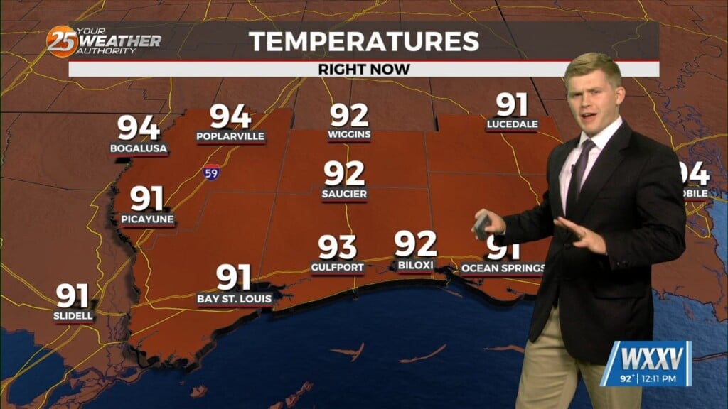
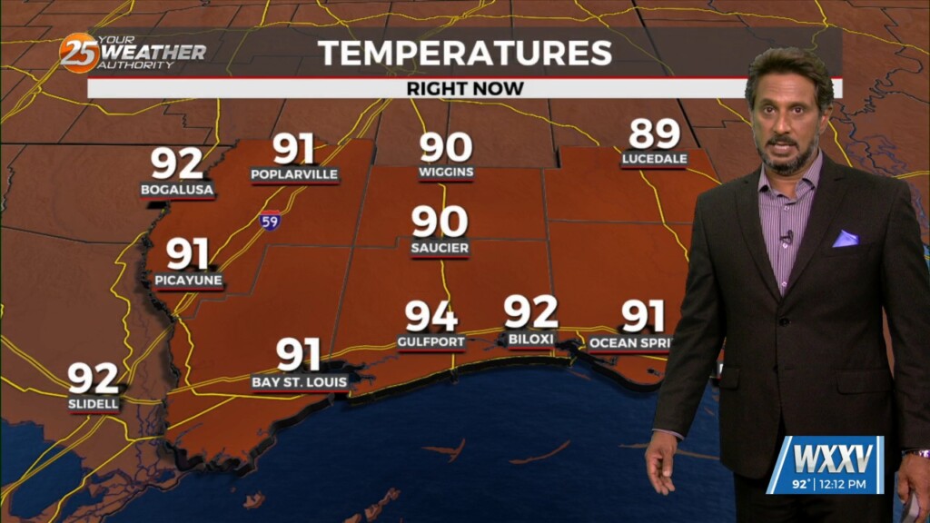
It will be warm and humid out the door tomorrow morning. Your Wednesday is going to start off with sunny skies and that will allow for hot…
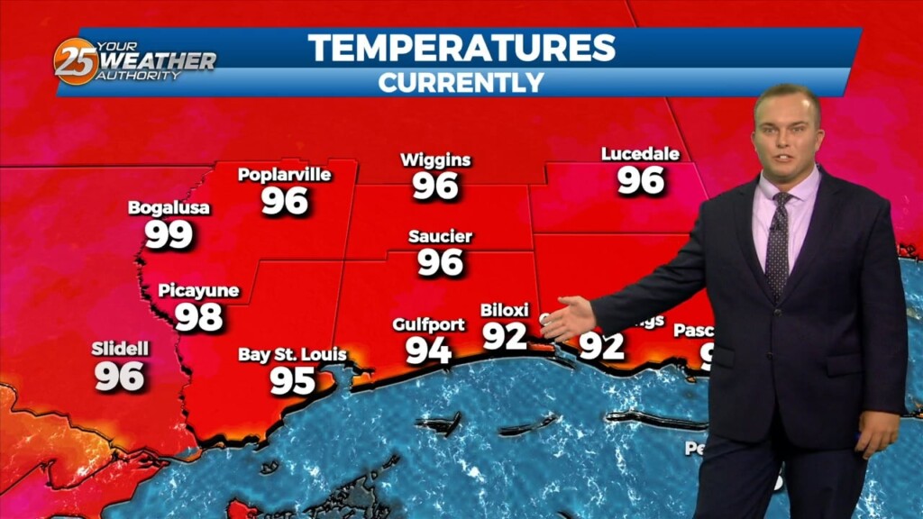
An Excessive Heat Warning remains in place for Hancock, Harrison, Jackson, and Pearl River County until 7 PM. Skies will clear from partly cloudy to mainly clear skies…
Warm and humid conditions will linger overnight as the flow gradually becomes southerly. Skies will be mostly clear if not totally clear. Tomorrow will be a repeat…
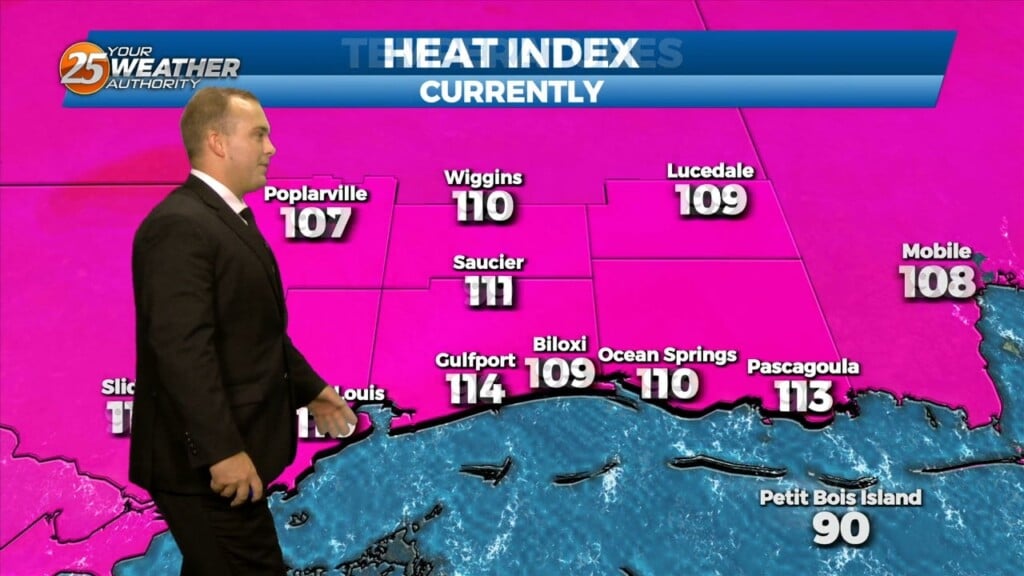
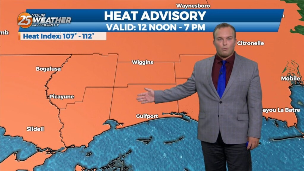
A Heat Advisory remains in effect until 7 PM. Heat indices of over 100 degrees will be around into portions of this evening. Skies will clear out…
Another hot and humid day is expected across the Southern 6 counties. A HEAT ADVISORY goes in effect from 12pm until 7pm as heat indices will…
Thunderstorm chances this evening will move out and skies will also clear somewhat. Humidity will remain uncomfortable to start your weekend. A Heat Advisory will be…
A Heat Advisory is in effect until 8 PM for heat indices between 105 and 110 degrees. This evening, thunderstorm chances will be elevated for a window…
A Heat Advisory remains in effect until 7 PM this evening. Hot and humid conditions are here for the week with strong high pressure and intense…
A Heat Advisory is in effect untill 7pm, showers and thunderstorms will bring relief to a lucky few. How long can our NW to westerly upper…
A Heat advisory is in affect for area from 11 am to 7 pm, be sure to practice summertime safety. The boundary has generally been north of our…
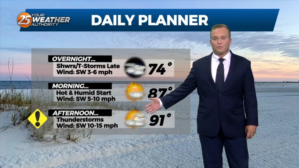
It will remain warm overnight as temperatures will not drop significantly. The humidity will remain in place as we are in meteorological summer. There is the low-end potential…
Clouds took a very slight edge off of the heat today. Some spotty rain has popped up here and there. It will remain very warm overnight…
Other than very isolated shower/thunderstorm chances, the threat for severe weather has ended. Temperatures will remain warm overnight as humidity won’t allow for much cooling off.…
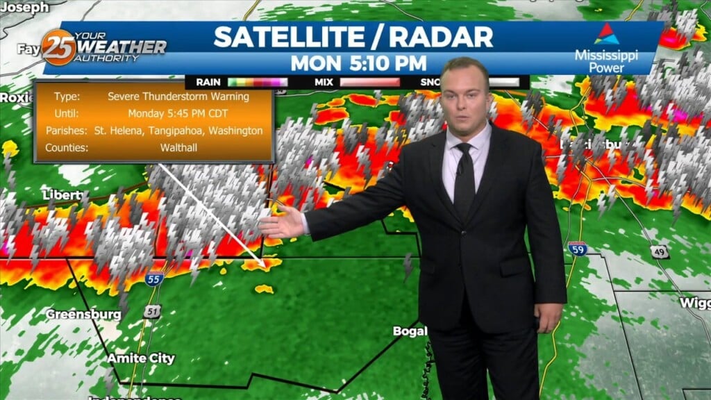
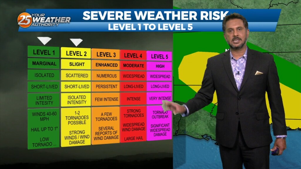
There is the potential for strong thunderstorms this evening. Our Southern Six Counties are under a Severe Thunderstorm WATCH until 8 PM CDT. Thunderstorms could have…
Winds have primarily become a southerly flow which is taking the humidity up another notch. Overnight, there is the possibility for showers and thunderstorms after midnight.…
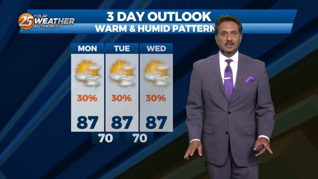
We are still in a persistent pattern of afternoon showers and thunderstorms due to a boundary in the area will last through Wednesday. This afternoon daytime heating interacts…