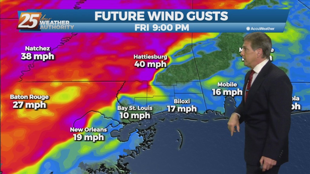
12/15 - Jeff's "Rain/Wind" Weekend Forecast
Clouds will build back in tonight thanks to an area of low pressure in the Gulf of Mexico. It, combined with another system to our north will influence our conditions…
Clouds will build back in tonight thanks to an area of low pressure in the Gulf of Mexico. It, combined with another system to our north will influence our conditions…
Partly cloudy skies and breezy conditions remain overnight. Temperatures will be fairly mild compared to earlier this week. Friday will feature more sunshine and windy conditions at times.…
Cloudy skies this evening will clear out somewhat overnight while winds will remain elevated. Expect mild temperatures out the door for your Friday while winds will…
Winds remaining a factor overnight and increasing cloud cover will help keep temperatures milder with about 5 degree warmer readings to start your Thursday. For tomorrow, expect…

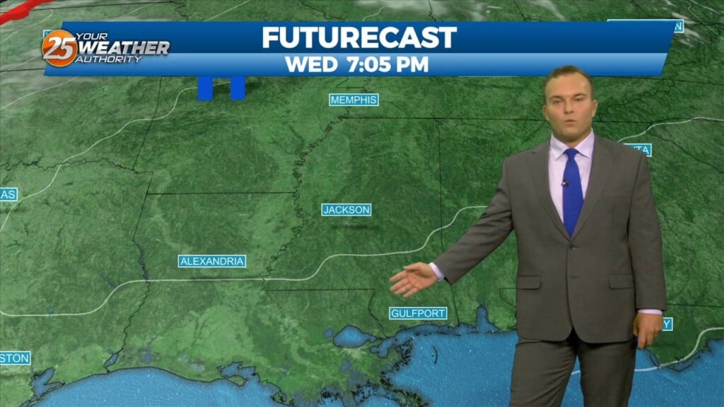
Breezy conditions will subside somewhat this evening while partly cloudy skies are expected overnight. Temperatures will be milder with generally 40s across South Mississippi. Thin upper-level clouds…

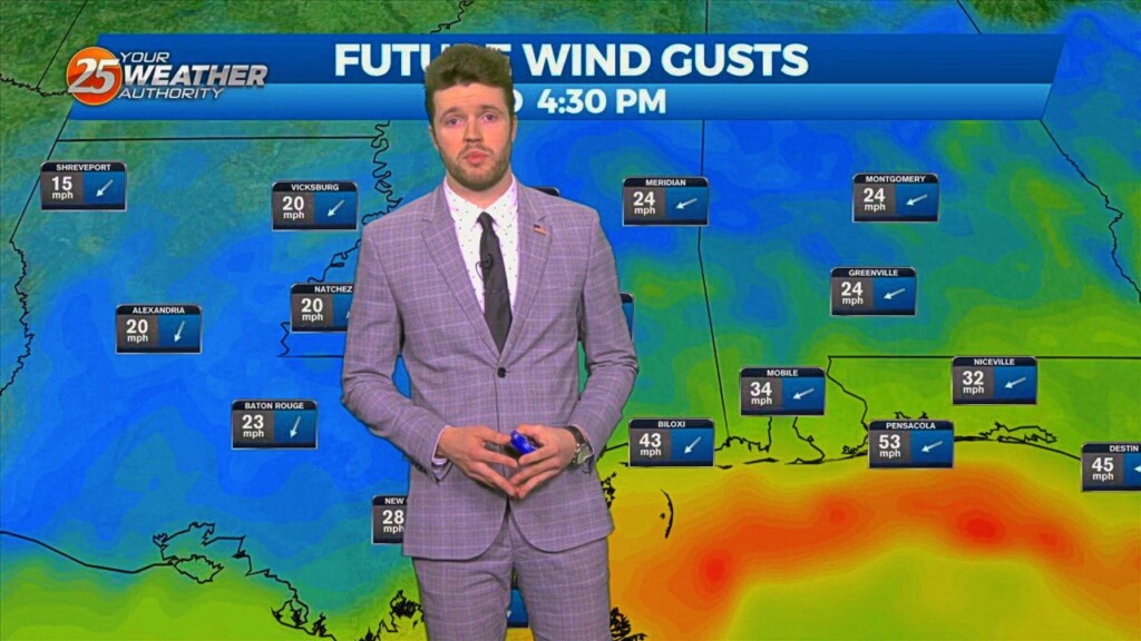
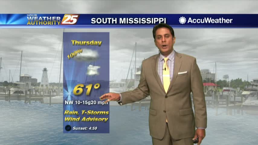
Mostly cloudy skies will continue Thursday thanks to a persistent corridor of easterly lower-tropospheric moisture advection that isn`t backing down much, if any. Strong winds will…
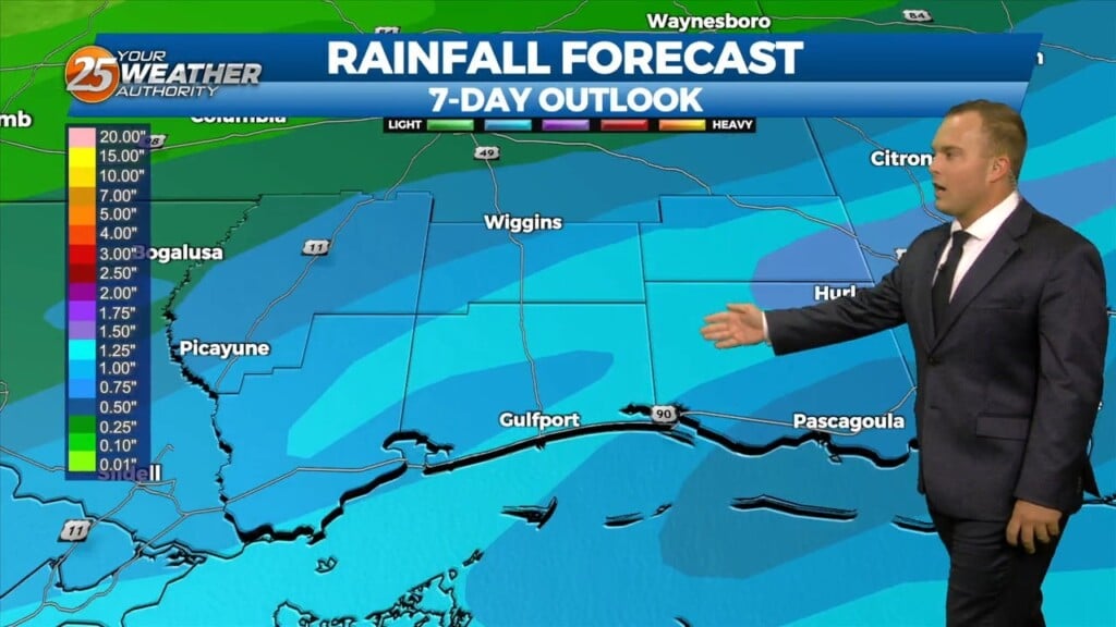
Here on the Mississippi Gulf Coast, as this workweek approached, weather models began agreeing more on the current system bringing heavy rainfall in…
Here on the Mississippi Gulf Coast, as this workweek approached, weather models began agreeing more on the current system bringing heavy rainfall…
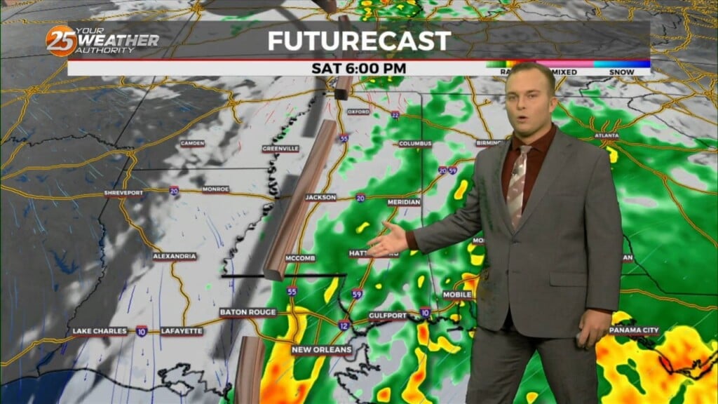
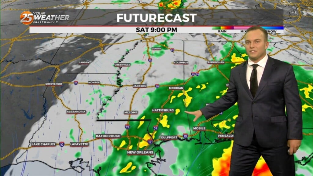
Rain will develop and move back into place by the evening with the possibility for steady rainfall at times tonight. Coverage will peak at around 70-80%…
Light rain around at times this morning will fade and there will be a break in the action from this morning into the afternoon. With that,…
It will be chilly and windy overnight as a cold front is well past our area. Some light rain will work into South Mississippi towards daybreak and…
A cold front has moved through our area and big changes are taking place behind it. Temperatures are already much cooler compared to earlier and…

Rain will gradually exit the area overnight as winds will remain blustery until around daybreak. Alerts including a Wind Advisory for the 3 immediate coastal counties and…
Cloudy skies will prevail tonight and rain chances will begin to come into play after 2 AM. Light southerly winds will remain in place until the…
Cloudy skies with very few breaks in cloud coverage will continue this evening with light southerly winds shifting to easterly overnight. Temperatures will be slightly warmer overnight as…
Spotty rain chances will be in the picture overnight. Winds will become elevated towards daybreak as an area of low pressure takes hold on our region. Coastal…
Drier and cooler temperatures are here, and Fall-like feeling is in the air! No rainfall is expected for the next few days. And while the tropical system…
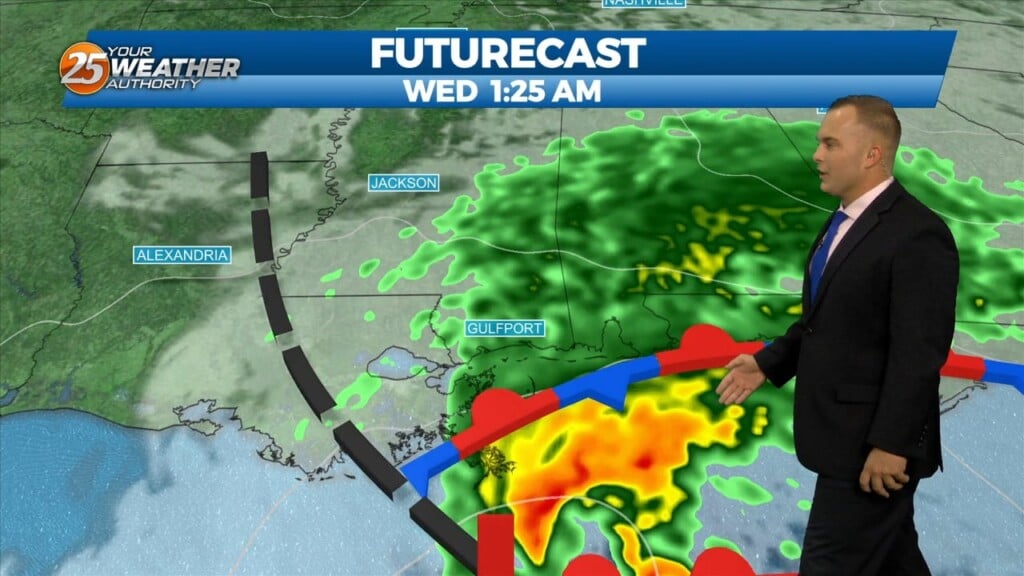
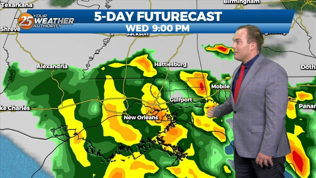
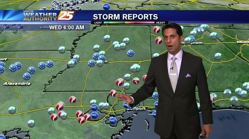
SEVERE STORM THREAT INCREASING FOR WEDNESDAY. The entire forecast area is now in a category 4 (out of 5) for severe potential Wednesday evening and night. Rarely do we see that 4th category, let alone in all the way to…
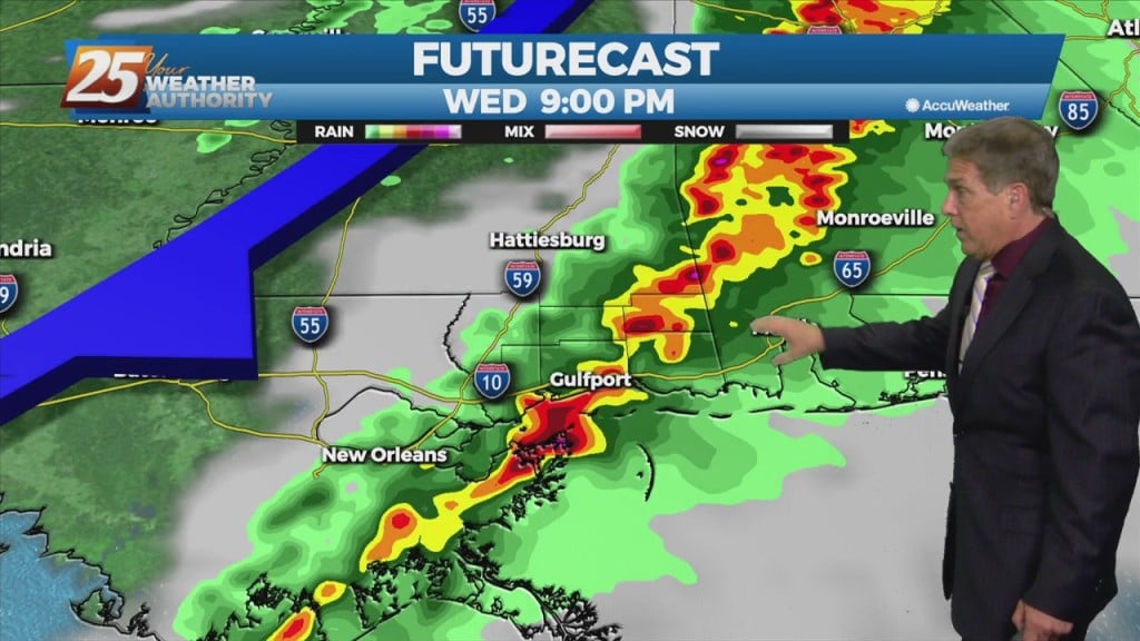
SEVERE STORM THREAT INCREASING FOR WEDNESDAY. The entire forecast area is now in a category 4 (out of 5) for severe potential Wednesday evening and…
Thunderstorms to increase in number and intensity tonight. Strong to possibly severe storms will be possible along the MS coastal areas and east. The more favorable parameters for strong storms will be in place along the MS coast as the system moves…
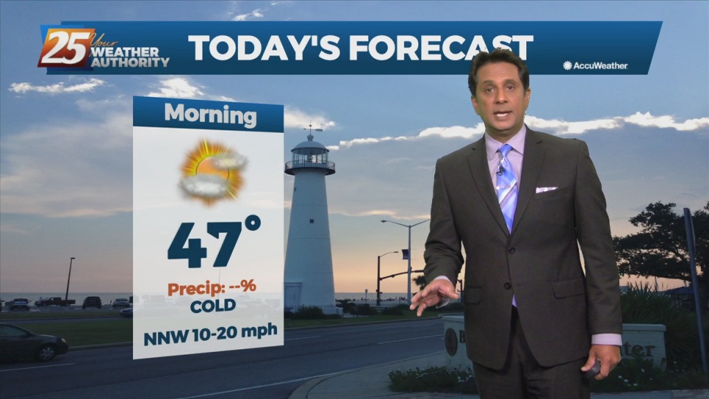
Strong cold and dry air advection has allowed for freezing temperatures across the entire area this morning and is expected again on Tuesday morning. A…
Light rain is now east of the area with DENSE FOG along the southern 6 counties...
Cool and cloudy with winds gusting into the 20 mph range...
After a cool weekend, a cold front moving through the area will bring a reinforcing shot of cold air and WINDY conditions.