7/21 - Rob's Friday Morning "Weekend" Forecast
A warm and humid start to the day/weekend with isolated activity to the south over the sound/northern Gulf...
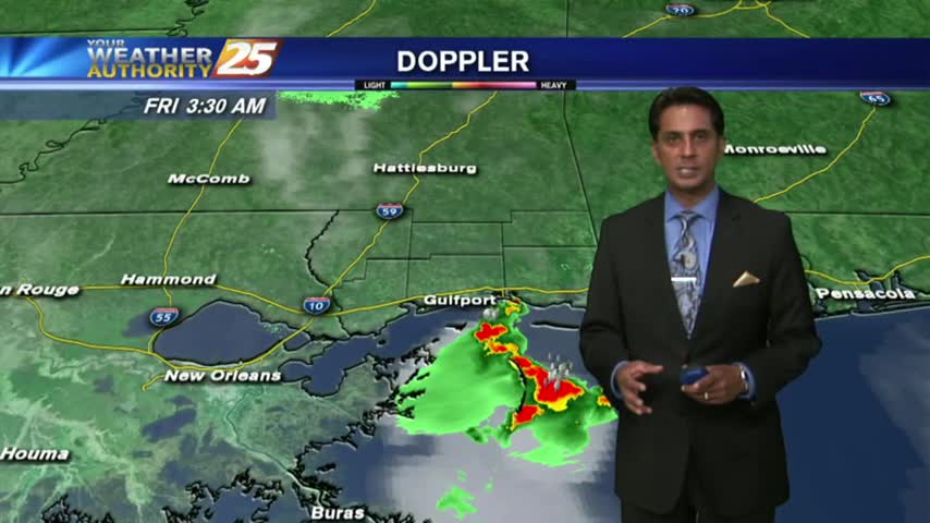
A warm and humid start to the day/weekend with isolated activity to the south over the sound/northern Gulf...
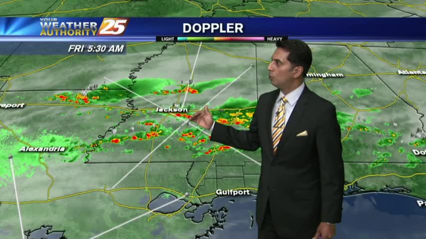
Showers and thunderstorm chances today as a surge of deep tropical moisture into the region.
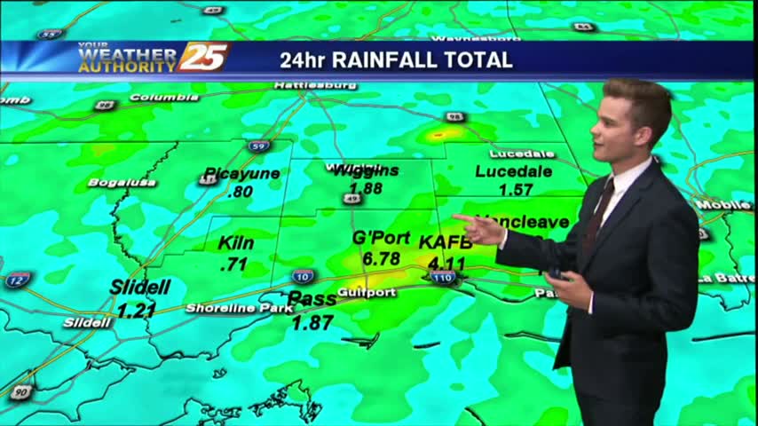
We are ending the month as the wettest June on record.
We are ending the month as the wettest June on record.
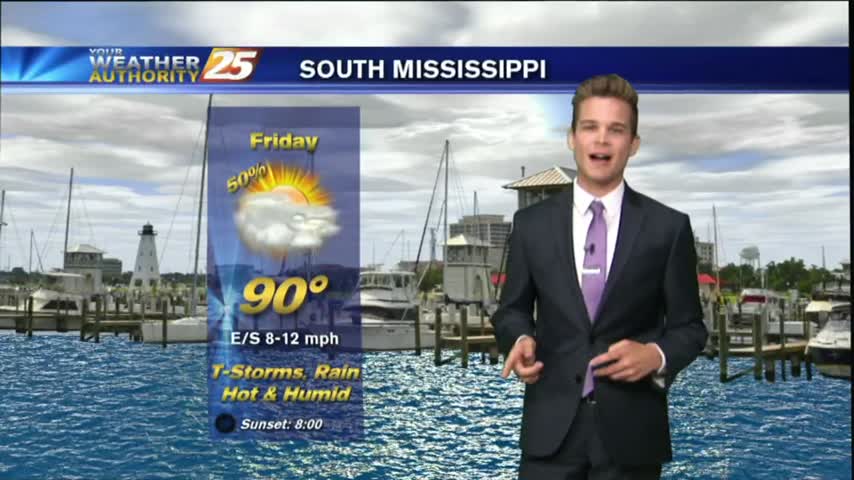
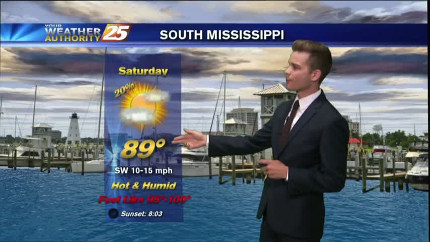
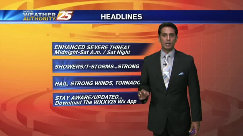
It's a WARM/HUMID day long the Mississippi Gulf Coast with the potential for HEAVY RAIN through the weekend...
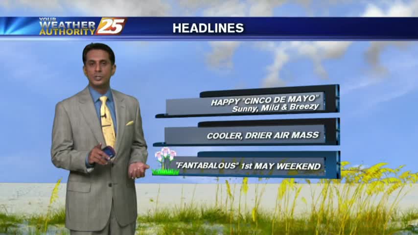
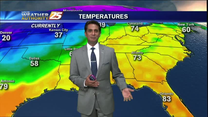
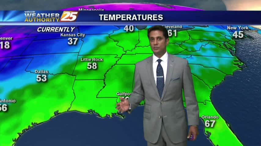
Another CHILLY morning as a COOLER/DRIER air mass begins to move into the region...
Its a BEAUTIFUL start to the day with chilly temperatures, low humidity and clear skies...
Areas of PATCHY DENSE FOG this morning as a cold front in Central Mississippi moves south...
Dense fog burned off earlier this morning, with now partly cloudy skies and breezy conditions setting up...
As the warm/humid air mass continues to dominate the area, DENSE FOG has developed this morning with an ADVISORY in effect...
After rain yesterday afternoon...very light fog is in the area with warm & humid conditions to head into the weekend...
It's another cool start on this Friday morning with temps averaging 60 degrees, and areas of patchy fog...