1/17 - Payton's Thursday Night Forecast
Fog, Severe Weather, Windchills in the 20s...Buckle Up
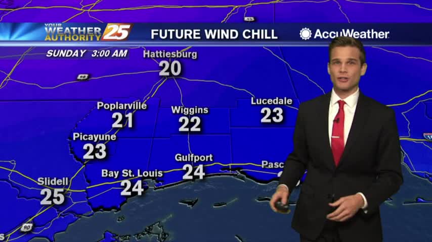
Fog, Severe Weather, Windchills in the 20s...Buckle Up
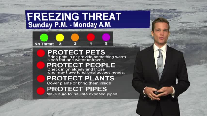
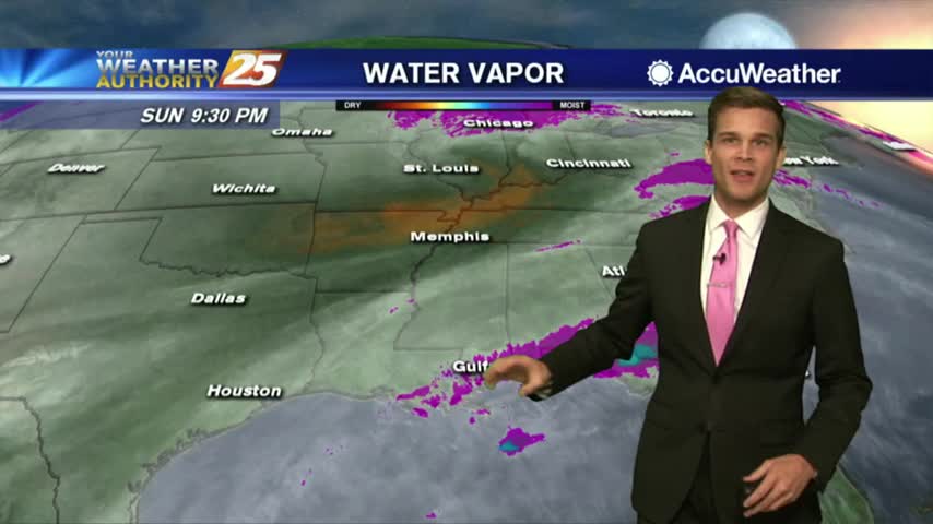
Dense fog, severe weather, freezing temperatures...all in the forecast.
Clouds still here...sunshine is on the way along with rain and colder air.
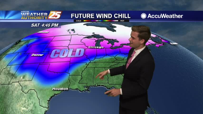
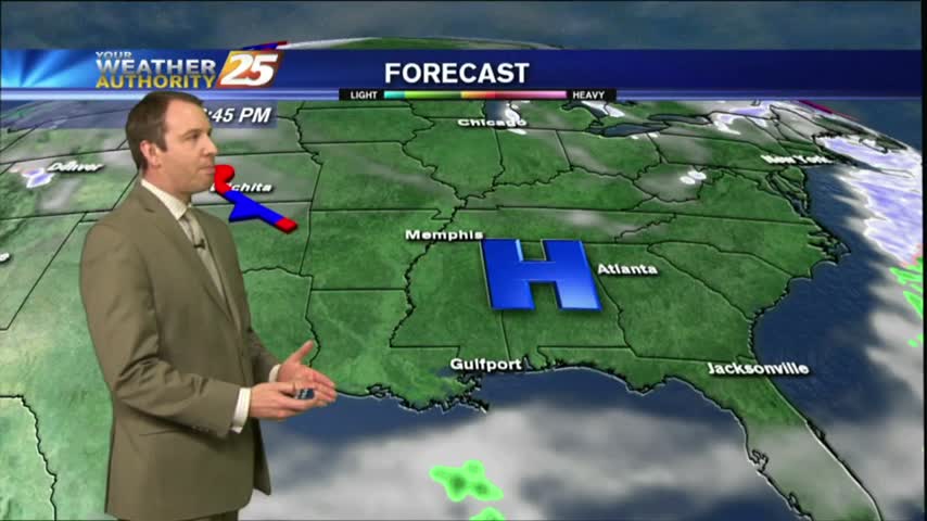
Enjoy some of the warmer weather this week...Arctic air possible next week.
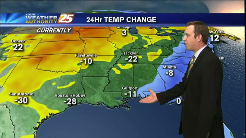
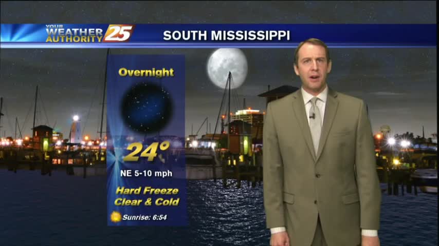
Bundle up tonight! It's going to be a cold one.
The residual cloud cover and humidity from the weekend is finally being ushered away, and chilly, drier nights and days are moving in....for now....
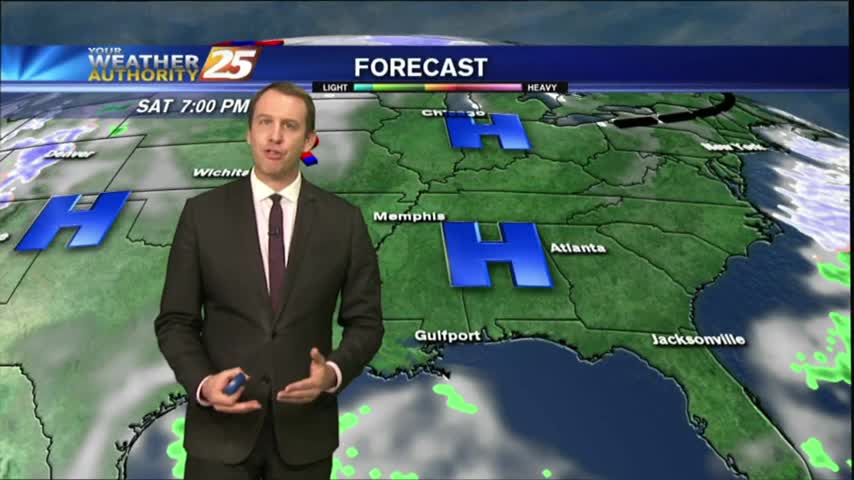
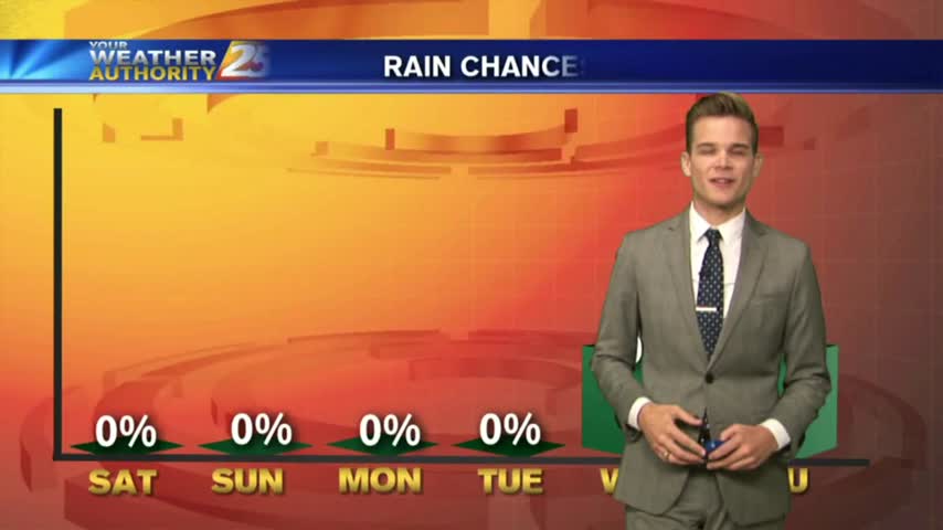
More sunshine through Tuesday...Rain by Thursday.
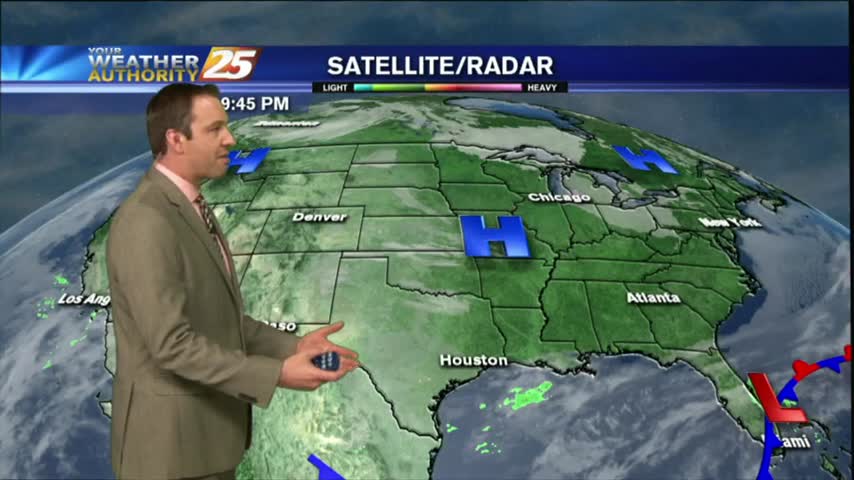
The colder air has arrived and it'll stick around for a few days...then rain chances as we head into Thursday.
Fog now, cold and windy by tomorrow.
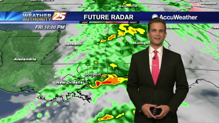
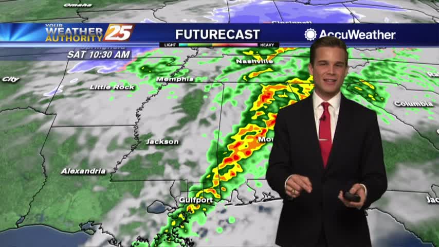
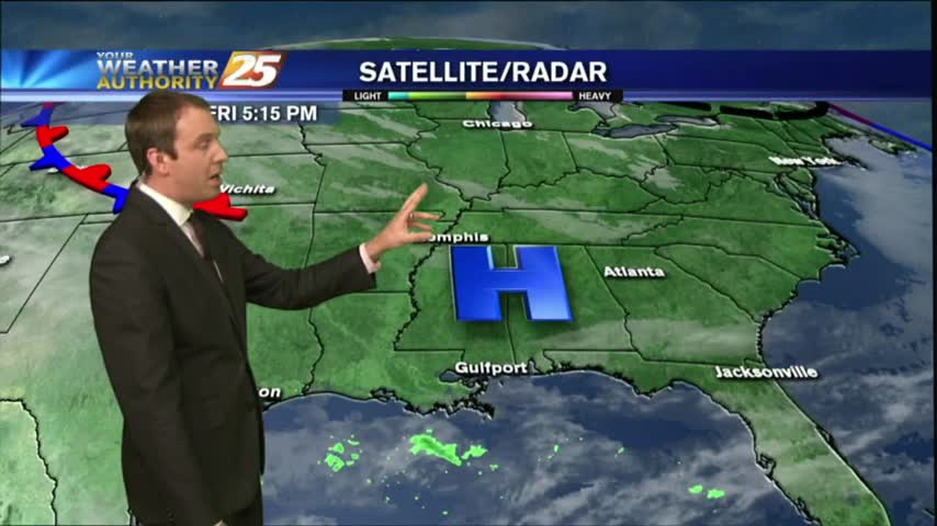
Rain moving through the area over the next several hours.
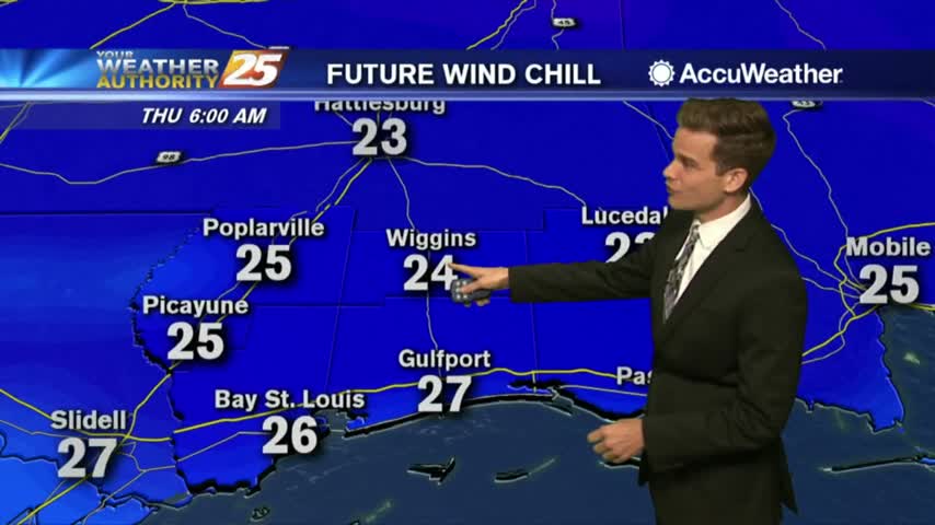
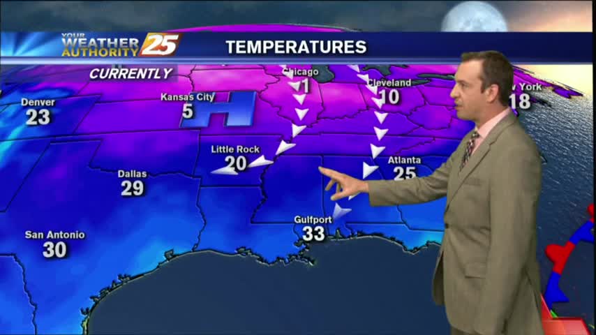
Getting colder throughout the day...temperatures approach freezing by Thursday.
Plenty of rain in the forecast, but some much colder air is headed our way.
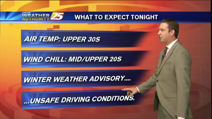
There won't be any winter weather tonight, but icy conditions will remain on some South MS roads. Watch the full forecast for the latest.
We're in for another brutal and dangerously cold evening, but without the added drama of the winter weather which has moved East. Click this link for the full forecast.
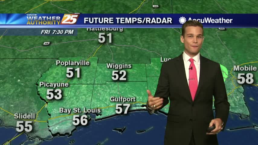
Today was the last afternoon below 50 degrees and tonight will be the last evening below freezing for at least as week as warmer, wetter air moves in rapidly through the weekend. Watch the full forecast for more.
Today remained in the upper 40s as expected, and we'll see one more night at or below freezing before our evenings warm drastically. Click this forecast link for more information.
Temperatures continued their warming trend this afternoon, but we'll see a slight setback tonight as reinforcing cold air moves in from the North. Click the link for the full forecast.
Continued gradual warming has brought us very close to the 50s for our afternoon high, but reinforcing cold air will keep them away until the weekend. Expect another night below freezing tonight, and watch the full forecast for details.
This year is starting off on an abnormally cold foot, and we'll remain in the 40's during the day and 20's at night all week long despite a gradual warming trend and plenty of sun. Click the forecast link for more details.
It's the first day of the new year and we're starting off by continuing our abnormally cold conditions. Don't expect much change this week, details within.
The winter weather has moved on, but even colder conditions are moving in as cooler and drier air forces the active weather from the area. Watch the forecast for the full forecast.
The rain continued its on-again/off-again pattern through the day, but night will bring conditions conducive to the creation of freezing rain/sleet or even snow flurries. Watch the full forecast for details.
Temperatures were still holding on the the 60s as the late show started, but I'm expecting it to continue falling into the upper 40s tonight with even colder weather ahead. Watch the forecast for more.
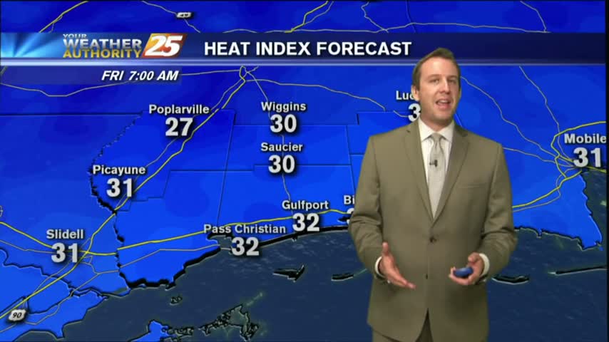
Bundle up this morning...it is freezing in a few locations.