1/15 - Jeff's "Ice Possible/VERY COLD" Monday Night Forecast
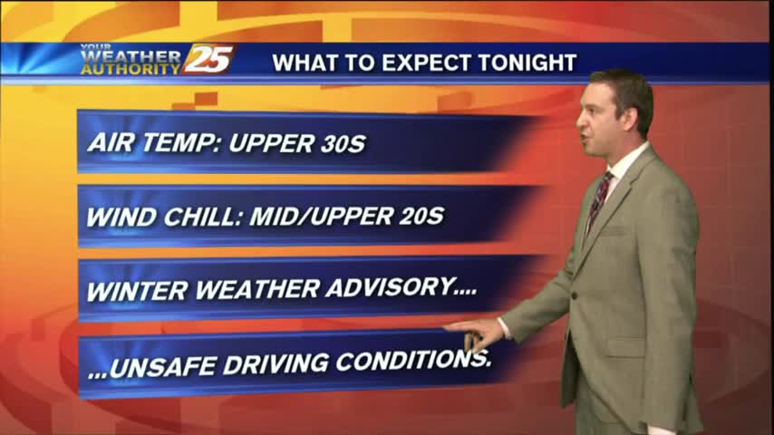
A Winter Weather Advisory is in effect for our area until 9 AM. There will be the possibility of light freezing rain leading to some icing concerns,…
A Winter Weather Advisory is in effect for our area until 9 AM. There will be the possibility of light freezing rain leading to some icing concerns,…
A Winter Weather Advisory is in effect for our area tonight until 9 AM Tuesday. There will be the possibility of light freezing rain leading…
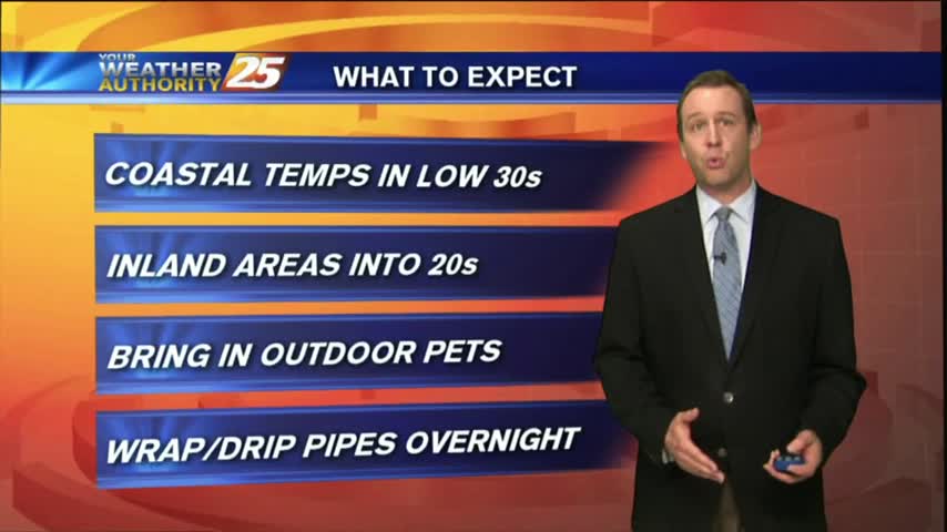
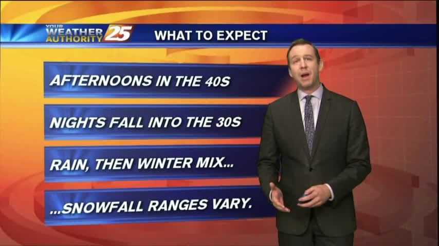
A fairly tame one we’ve had this weekend will give way to a challenging week at times for the Mississippi Coast. DANGEROUSLY COLD temperatures arrive…
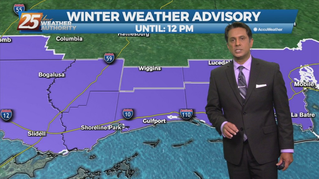
Light freezing rain/drizzle this morning will move east and transition back to liquid by mid-morning. A WINTER WEATHER ADVISORY is in effect through noon. A deep layer…
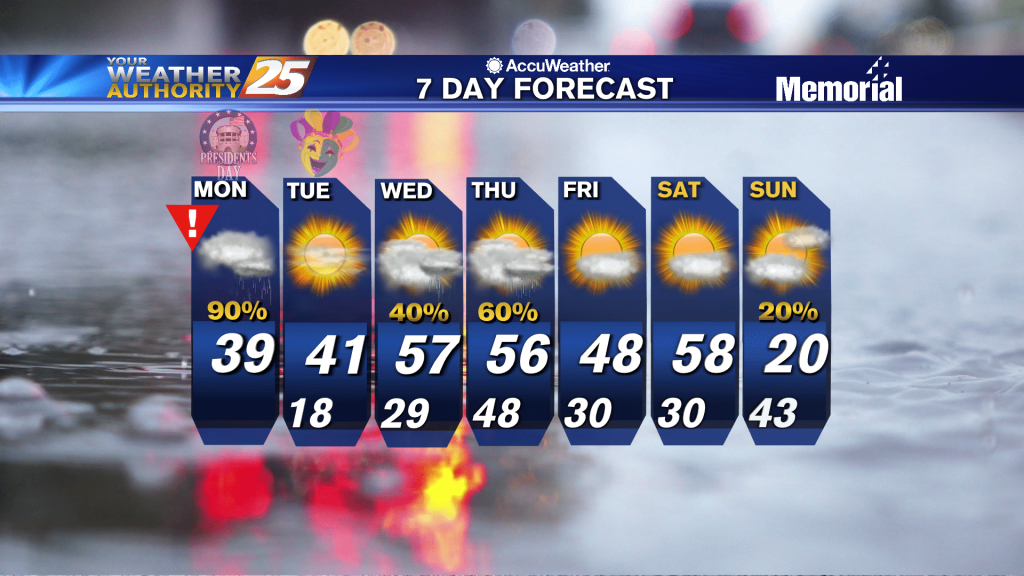
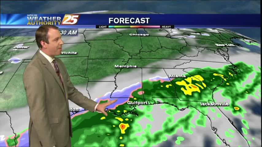
With rain on Monday, high temperatures north of I-10 will struggle to climb out of the 30s with highs a little warmer along the coast. Once the low passes, temperatures will quickly begin to drop off heading into Monday evening.…
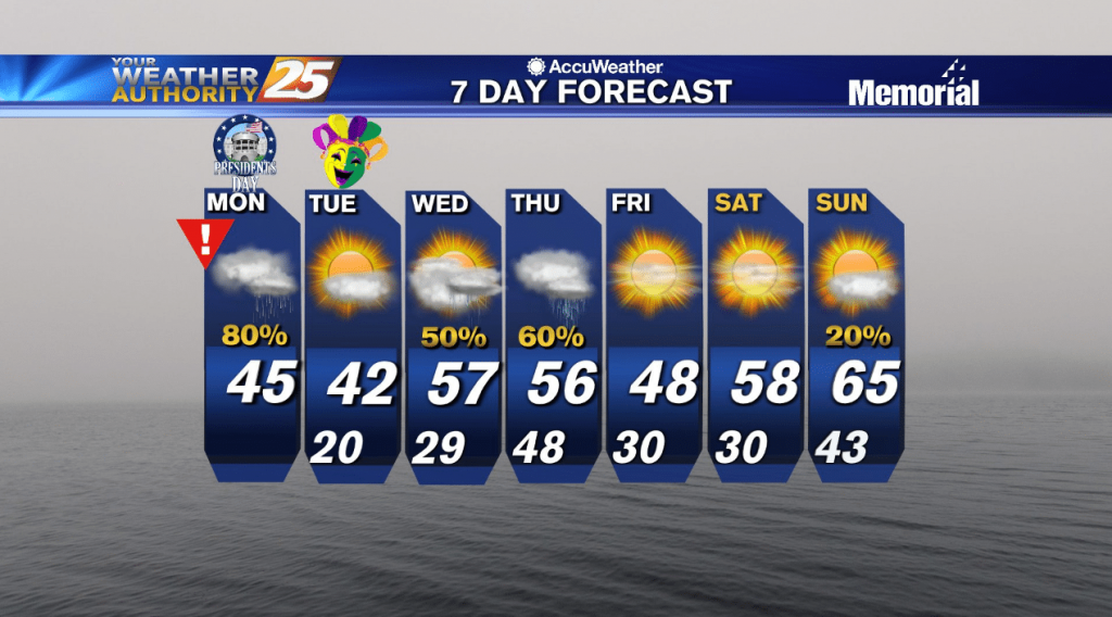
Temperatures tonight will remain cold with cold air moving in quickly at the surface and a shallow arctic air mass in place. Lows will be in the low 30s. With rain on Monday, high temperatures north of I-10 will struggle…
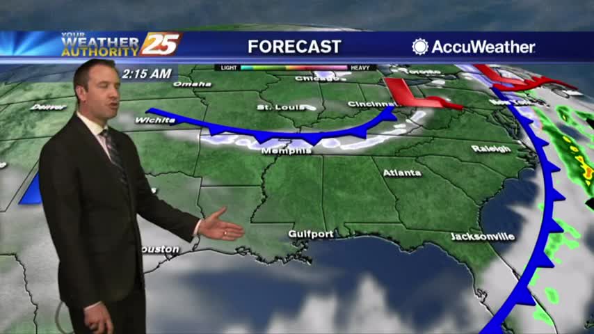
We had a nice, dry, and sunny weekend, but drastic changes moving in early tomorrow morning as a front slides down....
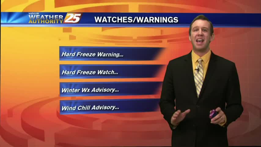
As we finished the afternoon shows earlier today the winter weather was beginning to taper off, but the coldest temperatures are still coming in. Watch the full forecast for details.
The rain continued its on-again/off-again pattern through the day, but night will bring conditions conducive to the creation of freezing rain/sleet or even snow flurries. Watch the full forecast for details.
Winter weather is moving into South MS, but it remains to be seen just how much we will actually see and whether it will accumulate. Watch the full forecast for the latest and stay tuned for updates.
Yesterday's cold front brought rain and colder temperatures, but we haven't seen the last of either just yet. Even winter weather may make an appearance before the week is up, but you'll have to watch the forecast for details.
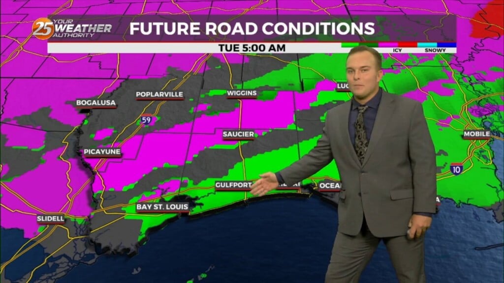
The rain has moved East but the most dangerous road conditions are still ahead. Forecast details inside.