
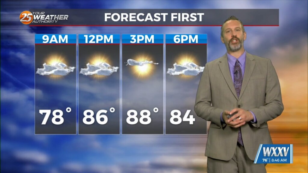
10/30 Ryan's "Clouds Move In" Tuesday Morning Forecast
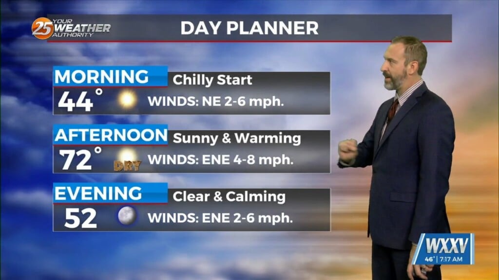
The fog takes a break this morning despite the lingering humidity, but today's winds are keeping it away and will cause clouds to move in through the day.…
The fog takes a break this morning despite the lingering humidity, but today's winds are keeping it away and will cause clouds to move in through the day.…

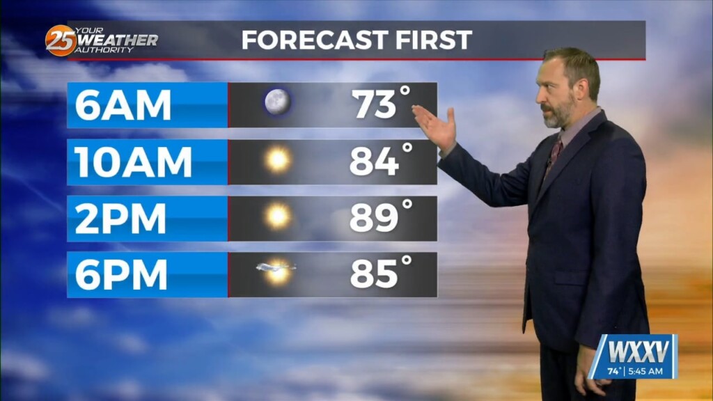
The humidity continues to rise, leading to warmer mornings and more fog in the days ahead as a front moves in. Unfortunately this front won't pass through, so don't…
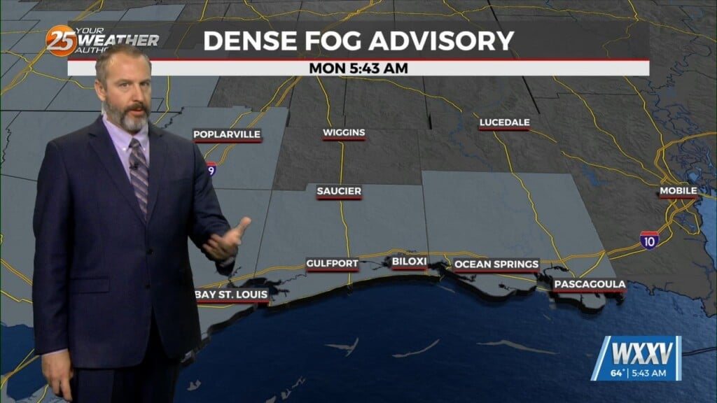
We were right on the edge of foggy morning weather by the end of last week, but we're starting this week off with it firmly in place. It has become…

Get ready for another nice day, South MS, but we may start seeing some fog development as the humidity continues to inch upwards. Couple this with more clear skies,…

Recent mornings have been a bit too cool if you ask me, I'm notoriously not a fan of cold weather, but thanks to steady warming we're back to…

Our afternoons crept above normal a couple days ago, but our mornings have still been considerably cooler thanks to clear skies, low humidity, and light winds. We'll…

While not quite as chilly as the weekend, we're still seeing some nice cool mornings out there as we start off this week. This morning ended up several degrees below…
Expect a smoky start to the day in addition to it being one of the coolest mornings since early March for South Mississippi. While it wouldn't surprise me…
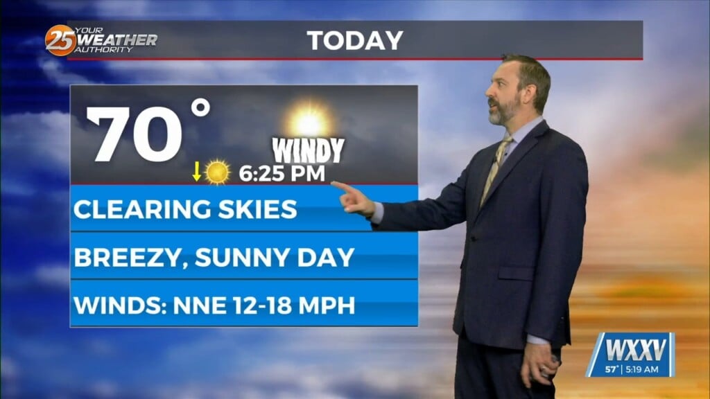
Things had already begun to cool off yesterday thanks to Monday evening's cold front, but stronger high pressure moving in overnight is responsible for today's windy weather. This…

Despite a similar temperature thanks to our cloudy morning skies, it'll feel noticeably better thanks to considerably drier air. That means for the second day in a row, lows…
Just like last week we're starting things off with a warm-up across South Mississippi, but another cool-down is coming, bringing the coolest weather we've seen since the start of the…
I hope you enjoyed the coolest morning of the week so far, with a few coastal lows falling into the mid 50s! Gulfport and Biloxi stayed on the warmer side…

This morning was even cooler across South Mississippi than yesterday's amazing start, but we'll see a bit of a warming trend through the rest of the day. Thankfully, it…
Yesterday wasn't too bad out there, but today is already noticeably cooler and this afternoon will be even better thanks to cooler, drier air! That's all thanks to yesterday's…

Good morning, Gulf Coast! Things are still a bit on the warm side this morning, but the good news is it'll be the warmest morning of the week as cooler,…
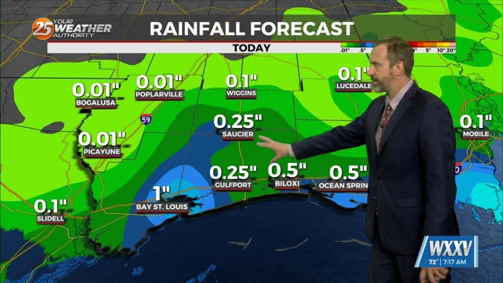
Your Thursday will get off to a nice, sunny start, but it won't last too long as cloud cover and rain moves in quickly later today. We aren't expecting…

After a fall-like start to the weekend, our more "seasonal" late September weather has returned! That means things will be slightly warmer than they should be, though thankfully the humidity…

Fall officially began last Sunday morning, but it waited until today to noticeably arrive in South Mississippi. Yesterday was a good start after Wednesday's front moved in, but dew points…
Today will see fluctuating cloud cover and breezy conditions throughout the day thanks to influences from Hurricane Helene, but ultimately it'll just usher in an appropriately fall-like end to…
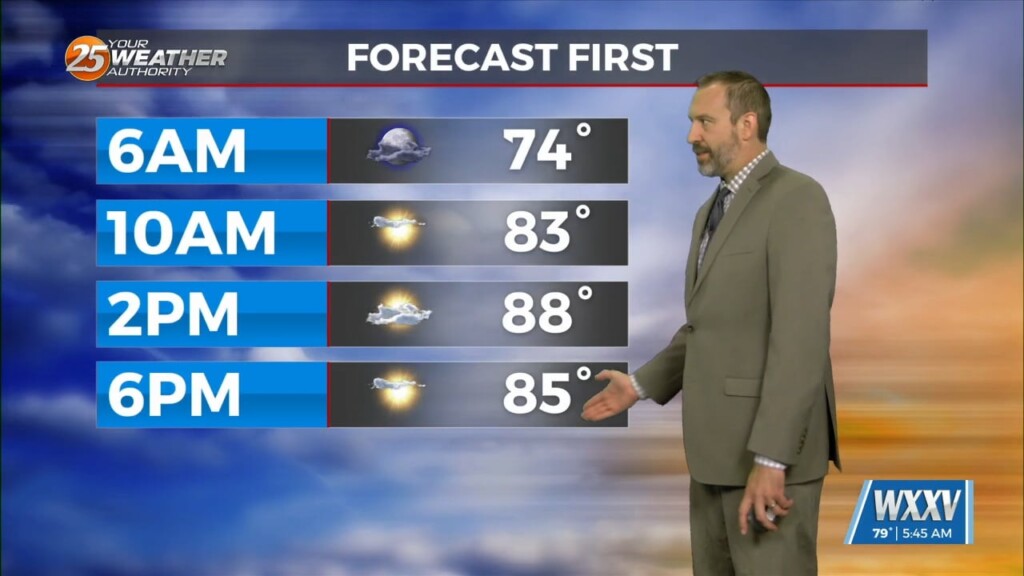
This morning won't be wildly different from the last few mornings, but an approaching cold front is bringing a bit more cloud cover, humidity, and eventually some thunderstorms. We're…

Fall may have started Sunday, but we're still seeing more summery weather at the moment, though a few more clouds will cool things down a tad today. Just a…
Fall officially arrived Sunday morning just after sunrise as the equinox occurred, making today the first full day of fall 2024! If you've lived in South MS for any…
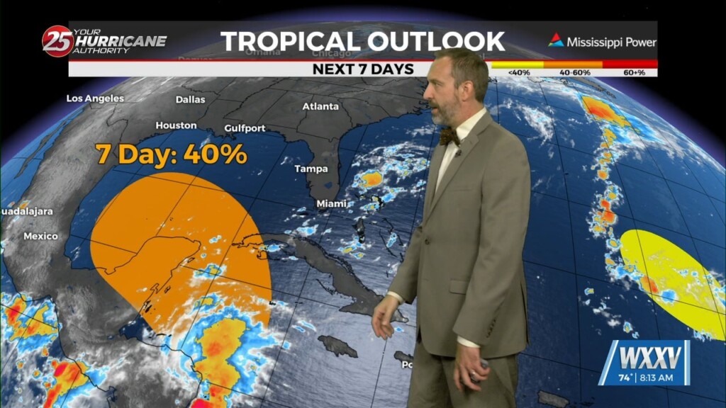
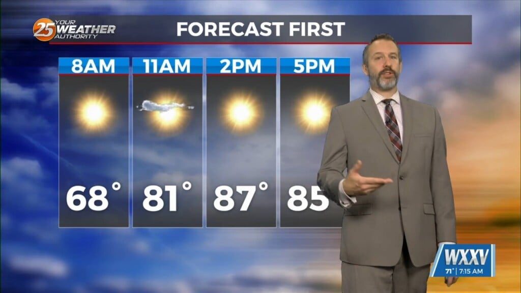
A sunny, hotter weekend lies begins today, but you'll also need the latest update on potential tropical developments. Lets get the good news out of the way…
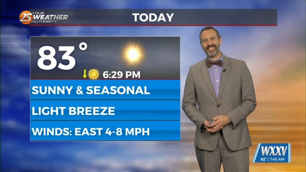
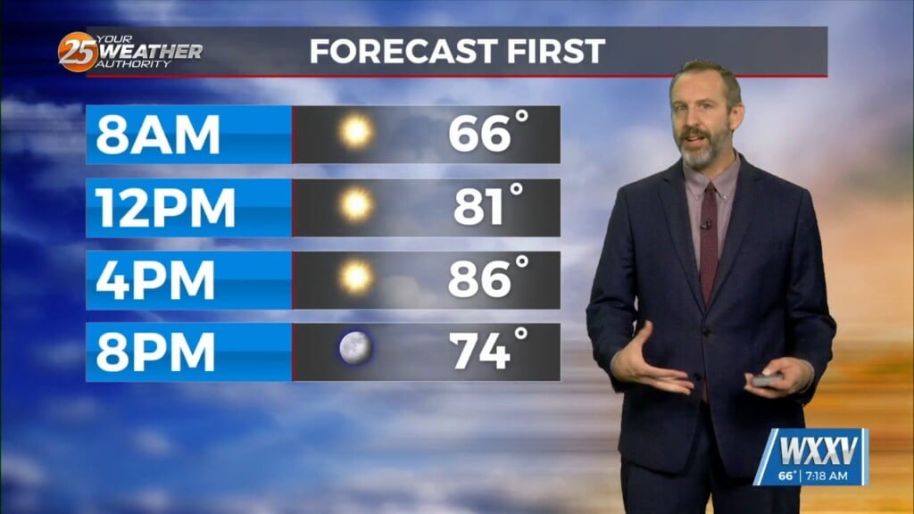
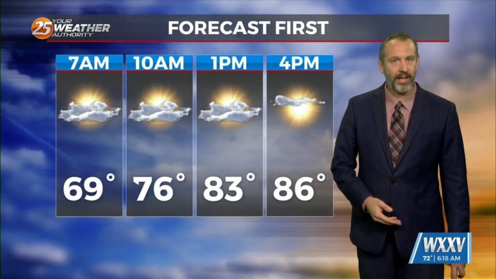
Yesterday didn't see much rain as we're starting to see noticeably drier conditions moving into the mid-and-upper-levels. That'll lead to fewer clouds, no showers, and lots more sun today…