12/03 Ryan's "More Frost" Tuesday Morning Forecast
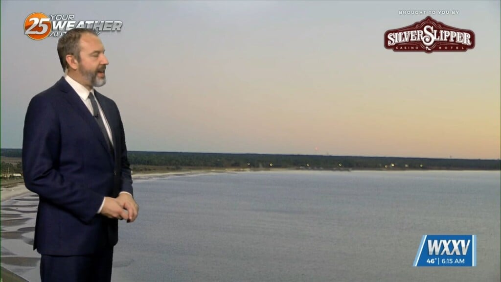
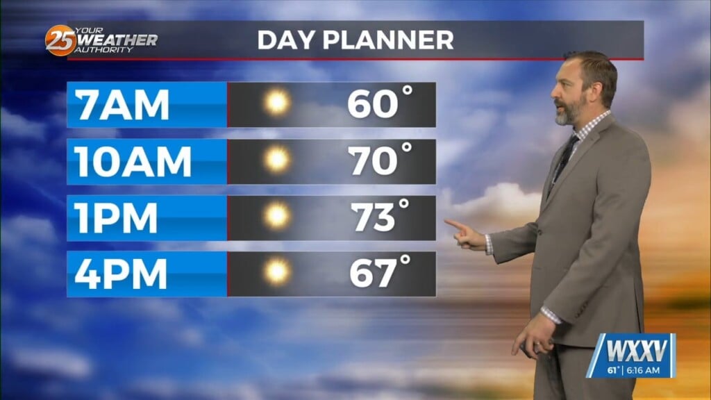
We enjoyed another frosty start to the day this morning, and have at least one more left before we'll leave the wintery weather behind for a few days. Today's…
We enjoyed another frosty start to the day this morning, and have at least one more left before we'll leave the wintery weather behind for a few days. Today's…

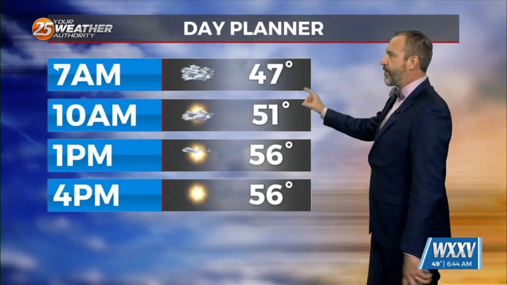
It was clear and frosty across South MS once again, a continuation of the dry weather we saw move in after last week's front. Our afternoon highs will…
Yesterday's front didn't bring much rain, but things are cooling quickly as we finish off the week and head into the weekend. In fact, we have I believe our…
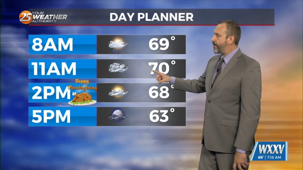
It may be Thanksgiving, but we're once again seeing temperatures over 20 degrees above normal for late November. That's due to our next cold front, which is actually passing…
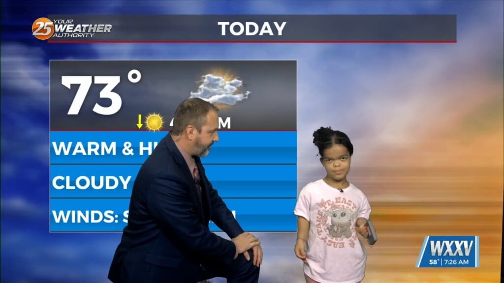
Today's WXXV Weather Kid helping me with Wednesday's forecast is Angela! Angela is a 5th grader from Biloxi Upper Elementary, and she loves hanging out. She advises "chilling" inside on…
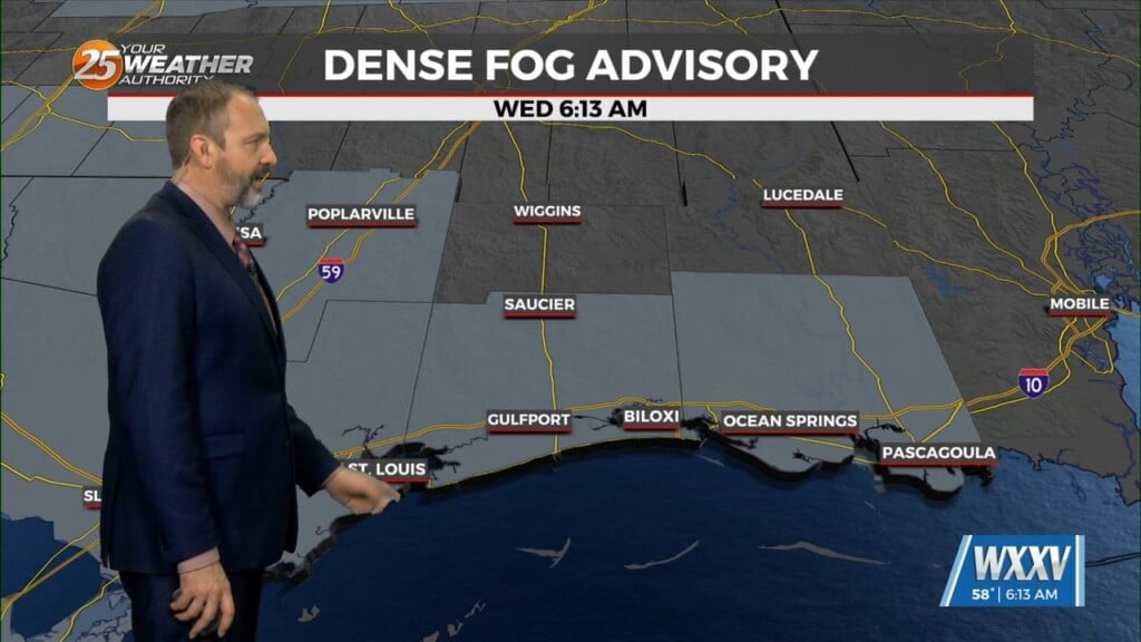
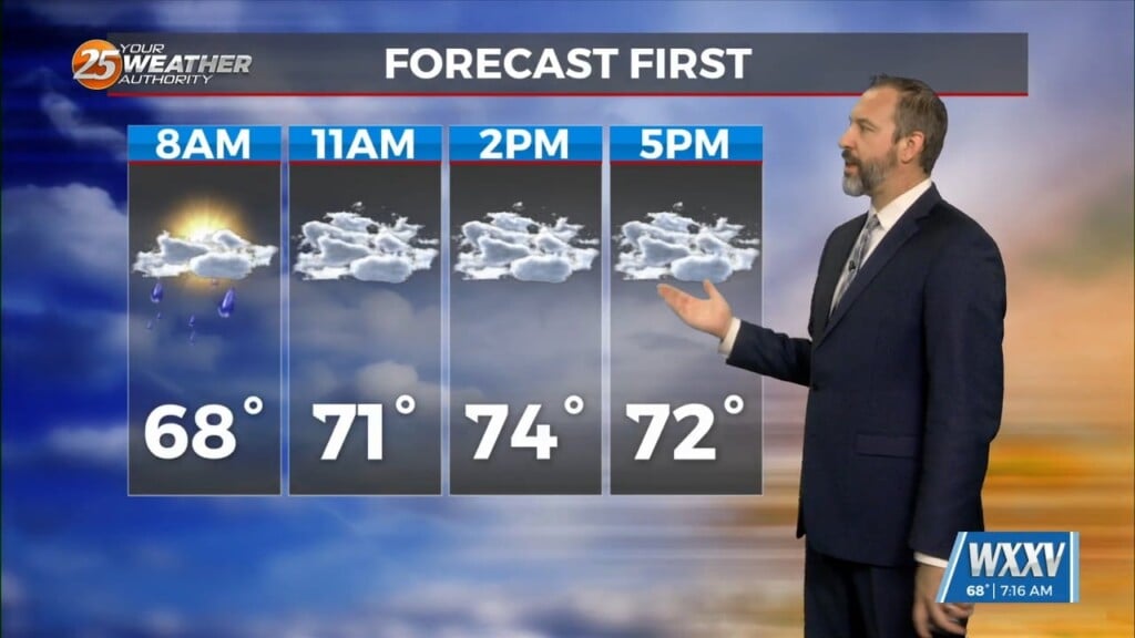
Yesterday's cold front brought some slightly cooler weather, but it wasn't much drier, leading to a foggy start to your Wednesday. We even had some Dense Fog Advisories early on,…
The first front out of the two we'll see this week is through South Mississippi, with only a couple showers and a cloudy day ahead to show for it.…
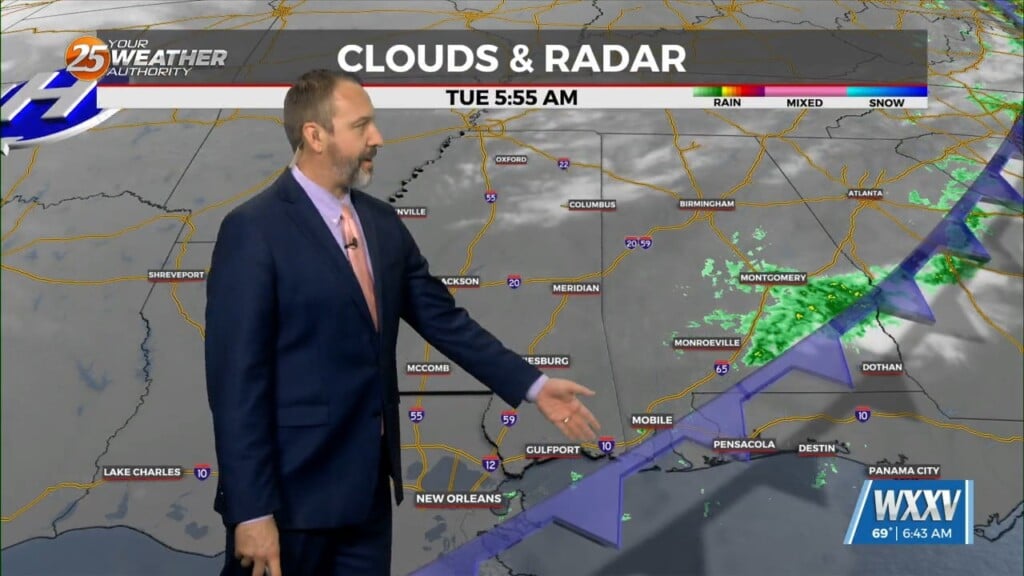
The end of last week brought a cold front and some seasonal weather, but we're off to a much warmer start this week as another front approaches. That's due…
It was another chilly, but not quite frosty morning across South Mississippi today, even though it did warm up a degree or so. We haven't seen many consistently…
It's taken a while, but we're finally getting some more consistent chilly weather in South Mississippi. In fact, it'll be below "normal" for both our highs and lows…
Yesterday's front brought some heavy rainfall and a few rumbles of thunder, but now things are clearing out and cooling down nicely! It won't be all that noticeable right…
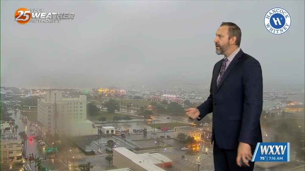
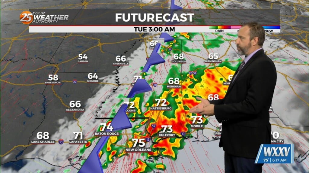
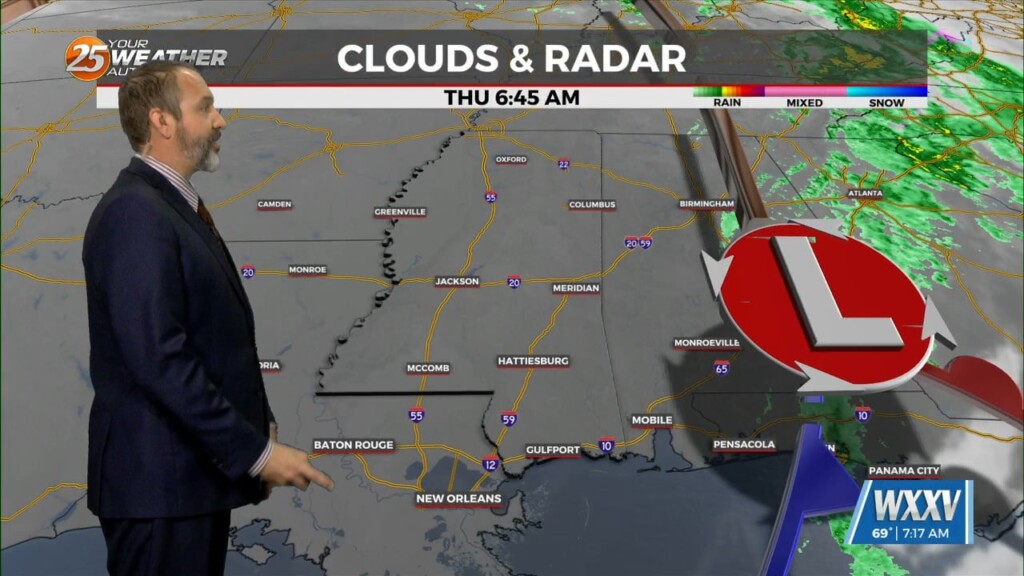
The rain started last night, but we're just now getting our heavy rain as showers and thunderstorms pop up along this morning's cold front. We're still under a level…
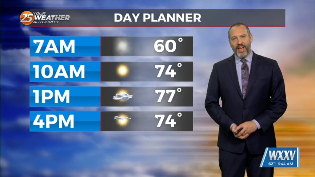
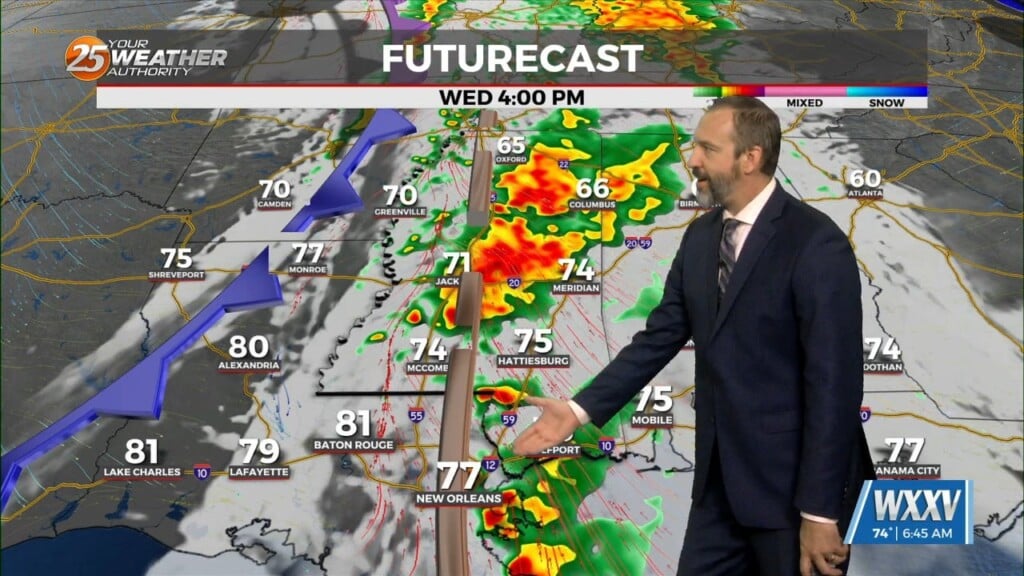
Your Monday will largely just be more cloudy and warmer than the last couple of days have been, but we're in for a stormy end that could…

Things are finally going to feel like fall after a warm, dry October and a quite humid first couple of weeks of November! Yesterday's front has lows down into…
It was cloudy and a bit stormy yesterday as a front moved in, but today's post-front weather will be considerably nicer! By that I mean the cloudy skies and…
Tuesday was much cooler than it has been thanks to the consistent light rain that stuck with us for the front half of the day, but this…
We're off to another damp start today, though unlike yesterday we won't see the sun peaking through this afternoon. I expected we'd see some clearing yesterday as we…

We're getting a dreary end to a fairly damp and grey week, though I expect today will end up one of the drier of the week ahead of our next…

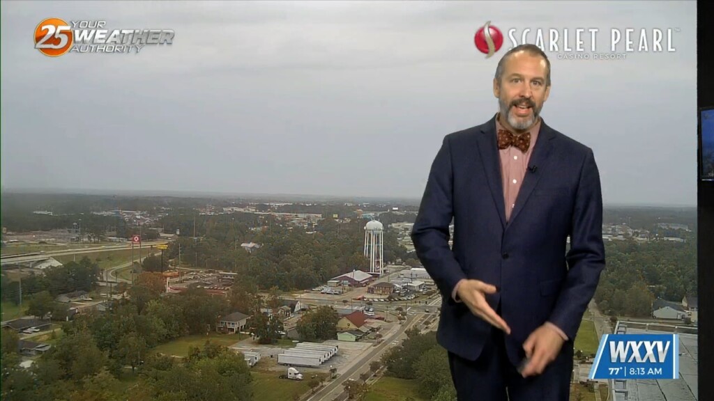
A lingering overnight shower led to damp roadways in Gulfport this morning, with another day of spotty showers and more consistent grey skies. This morning remained on the…
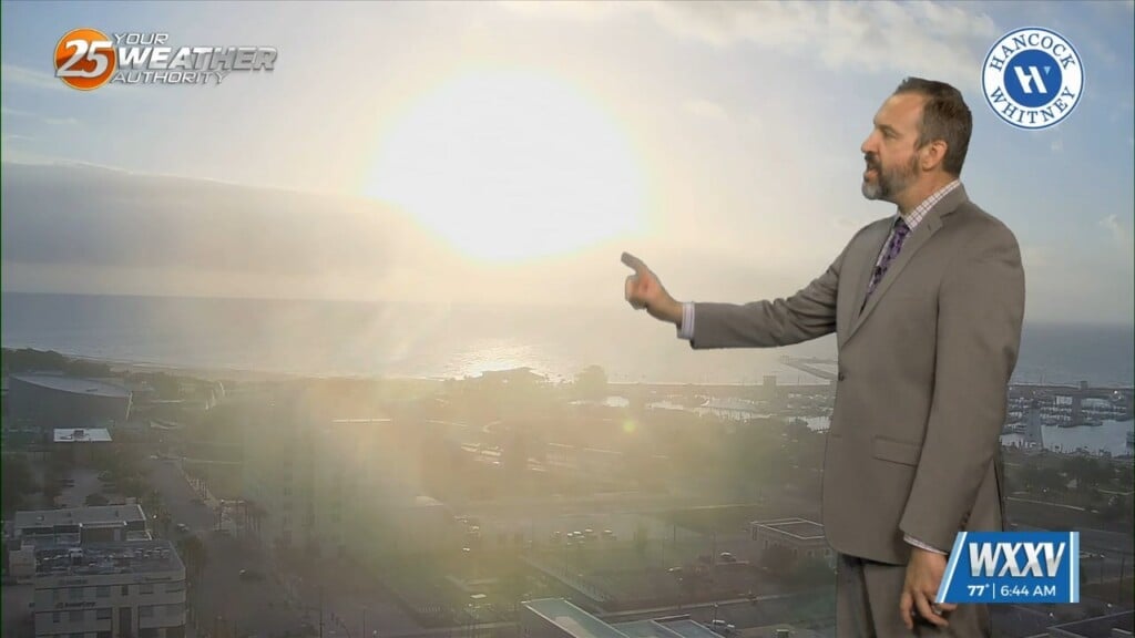
It's another warm one out there across South MS, and while it's slightly cooler than the start of the week was it's still 20° above normal. Our morning…
It's Election Day across the country today, and South Mississippi has more warm & humid weather on tap without any significant rain. Like yesterday, cloud cover will stream across…

It's still warmer than it should be out there after a barely noticeable break over the weekend, but not much is changing this week. In fact, our afternoon high…
Expect to head out for your morning commute with grey skies and misty, damp weather across South Mississippi. Yesterday did see a little rain in the area in…
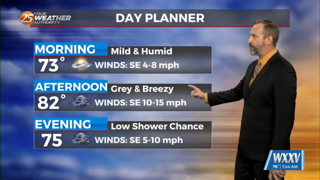
It's going to be quite a warm Halloween for everyone on the Mississippi Gulf Coast! Our morning was even more humid than it was at the start of the…