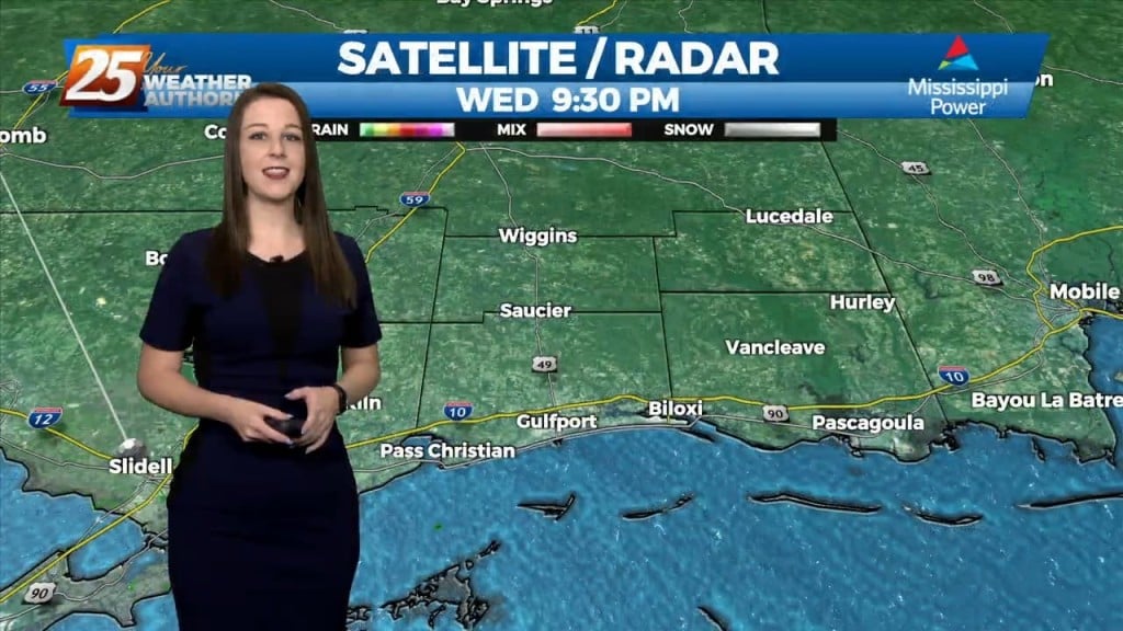
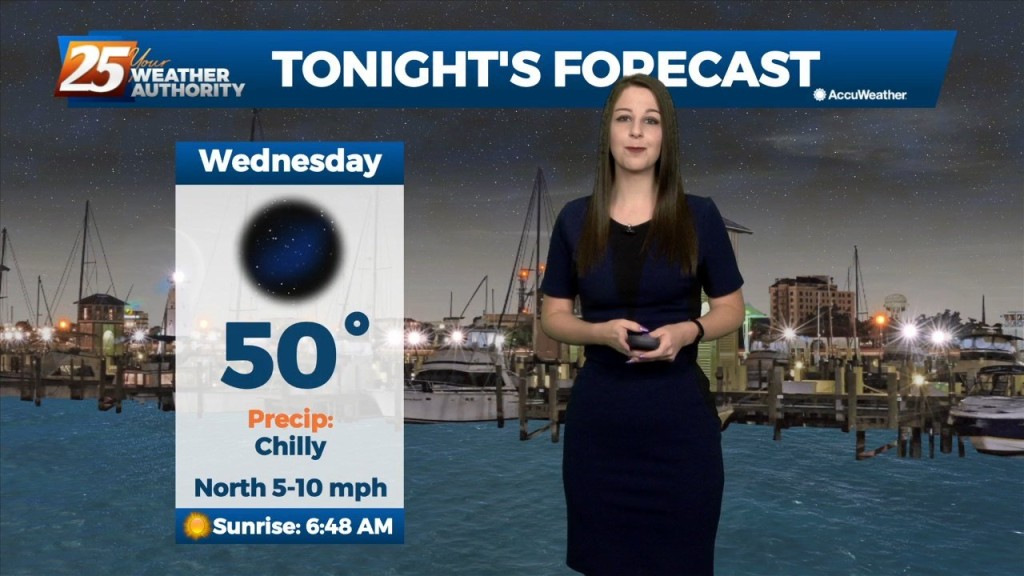
10/26 - Brittany's "Chilly" Wednesday Night Forecast
The upper flow is expected to remain zonal across the area today and tonight before the Pacific Coast disturbance reaches the southern Rockies tomorrow. This will cause the upper…
The upper flow is expected to remain zonal across the area today and tonight before the Pacific Coast disturbance reaches the southern Rockies tomorrow. This will cause the upper…
From a meteorology standpoint, we are still between a trough to the east and a ridge to the west. This is bringing winds out of the north carrying cool…
Today has been another early fall like day with lows in the 50s and highs in the 80s with dry conditions expected. We still have some minor impacts due…
A shortwave upper level trough will continue to move southward and push through our area tonight overnight into Monday. Isolated to scattered showers could be possible along…
A cold front will continue pushing through the area this evening with noticeably drier air behind it. Surface ridging will build in behind it which will allow…
It may be the earliest it could possibly be in the fall season, but it'll feel like late fall for the rest of the week. That’s due to…
It is finally fall in South Mississippi and we usually have to wait longer for some fall-like weather. That's not the case this year as a well-timed cold…
The next few days may be "fall-ish" with hot days and low humidity, but the nights will be much more "fall-like!" Expect tonight to fall into the mid 60s…
The last official weekend of summer felt very fall-like, but fall doesn't begin until tomorrow!
Things are finally changing back to Fall-like weather, but we'll see more rain before the week is through....
Cool, dry air has continued to filter into the area after a front moved through Monday morning, and today's great Fall weather continues for a few more days, but warms by the weekend. Details within.