12/6 - The Chief's "Clearing Skies & Breezy" Wednesday Morning Forecast
A large upper disturbance over the eastern states will continue to move off into the western Atlantic on later today. High pressure albeit fairly weak…will…
A large upper disturbance over the eastern states will continue to move off into the western Atlantic on later today. High pressure albeit fairly weak…will…
It’s a bit on the warm side across the region this morning. A low level thin stratus deck has developed, which is keeping most of the…

A few shower in the area will begin to dissipate this afternoon as a drier air mass moves in behind a cold front moving SE. High…
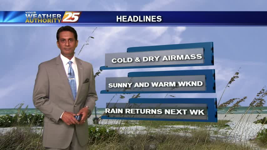
A cold front will continue pushing through the area this evening with noticeably drier air behind it. Surface ridging will build in behind it which will allow…
Early this morning, we will continue to see decaying showers over coastal Mississippi, with a remnant boundary possibly leading to a few re-developing isolated showers…
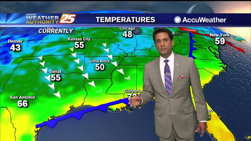
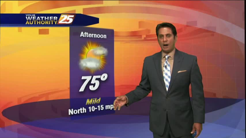
High-pressure over the region will provide for clear skies, lighter wind than what we have become accustomed to these past few weeks. A less humid air…
A nice start to the day as a weak dry front overhead is pushing SE...
An absolutely LOVELY start to the day as a cold front is now to our south...
A weak cold front is overhead moving south with a drier air mass beginning to move in...
After patchy fog and mid-level clouds earlier this morning, partly cloudy skies continue as temps warming into the 70s...
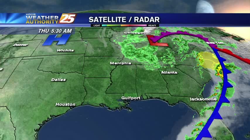
IRMA, now a TROPICAL DEPRESSION moving through N'tern Alabama continues to bring lovely conditions and a dry north wind to south Mississippi.
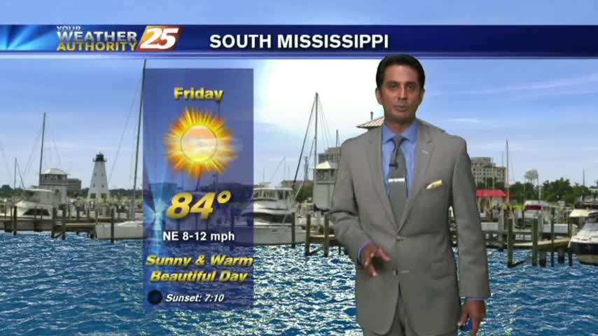
As all eyes continue to focus on the tropics and MAJOR HURRICANE IRMA, it's a BEAUTIFUL start to the day under clear skies and cool temps...
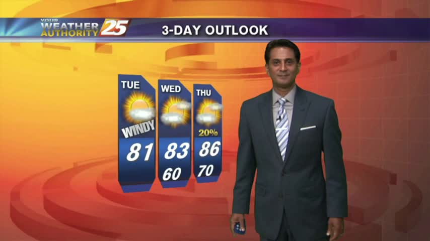
In the wake of yesterday’s cold front, BREEZY conditions will continue with a tightening gradient and high-pressure moving in from the NW...
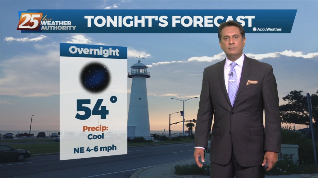
A cool and clear start as high-pressure brings a DRIER air-mass to the gulf south...