9/27 - Sam Parker's "Cool Feel" Friday Midday Forecast
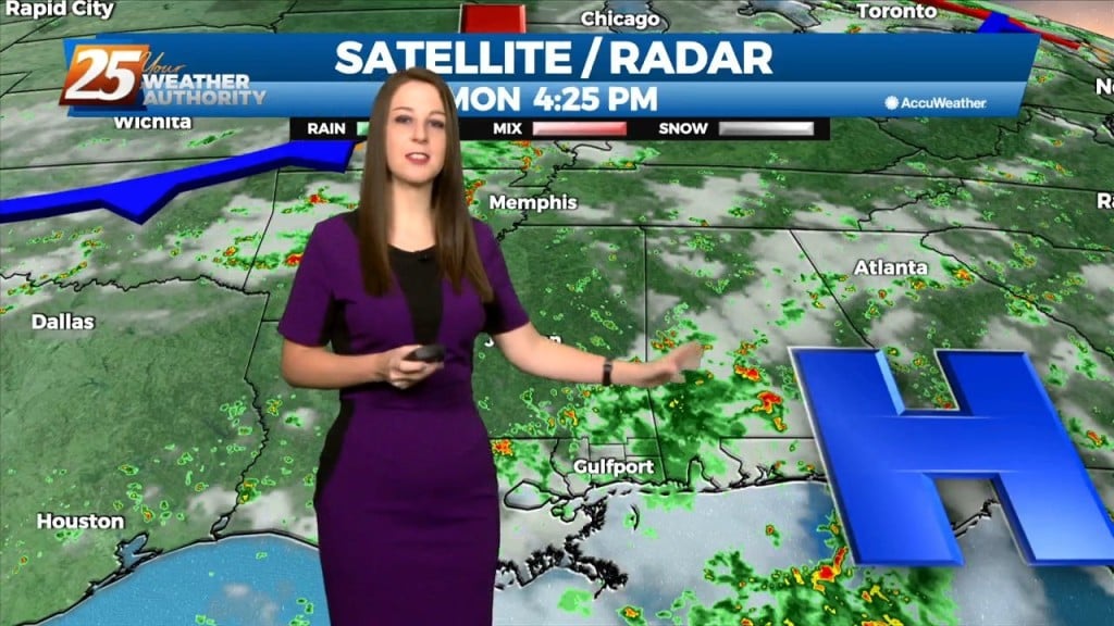
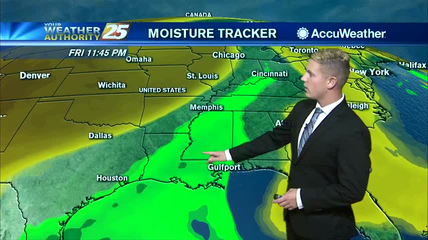
Weakening hurricane Helene racing north-northeast through Georgia. The low pressure centered near Memphis helping to accelerate Helene northward. Both are helping to pump cooler and drier air…
Weakening hurricane Helene racing north-northeast through Georgia. The low pressure centered near Memphis helping to accelerate Helene northward. Both are helping to pump cooler and drier air…
The upper level ridge axis that has been dominating the region over the past several days will weaken tomorrow as a progressive upper level trough passes through. The…
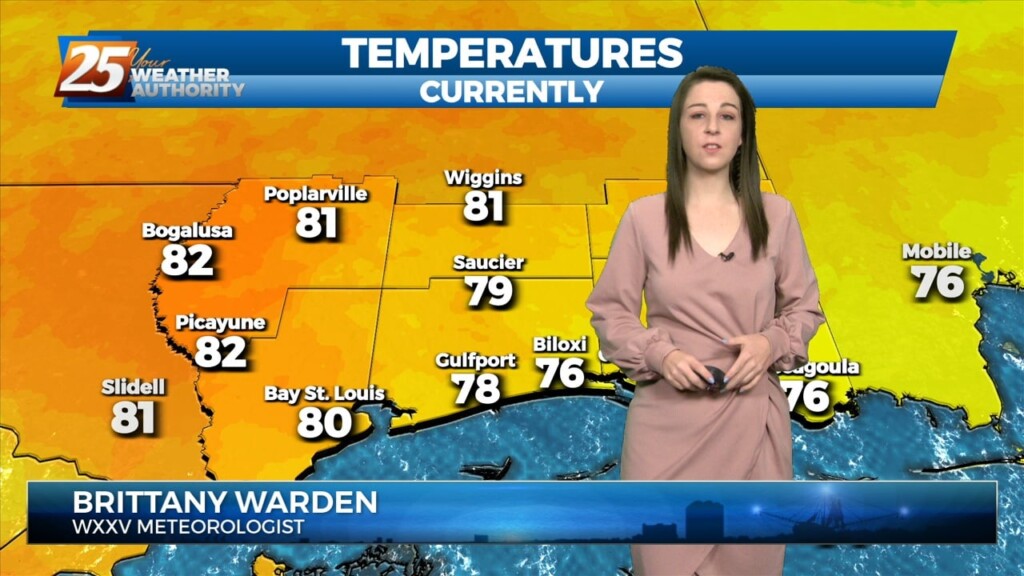
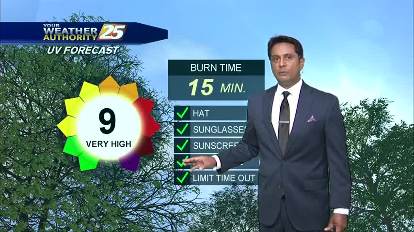
Cooler temperatures are finally ahead! Tonight, they'll bottom out more so toward the low 60's as opposed to last nights upper 60's. Beginning tomorrow, throughout the rest…
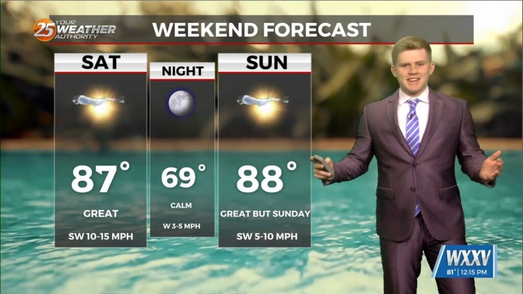
One last quiet day allowing for another pleasant Sunday and weekend as a whole. Not expecting much in the way of impacts for the…
Upper ridging over Texas will be in the process of getting suppressed southward by Saturday night and Sunday as a strong trough digs through the Great Lakes. This will…
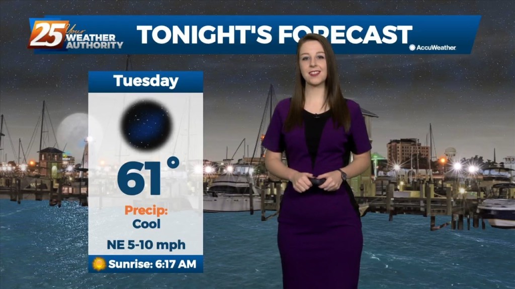
Temperatures this evening are cooling rather quickly. As the surface high pressure settles in just to our north, winds will decouple across most of the area. This,…
We could see some lingering showers and thunderstorms this evening. Heading into tomorrow, an upper low will be completely closed off at this point and meandering around…

Tonight, we're seeing some lingering showers, mainly west of highway 49. Through the end of the week, an upper level low is expected to influence the area, enhancing rain…
Tonight through Wednesday Night, little change in the ongoing pattern is expected through Wednesday night as a broadly diffluent westerly upper level pattern, a weak shortwave trough,…
If we thought we had a lot of rain and coverage today it looks like things will ramp up over the next 3 days. We start tomorrow…
Not much in the way of change is expected tomorrow or Thursday. As mentioned yesterday, the continued rainfall across the area will accumulate as the week continues…
A stationary front along the coast will meander there all week long, providing spotty storms and the potential for heavy rain. If there’s some good news,…
An area of low pressure located of across Central Alabama is producing showers and thunderstorms that are expected to move to the north and east. This low…
Rain will continue this afternoon with a few embedded t-storms...
The cold front that has been discussed for the last several days has finally moved through the viewing area. Rain and cloudy conditions associated with the front has mostly cleared the Gulf Coast, but a pop-up shower this afternoon cannot…
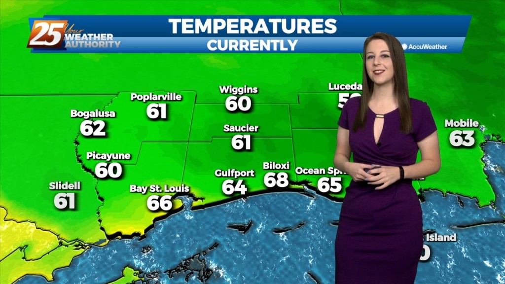
A nice start to the workweek with morning low temperatures in the mid/upper 60s heading out the door...