12/12 - Jeff's "Gradual Changes This Week" Tuesday Night Forecast
It will be cold again overnight but frost concerns should be very isolated. Your Wednesday will feature upper-level clouds streaming in leading to a few clouds…
It will be cold again overnight but frost concerns should be very isolated. Your Wednesday will feature upper-level clouds streaming in leading to a few clouds…
Temperatures will be cool this evening but winds will back off gradually. Skies will be mostly clear which will help it turn cold in a hurry…
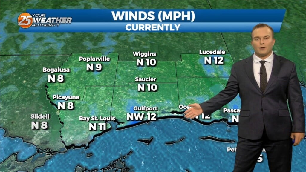
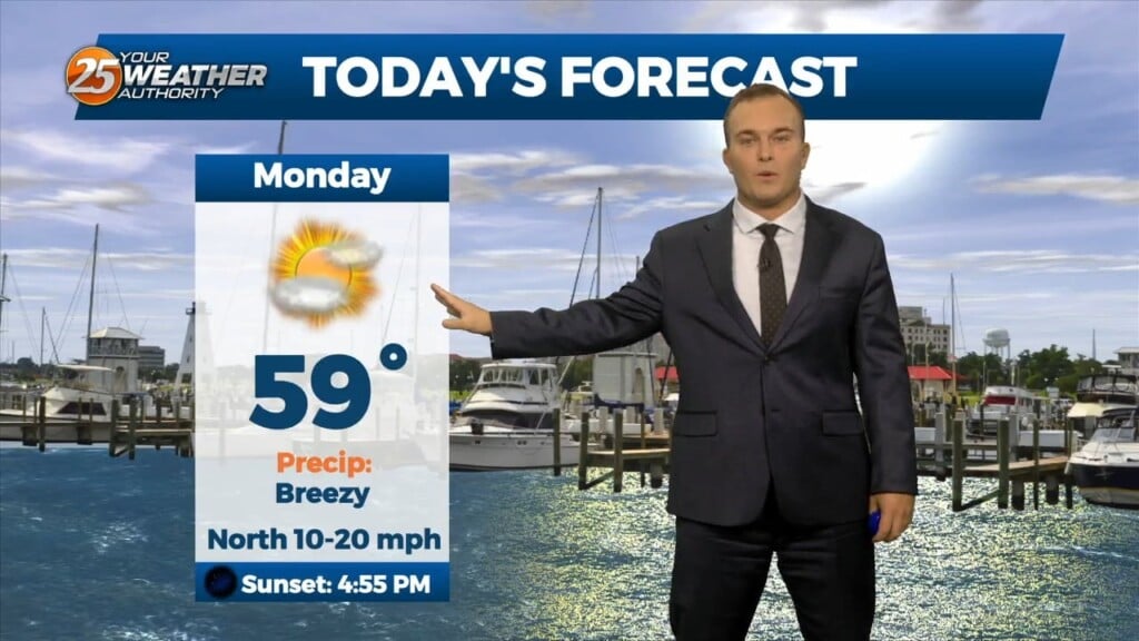
Even with more sunshine, temperatures will struggle to reach the 60-degree mark today. Winds out of the north will be quite breezy for some portions of…
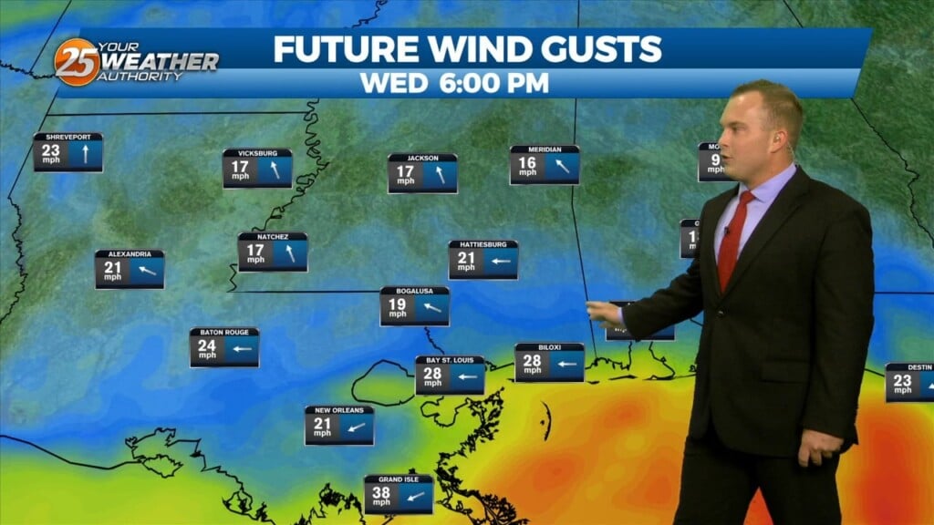
Skies will clear out somewhat this evening into the overnight hours. A weak dry cold front will make its way through the area overnight. Winds will pick…
This afternoon will be a repeat of yesterday with slightly cooler temperatures and a bit less wind. Cool conditions linger into this evening and clouds will clear out…
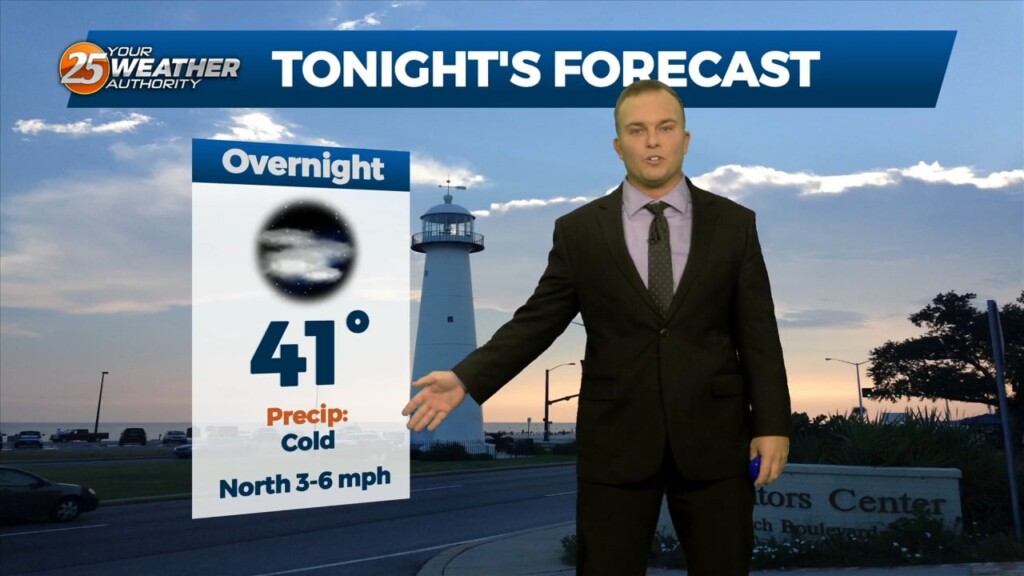
Skies will remain partly cloudy overnight thanks to upper-level clouds streaming in from southwest-to-northeast. Temperatures do plummet tonight with cool readings in the evening turning cold past midnight.…
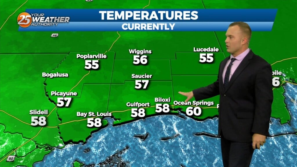
Some sunshine will be around this afternoon with thin upper-level clouds continuing to stream in. Temperatures will be fairly mild but winds will be breezy at times…
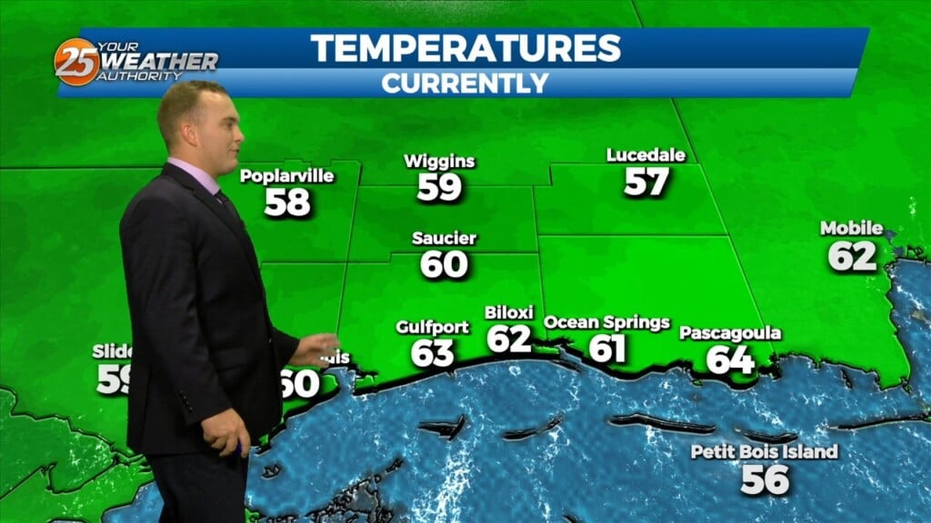
Another cool and breezy afternoon will be in store for us. Temperatures will be similar to yesterday but winds will be slightly more tolerable. Lots of sunshine…
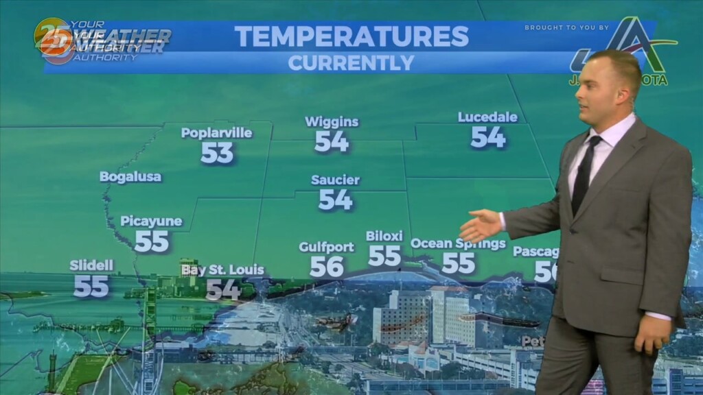
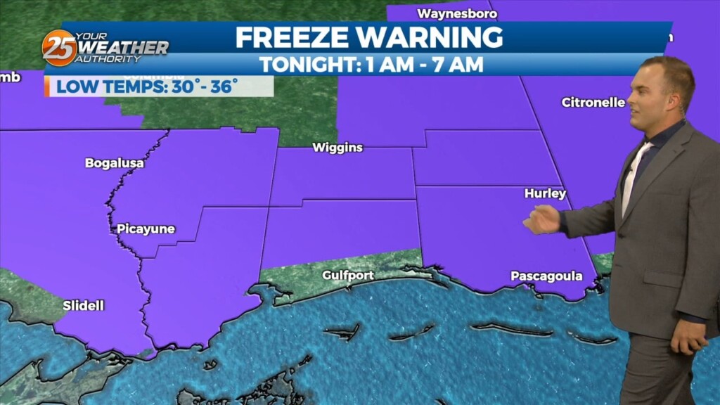
It is another cold start to the day with winds still remaining in play. Temperatures in the upper-30s to lower-40s will have a wind chill factor to…
Some thin, upper-level clouds move in this afternoon. Outside of that, sunshine does dominate and expect cool conditions. It will be breezy if not windy at times.…
It is a much colder start this morning with temperatures in the 40s and breezy northerly winds behind a cold front. Expect sunshine to dominate early but…
Some opportunities for sunshine return this afternoon and rain chances are out of the equation. Expect cool conditions and a light breeze out of the northeast. Clouds clear…
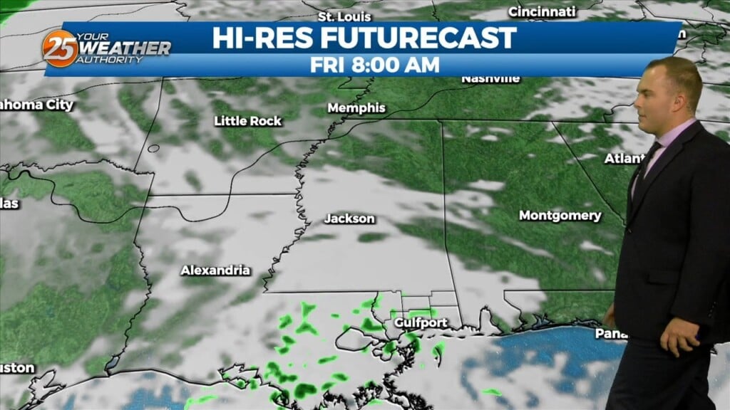
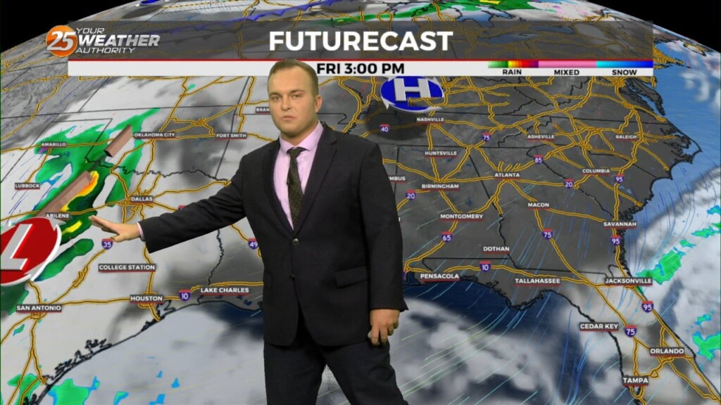
Cloud cover remains dominant for a lot of Black Friday with a cool and somewhat unsettled pattern around. There will be a 20% chance of…
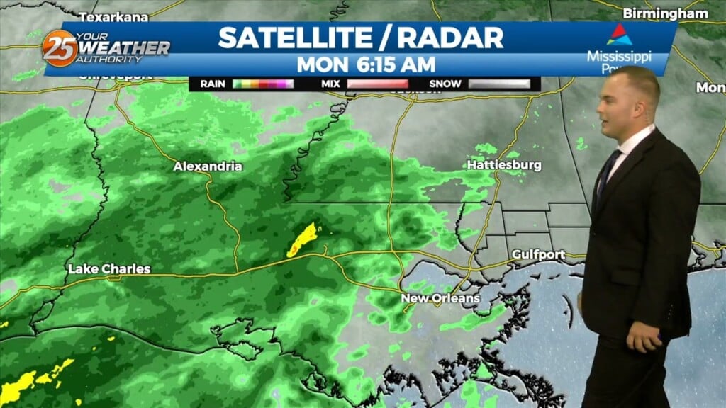
Rain will develop and move back into place by the evening with the possibility for steady rainfall at times tonight. Coverage will peak at around 70-80%…
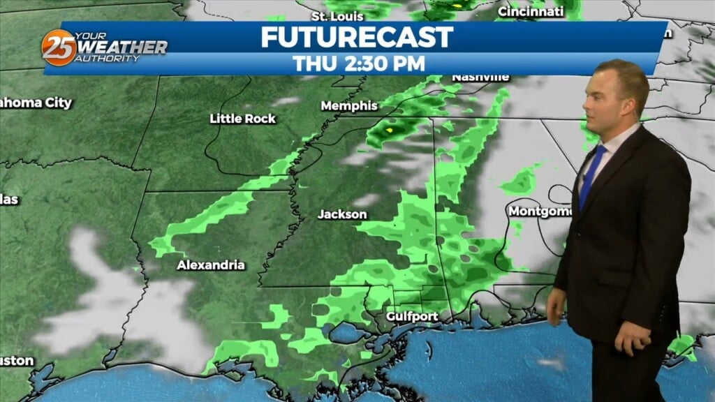
Light rain around at times this morning will fade and there will be a break in the action from this morning into the afternoon. With that,…
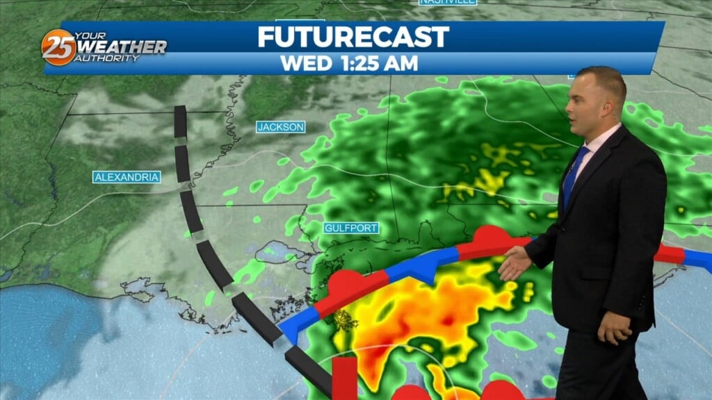
Coverage of rainfall will pick up this afternoon through the evening. Rainfall will be fairly light and steady through about the next 18 hours or so. Tomorrow will be…
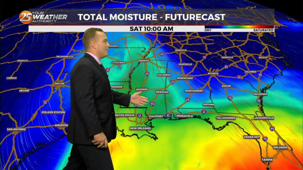
After a relatively dry weekend, rain from a new area of low pressure located off of the Texas coast will move in. By the middle…
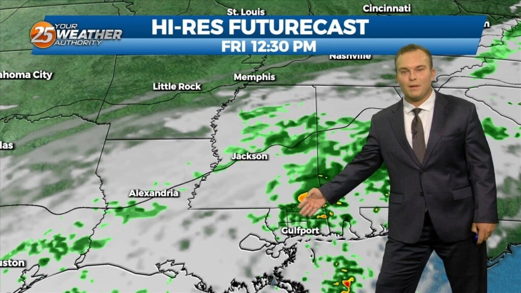
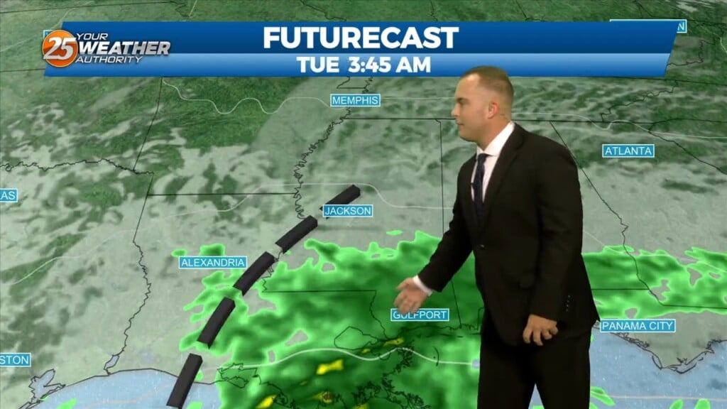
A quiet evening with increasing clouds will give way to chances of showers overnight before dawn. The main batch of activity arrives as early as mid-morning or…
It will be slightly less chilly overnight but overall, the same conditions will hold true with clear skies and light winds. Some spots could see fog develop…

The breeze will be less of a factor this evening as we will continue to enjoy nice conditions. Overnight, clear skies and light winds dominate and…
Clouds will thin somewhat overnight but the same cool conditions will linger into early tomorrow. Your Friday will start off with mostly cloudy skies and seasonal temperatures. As…
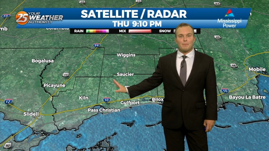
Thursday has been a much quieter day, and will remain generally quiet through the evening. Even with a cold front expected Friday night and Saturday it…
Rain will gradually exit the area overnight as winds will remain blustery until around daybreak. Alerts including a Wind Advisory for the 3 immediate coastal counties and…
Some changes will be taking place over the next 48 hours that will be quite noticeable. First and foremost, tonight will be cool again with the only…