11/18 Ryan's "Cool, Calm" Wednesday Evening Forecast
Things'll be slow to change this week, but they eventually will after several more calm, sunny days.
Things'll be slow to change this week, but they eventually will after several more calm, sunny days.
Lows the next couple of nights should easily reach the lower to mid 40s inland and the mid 50s closer to marine influences. Highs will be in seasonably mild ranges, generally upper 60s to lower 70s through thursday now that…
Just as cool as last night and even drier, but it won't last forever....warmer, more humid days lie ahead.
Lows the next couple of nights should easily reach the lower to mid 40s inland and the mid 50s closer to marine influences. Highs will be in seasonably mild ranges, generally upper 60s to lower 70s through Wednesday as a…
Last week looked beautiful, but was warmer and more humid than normal, which this week corrects!
Cooler, drier air remains, but we will continue to warm steadily through the week.
Cooling has stopped, so now warming can begin as we head into the rest of the week and the weekend.
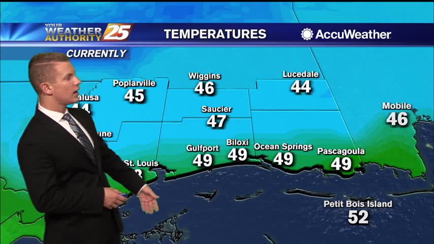
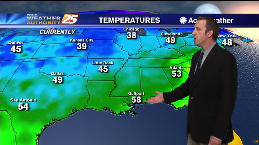
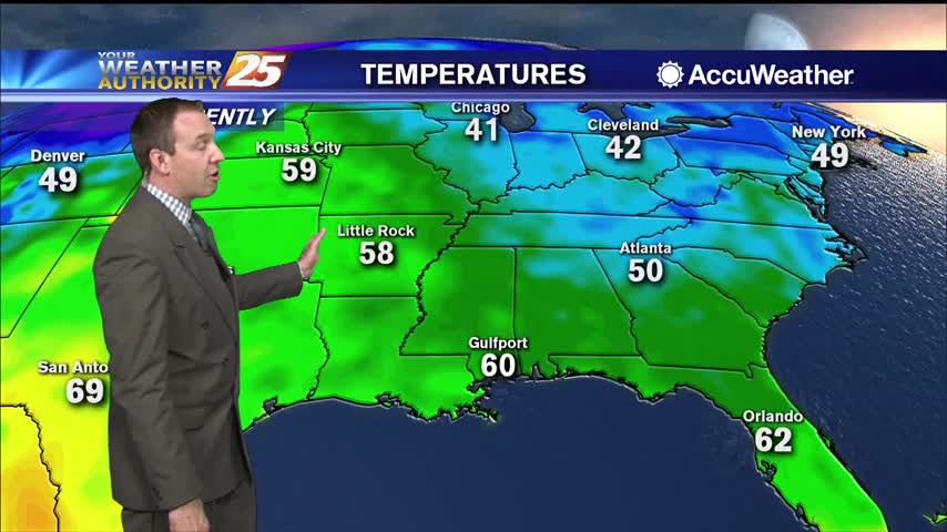
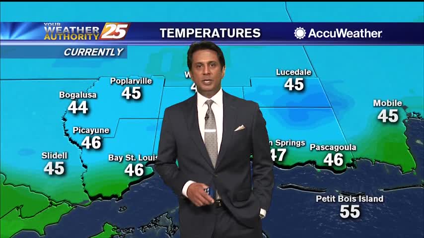
It’s quite the chilly morning across the area with some of the coldest temperatures we’ve seen in a while. Early morning temperatures are sitting in the lower to mid 40s across most of the viewing areas. Some upper 30s are…
Coldest overnight lows of the week are expected Monday night into Tuesday morning as skies remain clear and winds turn very light to calm across inland areas. Temperatures will plummet into mid to upper 30s across most inland communities Monday…
Another chilly night in the upper 40s, but slightly warmer weather is ahead...just doesn't last long before another cold front moves in.
Another cool evening ahead before we move into quite a chilly night, but a little warm-up is on the way.
Zeta is gone and cooler, drier air is rapidly filling in its wake...
Pretty cool and dry today, but warm, humid, and cloudy weather with scattered showers will move in quickly ahead of the weekend.
Pleasantly dry and cool weather will remain through tonight and the first part of tomorrow, but an approaching potentially severe storm will bring warm, humid conditions rushing back.
Another chilly night and still much drier than we've seen in recent weeks, but warmer, more humid air will continue to move in.
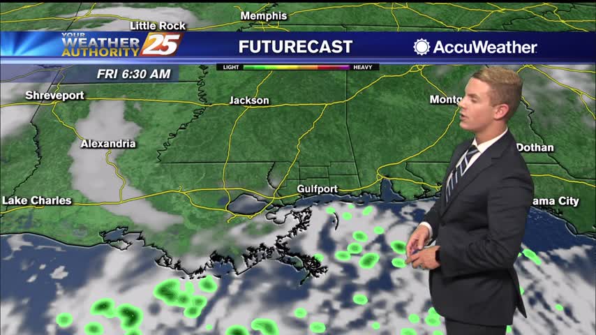
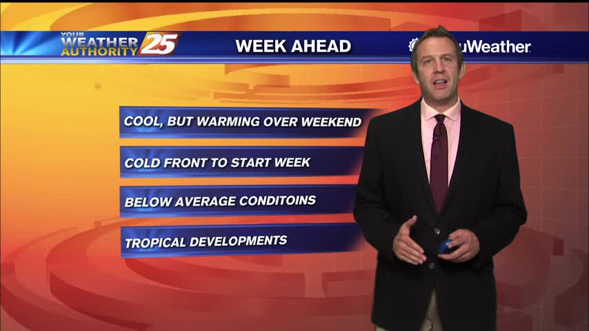
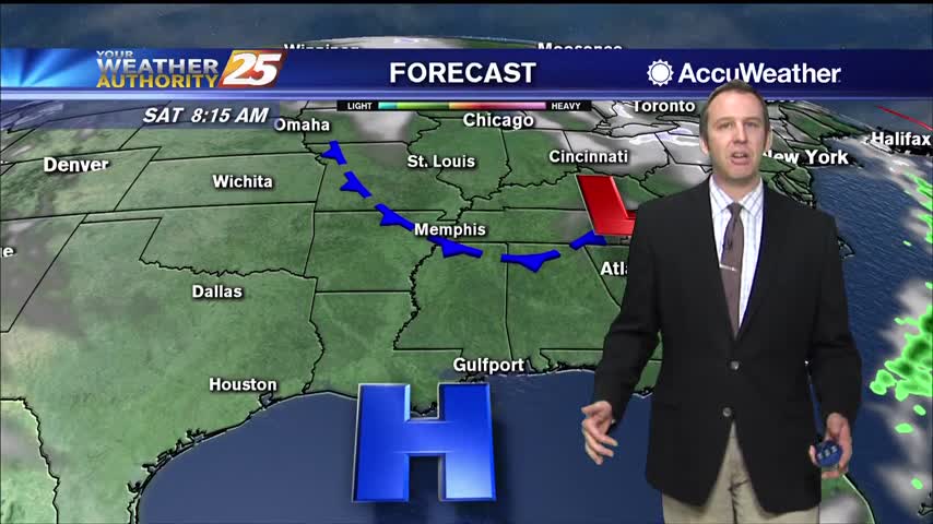
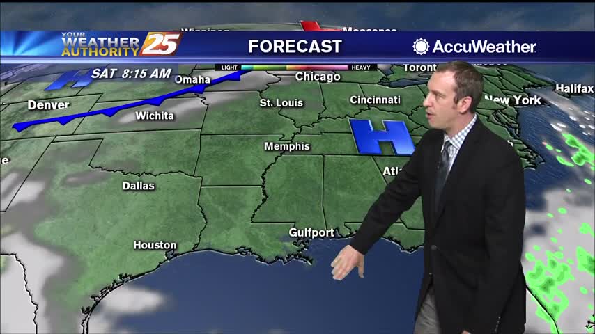
Dry conditions expected through Friday then the return flow will begin to bring the humidity and warmth back to the area. Saturday through Tuesday: a relatively strong late season cold front moves out of Canada Friday but quickly shunts eastward…
Coldest and driest air we've seen in quite some time is moving in, so get ready for some sunny weather and clear skies.
We're heading into a nice weekend after a grey, muggy week, but a few chilly nights lie ahead.
Active weather has moved on, so expect changing improving conditions heading into the weekend.
We've warmed over the last few nights, but even more warm, moist air is moving in over the weekend.
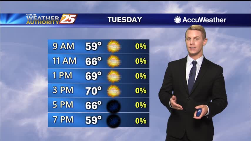
Get ready for another cold one, but I expect it to be slightly (a degree or so) warmer than last night. Warming increases into next week, into the low 70s by Tuesday.
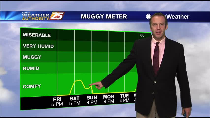
Clouds remain for now, but will slowly clear through the night. Expect a sunny and dry weekend ahead, but clouds return soon after.
After a stormy start to the day, lingering cloud cover will slowly clear through the night as colder, drier air moves in.
It's clear for now, but a few clouds will move in as we prepare for a rainy start to next week.