7/8 - The Chief's "Hot But Wet Weekend" Friday Afternoon Forecast
Southerly surface winds will help to advect moisture and warm air into the environment. There will still be plenty of moisture in the atmosphere and moisture…
Southerly surface winds will help to advect moisture and warm air into the environment. There will still be plenty of moisture in the atmosphere and moisture…
High pressure will dominate the upper level pattern today through Saturday morning. Southerly surface winds will help to advect moisture and warm air into the environment.…
High pressure is centered pretty much over our area as the disturbance that brought the heavy rainfall to portions of the area yesterday, is well…
At the surface, high pressure is centered pretty much over our area as the disturbance that brought the heavy rainfall to portions of the area yesterday, continues…
High-pressure is currently centered near the Texas-Louisiana border, with a north-south axis into the Dakotas early this morning with an easterly wave wrapping around the…
A southerly surface winds will help to advect warm air and moisture into the area, enhancing lifting in the environment. Elevating atmospheric moisture will allow for more efficient…
High pressure will dominate the upper level pattern today through Wednesday. A southerly surface winds will help to advect warm air and moisture into the area, enhancing…
There is an area of high-pressure over the Rockies and along the Atlantic Coast with disturbances over the Great Lakes and approaching the Pacific Coast. Pressure fields…
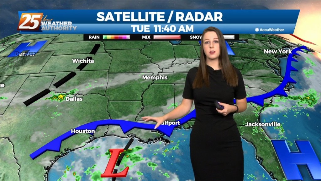
The area of disturbed weather over the Gulf of Mexico appears to be centered south of Lake Charles, which will drift slowly westward over the next…
An Upper level low-pressure over the north central Gulf of Mexico will continue to drift slowly westward over the next few days, with blocking pattern finally breaking…
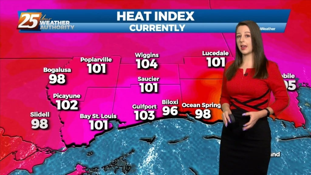
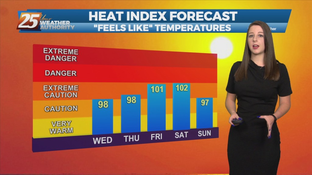
The HEAT WAVE CONTINUES... Seems hard to believe, but normal highs this time of year should only be about 90 degrees, but the area will continue…
"Summertime Safety" Is The Name Of The Game... Upper level high-pressure centered over West Texas has expanded across the northern Gulf Coast. This pattern will generally remain…
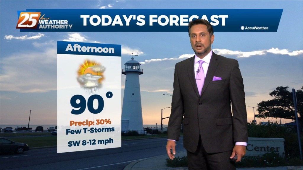
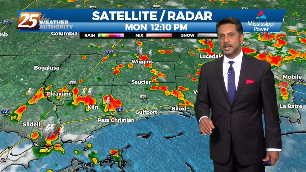
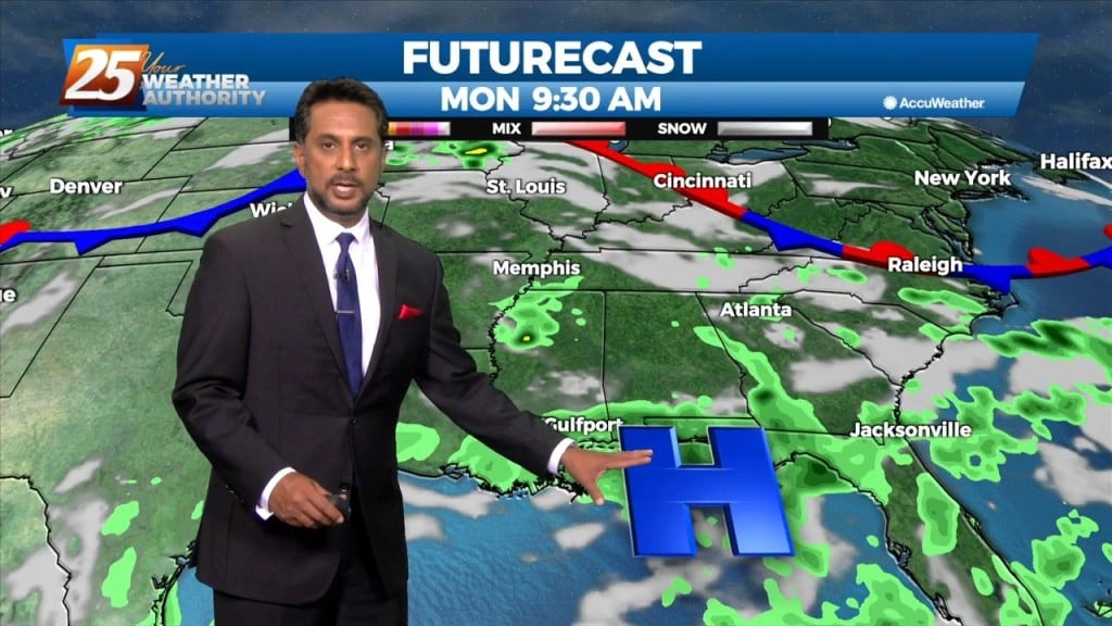
This afternoon will fall into that bracket of typical summer thermal showers and thunderstorms. The best probabilities for getting activity will be the Miss gulf coast starting…
The cold front is now eat of the area with a few linger showers (even an Isolated t-storm) expected early this afternoon. Skies will begin to slowly…

The synoptic pattern will hold through the short-term period with a broad area of high pressure off the Southeast U.S. coast extending westward along the…
Today will mainly be a transitional day where the surface winds will shift from northerly to southerly. Some moisture will be reintroduced to the environment and instability…
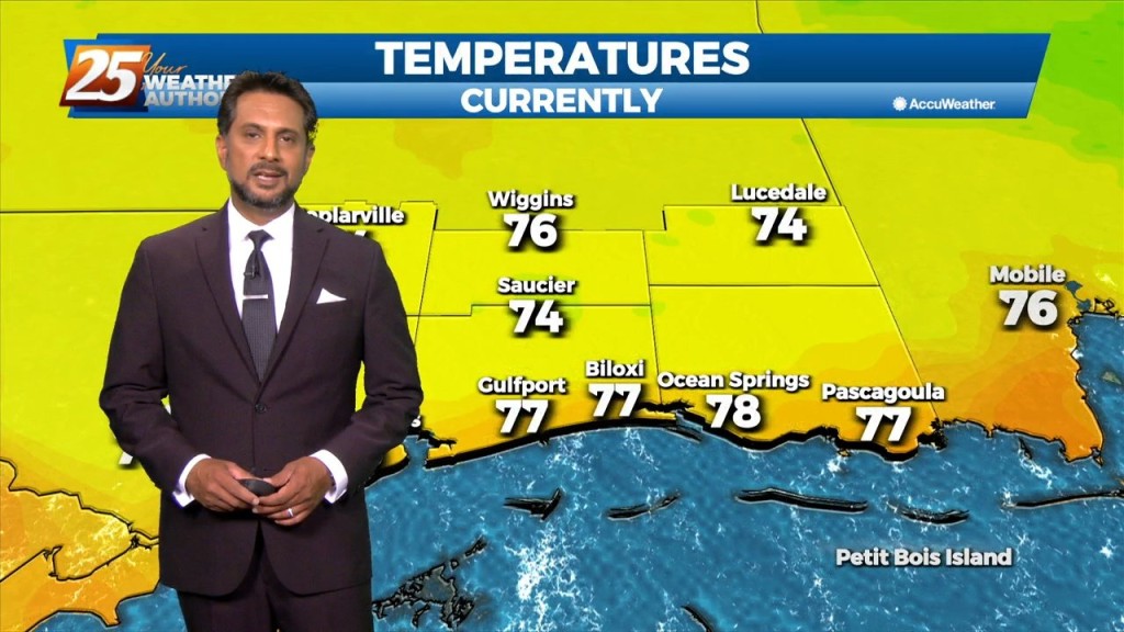
This afternoon, high-pressure NE will easily support max temperatures around 90 degrees, with isolated locations approaching mid-90 with the heat index. Low-pressure currently in the western Atlantic will approach…
A weakening disturbance west will move east across the region with no significant convective development today. Beyond tonight, high-pressure over the western Gulf of Mexico should keep any…
As the cold front is now to the east, post frontal clouds will slowly dissipate this afternoon as drier air moving in from the NW. High pressure will…
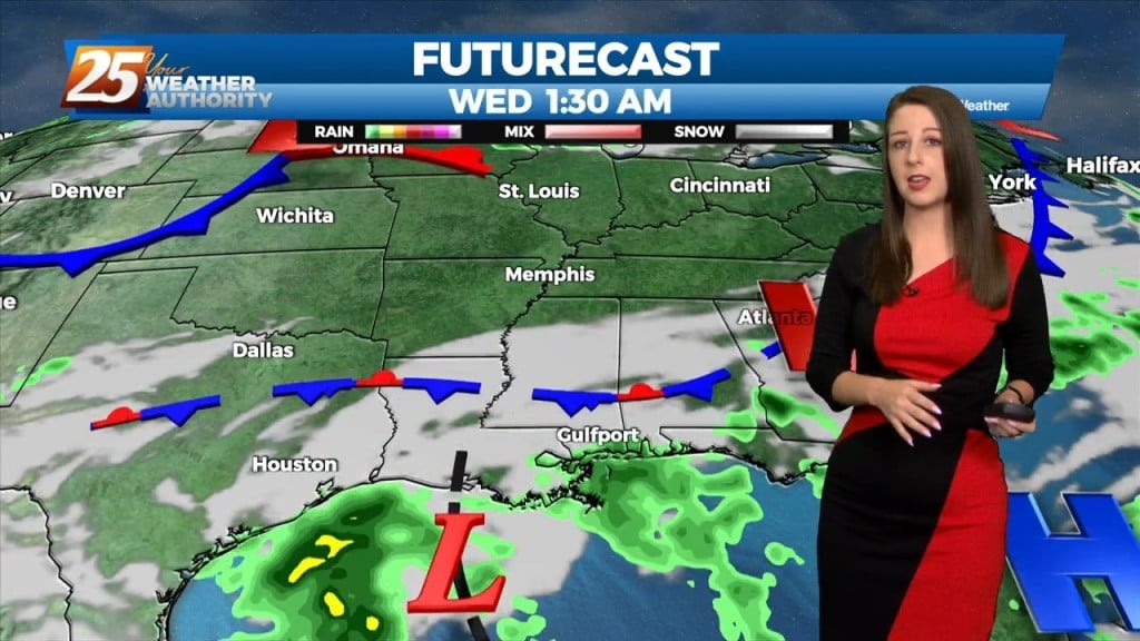
A cold front from the NW will drive south to central LA and MS late in the day. Showers and thunderstorms along/ahead of the boundary should be…
Post front airmass continues to push in today as upper level high-pressure to the NW shapes the short term forecast. This will bring another below normal temperature day with…
The cold front is now well east of the area as skies have cleared. A less humid flow and sunshine will dominate the forecast ahead, but this will not…
A few afternoon showers/t-storms will be possible including this evening as a cold front moves through the area. If the lift can be realized and overcome the dry…
The moisture flow will move slowly eastward over the next day and a half, and may take until about Friday to totally clear the region. Lower levels should…