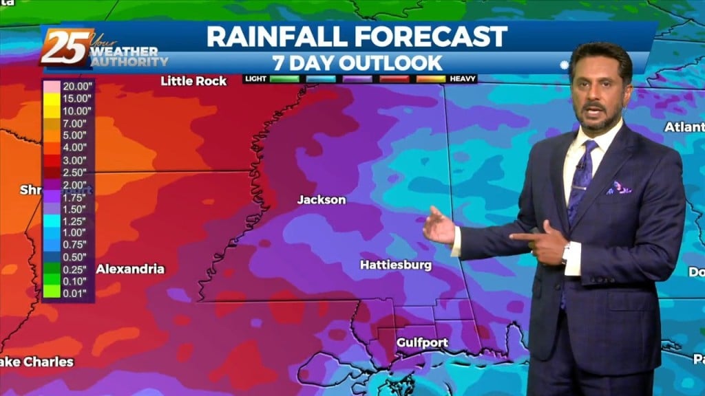
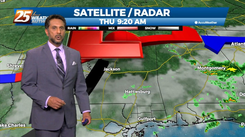
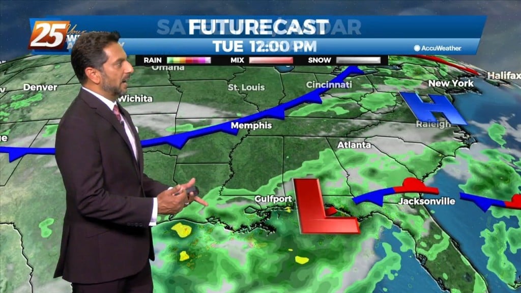
8/18 - The Chief's "Heavy Rain/Flash Flooding" Thursday Afternoon Forecast
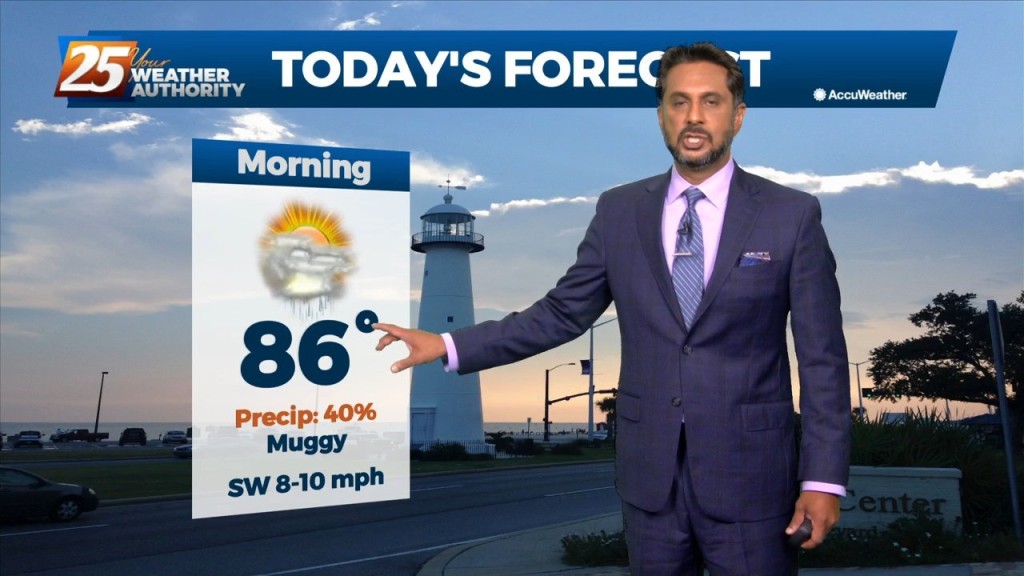
This afternoon will continue to bring showers/t-storms to the area. The main concerns over the next few days will be the threat of thunderstorms. Heavy rain…
This afternoon will continue to bring showers/t-storms to the area. The main concerns over the next few days will be the threat of thunderstorms. Heavy rain…
The focus this afternoon and evening will be on convective development to our north and east, moving into south Mississippi. A zone of low-level convergence oriented NW…

The focus late this afternoon and evening will be on convective development to our north and east, moving into south Mississippi. A zone of low-level convergence oriented…
The focus late this afternoon and evening will be on convective development to our north and east, with short-range guidance identifying a zone of low-level convergence oriented…

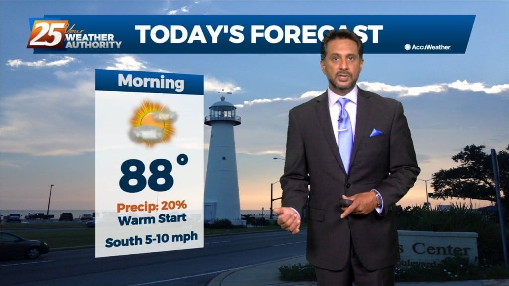
Hot and dry again on today for most of the day. No real distinct changes in the overall profile of the atmosphere. This subsiding dry layer has…
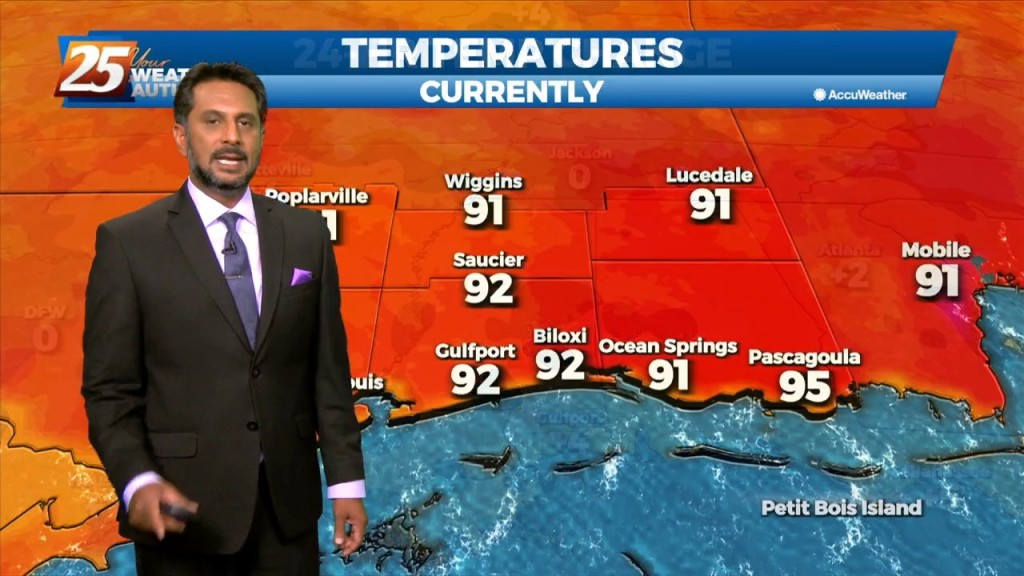
Low moisture flow will lead to low rain chances and HOT TEMPERATURES... The upper pattern doesn’t change a lot between now and Wednesday afternoon, with the local…

Moisture flow has decreased and there are no real saturated layers. Winds are primarily northerly from 5k upward. No real indications that anything will change significantly during…
The upper high pressure over Colorado this morning will gradually build southeastward over the next few days, even as the trough to our northeast continues to dig…

The upper high pressure over Colorado this morning will gradually build southeastward over the next few days, even as the trough to our northeast continues to…
Today the flow will shift more northerly as a weakness along the coast continues to amplify activity. At the surface, a weak frontal boundary…
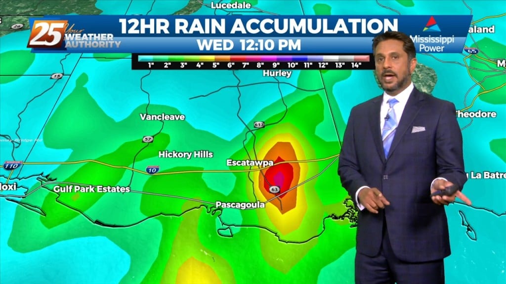
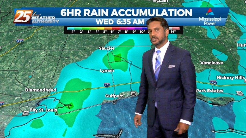
The threat for heavy rain and pockets of FLASH FLOODING continues this afternoon. While it is very likely that some areas see heavy rainfall, the somewhat…
At the risk of sounding repetitive, another day of high rain chances is on tap for the area. Once again, these storms can easily produce hourly…
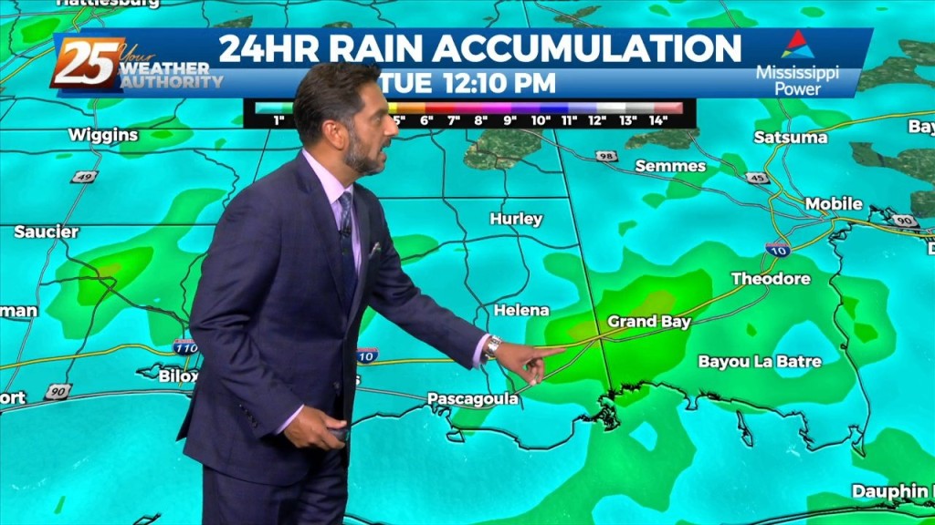
Deep moisture from the Gulf of Mexico will continue to stream into the area with model indicating well above seasonal normal. This will allow for another…
Today will bring more of the same as yesterday as numerous showers and thunderstorms are expected to develop. Deep moisture from the Gulf of…

Over the short term period a wetter period will begin today as general weakness in the overall patter to the north of Hattiesburg slowly moves into…
Scattered shower/t-storms this afternoon will see a gradual transition of dry air replace deep moist air this weekend. Then another transition of this dry air to…
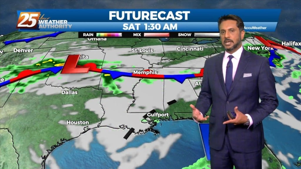
Today won’t be very different from the last several but there are some minor changes on the way. We should see a gradual transition of dry…
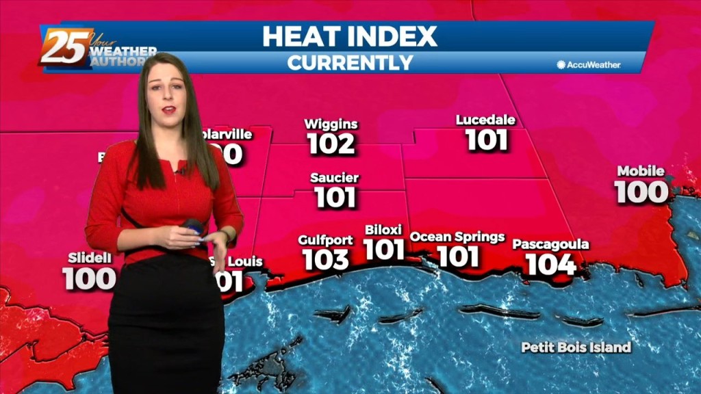
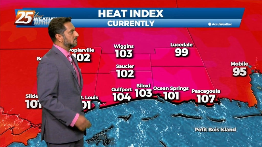
Strong high pressure will continue to shape the forecast with hot temperatures and low rain potential due to the compression of the atmosphere. The best potential for…
A broad upper level high-pressure remains centered near New Mexico and extends from Mexico to Canada and the Pacific Ocean to the MS River Valley. A…
The eastern portion of a high pressure system to the NW will begin to eroded as an upper disturbance digs south across the Great Lakes to…
The Bermuda high pressure extends into the far eastern Gulf of Mexico and a weakness between it and the ridge to the west. Abundant moisture exists…
Locally, there’s still some form of residual frontal boundary that moved through to the area Sunday, with an area of low-pressure which developed east of…

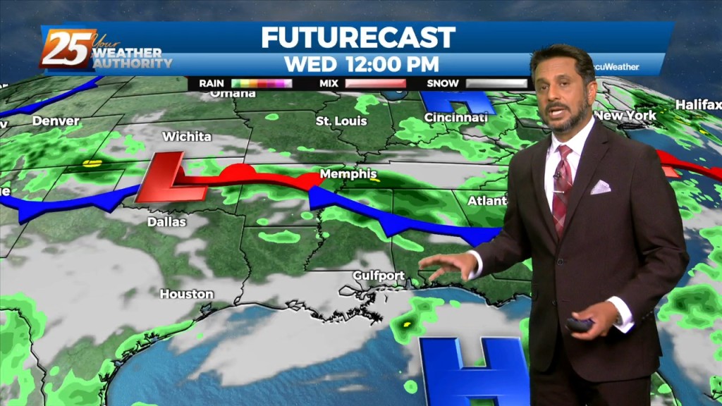
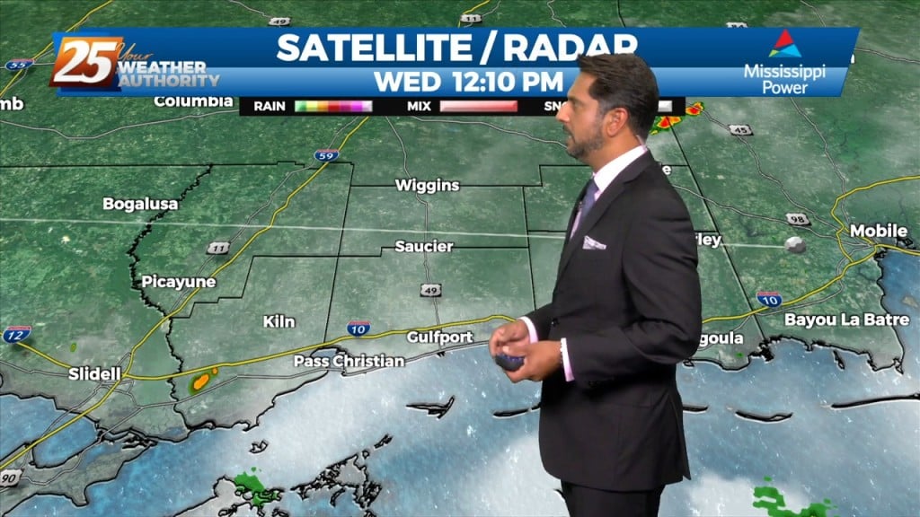
A stationary front along the coast will undulate north and south for several days, providing for rainfall and the potential for HEAVY RAIN. If…
An upper level high pressure is to the north of a stationary front situated along the Mississippi gulf coast. If there’s some good news, it is…