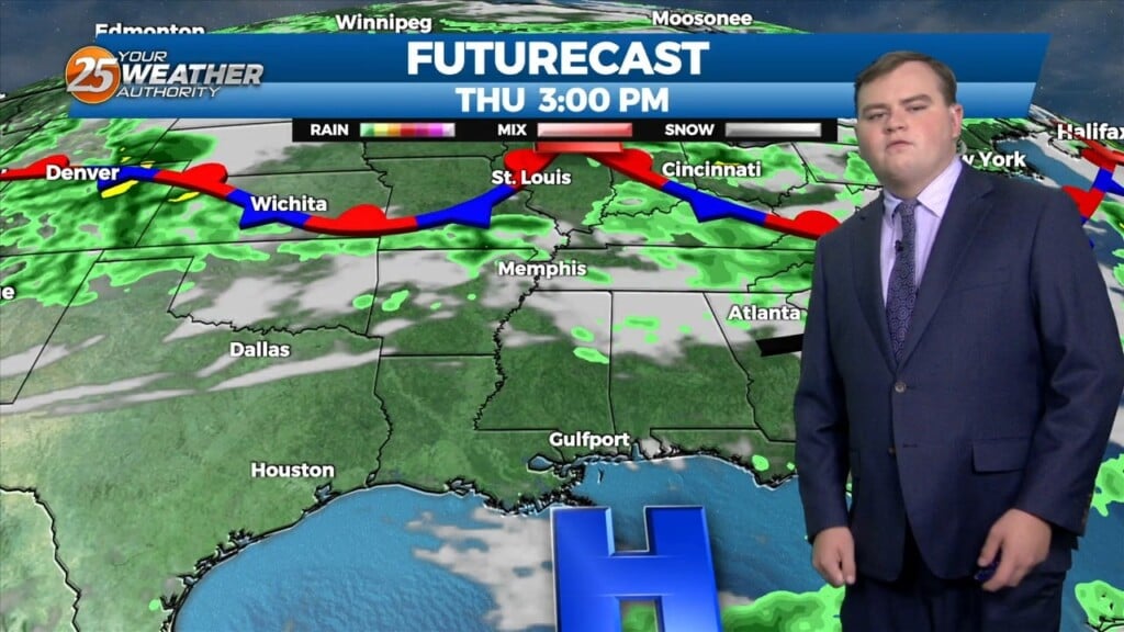
4/22 - Sam Parker's "Slow Movers" Tuesday Night Forecast
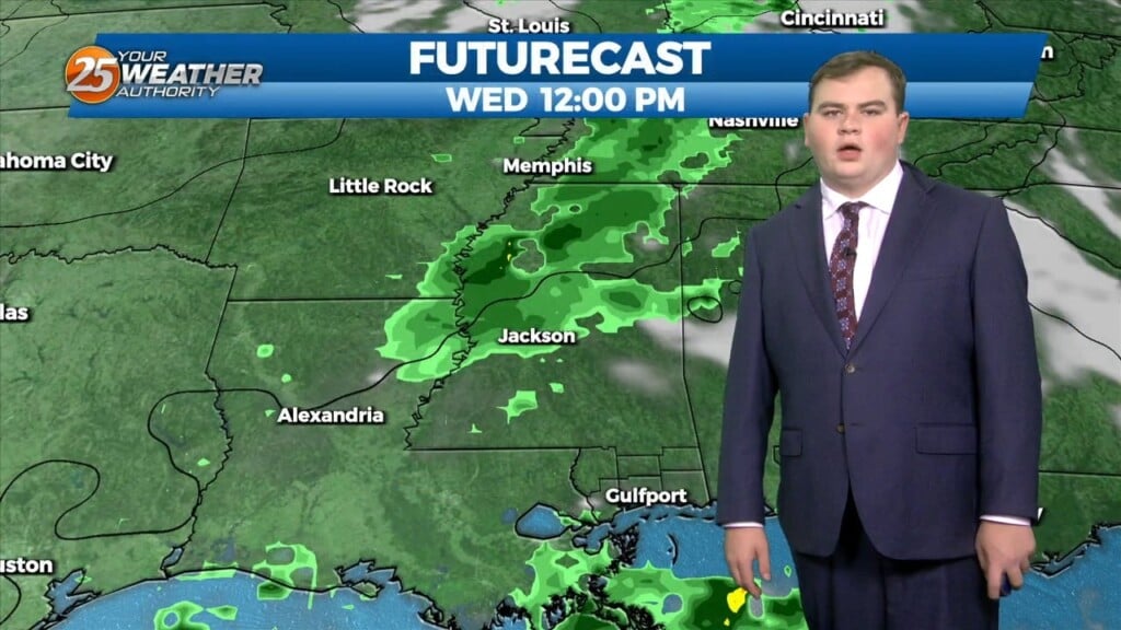
Scattered pop up showers across earlier today and more expected Wednesday. We had one severe warning for Hail and a flash flood warning. Now things will…
Scattered pop up showers across earlier today and more expected Wednesday. We had one severe warning for Hail and a flash flood warning. Now things will…
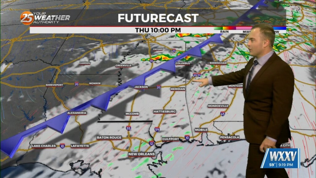
Watch out for pop up showers across the area for the next couple of days. A gradually weakening stationary front draped across north of the area allowing…
Above average temperatures for most of this week but a cold front comes Thursday with a chance of little rain. Today we saw an…
There are no significant weather impacts to the local area for the next few days, though rain chances are currently forecast to increase toward the…
Clouds increase ahead of the start of your Thursday morning. Fog should not be a widespread issue again but some spots may have light patches of it.…
A fairly comfortable one is on tap this evening and temperatures will be fairly mild overnight. Clouds will increase after midnight and while fog is not a widespread…
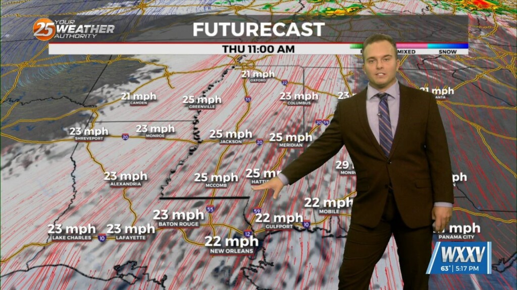
Winds will settle down overnight and it will be slightly warmer as compared to last night. Winds should remain elevated enough to avoid fog trouble for…
Skies will clear out this evening and any spotty rain chances will also be put to bed. Winds will relax as well and it will be mild…
Currently high pressure is the dominate feature across the southeast. There is currently lots of sunshine across the area this afternoon. A stationary front is well to…
An upper level trough of low pressure currently moving across the Great Lakes will continue to move through the Ohio River Valley today. With the base of the…
An area of high pressure is currently centered near El Paso extending through the Mid-Atlantic States. A weakness in the overall pattern in the upper levels currently…
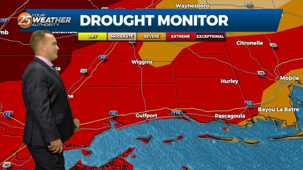
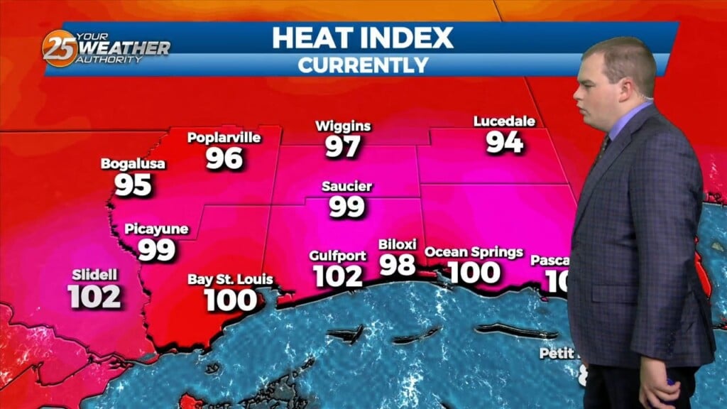
The pattern in the area is starting to feel like a broken recorded with oppressive temperatures daily. High pressure is the dominant feature and will continue to be…
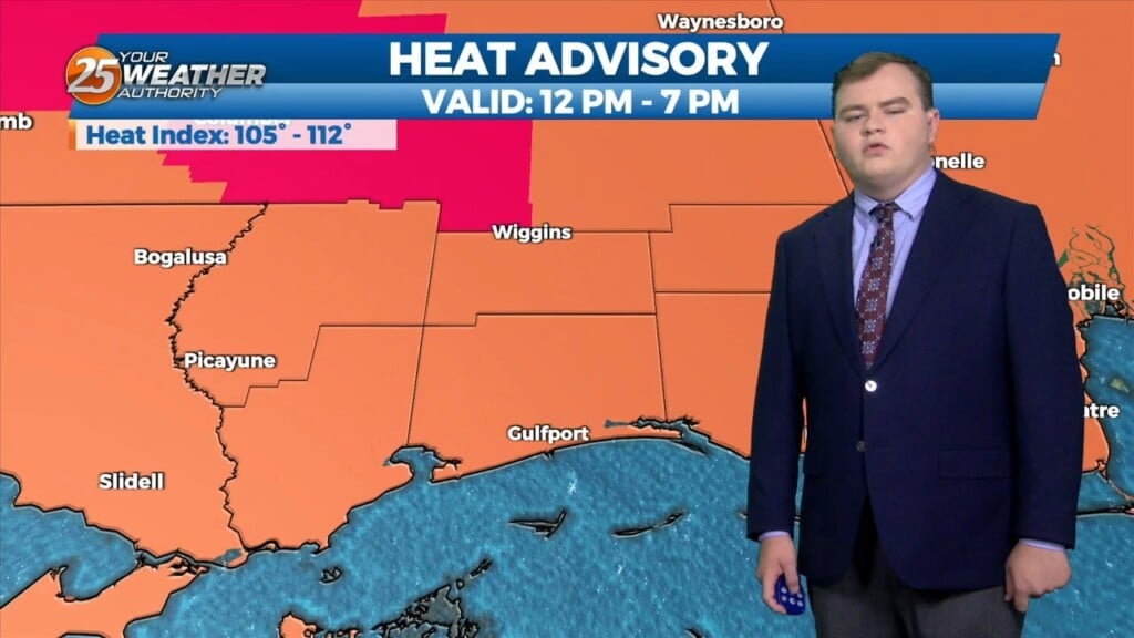
A HEAT ADVISORY is in effect until 7 pm as heat indices will max out between 107 to 111 degrees. High pressure is the dominant feature…
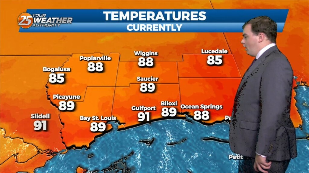
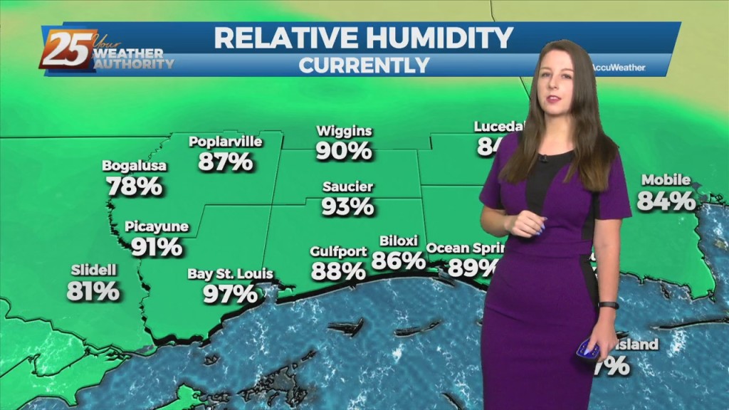
This afternoon temperatures will be in the low 90s, however heat indices will remain below advisory level. This is due to sea-breeze activity that will form coupled with daytime heating especially to the south of I-10 this afternoon. Activity will…
This morning there is a stationary boundary to the north us across the I-20 corridor with cloud coverage all across the southern six counties. Temperatures are much cooler this morning than yesterday morning. This afternoon temperatures will be in the…
The main talk of the short term will be the heat, we will definitely have plenty of it to go around. Many areas will see the low 90s Monday…
With the cold front now east of our area temperatures will begin to drop off. The high for today will be in the mid-50s with tonight's low being in…
Much more consistent weather this week without multiple fronts moving through, but there will be some rain.