Friday 072415 Forecast
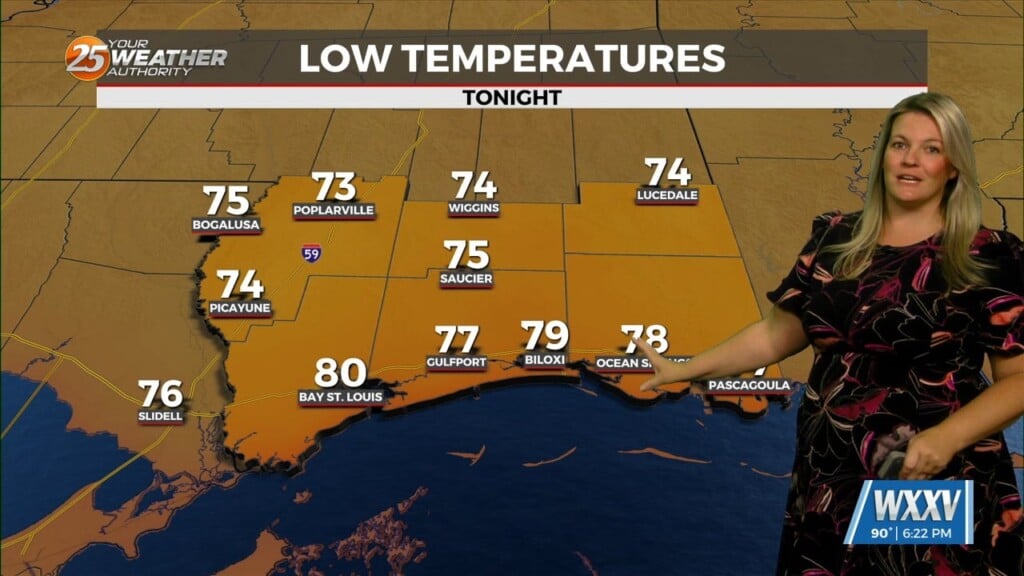
A weak cold front is moving into the area Saturday and will transition to a stationary front over time. This feature will bring a moderate chance of showers into the area as the air will be slightly easier to lift, so cloud cover and rain chances will increase over the weekend. Things dry out by Monday and we return to our Summer sea breeze setup with a slight chance of afternoon storms and temperatures in the mid 90s. Westerly winds will prevail for the next few days. Night time temperatures remain consistent around 79 degrees.


Leave a Reply