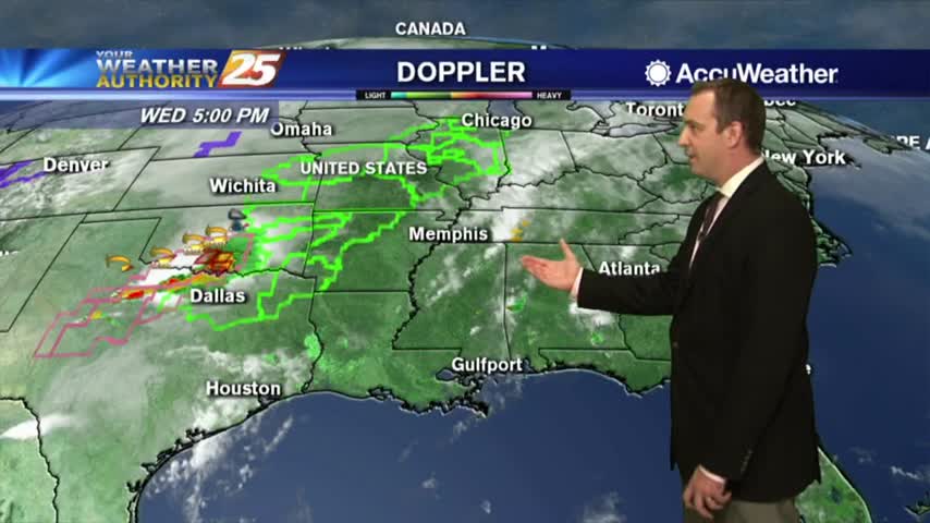
05/08 Ryan's "Goodbye Sun" Wednesday Night Forecast
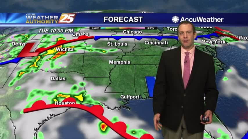
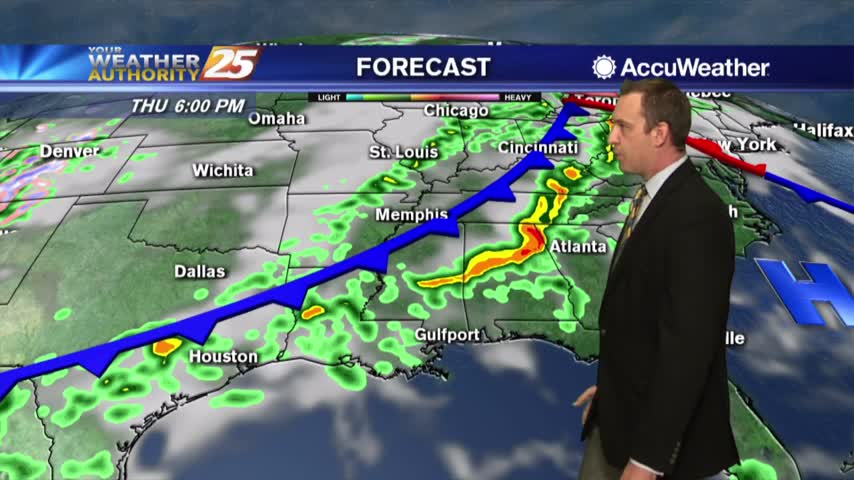
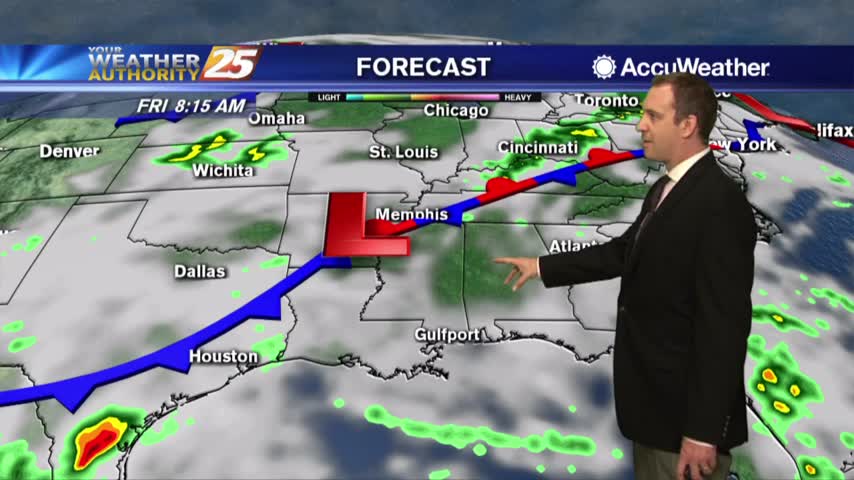
Don't expect much sun in the coming days, but we are going to see plenty of rain and thunderstorms....
Don't expect much sun in the coming days, but we are going to see plenty of rain and thunderstorms....
I hope you had enough sun this week, because we won't see it again until the next....
The warm and humid conditions continue as skies have become mostly cloudy...
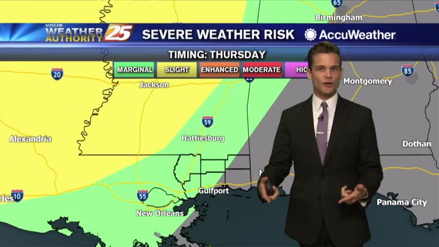
A much warmer and humid start to the day with a complex of showers/t-storms to our south...
It's been hotter and more humid each day since Sunday and rain finally returns by the weekend....
It's still getting warmer, more humid, and more cloudy each day, but the rain will stay away a little longer....
Last day of nice weather...rain later this week.
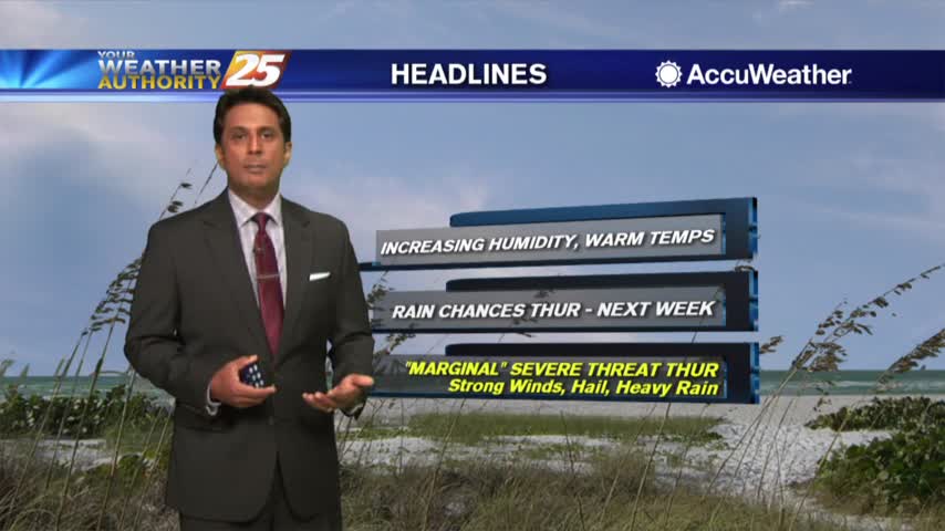
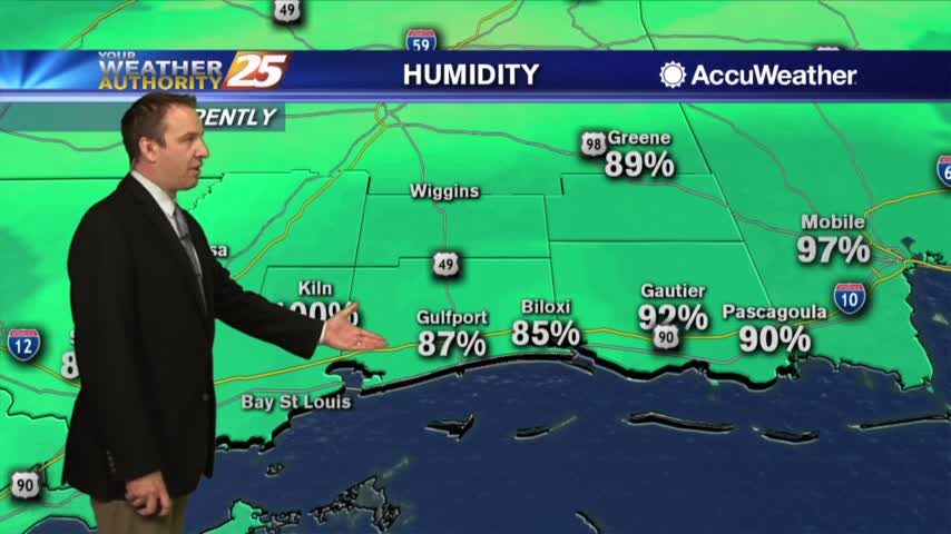
As the humidity continues to elevate, warmer morning temperatures have moved in...
It's sunny again after a somewhat cloudy weekend, but the clouds don't stay away long....
Starting off this week with plenty of sunshine, but rain moves in again before the week ends....
A mild and clear start to the day/workweek...
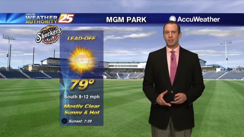
Hot and sunny Monday...wet later this week.
Another damp night is ahead as fog forms in light winds and high humidity, but rain will arrive tomorrow....
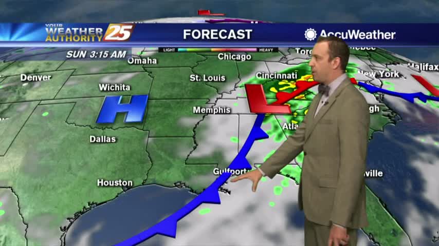
We haven't seen much change in our weather over the last few days, but that's fixed soon as a cold front moves in....
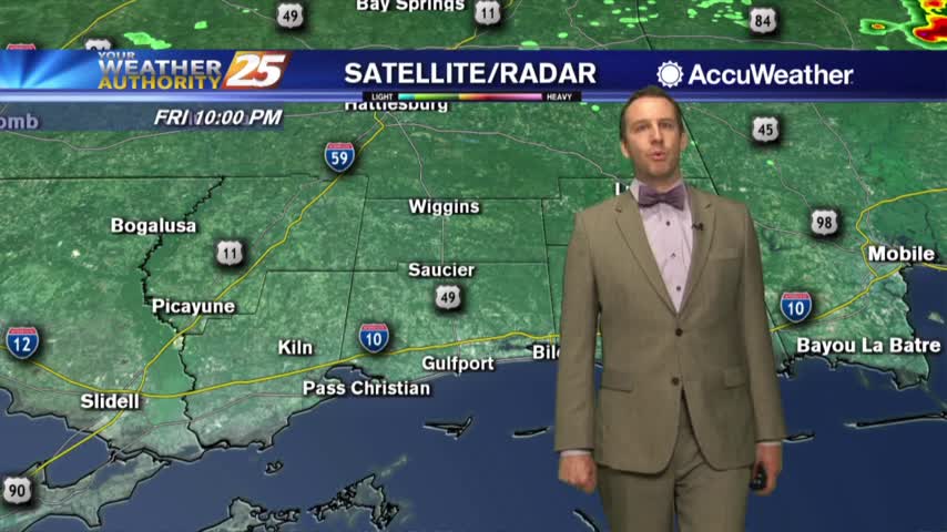
Mainly dry Friday, but t-storms possible on Saturday.
Another humid start to the day with areas of PATCHY FOG along south Mississippi...
Today was much more clear, but clouds and fog are moving back in overnight....
Today was a bit more sunny, warmer, and more humid than the last few days have been and rain isn't far away....
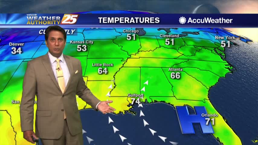
Temperatures continue to warm as high-pressure to our east continues to bring in a humid flow from the Gulf...

A very warm and humid start to the day with areas of patchy fog...
Other than the wishy-washy cloud cover, things have been pretty consistent in South MS recently...that changes soon....
We're seeing very consistent weather heading into the weekend, but rain is right around the corner...
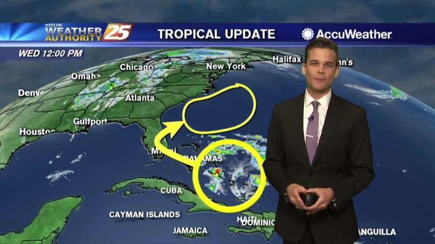
No worries about the disturbance in the Atlantic, but a good reminder hurricane season is just one month away!
A VERY WARM & HUMID start to the day with a few light sprinkles in SE Louisiana moving east...