04/30 Ryan's "Good To Be Back" Tuesday Night Forecast
Good to be back after a short vacation, but clouds are starting to move in....
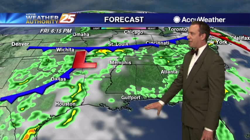
Good to be back after a short vacation, but clouds are starting to move in....
Starting to see clouds moving in, ruining our clear skies but not bringing any rain...for now....
Humidity building in...rain chances aren't far off.
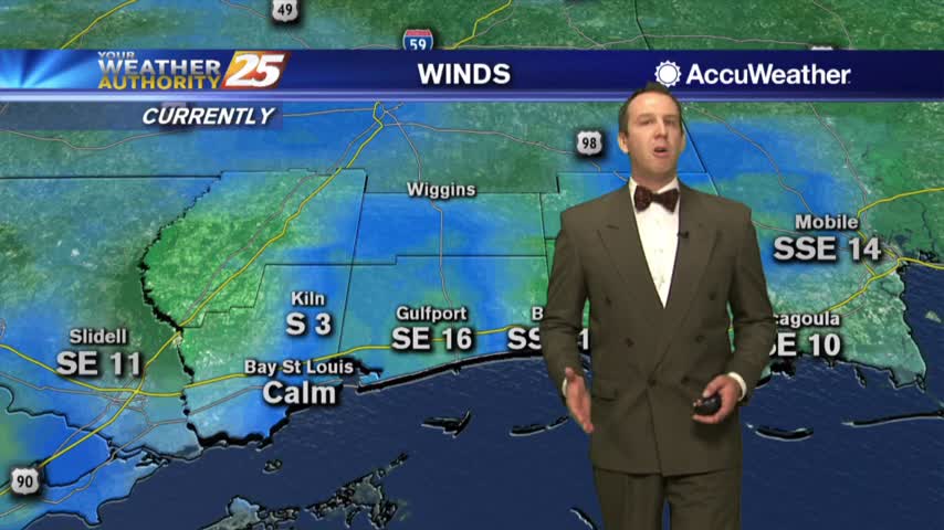
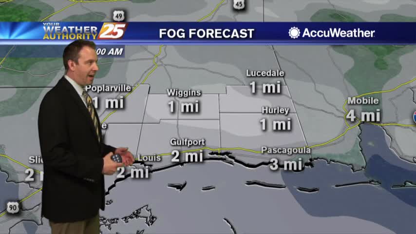
A much warmer and humid start this morning with areas of PATCHY FOG east of Hwy 49...
A little patchy fog possible tonight...Tuesday looking nice.
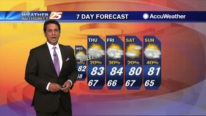
The perfect weather is about to come to an end, but overall the extended forecast isn't bad.

After a BEAUTIFUL clear start earlier this morning, daytime heating has developed a few clouds along the coastal counties...
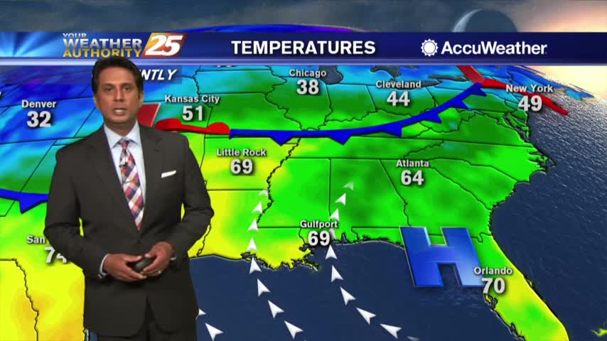
A mild and humid start to the final Monday of April, with a few low-levels clouds inland...
Beautiful weather continues as we start the work week.
Enjoy the cool Saturday morning...the afternoon will also be beautiful!
Patio weather this evening!
As the cold front from yesterday continues to move further east, it's shaping up to be a GORGEOUS afternoon...

A LOVELY start to the day and the weekend with cool temperatures and clear skies...
Sunshine headed our way...and a lot of it!
Rain heading out...clear skies heading in!
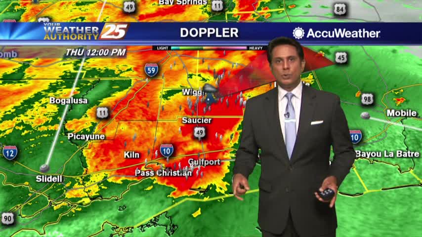
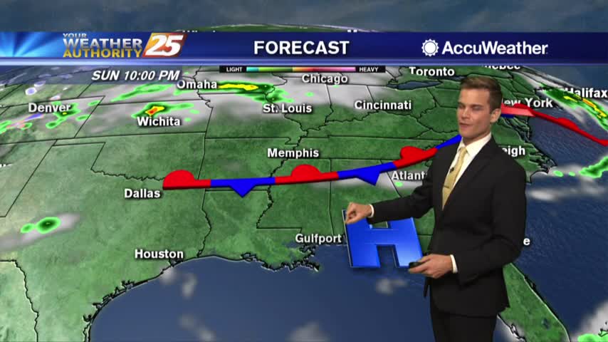
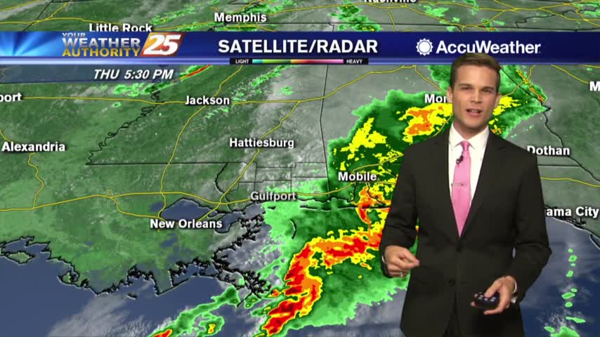
Showers and t-storms continue to move into south Mississippi with a TORNADO WATCH in effect through 3 PM...
It's a cloudy start this morning as a cold front will move through south Mississippi later today...
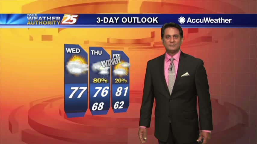
It's been getting progressively warmer and more humid each night, and tomorrow brings storms before sunnier weather returns....
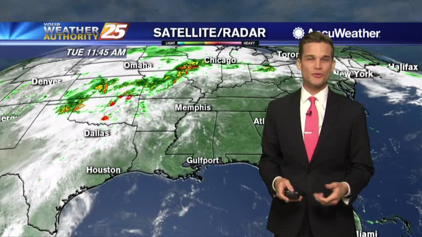
Cloudy again today, but the storms stay away until tomorrow....
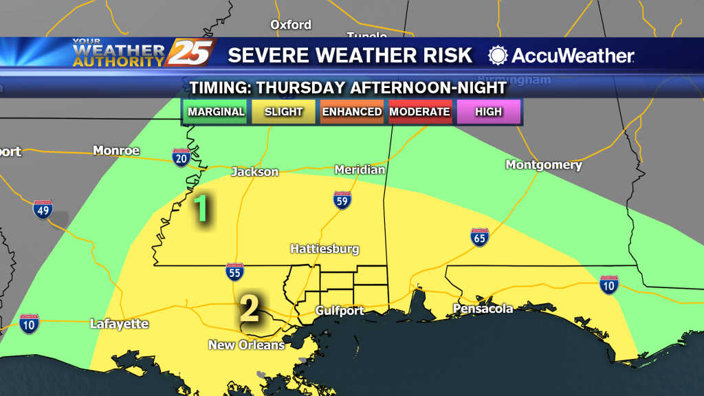
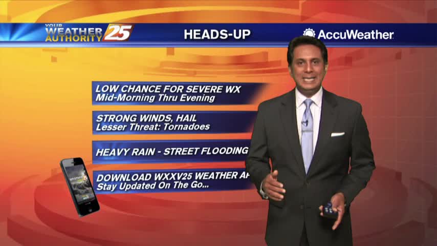
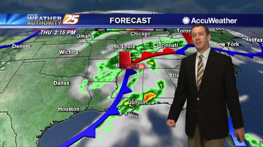
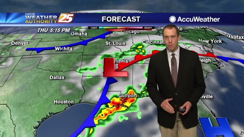
Clouds today...possibly severe t-storms for Thursday.
The warmer overnight temperatures and cloud coverage continues with a humid flow through the region...
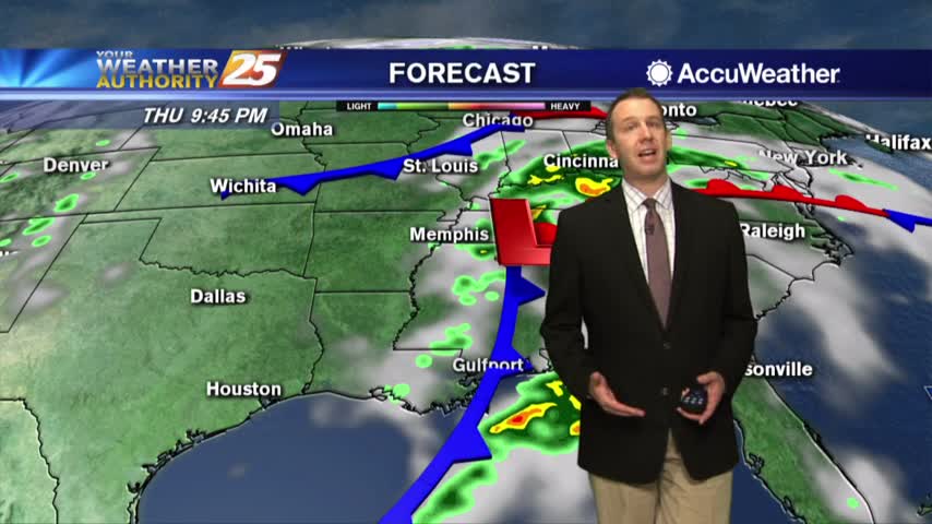
Clouds have moved in and will linger until a front passes Thursday evening, bringing more thunderstorms....
We're seeing more clouds and it's even more humid today, but significant rain is still days away....
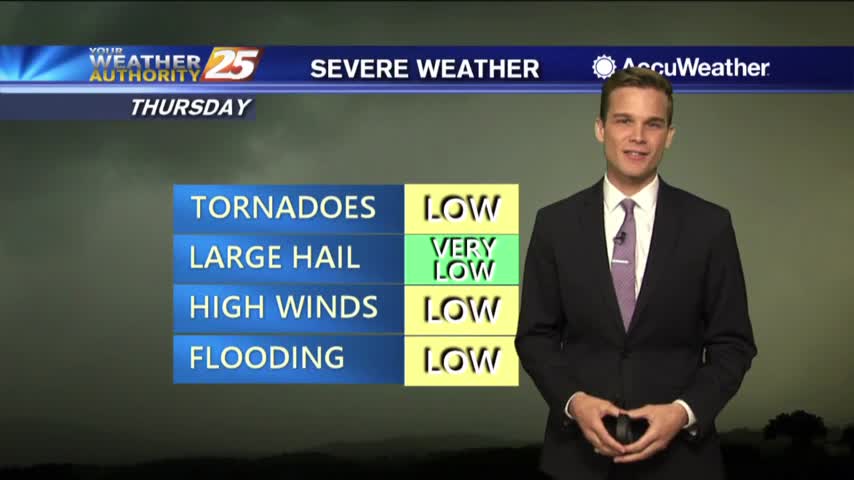
Clouds moving in. Strong T-Storms Possible by Thursday.