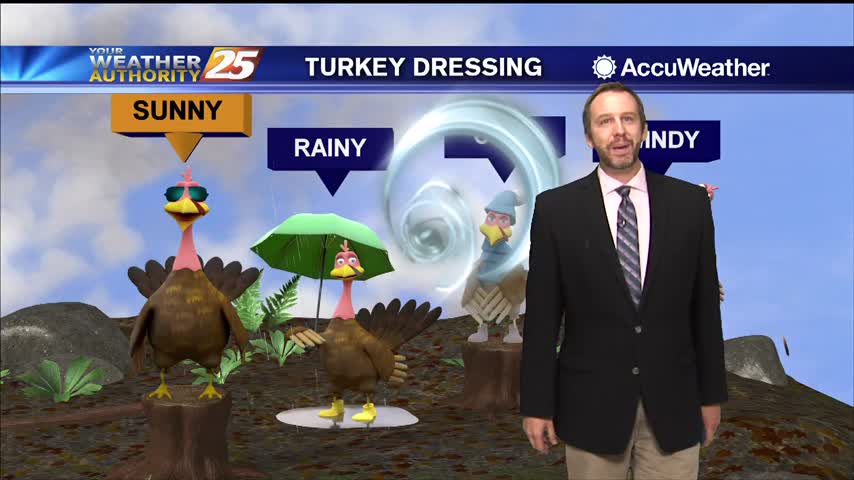
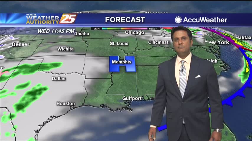
11/29 - Rob's "Black Friday/Weekend" Forecast
A cool start with higher humidity than yesterday...
A cool start with higher humidity than yesterday...
After a pleasant Thanksgiving Day, temperatures will dip into the upper 40s tonight. With high pressure parked over the Southeast, we will keep mostly clear skies through the night. A few clouds will work their way into the area by…
After a pleasant Thanksgiving Day, temperatures will dip into the upper 40s tonight. With high pressure parked over the Southeast, we will keep mostly clear skies through the night. A few clouds will work their way into the area by…
Cooler temperatures and clear skies makes for a beautiful start to Thanksgiving...
It's only cooled a handful of degrees so far, but we'll wake up to a chilly Thanksgiving!
Cold front only moved through a few hours ago, so it hasn't cooled much now but chilly nights lie ahead!
After a foggy start to the day with some morning rain showers, skies are clearing up as a weak cold front moves through the area. Temperatures today will top out in the mid 70s and tonight we reach a low…
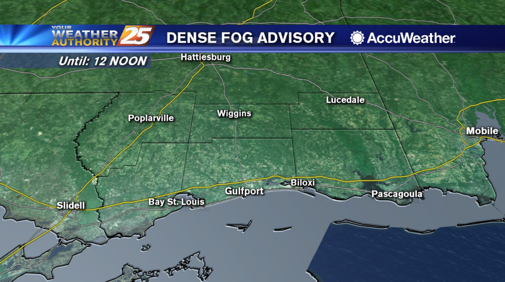
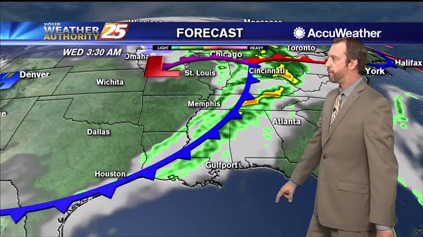
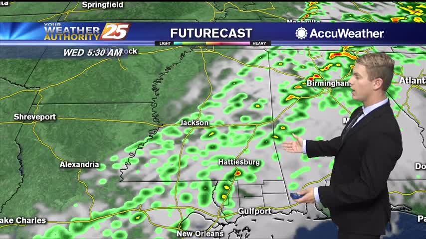
The National Weather Service has issued a Dense Fog Advisory, which is in effect until 12:00 noon Wednesday. Sea fog has reduced visibility along the Mississippi Coast, mainly to the south of Interstate 10 with the greatest impacts along Highway…
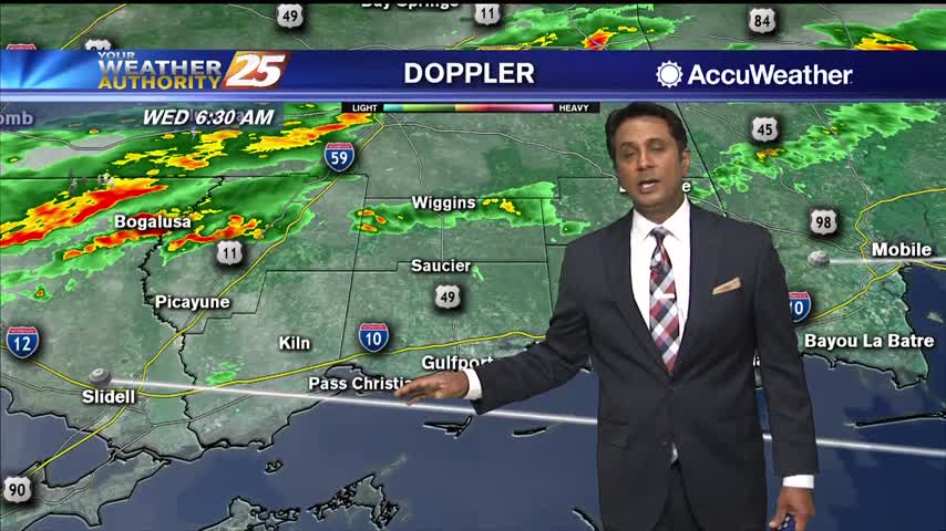
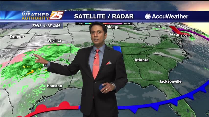
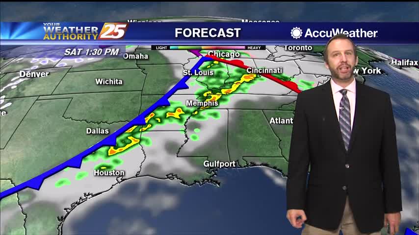
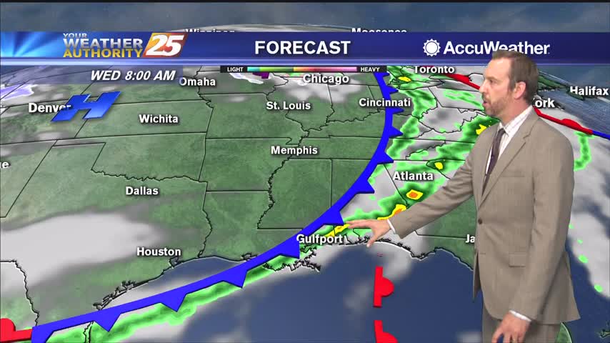
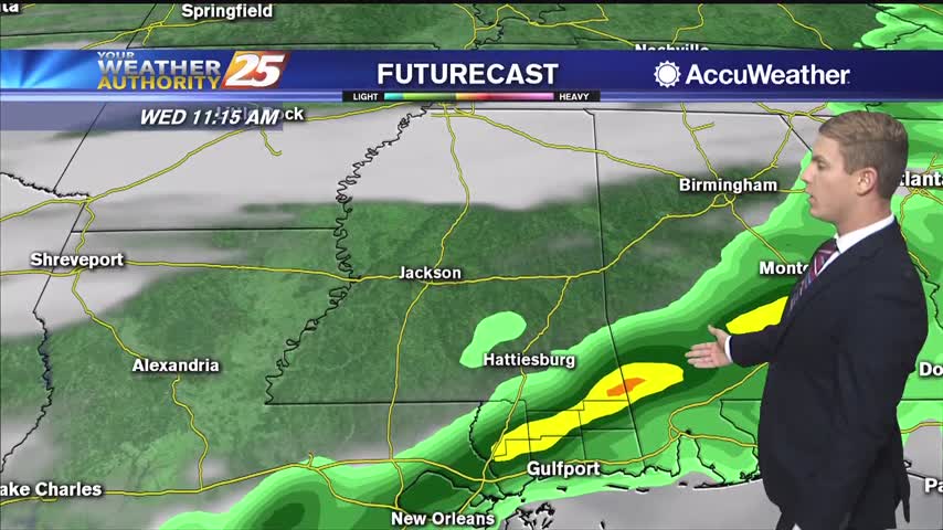
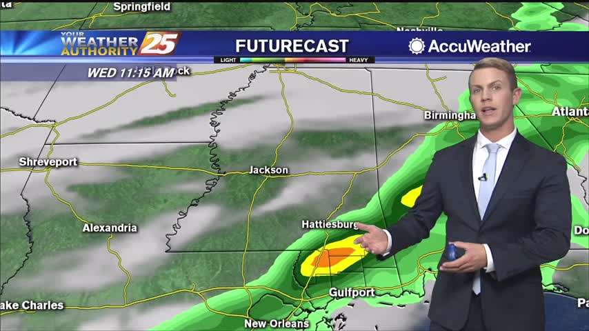
The cold front is moving through the area this morning with warm and humid conditions, patchy dense fog, and isolated rain. The front should move through the area by midday into early afternoon as partial clearing will occur. Dry weather…
Haven't seen much rain by this point in the day, but it'll continue to increase through the night as a cold front moves in.
Skies were cloudy today with a little sun peaking through around sunset, but more clouds and rain are moving in slowly.
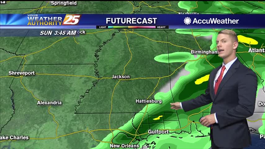
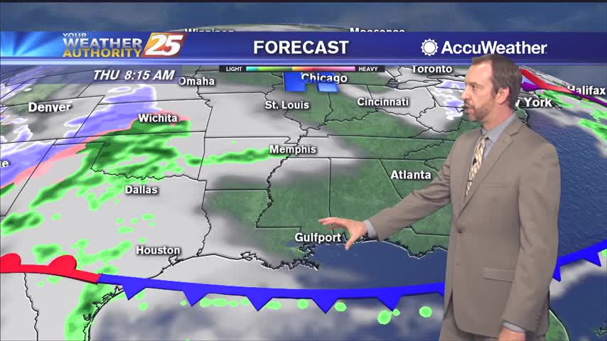
Overcast skies will likely continue through Tuesday afternoon and evening. Pop up showers will be possible for the remainder of the day. High temperatures will top out in the lower 70s and it will be breezy with winds out of…
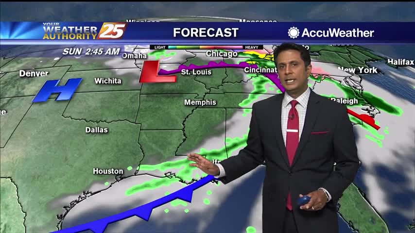
High pressure is now centered off the east coast of Florida and will move southeast as a developing cold front moves through the Southern Plains. Locally, with the high to the east, onshore wind flow has returned moisture to the…
Nice and cool this afternoon, but we're beginning a warming trend that will take us back into the 70s quickly.
The weather was still cool and clear today, but clouds and rain are right around the corner.
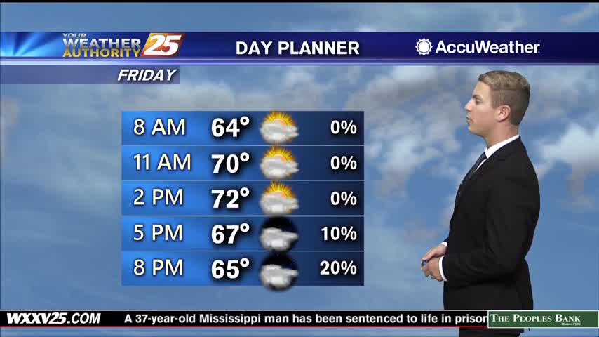
Southerly winds and continued mostly clear skies will allow for warmer temperatures with highs in the mid to upper 60s on Monday. Conditions will quickly transition to a more unsettled pattern heading into Monday night and Tuesday. A few pop…
A cold start with a few upper clouds moving across south Mississippi and areas of light patchy fog inland...
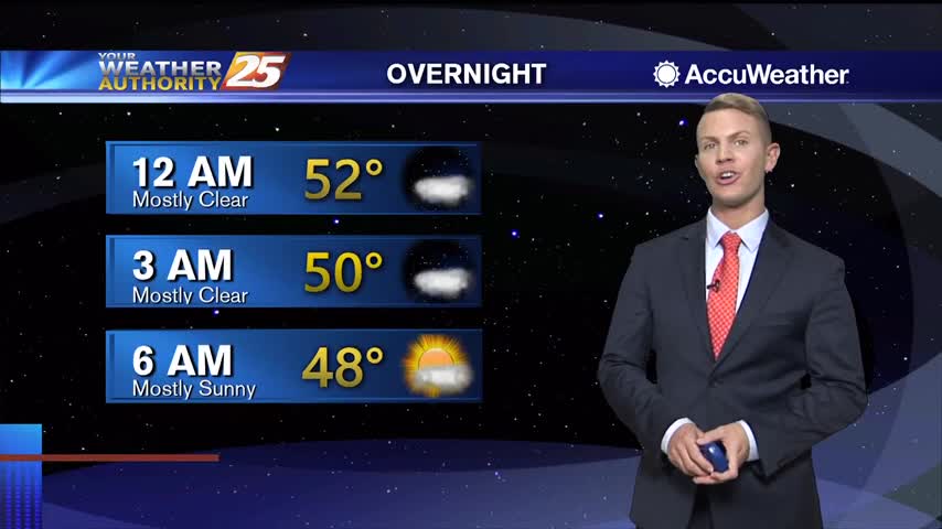
After a cool day across the area, calm winds and clear skies will make for another chilly night tonight with lows in the upper 30s along the coast…possibly dropping to the mid 30s for inland areas away from the water.…
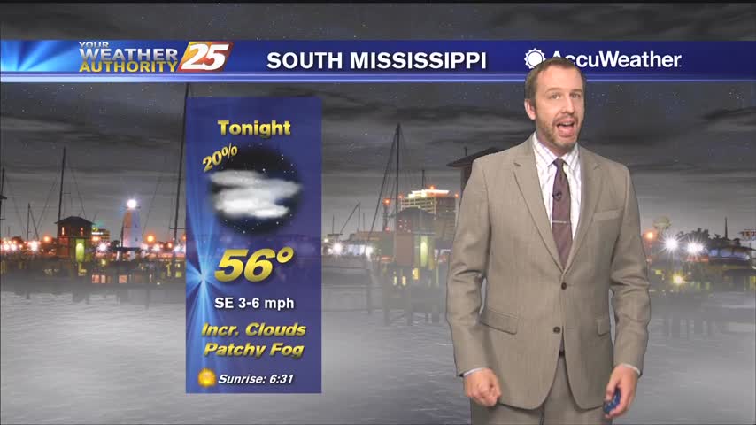
Increasing cloudiness will continue to be the trend through the night. Because of the cloud cover, some heat will get trapped in the lower levels of the atmosphere and lows should only dip into the lower 60s. Winds coming out…

Increasing cloudiness will continue to be the trend through the night. Because of the cloud cover, some heat will get trapped in the lower levels of the atmosphere and lows should only dip into the lower 60s. Winds coming out…
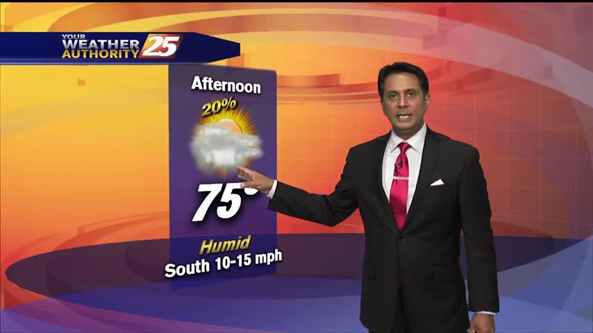
It's getting very warm this afternoon in advance of a cold front...
Light FOG is in the area this morning with a more humid start to the day...

Increasing cloudiness will continue to be the trend through the night and into Friday. Because of the cloud cover, some heat will get trapped in the lower levels of the atmosphere and lows should only dip into the upper 50s…
Increasing cloudiness will continue to be the trend through the night and into Friday. Because of the cloud cover, some heat will get trapped in the lower levels of the atmosphere and lows should only dip into the upper 50s…