5/1 - Rob Knight's "Modifying Air Mass" Morning Forecast
Another chilly morning along the Mississippi Gulf Coast heading into the 1st weekend of May...

Another chilly morning along the Mississippi Gulf Coast heading into the 1st weekend of May...
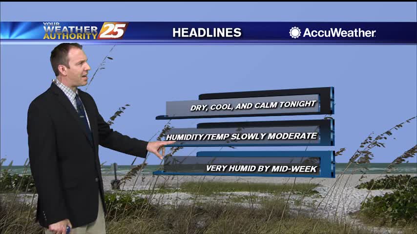
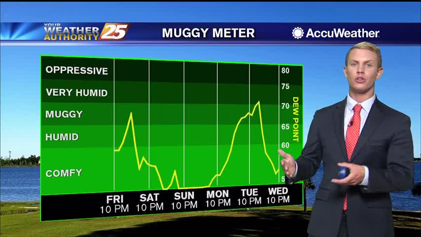
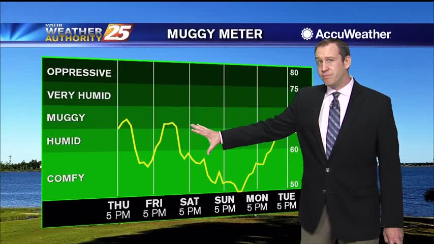
Comfortable levels of humidity will remain in place for the rest of the week, but it does begin to get a bit muggy by the start of the next.
If you liked today, there isn't much you won't like about the rest of the week and most of the next....
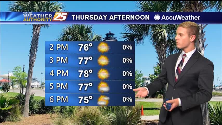
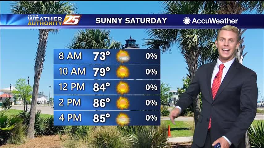
Thursday through the weekend, skies will be sunny with just a few upper-level clouds rolling through. High temperatures today will be in the upper 70s, gradually increasing to the mid 80s over the weekend. By early next week, temperatures will…
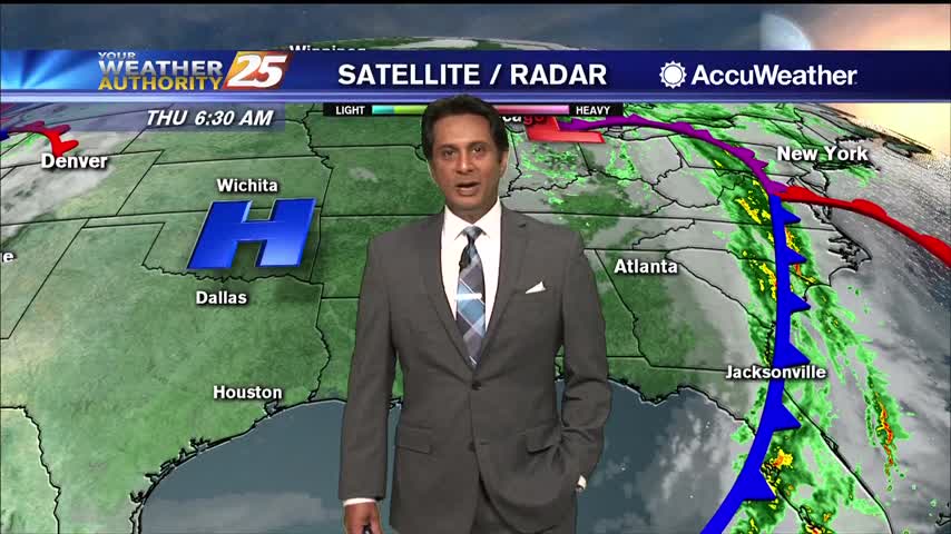
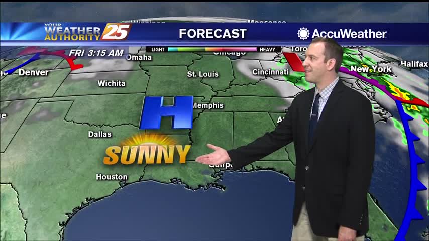
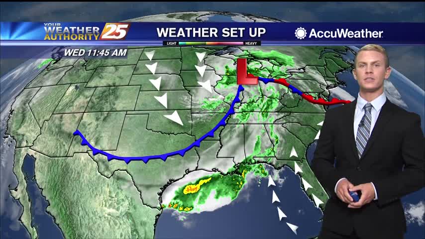
Dry high pressure has settled east of the continental divide and will remain in place for quite a while. Initially centered along the NW Gulf Coast, will migrate eastward slowly and park over NE Gulf Coast over the weekend into…

Cold front brought strong storms early this morning, but is now bringing much cooler and eventually much drier air into South MS.

Had a stormy start to the day, but cooler drier air will slowly move in for the rest of the week.
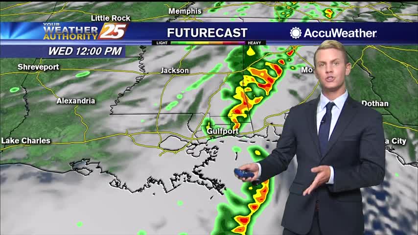
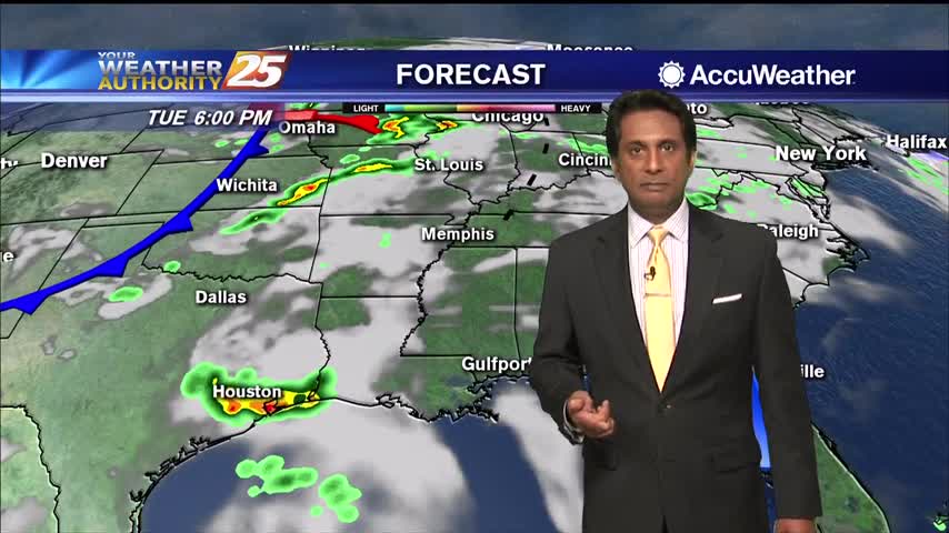
The severe weather threat has come to end across the Gulf Coast, but showers will continue to pop up on and off throughout the afternoon. Rain will eventually move out of the area late this evening and skies will quickly…
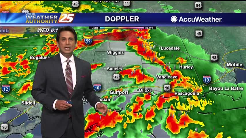
High rain chances will continue this morning with showers and scattered embedded storms along the front. A few strong to severe storms in this squall line are expected with hail and strong to damaging wind gusts being the main factor,…
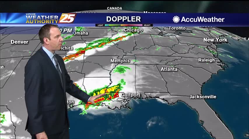
A small convective system brought a few thunderstorms before midnight, but we'll see the strongest activity with this frontal system move in tomorrow morning.
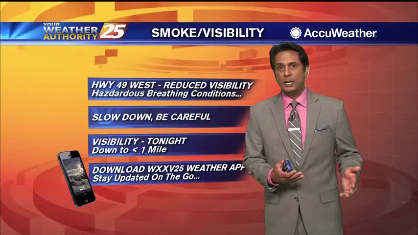
They dry conditions haven't helped in regards to the Canal Road fire, but the humidity is slowly rising and rain is expected overnight and tomorrow.
Sunny, dry conditions will continue through Tuesday afternoon. Winds are blowing out of the southeast at 10 to 20 miles per hour, with gusts up to around 25 miles per hour. Those winds are bringing in more moisture, but what…
Another cool start to the day with upper clouds beginning to move in from the west...
Clear, calm, and cool tonight, but things heat up again tomorrow and the dry conditions won't help the wildfire in Harrison County.
Our beautiful weather isn't helping firefighters battle the blaze in Harrison County, but at least some rain is on the way.
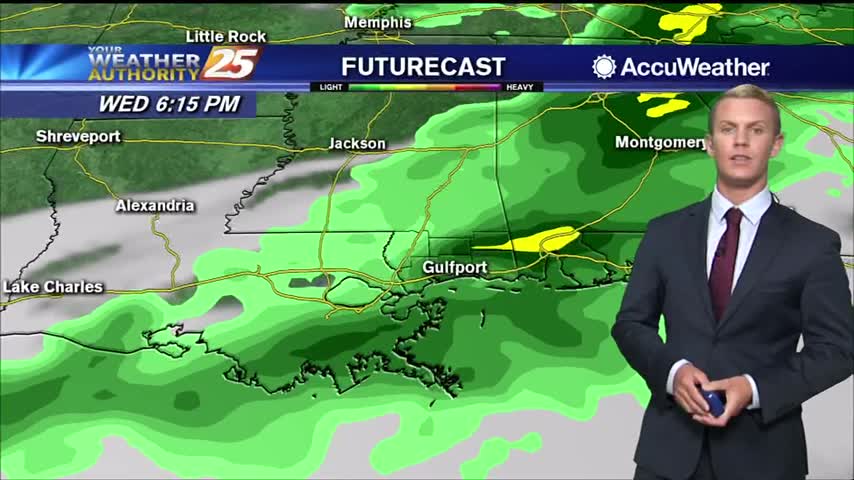
High pressure has settled into the area, creating calm conditions for most of the Gulf Coast. Generally clear skies are expected with northwesterly winds through mid-week. There will be a brief window late Tuesday night and Wednesday morning, just ahead…
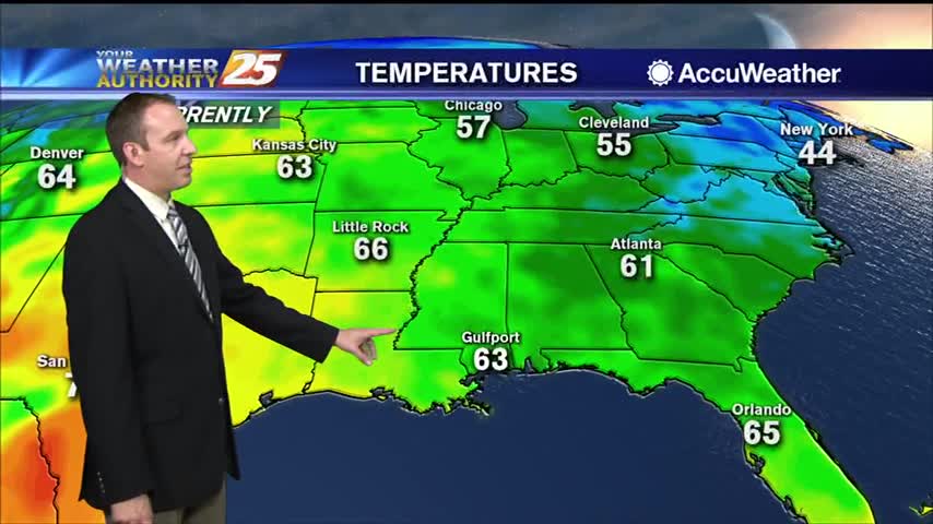
After a lovely weekend, it's a chilly start with morning low temperatures in the /40s50s...
A reinforcing surge of dry air moving through the area has dropped dew points to the mid and upper 40s, making it feel quite comfortable. High pressure has settled into the area, creating calm conditions for most of the Gulf…
Moist, southerly flow in addition to increasing cloud cover will keep overnight lows slightly warmer than last night. Lows tonight will only fall into the mid to upper 60s at the beaches and low 60s to upper 50s further inland.…
Clear skies and much nicer conditions are noted today in comparison to yesterday at this time. The upper level shortwave that brought us yesterday's severe weather continues to slide up toward the Mid Atlantic and Atlantic Coast today. A cold…
A GORGEOUS Friday afternoon throughout the Mississippi gulf coast...
A BEAUTIFUL start this morning as the system from yesterday continues to track further east...
Don't expect significant cooling behind today's front, but it will feel much drier heading into the weekend.
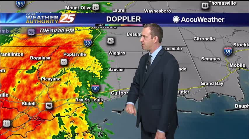
Thunderstorms pushed through South MS early this morning bringing a possible tornado to George County, but things are clearing quickly into the night.