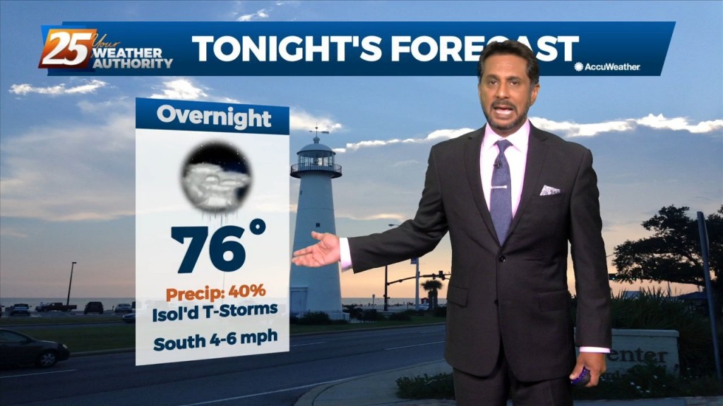
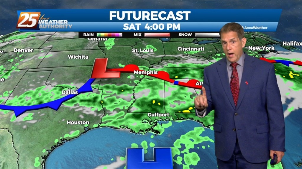
7/14 - Rob Martin's "Into The Weekend" Thursday Evening Forecast
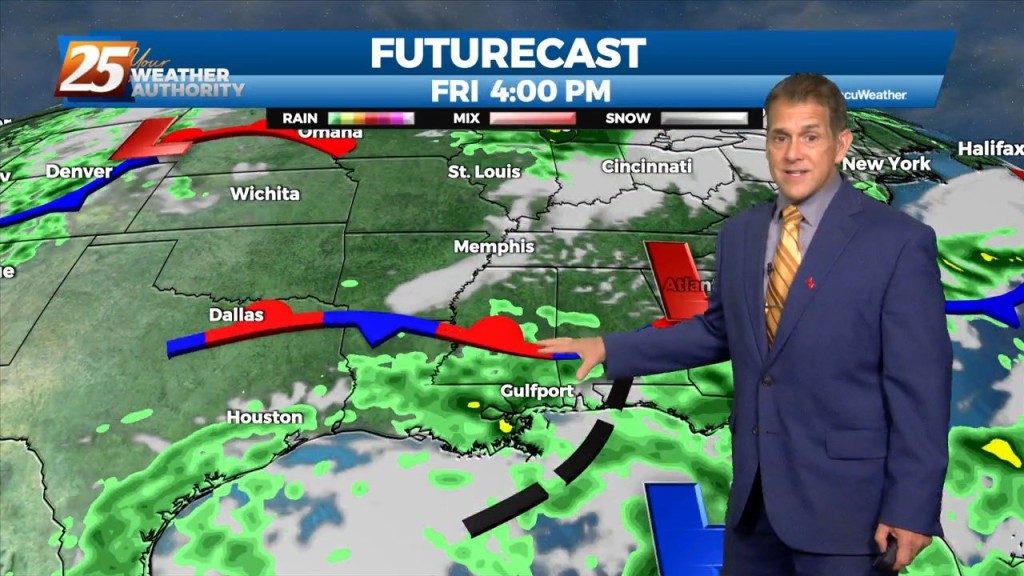
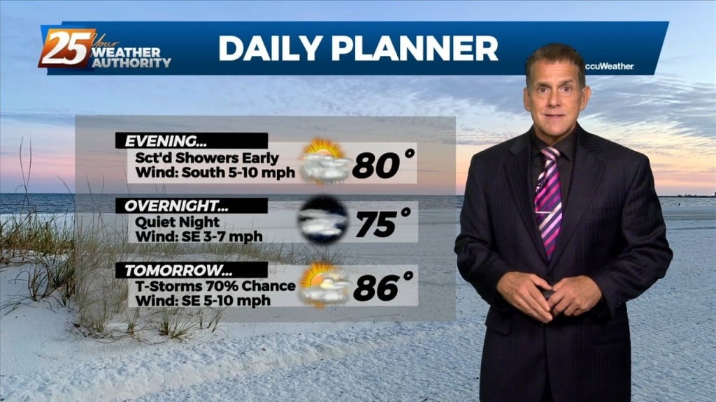
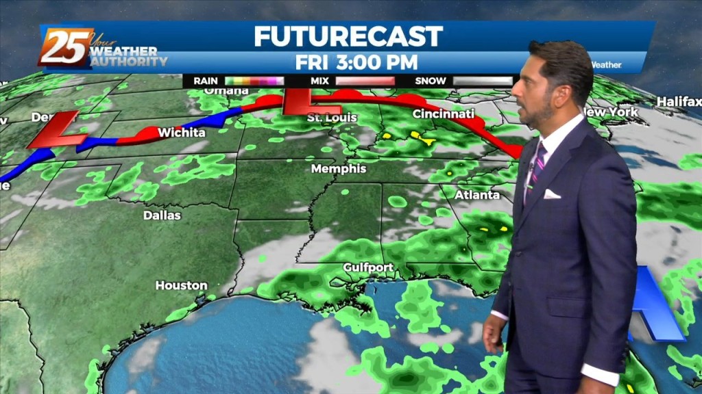
Storms and rain will diminish overnight before returning Friday afternoon. We had active weather late this afternoon, with a severe t-storm in George County and a…
Storms and rain will diminish overnight before returning Friday afternoon. We had active weather late this afternoon, with a severe t-storm in George County and a…
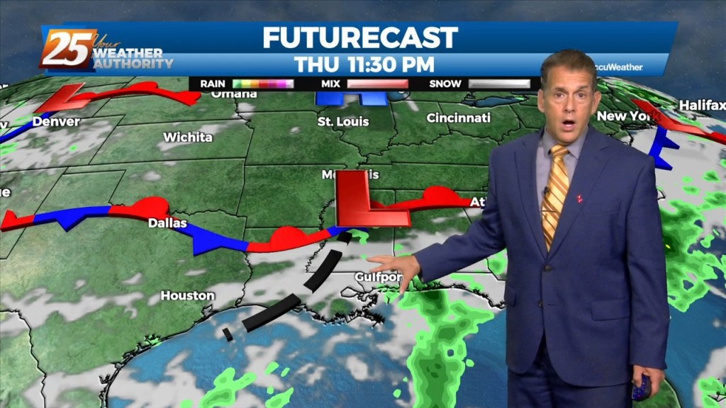
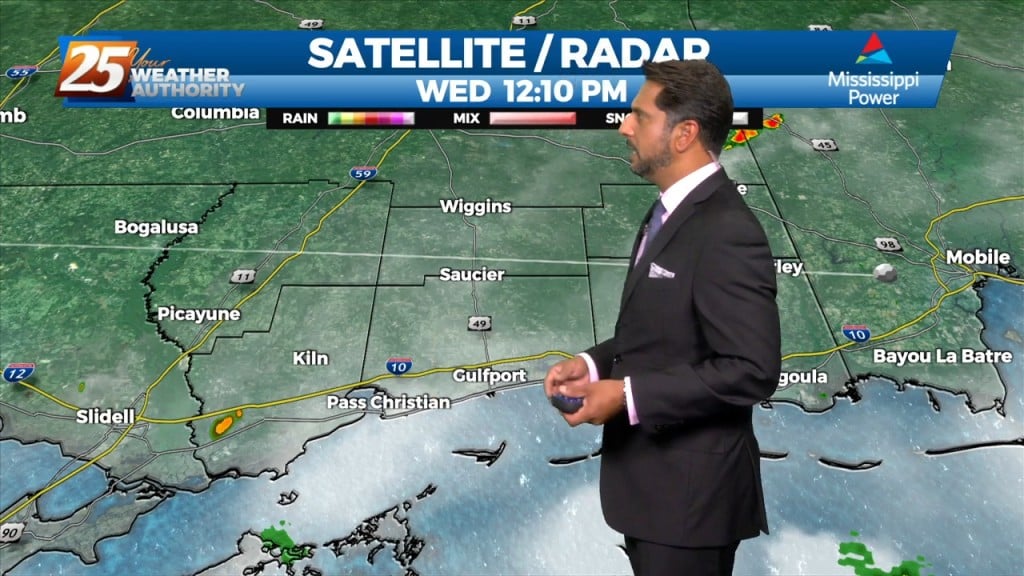
It did indeed hit the fan a bit late this afternoon, with a severe t-storm in George County and a flood advisory in Stone County. This…
The eastern portion of a high pressure system to the NW will begin to eroded as an upper disturbance digs south across the Great Lakes to…
A broad upper level high pressure centered near the 4-Corners region extends from Mexico to Canada and CA to around MS. It will generally be…
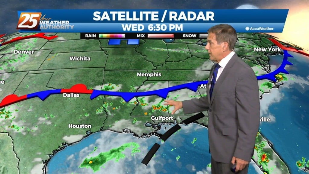
A relatively quiet Hump Day night is in store. Our current frontal boundary over the northern Gulf is rather diffuse, so an about-face here…we’re not expecting…
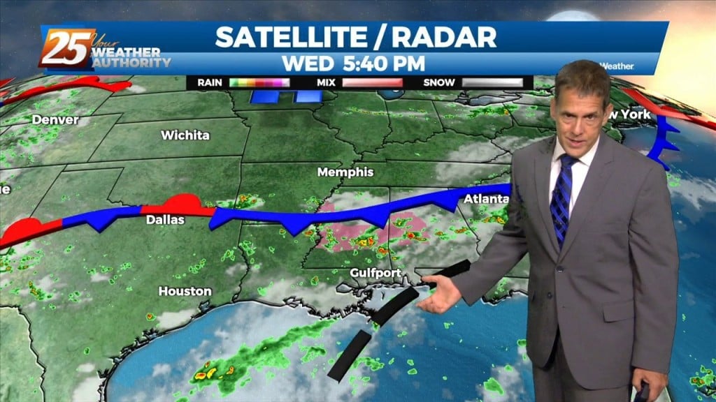
The low that caused yesterday’s rain has moved on, and our current frontal boundary ove the northern Gulf is rather diffuse, so an about-face here…we’re not…
The Bermuda high pressure extends into the far eastern Gulf of Mexico and a weakness between it and the ridge to the west. Abundant moisture exists…
A broad upper level high pressure system is centered near the 4-Corners region extends from Mexico to Canada and CA to around MS. This eastern portion of…
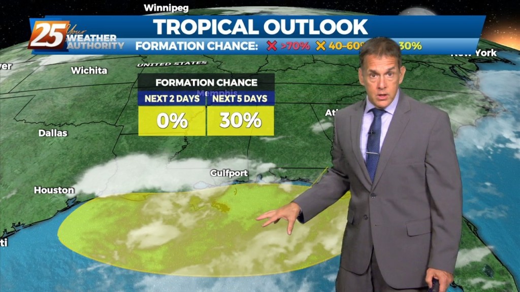
We’ll have a break in the action Tuesday night after the latest round of showers, but more will be hugging the coast by Wednesday morning. There’s…
A near-repeat today with the downpours coming in northeast to southwest along a frontal boundary close by, with a broad, weak area of low pressure to our…
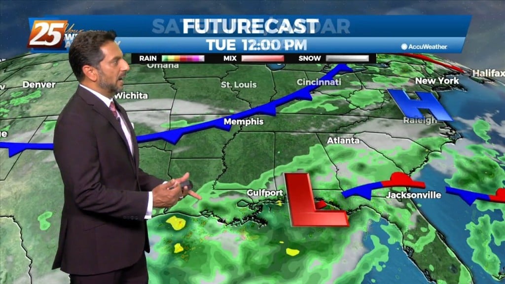
Locally, there’s still some form of residual frontal boundary that moved through to the area Sunday, with an area of low-pressure which developed east of…

An upper level high pressure system centered near the 4-Corners region extends to the east coast north of Florida. This eastern portion of the ridge is rapidly eroding…
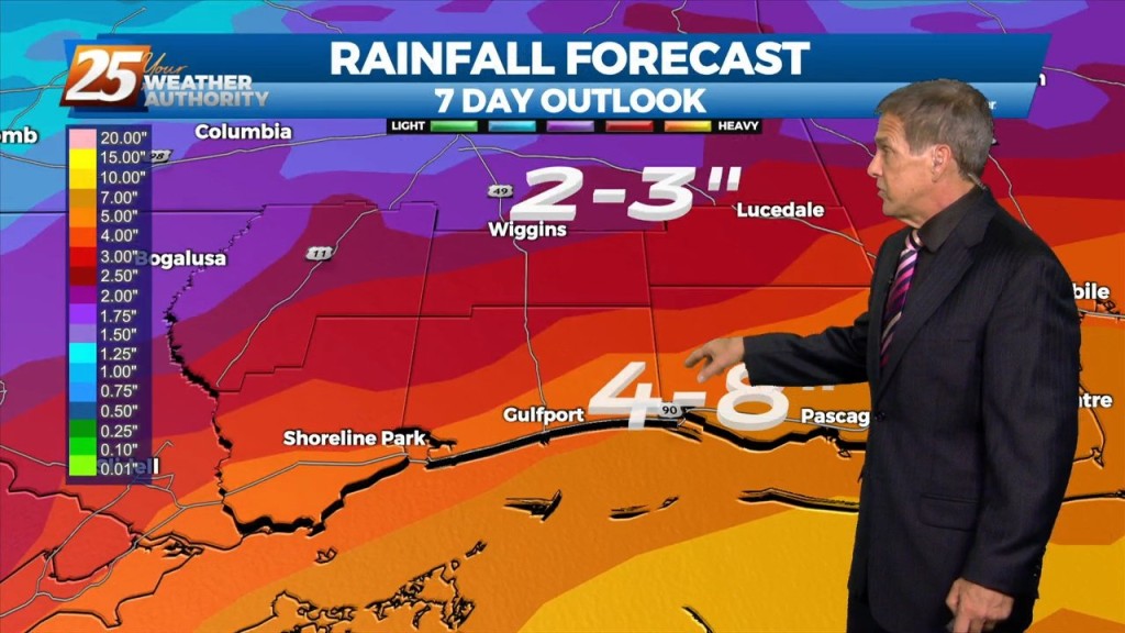
A stationary front along the coast will meander there all week long, providing spotty storms and the potential for heavy rain. If there’s some good news,…
Still hot today with enough sunshine to get those real-feels in the 103 – 108 range. A stationary front along the coast will drift north and…

A stationary front along the coast will undulate north and south for several days, providing for rainfall and the potential for HEAVY RAIN. If…
An upper level high pressure is to the north of a stationary front situated along the Mississippi gulf coast. If there’s some good news, it is…
Although it was still hot today, it didn’t compare to Saturday when Pascagoula reached a scorching 117°real-feel temperature. Some storms did fire up today, but the pattern…
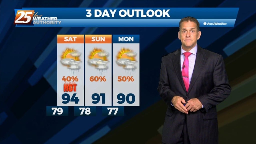
It'll be muggy this Friday night with lows not far from 80 degrees. Gulfport led the way with a real-feel of 111 degrees today, followed closely by…
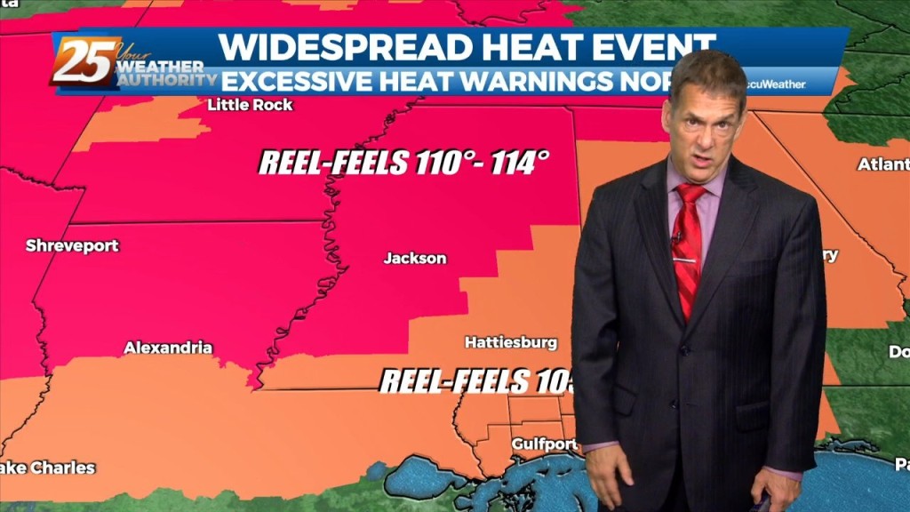
Gulfport led the way with a real-feel of 111 degrees today, followed closely by Pascagoula at 110. It will remain hot this weekend with heat advisories…
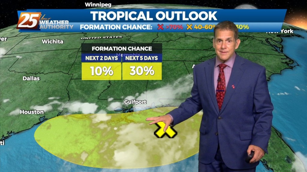
Southerly surface winds will help to advect moisture and warm air into the environment. There will still be plenty of moisture in the atmosphere and moisture…
High pressure will dominate the upper level pattern today through Saturday morning. Southerly surface winds will help to advect moisture and warm air into the environment.…
It's back to the heat..for now. As of 8 PM Thursday, real-feel temperatures were still near 100 degrees, with Pascagoula peaking at 110 degrees at 1 PM.…
Some heat has returned to the gulf coast today, with Pascagoula checking in with a real-feel of 110 degrees at 1 PM. High pressure will…
High pressure will continue to shape the forecast into the weekend. As an upper level disturbance digs through the Great Lakes and Ohio River Valley, it will…