7/22 – Rob Martin’s “Some Heat Returns” Friday Night Forecast
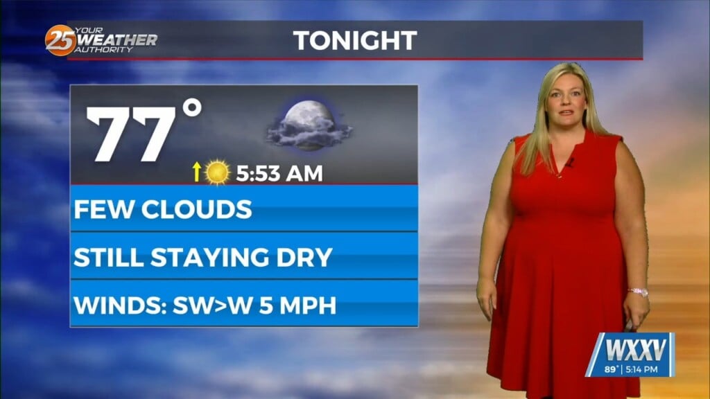
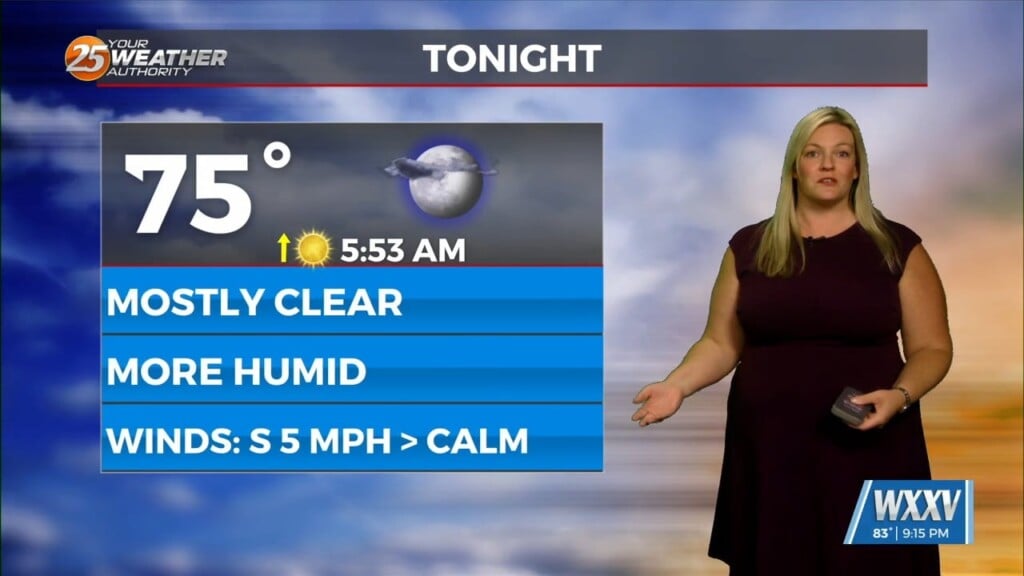
After record-warm overnight temps this week, some relief finally arrived today, as some rain came in early-morning and again this afternoon. However, we’re not quite done with the heat. We’ll be a little bit cooler tonight as a result of the rain before temps start to ramp up for the weekend.
Tonight we’ll be dealing with the remnants of the convection and outflow boundaries currently moving through the area. And lastly there’s also somewhat of an easterly wave that will try to move from GA over southern MS and possibly into central LA by late tonight. All of this makes for a rather difficult and messy forecast as any one of these could increase or decrease coverage, leading to far different time frames of precip into tonight. But, most analysis has it settling down a bit over the next few days.
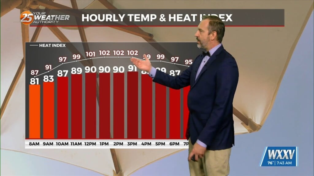
Heading into the weekend, convection will still be possible but the probabilities will steadily drop each day as high pressure starts to take over. Models in the long term are in good agreement that upper level high pressure will be dominating the area and we will be on the western periphery of surface high pressure. These will give us a routine and fairly benign weather pattern bringing southerly winds and gulf moisture over much of the period. Cloud coverage associated with the convection should moderate temperatures slightly giving highs in the low to mid 90s with real-feel temperatures above 100 but not as hot as what we had Wednesday and Thursday this week.