6/14 – Night Rob’s “Temporary Relief” Tuesday Night Forecast
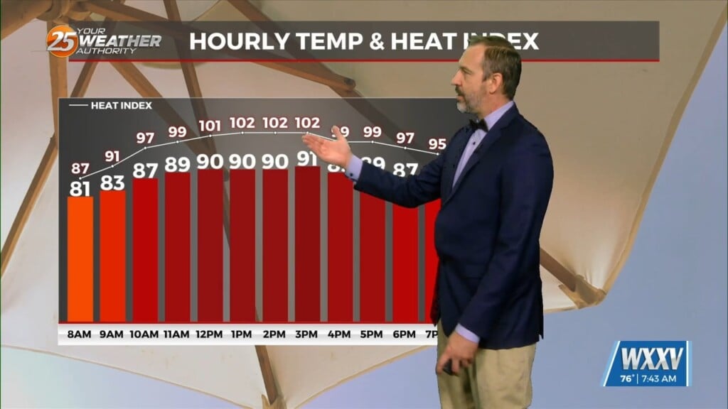
A few weak thunderstorms did pop up Tuesday evening…an early sign that the high pressure responsible for the heat is losing its grip just a bit. Although heat advisories weren’t up today, the numbers weren’t too far off from yesterday’s. Pascagoula again came in with a scorching real-feel temp of 110°, while most everywhere else was still above 100.
High pressure over the Midwest (and extending into the gulf) remains in control with hot condition persisting, but also limiting thunderstorm development. The high will retrograde westward over the next couple of days, allowing some storms to actually form to our east and then move westward over our area. However, there is still doubt as to how far this process will go, as some forecast models have the high holding firm a bit. So, we’re still bumping up t-storm chances to 30% on Wed/Thu. Even if storms occur, it would be the afternoon scattered type that fades around sunset.
Indications are that the high strengthens again later in the week, and combined with weak low pressure to our east, bringing more of an offshore flow that cuts off the gulf moisture, at least temporarily…along with any cooling influence of the sea breeze. Thus, it’s possible that temps could rebound back to heat advisory levels by Friday or Saturday, followed by a drop in humidity on Sunday.