3/17 – Rob’s St. Paddy’s Day “Afternoon/Weekend” Forecast
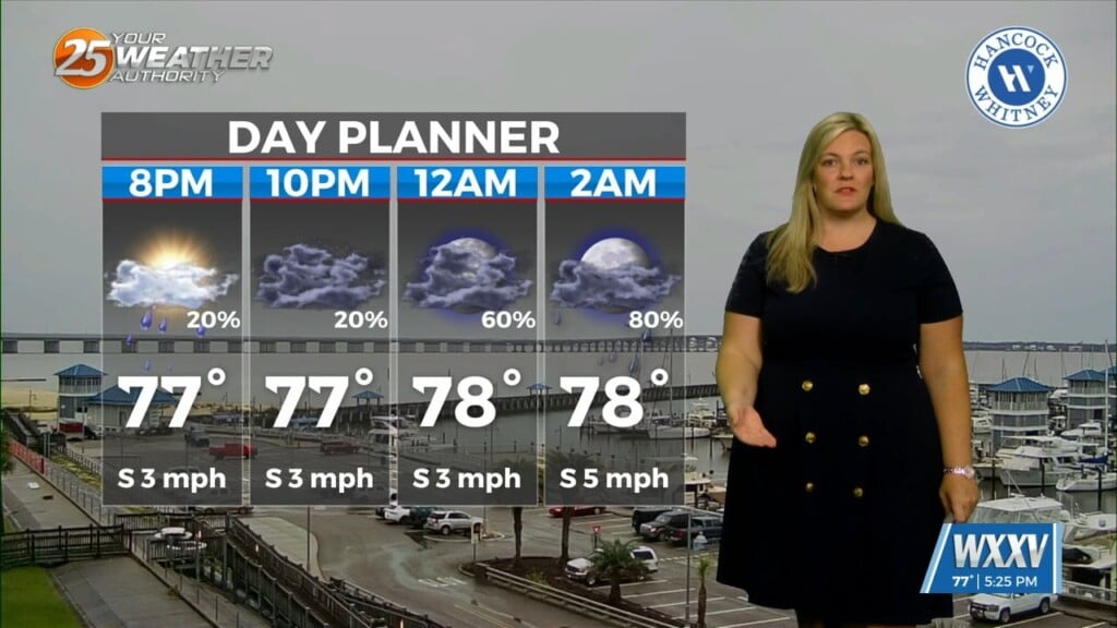
After a mostly cloudy start with mid/upper level clouds dominating the region, skies have partially cleared. This afternoon will bring mostly clear to partly cloudy skies, becoming clear late afternoon/evening. As the south wind continues, a warmer night is on-tap with an approaching cold front which will move into the area late tomorrow afternoon.
As the front moves into the area, it will begin to dissipate and only a few light showers are expected Saturday late afternoon/evening. Sunday will bring the possibility for a few showers as well with temps in the mid 70s for the final weekend of Winter. Dry conditions will continue through much of the 1st week of Spring with a better chance for rain/t-storms late in the workweek.


Leave a Reply