08/27 Ryan’s “Rain Returns” Tuesday Morning Forecast
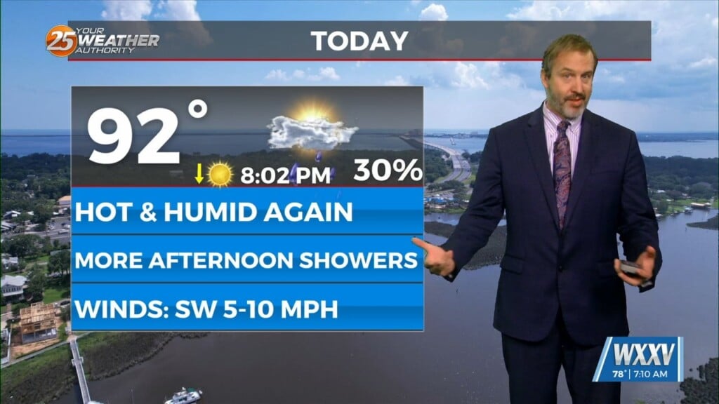
Not much changes today temperature-wise, but even more cloud cover and a few afternoon showers will move in today.
Despite expecting a cool-down of a degree or so for today, it looks like we’ll stay about the same as we wait for the clouds to thicken and the rain to return. It won’t necessarily be a “rainy” day though, as today’s will be a return to our familiar “afternoon shower” pattern. Thunderstorms are certainly possible too, and there could be some locally heavy, but generally short-lived showers developing in the heat of the day.
I expect them to develop just after noon and drift slowly inland as they break down, but there is a degree of randomness which may have them bouncing around the I-10 area. That’ll thankfully keep us from getting much warmer than today’s 93 degree high, with even more rain in the days ahead to bring even more cooling. We’ll slowly work our way up in the rain chance department to 60% by Friday as the temperature works its way down to ~87. Severe weather isn’t likely but stay weather aware if they develop near you.